Deoli, Rajasthan

Last updated

Deoli
Chhavni
City
Nickname: 
Chhavni
India Rajasthan location map.svg
Red pog.svg
Deoli
Location in Rajasthan, India
India location map.svg
Red pog.svg
Deoli
Deoli (India)
Coordinates: 25°45′00″N75°23′00″E / 25.75°N 75.3833°E / 25.75; 75.3833
CountryFlag of India.svg  India
State Rajasthan
District Tonk
Government
  BodyDeoli Nagar Palika
Elevation
296 m (971 ft)
Population
 (2011)
  Total29,238
Languages
  Official Hindi , Marwari and dhundhari
Time zone UTC+5:30 (IST)
PIN
304804
Vehicle registration RJ26
Website http://urban.rajasthan.gov.in/content/raj/udh/nagar-palika-deoli/en/home.html footnotes =

Deoli is a city situated at the point at which Tonk, Shahpura, Kekri and Bundi districts meet, though the bulk of the city is located in Shahpura and Tonk districts. It is officially a part of Tonk district. It is the tehsil headquarters of the Deoli tehsil.

Contents

It is located 85 km from Kota. Deoli is surrounded by Todaraisingh Tehsil towards North, Kekri Tehsil towards West, Hindoli Tehsil towards South, Jahazpur Tehsil towards South.

Todaraisingh, Tonk, Malpura, Shahpura are the nearby Cities to Deoli

This Place is in the border of the Tonk District and Ajmer District. Ajmer District Kekri is west towards this place.

To facilitate the administration, Deoli Tehsil is further divided into 1 town and 186 villages.

Demographics

Deoli had total population of 214,408 as per the 2011 Census. Of those 110,648 are male and 103,760 are female, comprising 43,632 families. 14% of residents are children of aged six and under, (15928 boys and 14195 girls, a child sex ratio of 891) The male literacy rate is 66.52% and the female literacy rate is 37.54%.

10.3% people lives in urban areas while 89.7% live in rural areas. The average literacy rate in urban areas is 86.7% while that in the rural areas is 58%. The sex ratio in urban areas is 837, and 950 in rural areas.

Scheduled castes constituted 21.1% of the population and Scheduled tribes were 20.4%.

TotalMaleFemaleUrbanRural
Population214,408110,648103,76022,065192,343
Children (Age 0-6)30,12315,92814,1952,53727,586
Literacy61.07%66.52%37.54%86.72%58.03%
Scheduled Caste45,29223,32221,9704,12242,893
Scheduled Tribe43,73822,74920,98984542,893
Sex ratio938837950

Religion

<div style="border:solid transparent;background-color:initial;position:absolute;width:100px;line-height:0;

Religion in Deoli, Rajasthan

   Hindu (94.83%)
   Muslim (3.31%)
   Jain (1.67%)
   Christian (0.7%)
   Sikh (0.7%)
   Buddhist (0.1%)
  Other or not stated (<0.1%)

Nearly 95% of Deoli's residents are Hindus, with small numbers of Muslims, Jains, Sikhs, Christians, and Buddhists.

Working population

In Deoli Tehsil out of a total population, 105,918 were engaged in work activities. 72.3% of workers describe their work as 'main work' (employment or earning for more than six months) while 27.7% were involved in marginal activity providing a livelihood for less than six months. Of 105,918 workers engaged in main work, 43,529 were cultivators (owner or co-owner) while 9,757 were agricultural workers or labourers.

TotalMaleFemale
Main Workers76,61349,13727,476
Cultivators43,52925,47318,056
Agriculture/Labourer9,7574,5505,207
Household Industries1,4401,024416
Other Workers21,88718,0903,797
Marginal Workers29,30510,37818,927
Not Working108,49051,13357,357

History

The town of Deoli was established by the British in 1854, earlier it was a small village. [1] It is believed that the name Deoli came from the Hindi word Devro (देवरों), meaning "Place of Gods", due to the existence of many temples to Hindu deities. It has a reservoir, "Nayanabhiram" or "Nekchal" Lake, literally meaning "good motive lake". This British-made lake was constructed to fight drought and scarcity of water. The cost of acquiring land, incurred for construction of Camp Deoli, by the British, was Rs. 368 [1] at the time. Although most of the princely states of Rajasthan had accepted the sovereignty of the British, the British officials remained skeptical about the intentions of the annexed states. In order to overcome this, a regulation was passed, making it mandatory to keep a conservator from the annexed princely state under the control of a British agent. This agent was referred to as Rokadia; although they had all the facilities they were, in a way, under the detention of the British Government. The present Senior Secondary School building was the bungalow of the then political agent, which had a swimming pool. Similarly, the famous Nevar Bagh (नेवर बाग) was also developed by the English agent. A swimming pool was also built here which has now been dumped. Today's CISF set-up was originally a prison. There is also a "फांसीघर" (gallows) board which is visible at the gate of the facility which remains a relic of the past. German and Italian civilians were interned here after the British declaration of war in 1939. Later prisoners of the Indian freedom struggle were kept here.

After the 1962 Sino-Indian War, approximately 3000 Indian citizens of Chinese origin along with Tibetans suspected of being Chinese agents were interned here, some till 1967. [2]

The church was established here during the British period. It is said to be about a hundred years old. There is a medieval pilgrimage center around the Deoli, which includes Boeyda Ganeshji (in the nearby village of Boeyda), Kunchalvada-Mata, Chandali Mata (in the nearby village of Chandali), Gokarneshwar Mahadev, Ravata Hanuman ji, Gadoli Mahadev, Lakdeshwar Mahadev, Hindeshwar Mahadev etc. Amongst these, there is a story associated with Hindeshwar Mahadev of Hindoli that, during exile, the Pandavas built this Shiva Lingam with only five fistfuls of clay (पाँच मुटृठी (धोबे)). There is also a folklore that ten-headed Ravana performed Shiva Worshipping in nearby Bisalpur at Gokarneshwar Mahadev Temple. [1]

Places

Deoli is 176.5 km from Jaipur and 64.8 km (56 min) away from Tonk. The nearest Railway Station is Bundi, 45 km away. The nearest airport is in Jaipur International Airport, 79 km away.

Deoli has a CISF training center. RTC Deoli was established on 1 August 1984. It is located in District Tonk, Post Deoli, Rajasthan, which is 165 kilometres (103 mi) away from Jaipur Airport and 85 kilometres (53 mi) from Kota Railway Station. RTC Deoli conducts the basic induction training of directly recruited Constables. It also provides professional and specialized training to officers and men of CISF and other private security organizations.

The Bisalpur Dam on the Banas River is a multipurpose scheme, which supplies water for drinking and irrigation to Jaipur district and Ajmer, Beawar, Nasirabad and Kishangarh towns of Ajmer district. The dam was constructed in 1993–94. [3]

Villages

Related Research Articles

<span class="mw-page-title-main">Rajputana Agency</span> Former political office of the British Indian Empire

The Rajputana Agency was a political office of the British Indian Empire dealing with a collection of native states in Rajputana, under the political charge of an Agent reporting directly to the Governor-General of India and residing at Mount Abu in the Aravalli Range. The total area of the states falling within the Rajputana Agency was 127,541 square miles (330,330 km2), with eighteen states and two estates or chiefships.

<span class="mw-page-title-main">Banas River</span> River in Rajasthan, India

The Banas is a river which lies entirely within the state of Rajasthan in western India. It is a tributary of the Chambal River, itself a tributary of the Yamuna, which in turn merges into the Ganga. The Banas is approximately 512 kilometres in length.

<span class="mw-page-title-main">Sawai Madhopur district</span> District of Rajasthan in India

Sawai Madhopur district is a district of Rajasthan state in north-west India. Sawai Madhopur is the chief town and district headquarters. Sawai Madhopur district comes under Bharatpur division.

<span class="mw-page-title-main">Ajmer district</span> District of Rajasthan in India

Ajmer district is a district in the Indian state of Rajasthan. It is part of the Ajmer division–one of the ten administrative divisions of Rajasthan. The city of Ajmer is the district headquarters. The district is situated in the center of Rajasthan, and is bounded by Didwana Kuchaman district to the north, Jaipur Rural and Dudu to the north-east, Tonk to the east, Kekri and Beawar to the south, and Nagaur to the west. It has an area of 8,481 km2 (3,275 sq mi), and a population of 2,583,052.

<span class="mw-page-title-main">Bhilwara district</span> District of Rajasthan, India

Bhilwara District is a district of the state of Rajasthan in western India. The city of Bhilwara is the district headquarters.

<span class="mw-page-title-main">Tonk district</span> District of Rajasthan in India

Tonk district is a district of the state of Rajasthan in western India. The city of Tonk is the administrative headquarters of the district. The district is bounded on the north by Jaipur district, on the east by Sawai Madhopur district, on the southeast by Kota district, on the south by Bundi district, on the southwest by Bhilwara district, and on the west by Ajmer district.

<span class="mw-page-title-main">Bundi district</span> District of Rajasthan in India

Bundi is a district in the state of Rajasthan in western India. The city of Bundi is the district headquarters. It has an area of 5,550 km2 and a population of 1,110,906. It is divided into 5 tehsils which are: Bundi, Hindoli, Nainwa, Keshoraipatan and Indergarh.

<span class="mw-page-title-main">Tonk State</span> Princely State of India

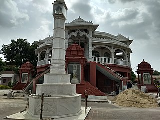
Tonk was a princely state in India under the supervision of the Rajputana Agency of the British Raj. It was located primarily in the present-day Indian state of Rajasthan with small portions in Madhya Pradesh. The town of Tonk, which was the capital of the state, had a population of 273,201 in 1901. As a salute state, its ruler, styled the Nawab of Tonk, was granted a 17-gun salute. The state came to an end after the partition of India when the Nawab of Tonk acceded to India. At that time, it was the only princely state of Rajputana with a Muslim ruling dynasty.

Aklera is a town and an Indian municipality in Jhalawar district in the state of Rajasthan. It is in the south-eastern region of Rajasthan at the edge of the Malwa plateau and has a rocky, scrub-covered terrain.

Jahazpur is a historical town and a municipality in Bhilwara district in the Indian state of Rajasthan. It is also the tehsil headquarters of the Jahazpur tehsil. It is known for the Jain temple swastidham, built around the Jahazpur fort.

Malpura is a town with municipality in Tonk district in the Indian state of Rajasthan. Malpura is known for its Dadabadi, built by the Khartargach Sect of Shewtambar Jain in memory of 3rd Dada Gurudev Shri Jinkushalsurishwarji.Also known for its Forts,Malpura is popular visiting palace in Rajasthan.

Nainwan is a tehsil of Bundi district and a municipality in the Hadoti region of the state of Rajasthan in India.

<span class="mw-page-title-main">Newai</span> Town in Rajasthan, India

Newai or Niwai is a town, and a municipality and tehsil in Tonk district in the Indian state of Rajasthan. The Tonk district is bounded in the north by Jaipur district, in the east by Sawai Madhopur district, in the southeast by Kota district, in the south by Bundi district, in the southwest by Bhilwara district, and in the west by Ajmer district. Jaipur, capital of Rajasthan is the closest major city to Newai. In 1783 Nepalia-Mathur Kayastha of Jaipur estate occupied it after defeating Nawab of Tonk in a bloody battle fought at the fort of Rakhtanchal. Since then it was a vassal state to the Jaipur estate until Jaipur became part of Independent India. Darbar of Daroga ji ruled Niwai under Maharaja of Jaipur.

Uniara is a town and a municipality in Tonk district in the Indian state of Rajasthan. It is a tehsil of the Tonk district.

Bijainagar is a city and headquarters of Bijainagar tehsil in the Beawar district of the Indian state of Rajasthan.It was founded by Shri Rao Saheb Vijay Singh ji Of Masuda in 1919 CE,This city is situated along the Khari River close to the southern border of Ajmer District.

<span class="mw-page-title-main">Tourism in Rajasthan</span>

Rajasthan is one of the most popular tourist destinations in India, for both domestic and international tourists. Rajasthan attracts tourists for its historical forts, palaces, art and culture with its slogan "Padharo Mhare Desh " The capital city, Jaipur, also known as Pink City, is a very popular tourist destination and is a part of the Golden Triangle. The Walled City of Jaipur is only the second Indian city to be recognized as a UNESCO World Heritage Site, after Ahmedabad.

<span class="mw-page-title-main">Mathura–Vadodara section</span> Railway line in India

The Mathura–Vadodara section is a railway line connecting Mathura and Vadodara. This section is part of Delhi–Mumbai line. This section includes Jaipur–Sawai Madhopur, Ajmer–Ratlam and Udaipur–Kota for branching and connectivity to this section.

Devli Kalan is a village in Nawa Tehsil in Didwana Kuchaman district of Rajasthan State, India. It belongs to Ajmer Division. It is located 176 km towards East from District headquarters Nagaur, 60 km from State capital Jaipur. Devli Kalan Pin code is 341507 and postal head office is Maroth. Renwal, Jaipur, Sambhar, Phulera, Reengus are the nearby Cities to Devli Kalan. Minda, Loonwa, Shyamgarh & KANCHANPURA 1.5 km are the nearby Villages to Devli Kalan. As per constitution of India and Panchyati Raaj Act, Devli Kalan village is administrated by Sarpanch who is elected representative of village.

References

  1. 1 2 3 "Introduction". Government PG College, Deoli. Archived from the original on 17 February 2020. Retrieved 30 March 2023.
  2. Brar, Aadil (2 September 2020). "The 1962 Internment of Chinese Indians". The Diplomat. Retrieved 8 June 2023.
  3. "census report motif" (PDF). Retrieved 30 March 2023.