This article needs additional citations for verification .(October 2012) |
Karauli | |
---|---|
Coordinates: 26°30′N77°01′E / 26.5°N 77.02°E | |
Country | India |
State | Rajasthan |
District | Karauli |
Founded by | Raja Bijaipal [1] |
Government | |
• Body | Nagar Parishad |
Area | |
• Total | 18 km2 (7 sq mi) |
Elevation | 275 m (902 ft) |
Population (2011) | |
• Total | 82,960 |
• Density | 4,600/km2 (12,000/sq mi) |
Languages | |
• Official | Hindi |
• Native | Rajasthani, Braj Bhasha |
Time zone | UTC+5:30 (IST) |
PIN | 322241 |
Vehicle registration | RJ 34 |
Website | karauli |
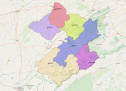
Karauli (also formerly spelled Karoli or Karaulee) is a city located in the Indian state of Rajasthan. It is located in the Braj region and holds religious importance in Hinduism. The city is the administrative center of Karauli District, and was formerly the capital of the erstwhile princely state of Karauli. Karauli District comes under Bharatpur Divisional Commissionerate. Karauli is 166 Kms from Gwalior and 187 Kms from Jaipur.
Karauli is located at 26°30′N77°01′E / 26.5°N 77.02°E . [3] It has an average elevation of 275 metres (902 ft).
Karauli was a part of the Matsya Kingdom (1400-300 BCE), one of the 16 ancient Mahājanapadas.
Earlier, Karauli, along with Alwar, was part of the Matsya kingdom, according to the legend of Mahabharata. The modern princely state Karauli State was founded in about 995 by Jadaun Rajput ruler Raja Bijai Pal, who is claimed descent from the Hindu god Krishna. [4] [5] His Highness the Maharaja maintains a military force of 281 cavalry, 1640 infantry, and 56 guns, and is entitled to a salute of 17 guns (as of 1892). The Britishers later occupied it, and they ruled up to 1947. The Maharaja's palace is a handsome block of buildings, some of them dating to the mid-18th century. [6] Karauli State was founded by Maharaja Bijaipal. The dynasty is said to be of Jadaun (clan) Rajput. [7] [8]
A municipality was established at Karauli in 1884. [9]
As of 2011 India census, Karauli had a population of 82,960. Males constitute 53% of the population and females 47%. Karauli has an average literacy rate of 53%, lower than the national average of 59.5%. Male literacy is 65%, and female literacy is 41%. In Karauli, 19% of the population is under 6 years of age.
Rajasthan is a state in northwestern India. It covers 342,239 square kilometres (132,139 sq mi) or 10.4 per cent of India's total geographical area. It is the largest Indian state by area and the seventh largest by population. It is on India's northwestern side, where it comprises most of the wide and inhospitable Thar Desert and shares a border with the Pakistani provinces of Punjab to the northwest and Sindh to the west, along the Sutlej-Indus River valley. It is bordered by five other Indian states: Punjab to the north; Haryana and Uttar Pradesh to the northeast; Madhya Pradesh to the southeast; and Gujarat to the southwest. Its geographical location is 23°.3' to 30°.12' North latitude and 69°.30' to 78°.17' East longitude, with the Tropic of Cancer passing through its southernmost tip.
Braj, also known as Vraj, Vraja, Brij or Brijbhumi, is a region in India on both sides of the Yamuna river with its centre at Mathura-Vrindavan in Uttar Pradesh state encompassing the area which also includes Palwal, Ballabhgarh and Nuh in Haryana state, Deeg, Bharatpur, Karauli, and Dholpur in Rajasthan state and Morena District in Madhya Pradesh. Within Uttar Pradesh, it is very well demarcated culturally, the area stretches from the Mathura, Aligarh, Agra, Hathras and districts up to the Etah district. Braj region is associated with Radha and Krishna who according to scriptures were born in Barsana and Mathura respectively. It is the main centre of Krishna circuit of Hindu pilgrimage.
Alwar is a city located in India's National Capital Region (NCR) and the administrative headquarters of Alwar District in the state of Rajasthan. It is located 150 km south of Delhi and 150 km north of Jaipur.
The Rajputana Agency was a political office of the British Indian Empire dealing with a collection of native states in Rajputana, under the political charge of an Agent reporting directly to the Governor-General of India and residing at Mount Abu in the Aravalli Range. The total area of the states falling within the Rajputana Agency was 127,541 square miles (330,330 km2), with eighteen states and two estates or chiefships.
Dholpur is a city in the Dholpur district in Rajasthan state of India. It is situated on the left bank of the famous Chambal river. The city is the administrative headquarters of Dholpur District.
Pali is a city and capital division in Pali district in Indian state of Rajasthan. It is the administrative headquarters of Pali district. It is on the bank of the river Bandi and is 70 km (43 mi) south east of West Jodhpur. It is known as "The Industrial City".
Hindaun is a city and municipality, near city of Karauli in Karauli district, Rajasthan, India. It has a population of 105690 and is governed by a municipal council.
Nalagarh is a city and a municipal committee, near the city of Solan in Solan district in the Indian state of Himachal Pradesh. Nalagarh is a gateway to Himachal Pradesh in North India, 95.6 km (59.4 mi) from Shimla, 300 km (190 mi) from Delhi and 60 km (37 mi) from Chandigarh.
Dhaulpur State or Dholpur State, was a princely state under British suzerainty, in eastern Rajasthan, India, which was founded in AD 1806 by ruler Rana Kirat Singh of Gohad. After 1818, the state was placed under the authority of British India's Rajputana Agency. The Ranas ruled the state until the independence of India in 1947, when the kingdom was merged with the Union of India.
Bharatpur District is a district in Rajasthan state in western India. The city of Bharatpur is the District Headquarters, Division Headquarters and Headquarters of Bharatpur
Karauli District is a district of the state of Rajasthan in western India. It is located in the Braj Bhoomi region. The town of Karauli serves as the administrative headquarters of the district. Karauli district also comes under the Bharatpur Divisional Commissionerate.
The United States of Matsya, also called Matsya Union or Matsya Sangh, was a State of India which was formed on 18 March 1948 by the merger of four erstwhile princely states, Alwar, Bharatpur, Dholpur, and Karauli after accession. Shobha Ram Kumawat of Indian National Congress was the first and last chief minister of the State from 18 March 1948 till 15 May 1949. Maharaja of Dholpur became its Rajpramukh.
Behror is a city in the Kotpulti-Behror district of Rajasthan of the Jaipur division. It serves as the administrative headquarters of the eponymous Behror Tehsil and shares headquarters for Kotputli-Behror district with Kotputli. It is equidistant from both state capital Jaipur and national capital New Delhi. Located 120 km south-west of New Delhi and as a part of National Capital Region, it is regulated under National Capital Region Planning Board which is a federal authority for urban planning purposes in NCR. Along with Shahjahanpur and Neemrana it is grouped as SNB Complex (Shahjahanpur-Neemrana-Behror) of NCR- which includes 137 revenue villages, in which Behror municipality is the largest urban conglomeration. This region is also known as 'Ahirwal region' or simply as Raath and is an important industrial hub for the state of Rajasthan. Behror municipality spreads out in an area of 15 km2 is divided into four revenue villages namely Behror tarf Gangabishan, Behror tarf Doongrasi, Behror tarf Nainsukh, Behror tarf Balram.
Dhandera Rajputana is a census town in Haridwar district in the state of Uttarakhand, India. Dhandera is located at 29.84°N 77.89°E.
The history of human settlement in the western Indian state of Rajasthan dates back to about 100,000 years ago. Around 5000 to 2000 BCE many regions of Rajasthan belonged as the site of the Indus Valley Civilization. Kalibangan is the main Indus site of Rajasthan, here fire altars have been discovered, similar to those found at Lothal.
Bharatpur State was a Princely state under British suzerainty that was ruled by the Sinsinwar clan of the Hindu Jats. At the time of reign of king Suraj Mal (1755–1763) revenue of the state was 17,500,000 Gold coin per annum. The major architecture of this state include Lohagarh Fort and Deeg Palace.
Karauli State was a princely state in the north eastern edge of modern-day Rajasthan, India from 1348 to 1949. It is located in the cultural Braj region. Karauli city was the capital while Mandrayal or Mandrail was another important town.
Alwar State is a princely state of Naruka Rajputs with its capital at Alwar in India. Founded in 1770 CE by Pratap Singh Naruka, its reigning ruler, Maharaja Sir Tej Singh Prabhakar Bahadur, signed the accession to the Indian Union on 7 April 1949.
Hindaun is a Block in Karauli district of the Indian state of Rajasthan in Northern India. It is a subdivisional headquarter. Its population is approximately 442,000. The block covers an area of 700 Square kilometres, which makes it the biggest block in Karauli. The subdistrict code of Hindaun Block is 00522. There are about 165 villages in Hindaun Block.
Sarmathura is a city and subdivision located, near Dholpur city in Dholpur district, in the Indian state of Rajasthan.