
Godhra is a municipality in Panchmahal district in Indian state of Gujarat. It is the administrative headquarters of the Panchmahal district. Originally the name came from gou which means "cow" and dhara- which have two meanings depending on how you pronounce the word: 'dharaa' means a feminine thing or person that "holds" something and it usually means"land", and the other pronunciation is 'dhaaraa' in which means "flow". However, the second pronunciation is not popular nor is usually associated with this word. Hence, 'Godhra or Godharaa' means the Land of the Cow.
Banswara is a city in the Banswara district in southern Rajasthan, India. The name, Banswara, came from king ‘Bansiya Bhil’.

Guna is a city and a municipality in Guna district in the Indian state of Madhya Pradesh. It is the administrative headquarters of Guna District and is located on the banks of Parbati river.
Nabha is a town and municipal council in the Patiala district in the south-west of the Indian state of Punjab. It was the capital of the former Nabha State. Nabha is also a sub-division city which comes under Patiala district.
Bailhongal is a town, Taluk and one of the three Subdivisional headquarters in Belagavi district of Karnataka state in southern India. The taluk headquarters is about 44 km from the district headquarters.

Amreli is a city and a municipality in Amreli district in Indian state of Gujarat.
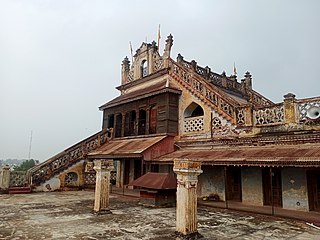
Galiyakot is a town in Dungarpur District of Rajasthan, India. It is situated about 56 km from Dungarpur city and 168 km from the Rajasthan city of Udaipur. It was controlled by the Parmar dynasty around Vikram Samvat 1000. In Vikram Samvat 1342, Rao Dedu (Devpal), Raja of the Sisodiya dynasty, subdued Galiyakot. The predecessors of Dungarpur controlled Galiyakot for many years before settling in Dungarpur. It is part of a Dawoodi Bohra pilgrimage site and contains many Hindu temples, including the Shitla Mata Mandir and the tomb of Babjee Moula Syedi Fakhruddin.
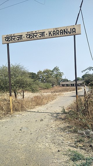
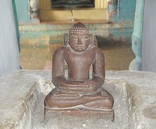
Karanja Lad, or Karanja, is a city of a Municipal council in Washim district in the Indian state of Maharashtra. The town is named after Saint Karanj. Karanja is a holy place for Hindus, Jains, and Muslims. It is the birthplace of Shri Narasimha Saraswati Swami Maharaj, believed to be the second incarnation of Lord Dattatreya.
Kukshi is a town in Dhar district of Madhya Pradesh state, India. Kukshi has population of around 37,482 making it a Tier-3 city and a Semi-Urban centre. It is a Nagar Parishad. Kukshi is famous for the business of cotton, mirchi, gold and silver, and ready made garments.
Nawa is a city, tehsil headquarters, panchayat samiti, and a municipality in Didwana Kuchaman District in the Indian state of Rajasthan. It is the Biggest Salt Market of Rajasthan.
Obedullaganj is a town and a nagar panchayat in Raisen district in the Indian state of Madhya Pradesh. It is situated 70 km from its district headquarter Raisen and 36 km from its state capital city Bhopal.

Raipur Rani is a census town in Panchkula district in the Indian state of Haryana. It is located on the Panchkula city-Chandigarh-Nahan-Paonta Sahib-Dehradun highway 30 kilometres east from the Chandigarh-Mohali-Panchkula urban cities combine. It is about 20 kilometres from the Dera Bassi Industrial belt and 10 kilometres from the Barwala industrial estate. Narayangarh in the Ambala District is the next large town in its proximity.
Rehli is a city and a municipality in Sagar district in the Indian state of Madhya Pradesh. it's also a tehsil headquarter.
Reoti is a town and a nagar panchayat in Ballia district in the Indian state of Uttar Pradesh. Known for got freedom before 1947 As usual India had got freedom on 15 Aug 1947 but all across the India Reoti town got freedom in 1942.
Sagwara is a city and municipality, near Dungarpur city in Dungarpur district in the Indian state of Rajasthan. It is one of two towns in Sagwara Tehsil, and the administrative center for the Sagwara Tehsil's additional district court and sub jailkshla.
Talbehat is a nagar panchayat city in Lalitpur district in the Indian state of Uttar Pradesh.
Khimel is an Indian village situated between Rani and Falna rail station in the Pali District of Rajasthan state. Khimel is divided into two parts: the village and dhani. Khimel is a village in Bali Tehsil in Pali District of Rajasthan, India. It belongs to Jodhpur Division. It is located 60 km towards South from District headquarters Pali. 22 km from Bali. 362 km from State capital Jaipur Khimel Pin code is 306115 and postal head office is Rani Sadar Bazar. Khimel have a small railway station where only local trains halts. Khimel receives 24/7 electricity. This region is called Gorwar and popular language is Marwari. Falna, Bali, Sadri, Sumerpur are the nearby Cities to Khimel.
Kabbur is a town in the southern state of Karnataka, India. It is located in the Chikodi taluk of Belgaum district in Karnataka.
Bhinder or Bhindar is a town in Udaipur District, that is located 315 km (196 mi) from the state's main city Jaipur. Bhinder borders the Chittorgarh District in Rajasthan and is located 58 kilometres (36 mi) south-east of Udaipur. Notable tourist sites nearby include Sita Mata Wildlife Sanctuary, Jaisamand Sanctuary, and Jaisamand Lake. Bhinder is surrounded by four lakes.
Simalwara is a census town in Dungarpur district in the Indian state of Rajasthan. It is the administrative headquarters for Simalwara Tehsil.


