Mithila first gained prominence after being settled by Indo-Aryan peoples who established the Mithila Kingdom (also called Kingdom of the Videha).[5] During the late Vedic period (c. 1100–500 BCE), the kingdom of the Videha became one of the major political and cultural centres of South Asia, along with Kuru and Pañcāla. The rulers of Videha were called Janakas.[5]
The Mithila Kingdom was later incorporated into the Vajjika League, which had its capital in the city of Vaishali, which is also in Mithila.[6]
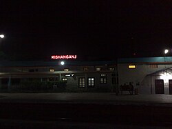
As of the 2011 Census of India,[8] Kishanganj has a population of 105,782 of which male and female are 55,143 and 50,639 respectively.[8][9]Literacy rate of Kishanganj city is 73.46% higher than the state average of 61.80%. In Kishanganj, Male literacy is around 78.37% while the female literacy rate is 68.08%.[8][10] In Kishanganj, Total children (0-6) in Kishanganj city are 16,884 as per figure from Census India report on 2011. There were 8,636 boys while 8,248 are girls. The children form 15.96% of the total population of Kishanganj City. Scheduled Castes and Scheduled Tribes make up 11.63% and 1.52% of the population respectively.[8]
12Witzel, Michael (1989). Caillat, C. (ed.). Tracing the Vedic dialects in Dialectes Dans Les litteratures Indo-Aryennes. Paris: Fondation Hugot. pp.13, 17 116–124, 141–143.
↑Hemchandra, R. (1972). Political History of Ancient India. Calcutta: University of Calcutta.
This page is based on this Wikipedia article Text is available under the CC BY-SA 4.0 license; additional terms may apply. Images, videos and audio are available under their respective licenses.