Purnia division

Last updated

Purnia Division
Purnia division.svg
Location of Purnia division in Bihar
Coordinates: 25°47′N87°28′E / 25.78°N 87.47°E / 25.78; 87.47
CountryFlag of India.svg  India
State Bihar
Region Mithila (Kosi—Seemanchal subregion)
Established1990[ citation needed ]
Headquarters Purnia
Districts Araria, Katihar, Kishanganj and Purnia district
Government
   Divisional Commissioner Mr. Rahul Mahival (IAS)
   Inspector General Mr. Vinod Kumar
Area
  Total10,009 km2 (3,864 sq mi)
  Rank4th in Bihar
Population
 (2011)
  Total10,837,617
  Rank4th in Bihar
  Density1,100/km2 (2,800/sq mi)

Purnia division is an administrative geographical unit of Bihar state of India. Purnia is the administrative headquarters of the division. The division consists of Purnia district, Katihar district, Araria district, and Kishanganj district. It was established in 1990.[ citation needed ] It is also known as Seemanchal. [1] It is a part of the Kosi—Seemanchal subregion of the cultural Mithila region. [2]

Contents

History

Purnia division, all of which was previously part of Purnia district, is part of the Mithila region. [3] Mithila first gained prominence after being settled by Indo-Aryan peoples who established the Mithila Kingdom (also called Kingdom of the Videhas). [4] During the late Vedic period (c. 1100–500 BCE), Kingdom of the Videhas became one of the major political and cultural centers of Asia, along with Kuru and Pañcāla. The kings of the Kingdom of the Videhas were called Janakas. [5] The Mithila Kingdom was later incorporated into the Vajjika League, which had its capital in the city of Vaishali, which is also in Mithila. [6] During the Mughal rule, Purnia was an outlying military province, and its revenue was mostly spent on protecting its borders against tribes from the north and east. [7] After the capture of Calcutta in 1757, Purnia's local governor raised a rebellion against Siraj ud-Daulah. In 1765, the district became a British possession, along with the rest of Bengal. [8] On February tenth, 1770 The district of Purnia in modern history was formed by the East India Company. [9] Purnia district has seen the three districts partitioned off from its territory: Katihar in 1976, [10] and Araria and Kishanganj in 1990. [10] The districts of Araria, Katihar, Purnia and Kishanganj together from the Purnia division.
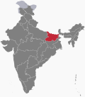
English rule and freedom struggle

The last of the Governors was Md. Ali Khan who was replaced in 1770 by Mr. Ducarrel, the first English supervisor or Collector. The early years of British rule were years of trouble for Purnia. The district suffered terribly during the great famine of 1770. From the old records, it appears that there were European settlers in Purnia almost immediately after the establishment of British rule in the district. By 1771, a number of Europeans had settled in the area known as Rambagh, the only building left in Rambagh was the church and the priests' houses. The Roman Catholic Church was dismantled and re-erected in the new station of Purnia where the Europeans had already set up their residences. The foundation of this new church was there until 1934, when it was badly affected by the Bihar earthquake. The church was dismantled again. The nuns of Loretto convent of Darjeeling had come to Purnia near about 1882 and had opened a day school as well as a boarding school for children in Purnia district. When the Jesuit Mission of Bengal took over the Purnia Mission from the Capuchin Mission, the school was closed and the nuns returned to Darjeeling. This house still stands and is known as the Coumblin. It is one of the oldest houses in Purnia town and is now occupied by the Allisons.

Kisan Sabha movement, which had been responsible for an acute agitation in Purnia district in the third decade in 20th century and figured prominently for about 20 years, had its roots in the very agricultural economy and the precious structure of permanent land-lordism in this state. The Kisan Sabha was formed at Munger near about 1922–23. After 1940–41, the kisan sabha movement slowly merged into the Congress Movement.

Purnia district, being so very contiguous to several districts of undivided Bengal, had been promptly affected by the swadeshi movement in the first decade of the 20th century. At that time there were no facilities for higher education in Purnia district and the students who sought higher education had to go to Calcutta or to Patna. The Bihar National College and TK Ghosh Academy were suspected as the two centers for a secret students organization, which indulged in sedition and both these institutions had a sprinkling of students from Purnia. A boy from Purnia, Atul Chandra Mazumdar, a student of the BN College, Patna was arrested under the Defence Act of India.

Since 1919, Purnia had closely followed the policy, aims and objectives of the Indian National Congress. Some of the delegates of Purnia attended the Nagpur session of Congress in 1920 and the moment Mahatma Gandhi gave the call for the Non-Cooperation, there were a number of volunteers in this district. Some of the early local leaders were Gokul Krishna Roy, Satyendra Narayan Roy and a few others who gave up their practice in the Bar and joined the movement.

In 1921, a national school was started in Katihar. Shri Rajendra Prasad toured Purnia district in 1921 and addressed meetings at Purnia and at other places. In 1942 Quit India Movement tactics were fully implemented by the people of Purnia. Mahatma Gandhi visited Purnia in 1929, during which time he met the Raja of Nazargunj and addressed crowded meetings at various places including Kisahnganj, Bishnupur, Araria and Purnia. The survey and settlement operations in Purnia district commenced in 1952 and settlement operations were concluded in 1960. During the 1911–20 period, Purnia suffered from epidemics of cholera every year from 1915 to 1919. A very serious outbreak of cholera occurred in 1925. Incidences of smallpox and malaria was very high during this period.

Since Independence, the region has suffered from significant neglect from successive governments.

Demographics

Religion in Purnia Division (Seemanchal)
Hindus
53.51%
Muslims
45.93%
Others
0.56%

Languages in Purnia Division (2011) [11]

   Hindi (23.65%)
   Urdu (20.72%)
  Other Hindi (17.20%)
   Surjapuri (17.10%)
   Maithili (9.14%)
   Bengali (6.37%)
   Santali (2.42%)
   Bhojpuri (1.21%)
  Others (2.19%)

According to the 2011 census, Purnia division has a population of 1,08,37,617 which is 10.41% of the population of Bihar. [12] Maithili is the main language of this area. [13] Hindi, Urdu, Surjapuri, Bengali, Santali and Kulhaiya boli are also spoken in this area. [14]

The religious demographics of Purnia division are very different from the rest of Bihar. Although in Bihar the overall Muslim population is 16.86%, in Purnia division the Muslim population is 45.93% while the Hindu population is 53.51%. [14]

2017 North Bihar Floods

2017 Floods affected 19 districts of North Bihar causing death of 514 people, [15] [16] [17] [18] [19] [20] in which four districts of Purnia division (Araria 87, Katihar 40, Kishanganj 24 and Purnia 9) accounted for 160 deaths alone. [21]

Note

    Related Research Articles

    Araria is a city and a municipality that is the headquarters of Araria district in the Indian state of Bihar. Araria is situated in the northern part of Bihar.

    <span class="mw-page-title-main">Kishanganj</span> Town in Bihar, India

    Kishanganj is a city and district headquarters of Kishanganj district in Purnia division of Bihar state.

    <span class="mw-page-title-main">Katihar</span> City in Bihar, India

    Katihar is a city situated in the eastern part of the state of Bihar in India. It is the regional headquarters of Katihar district. It is one of the important cities of Bihar. Also it is a main stop on the Delhi - Guwahati railway line.

    Madhepura is a municipality in Madhepura district in the Indian state of Bihar. It stands at the centre of Kosi ravine, It was called Madhyapura- a place centrally situated which was subsequently transformed as Madhipura into present Madhepura. It is surrounded by Araria and Supaul districts in the north, Khagaria and Bhagalpur districts in the south, Purnia district in the east and Saharsa district in the West.

    <span class="mw-page-title-main">Purnia</span> Urban Agglomeration in Bihar, India

    Purnia is the fourth largest city of Bihar and is emerging as the biggest economic hub in North Bihar. It serves as the administrative headquarters of both Purnia district and Purnia division in the Indian state of Bihar. It is well known for its favourable climate like Darjeeling and has an abundance of resources for human settlements and economic activities.

    <span class="mw-page-title-main">Saharsa</span> City and municipal corporation in Bihar, India

    Saharsa is a city and municipal corporation in the Saharsa District in the eastern part of the state of Bihar, India. It is situated near the eastern banks of the Kosi River. It serves as the administrative headquarters for Saharsa District and is also the Divisional headquarters of the Kosi Division.

    Supaul is a town and a municipality that is headquarters of Supaul district in the Indian state of Bihar. Supaul is the administrative headquarters of this district. There Are 11 block under the Supaul district Supaul, Kishanpur, Saraigarh-Bhaptiyahi, Pipra, Triveniganj, Raghopur, chhatapur, Nirmali, Marauna, Basantpur and pratapganj.

    <span class="mw-page-title-main">Araria district</span> District of Bihar in India

    Araria district is one of the thirty-eight districts of Bihar state, India. Araria district is a part of Purnia division. The district occupies an area of 2,830 km2 (1,090 sq mi). Araria town is the administrative headquarters of this district. Distance from Nepal border is only about 8 km from Forbesganj head quarter.

    <span class="mw-page-title-main">Purnia district</span> District in Bihar, India

    Purnia District is one of the thirty-eight districts of the Indian state of Bihar. The city of Purnia is the administrative headquarters of this district. The city of Purnia has continued its tradition of hoisting the national flag at 12:07 am on every Independence Day since 1947. Purnia district is a part of Purnia Division. The district extends northwards from the Ganges river.

    <span class="mw-page-title-main">Supaul district</span> District of Bihar in India

    Supaul district is one of the thirty-eight districts of Bihar, India. The town Supaul is the district's administrative headquarters. The district, which was split from the former Saharsa district on 14 March 1991, occupies 2,410 km2 (931 sq mi).

    <span class="mw-page-title-main">Katihar district</span> District of Bihar in India

    Katihar district is one of the thirty-eight districts of Bihar state in India, and Katihar city is the administrative headquarters of this district. The district is a part of Purnia Division. It is prominently known for its Katihar Junction Railway Station, which is a Category A station on the Barauni–Guwahati line. It has been included in the Aspirational Districts Program of the Government of India since 2018, to improve its socio-economic indicators.

    <span class="mw-page-title-main">Kishanganj district</span> District in Bihar, India

    Kishanganj district is one of the thirty-eight districts of Bihar state, India, and Kishanganj town is the administrative headquarters of this district. Kishanganj district is a part of Purnia division (Seemanchal).

    <span class="mw-page-title-main">Saharsa district</span> District of Bihar in India

    Saharsa is one of the thirty-eight districts of Bihar, India. Saharsa city is the administrative headquarters of this district. Saharsa district is a part of the Kosi Division and it became a district on 1 April 1954 and has subsequently become smaller with other districts being carved from it, most notably Madhepura in 1981.

    <span class="mw-page-title-main">Kosi division</span> Division of Bihar in India

    Kosi division is an administrative geographical unit of Bihar state of India. Saharsa is the administrative headquarters of the division. Currently (2022), the division consists of Saharsa district, Madhepura district, and Supaul district.

    Maithils, also known as Maithili people, are an Indo-Aryan ethno-linguistic group from the Indian subcontinent, who speak the Maithili language as their native language. They inhabit the Mithila region, which comprises Northern and Eastern Bihar and Northeastern Jharkhand in India and some adjoining districts of Nepal constituting Madhesh Province in addition to some terai districts of Bagmati and Koshi Provinces. The Maithil region forms an important part of Hinduism as it is said to be the birthplace of Sita, the wife of Ram and incarnation of Lakshmi.

    <span class="mw-page-title-main">North Bihar</span> Geographic Region in Bihar, India

    North Bihar is a term used for the region of Bihar, India, which lies north of the Ganga river.

    <span class="mw-page-title-main">2017 Bihar flood</span> Flood in Bihar, India

    2017 Bihar floods affected 19 districts of North Bihar causing death of 514 people. 2,371 panchayats under 187 blocks of 19 districts of Northern Bihar have been affected in the flood. Around 1.71 crore people were hit by the floods. Over 8.5 lakhs of people have lost their homes, with Araria district alone accounting for 2.2 lakh homeless people. 2017 Flood has broken 9-Year record of deaths In Bihar. Bihar is India's most flood-prone State, with 76% of the population in the North Bihar living under the recurring threat of flood devastation. Devastating flood was caused due to excess heavy rainfall in monsoon season.

    <span class="mw-page-title-main">Purnea University</span> State University in Bihar

    Purnea University is a collegiate public state university located in Purnia, Bihar, India. It has jurisdiction over Purnia, Araria, Kishanganj and Katihar districts. It was established by an act of State Legislature in 2018. As a collegiate university, its main functions are divided between the academic departments of the university and affiliated colleges.

    Kosi-Seemanchal is a subregion of Mithila region in the Northeastern part of Bihar. It consists of Kosi and Purnia divisions. It has seven districts — Araria, Madhepura, Saharsa, Supaul, Purnea, Kishanganj and Katihar.

    <span class="mw-page-title-main">Main Media</span> Digital News platform in Bihar, India

    Main Media is a hyper-local news platform based in the Seemanchal region, an area located at the border of Bihar and West Bengal. Main Media was founded by Tanzil Asif, an alumnus of the Indian Institute of Mass Communication, Delhi in 2018. With the tagline "Patna se door waala Bihar, Kolkata se door waala Bengal, the organisation aims to bring the focus of the media to the historically neglected Seemanchal region of Bihar and West Bengal. Main Media was formally launched on 18 February 2018.

    References

    1. "Internet services suspended in 7 districts of Bihar after carcasses found floating in canal". 5 September 2017.
    2. Kumāra, Braja Bihārī (1998). Small States Syndrome in India. Concept Publishing Company. p. 146. ISBN   9788170226918. Archived from the original on 4 September 2017. Retrieved 16 February 2017.
    3. Jha, Makhan (1997). Anthropology of Ancient Hindu Kingdoms: A Study in Civilizational Perspective. M.D. Publications Pvt. ISBN   9788175330344.
    4. Michael Witzel (1989), Tracing the Vedic dialects in Dialectes dans les litteratures Indo-Aryennes ed. Caillat, Paris, pages 13, 17 116–124, 141–143
    5. Witzel, M. (1989). "Tracing the Vedic dialects". In Caillat, C. (ed.). Dialectes dans les litteratures Indo-Aryennes. Paris: Fondation Hugot. pp. 141–143.
    6. Hemchandra, R. (1972). Political History of Ancient India. Calcutta: University of Calcutta.
    7. Purnea District - Imperial Gazetteer of India, v. 20, p. 414
    8. Purnia District - Imperial Gazetteer of India, v. 20, p. 415
    9. The Times of India, Patna Edition Feb 15, 2012
    10. 1 2 Law, Gwillim (25 September 2011). "Districts of India". Statoids. Retrieved 11 October 2011.
    11. "Table C-16 Population by Mother Tongue: Bihar". censusindia.gov.in. Registrar General and Census Commissioner of India. 2011.
    12. Munazir, Shahana (9 May 2019). "The anatomy of a marginalised region". The Hindu .
    13. Ranjan, Manish (19 January 2021). Bihar Samanya Gyan. Prabhat Prakashan. ISBN   9789386300850.
    14. 1 2 "District Census Hand Book - BIHAR". censusindia.gov.in. Retrieved 19 July 2021.
    15. "Floods in state not man-made, says minister". The Times of India . 29 August 2017.
    16. "Flood Situation Improves In Bihar, Number Of Dead At 514".
    17. "Bihar flood toll reaches 418; 1.67 crore affected in 19 districts". The Times of India . 25 August 2017.
    18. "Flood situation worsens in Bihar, death toll rises to 253". The Times of India . 20 August 2017.
    19. "Bihar floods: 119 dead; bridge collapse caught on camera". The Times of India . 18 August 2017.
    20. "Bihar floods: Death toll rises to 202 in 18 districts; thundershowers likely to continue today". 20 August 2017.
    21. "PM Narendra Modi to make aerial survey of flood-hit Purnia today". The Times of India . 26 August 2017.