Darbhanga Dorbhanga | |
---|---|
Darbhanga City | |
Nickname: Cultural Capital of Bihar | |
Coordinates: 26°10′N85°54′E / 26.17°N 85.9°E | |
Country | India |
State | Bihar |
Region | Mithila |
District | Darbhanga |
Established | 01 January 1875 |
Government | |
• Type | Municipal Corporation |
• Body | Darbhanga Municipal Corporation |
• Mayor | Smt. Anjum Ara |
• Municipal Commissioner | Shri Kumar Gaurav (IAS) |
• SP City | Shri Sagar Kumar (IPS) |
• Member of Parliament | Gopal Jee Thakur (BJP) |
• MLA | Sanjay Saraogi (BJP) |
Area | |
• Total | 39.83 km2 (15.38 sq mi) |
Elevation | 52 m (171 ft) |
Population (2011) | |
• Total | 296,039 |
Demonym | Darbhangvi |
Languages | |
• Official | Hindi [2] |
• Additional official | Urdu [3] |
• Regional | Maithili |
Time zone | UTC+5:30 (IST) |
PIN | |
Telephone code | 06272 |
ISO 3166 code | IN-BR |
Vehicle registration | BR-07 |
Sex ratio | 1000:910 ♂/♀ |
Lok Sabha constituency | Darbhanga |
Vidhan Sabha constituency | Darbhanga, Darbhanga Rural, Bahadurpur, Keoti, Jale, Kusheshwar Asthan, Gaura Bauram, Benipur, Alinagar, Hayaghat |
Website | darbhanga |
Darbhanga is the fifth largest city and municipal corporation in the state of Bihar in India, and is considered an important city in North Bihar. It serves as the headquarters of the Darbhanga district and the Darbhanga division. It is held that the name Darbhanga has been derived from Dwar Banga or Dari – Banga, meaning the 'door of Bengal'. [6]
Darbhanga was the seat of the erstwhile Khandwala zamidaar dynasty under the Mughals and British India. It is considered an important medical centre of North Bihar as it is the location of the Darbhanga Medical College and Hospital, and the second AIIMS of the state is to be constructed here. [7] [8] [9] [10]
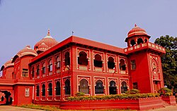
Darbhanga is one of the oldest cities in India. Musical, folk art, and literary traditions in Sanskrit,Urdu ,Hindi and Maithili have passed down generations in Darbhanga and constitute the city's strong cultural background. It is popularly known as the "Cultural Capital of Bihar" and the "Heart of Mithilaanchal". [11]
The city was the capital of the Darbhanga Raj, an estate established in the 16th century, containing the Anandbagh Palace. It was constituted as a municipality in 1864. Darbhanga is home to the Kameshwara Singh Darbhanga Sanskrit University (established 1961), which is located on the grounds of the palace, and the Lalit Narayan Mithila University (established 1972). Darbhanga has a museum housing archaeological materials, as well as historical and handicrafts exhibits.
Darbhanga has been a centre for music since the late 18th century and has produced multiple well-known dhrupad (an ancient form of Indian classical music) musicians. A major rail and road junction, Darbhanga trades in agricultural produce, mangoes, and fish. In addition to food processing, the city has a light manufacturing industry.
Darbhanga is situated on a vast alluvial plain, with low-lying areas containing marshes and lakes. Grains, oilseeds, tobacco, sugarcane, and mangoes are important crops in the region. [12]
Under the British Raj, Darbhanga was a part of Sarkar Tirhut until 1875, when it was constituted into a separate district. Its subdivisions had been constituted earlier – Darbhanga Sadar in 1845, Madhubani in 1866, and Samastipur (then known as Tajpur) in 1867. The city of Darbhanga is said to have been founded by one Darbhangi Khan, about whom practically nothing is known. It is also held that the name Darbhanga is derived from Dwar Banga or Dar-e-Banga, meaning the 'door of Bengal'. This etymology does not appear to be accurate as the division between Bengal and Bihar has always been held to be further to the east. Nonetheless, the region has a linguistic and cultural affinity with Bengal. [13]
Excavation at Balirajgarh revealed brick fortifications dating back to the 2nd century BC. [14]
Darbhanga is located in the northern part of Bihar. It lies between 25.53 degrees - 26.27 degrees N and 85.45 degrees - 86.25 degrees E at an average elevation of 171 feet (52 m). Darbhanga district covers an area of 2,279 sq km. Darbhanga is bounded by Madhubani district in the north, Samastipur district in the south, Saharsa district in the east, and Sitamarhi district and Muzaffarpur district in the west. Being located in Mithilanchal, Darbhanga district has a vast fertile alluvial plain devoid of any hills. It has a gentle slope from north to south direction having a depression in the centre. Darbhanga experiences a humid subtropical climate. It experiences three main seasons which are winter, summer, and rainy seasons. May is the hottest month when the temperature reaches up to 43 °C. Darbhanga district receives an average of 1142.3 mm rainfall and almost 92% of the annual rainfall is received during monsoon.
Darbhanga has a humid subtropical climate (Köppen climate classification Cwa).
Climate data for Darbhanga (1971–1990, extremes 1901–1998) | |||||||||||||
---|---|---|---|---|---|---|---|---|---|---|---|---|---|
Month | Jan | Feb | Mar | Apr | May | Jun | Jul | Aug | Sep | Oct | Nov | Dec | Year |
Record high °C (°F) | 30.6 (87.1) | 34.1 (93.4) | 40.6 (105.1) | 43.9 (111.0) | 44.1 (111.4) | 43.6 (110.5) | 39.3 (102.7) | 38.6 (101.5) | 38.6 (101.5) | 39.4 (102.9) | 34.1 (93.4) | 36.6 (97.9) | 44.1 (111.4) |
Mean daily maximum °C (°F) | 23.1 (73.6) | 25.8 (78.4) | 31.0 (87.8) | 35.1 (95.2) | 35.0 (95.0) | 34.9 (94.8) | 32.5 (90.5) | 32.8 (91.0) | 32.5 (90.5) | 31.6 (88.9) | 29.0 (84.2) | 24.8 (76.6) | 30.7 (87.3) |
Daily mean °C (°F) | 16.2 (61.2) | 18.4 (65.1) | 23.0 (73.4) | 27.1 (80.8) | 28.2 (82.8) | 28.8 (83.8) | 28.2 (82.8) | 28.4 (83.1) | 28.2 (82.8) | 26.5 (79.7) | 22.4 (72.3) | 17.7 (63.9) | 24.4 (75.9) |
Mean daily minimum °C (°F) | 9.2 (48.6) | 11.0 (51.8) | 15.1 (59.2) | 19.4 (66.9) | 21.2 (70.2) | 22.9 (73.2) | 23.8 (74.8) | 24.2 (75.6) | 23.8 (74.8) | 21.2 (70.2) | 15.8 (60.4) | 10.6 (51.1) | 18.2 (64.8) |
Record low °C (°F) | 0.0 (32.0) | 0.0 (32.0) | 4.1 (39.4) | 9.4 (48.9) | 10.6 (51.1) | 11.0 (51.8) | 13.5 (56.3) | 15.5 (59.9) | 13.5 (56.3) | 10.0 (50.0) | 7.2 (45.0) | 2.6 (36.7) | 0.0 (32.0) |
Average precipitation mm (inches) | 13 (0.5) | 14 (0.6) | 9 (0.4) | 29 (1.1) | 76 (3.0) | 139 (5.5) | 353 (13.9) | 254 (10.0) | 193 (7.6) | 73 (2.9) | 6 (0.2) | 7 (0.3) | 1,166 (45.9) |
Average rainy days (≥ 1.0 mm) | 1.6 | 1.7 | 1.6 | 2.6 | 4.6 | 7.6 | 16.4 | 12.2 | 10.5 | 3.4 | 0.5 | 1.0 | 63.7 |
Average relative humidity (%) | 68 | 63 | 49 | 56 | 60 | 70 | 78 | 79 | 79 | 73 | 66 | 67 | 67 |
Source 1: NOAA (1971–1990) [15] | |||||||||||||
Source 2: India Meteorological Department [16] |
The 2011 Census of India recorded Darbhanga as an Urban agglomeration with a population of 296,039 while the surrounding district has 3 million people. [18] It is the 5th largest city in Bihar in terms of the urban population. [19] The city has 196,573 males (52.6%) and 183,552 females (47.4%). Darbhanga has an average literacy rate of 79.40%, with male literacy at 85.08% and female literacy at 73.08%. [20] However, as per the document published on 6 March 2021 by the office of District Magistrate Darbhanga, the urban population of Darbhanga stands 380,125. [19]
At the time of the 2011 census, 50.25% of the population spoke Maithili, 26.80% Urdu and 20.98% Hindi as their first language. [21]
Darbhanga Junction lies on the East Central Railway. It is connected directly to all the major cities of India. Laheriasarai Railway Station is the second major station of Darbhanga and works as an important railway station for people living in south Darbhanga.
There are daily and weekly trains available for New Delhi, Patna, Secunderabad, Kolkata, Varanasi, Ahmedabad, Lokmanya Tilak Terminus, Howrah, Amritsar, Pune and other major cities.
Darbhanga also has its own commercial airport which is connected with all the major cities of India.
Darbhanga Airport (IATA: DBR, ICAO: VE89) is a civil enclave at the Darbhanga Air Force Station of the Indian Air Force, 6 kilometres from Darbhanga City near the NH 527B and NH 27 East-West Corridor Expressway which passes through Darbhanga. The civil enclave is operated by the Airports Authority of India (AAI). The foundation stone for the project was laid by Chief Minister Nitish Kumar and then Civil Aviation Minister Suresh Prabhu in the presence of state Civil Aviation Minister Jayant Sinha on 24 December 2018. After efforts taken by the MP of Darbhanga, Gopal Jee Thakur, [22] [23] and the then Civil Aviation Minister, Hardeep Singh Puri. Commercial flights started on 8 November 2020. [24]
NH 27 which is part of India's East–West highway corridor passes through Darbhanga. Darbhanga is connected to other parts of India by NH 27, NH 527B and Bihar State highways 50, 56, 88 and 75. Darbhanga is also connected to Muzaffarpur, Samastipur, Madhubani and Sitamarhi.
The East-West Corridor expressway, which connects Porbandar in Gujarat to Silchar in Assam, passes through Darbhanga.
The Amas–Darbhanga Expressway NH 119D is an approved 4/6-lane wide access-controlled expressway in India. Once completed, it will be the first expressway in the state of Bihar. NH 119D connects Amas village in Gaya district to Bela Nawada village in Darbhanga district.
Notable educational institutions include:
Dayanand Anglo Vedic(DAV) Gyan Sarita Public school Gyan Bharti public school Delhi public school Creative academy Harrow English School(2branch) Darjeeling Public School
Darbhanga has various tourist attractions and is among the oldest cities of Bihar.
Tourist spots include:
All India Radio has a 20 kW medium-wave radio station in Darbhanga which transmits various programmes of mass interest and covers a part of North Bihar as well as the Terai of Nepal.[ citation needed ]
Doordarshan has one DD National and one DD News LPT relay transmitters.[ citation needed ]
Madhubani is a City Municipal Corporation and headquarter of Madhubani district. Madhubani is situated in the Indian state of Bihar. It comes under Darbhanga Division. It is situated at 26 km northeast of Darbhanga City. The Madhuban Raj in Madhubani was created as a consequence. The word "Madhuban" means "forest of honey", from which Madhubani is derived, but sometimes it is also known as "madhu"+"vaani" meaning "sweet" "voice/language".
Samastipur is a city and Municipal Corporation in Bihar, India. It is the headquarter of Samastipur district and comes under Darbhanga division. The Burhi Gandak River flows through the city. It is one of the five railway divisions of ECR, Hajipur. The Samastipur junction is one of the busiest station in North Bihar after Patna and Katihar.
Mithila, also known as Tirhut, Tirabhukti and Mithilanchal is a geographical and cultural region of the Indian subcontinent bounded by the Mahananda River in the east, the Ganges in the south, the Gandaki River in the west and by the foothills of the Himalayas in the north. It comprises certain parts of Bihar and Jharkhand of India and adjoining districts of the Koshi Province, Bagmati Pradesh and Madhesh Province of Nepal. The native language in Mithila is Maithili, and its speakers are referred to as Maithils.
Kaluahi is a village in Madhubani District of Bihar in India.
Bharti Dayal is an Indian artist who specializes in Madhubani art.
Chhatwan is a village in Keotiranway Tehsil, Darbhanga District, Bihar, India.
Mithila Student Union (MSU) (Maithili : मिथिला स्टूडेंट यूनियन) is a non-political student organisation whose sole purpose is the development of Mithila and Maithils living in India. It is one of the largest student organisations in Bihar. It is a registered organization under the provisions of the Societies Registration Act, 1860 under the Indian constitution. Anup Maithil is the founder president of Mithila Student Union. They mostly keep Mithila Art Boarded Maroon Gamchha on their Sholder which is the Symbol of Passion, Love, Bravery and Courage.
Gopal Jee Thakur is an Indian Politician from the Bharatiya Janata Party, and a Member of Parliament representing Darbhanga in Bihar, India. He is a Member of Standing Committee on Railways, Member of Consultative Committee, Ministry of Railways, and the special invitee Member of BJP's National Executive committee.
Manas Bihari Verma was an Indian aeronautical scientist instrumental in the development of the light combat aircraft, Tejas. In 2018, he was conferred the Padma Sri civilian honour by the President of India. After his retirement he launched Mobile Science Lab aimed at promoting science education in Bihar.
Gopal Singh Shekhawat, also known as Gopal Singh Idwa is an Indian politician and the former Lok Sabha member, who represented Rajsamand constituency of Rajasthan state as the Member of the Bhartiya Janata Party.
Dr. Murari Mohan Jha is an Indian politician (MLA) from Darbhanga, Bihar. He is a member of the present Bihar Legislative Assembly. Jha contested the 2020 Bihar Legislative Assembly election on a BJP ticket and defeated his closest rival, Abdul Bari Siddiqui, a veteran leader of the Rashtiya Janta Dal.
Mithila Makhana is a special variety of aquatic fox nut cultivated in Mithila region of Bihar and Nepal. In Mithila, Makhana is also termed as Makhan. It is one of the three prestigious cultural identities of Mithila: Pond, Fish and Makhan "पग-पग पोखर, माछ, मखान ". It is also famous in Kojagara festival of Maithil Brahmins and Kaysath celebrated for newly married couples. Makhana contains protein and fiber, along with micronutrients like calcium, magnesium, iron, and phosphorus.
The Vishnu Statue in Bairwa is an ancient statue of Vishnu.
Ugna is the incarnation of Lord Shiva as the servant of his devotee Maithili poet Vidyapati around 6th decades of 14th century in Mithila. According to legend, the people of Mithila generally remember and worship Lord Shiva in the name of word "Ugna". Lord Shiva has thousand names and Ugna Deva is one of these names of Lord Shiva.
Yajnavalkya Ashram was a gurukul of the Indian philosopher Yajnavalkya. It is believed that Yajnavalkya got his enlightenment here. It is the place where he wrote many texts of Ancient Indian philosophy. He wrote Shatapatha Brahman, Yajnavalkya Smriti, Brihadaranyaka Upanishad, Yoga Yajnavalkya and many more. Yajnavalkya Ashram is situated at Jagban village of Madhubani district in Mithila region of Bihar.
Dilip Kumar Choudhary is an Indian politician from Darbhanga Graduate Constituency in Bihar. He was a Member of the Bihar Legislative Council two times, since 2007 and 2014. From the year 1990 to 2002, he was a councillor of Darbhanga Municipal Corporation. He completed his master's degree in chemistry subject from Lalit Narayan Mithila University and Ph.D. from Allahabad University. Choudhary is a professor of chemistry in Chandradhari Mithila Vigyan Mahavidyalaya at Lalit Narayan Mithila University, Darbhanga. Since February 2022, he is also principal of C.M. Science College along with the charge of C. M. Law College, Darbhanga. His father, Late Dr. Nilambar Chaudhary was also a Senior Leader of the Indian National Congress and a member of the Bihar Legislative Council multiple times from Darbhanga Graduate Constituency.
Mithila State Movement is a movement advocating a separate Mithila state in India. This movement gained momentum in 1902 AD when Sir George Grierson, an official of the British Indian government, prepared a map of Mithila state by conducting a language-based survey. In 1881 AD, the word Mithila was added to the dictionary of the British India government. According to the founder, president Dr. Dhanakar Thakur of the International Maithili Council in the proposed Mithila state, 24 districts of Bihar and six districts of Jharkhand, a total of 30 districts, have been included, which has a population of about 70 million. At the same time, the area is 70 thousand square km.
Chetavani ra Chungatya is a patriotic Dingal poem composed by Thakur Kesari Singh Barhath in 1903 and addressed to Maharana of Mewar, Fateh Singh, exhorting him to uphold the traditions of his lineage and to not attend the Delhi Durbar. The couplets had the desired effect on the Maharana who decided not to attend the durbar despite being present in Delhi. The work remains one of the great literary works produced during the freedom struggle. It consists of 13 stanzas or sortha (saurashtra-duha).
Sanjay Kumar Jha is an Indian politician who served as Minister of Water Resources and Information and Public Relations departments in Government of Bihar He was also Member of Bihar Legislative Council. In February 2024 he elected unopposed as Member of Parliament (India), Rajya Sabha to Janata Dal (United) in place of Bashistha Narain Singh from Bihar.
The Ahir Regiment, also known as the Yadav Regiment, is a proposed infantry regiment of the Indian Army that has been requested by the Yadava community.