
Sitamarhi is an Indian city in the Mithila region of Bihar. It is the district headquarters of the Sitamarhi district in Tirhut Division. The city was named in honour of the goddess Sita, who was born in Sitamarhi in Hindu mythology.

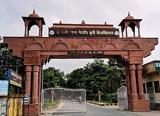
Darbhanga is the fifth largest city and municipal corporation in the state of Bihar in India, and is considered an important city in North Bihar. It serves as the headquarters of the Darbhanga district and the Darbhanga division. It is held that the name Darbhanga has been derived from Dwar Banga or Dari – Banga, meaning the 'door of Bengal'.

Lakhisarai town is the administrative headquarters of Lakhisarai district in the Indian state of Bihar. The town has a population of 99,979. it is situated about 45 km west of Munger.

Madhubani is a City Municipal Corporation and headquarter of Madhubani district. Madhubani is situated in the Indian state of Bihar. It comes under Darbhanga Division. It is situated at 26 km northeast of Darbhanga City. The Madhuban Raj in Madhubani was created as a consequence. The word "Madhuban" means "forest of honey", from which Madhubani is derived, but sometimes it is also known as "madhu"+"vaani" meaning "sweet" "voice/language".

Saharsa is a city and municipal corporation in the Saharsa District in the eastern part of the state of Bihar, India. It is situated near the eastern banks of the Kosi River. It serves as the administrative headquarters for the Saharsa District and is also the Divisional headquarters of the Kosi Division.

Samastipur is a City and Municipal Corporation in Bihar, India. It is the headquarter of Samastipur district and comes under Darbhanga division. The Burhi Gandak River flows through the city. It is one of the five railway divisions of ECR, Hajipur. The Samastipur junction is one of the busiest station in North Bihar after Patna and Katihar.
Samastipur is one of the thirty-eight districts of Bihar in India. The district headquarters are located at Samastipur. The district occupies an area of 2904 km² and has a population of 4,261,566.

Darbhanga district is one of the thirty-eight districts of Bihar state in eastern India, and Darbhanga city is the administrative headquarters of this district and 5th largest city of Bihar as well. Darbhanga district lies in Historical Mithila region. Darbhanga district is a part of Darbhanga Division. The district is bounded on the north by Madhubani district, on the south by Samastipur district, on the east by Saharsa district and on the west by Sitamarhi and Muzaffarpur districts. The district covers an area of 2,279 km2 (880 sq mi).

Madhubani district is one of the thirty-eight districts of Bihar, India, and is a part of Darbhanga division. Its administrative headquarters are located in Madhubani. The district has an area of 3,501 square kilometres (1,352 sq mi) and has a population of 4,487,379.

Supaul district is one of the thirty-eight districts of Bihar, India. The town Supaul is the district's administrative headquarters. The district, which was split from the former Saharsa district on 14 March 1991, occupies 2,410 km2 (931 sq mi).

Sitamarhi is one of the districts in the Mithila region of the Indian state of Bihar, India. Dumra is the administrative headquarters of this district. The district is a part of the Tirhut Division and is located along the border of Nepal.
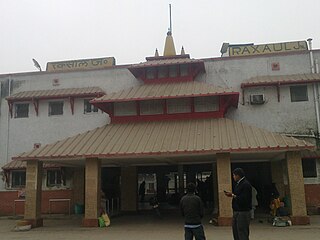
Raxaul is a sub-divisional town in the East Champaran district of the Indian state of Bihar. It is situated at the India-Nepal border with Birgunj city (Nepal). Raxaul is a major railway junction.
Janakpur Road is a town and a notified area in Sitamarhi district in the Indian state of Bihar.
Nirmali is a town and a notified area in Supaul district in the Indian state of Bihar.
Rosera is a city (subdivision) on the bank of River Budhi Gandak. It is a municipality in Samastipur district in the Indian state of Bihar. Rosera block consists of 48 villages. Rosera is well connected by the rest of the country through railway or road network. Rosera is connected to Begusarai district via SH-55 and Darbhanga district via SH-88 and it's approx 120km from Capital Patna.
Mahuli Nankar is a village in the Jale CD Block of Darbhanga district, in Bihar, India.
Bagha Kusmar is a small town in the Madhubani district in northern Bihar state, India. It is under Phulparas subdivision. The distance between Bagha Kusmar and its district headquarters is 52 km (32 mi). The distance between Bagha Kusmar and town Khutauna is 7 km (4.3 mi).
Pokhraira is a village in Bokhra block of Sitamarhi District in Bihar state of India. It is surrounded by three main cities of Bihar, which are Muzaffarpur, Darbhanga and Sitamarhi. Pokhraira is 27 km distance from district main city Sitamarhi and 97 km distance from state capital Patna.
Jale, or Jalley, is a town and the administrative center of Jale Block, Darbhanga District, Bihar, India. It is located to the north of Bagmati River, about 32 kilometres northwest of the district capital Darbhanga. The town was named after Jaleshwari sthan which is a pilgrimage site in rural area of Darbhanga. In the year 2011, it has a total population of 37,256.
Rarhi is a village in Jale Block, Darbhanga District, Bihar, India. It is located near the northern border of the country, about 27 kilometres northwest of the district capital Darbhanga, and 5 kilometres south of the block capital Jale, Bihar. In the year 2011, it has a population of 36,569.

