Jhanjharpur

Last updated

Jhanjharpur
Town
Jhanjharpurrail.jpg
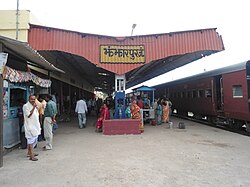
Jhanjharpur Railway Station
India Bihar location map.svg
Red pog.svg
Jhanjharpur
Location in Bihar, India
Coordinates: 26°16′N86°17′E / 26.27°N 86.28°E / 26.27; 86.28 Coordinates: 26°16′N86°17′E / 26.27°N 86.28°E / 26.27; 86.28
CountryFlag of India.svg  India
State Bihar
District Madhubani
Elevation
59 m (194 ft)
Population
 (2001)
  Total24,102
Languages
  Official Maithili, Hindi
Time zone UTC+5:30 (IST)
Lok Sabha constituency Jhanjharpur
Vidhan Sabha constituency Jhanjharpur

Jhanjharpur is a town and a sub-division in the Madhubani district of the state of Bihar, India. Jhanjharpur is well connected to the other cities of India with railways.[ clarification needed ]

Jhanjharpur town is connected with, Kamla Balan bridge, a century-old 220 ft bridge built by the British in the early 1900s, [1] being a rail-cum-road bridge (first rail-cum-road bridge in India) It facilitates the movement of dozen of trains and hundreds of vehicles every day to and from Jhanjharpur.

The nearest airport is Darbhanga Airport which is 48 km away from Jhanjharpur. People can also take their flights for the different cities of India from the Lok Nayak Jayprakash Narayan International Airport which is 191 km away from Jhanjharpur and present in the capital city of Bihar "Patna".[ clarification needed ]

Trade

Laukaha is a nearby town close to the border of Nepalese town of Thadi. Laukaha in India and Thadi in Nepal are a part of one of the agreed route for Mutual Trade between India and Nepal. [2] Nepal Government of Nepal has set up a dedicated customs office in the town. [3] and Government of India has set up a Land Customs Station with a Superintendent level officer. [4]

Related Research Articles

<span class="mw-page-title-main">Madhubani, India</span> City in Bihar, India

Madhubani is a City Municipal Corporation and headquarter of Madhubani district. Madhubani is situated in the Indian state of Bihar. It comes under Darbhanga Division. It is situated at 26 km northeast of Darbhanga City.The Madhuban Raj in Madhubani was created as a consequence. The word "Madhuban" means "forest of honey" from which Madhubani is derived, but sometimes it is also known as "madhu"+"vaani" meaning "sweet" "voice/language".

<span class="mw-page-title-main">Munger</span> Urban Agglomeration in Bihar, India

Munger, formerly spelt as Monghyr, is a twin city and a Municipal Corporation situated in the Indian state of Bihar. It is the administrative headquarters of Munger district and Munger Division. Munger was one of the major cities in Eastern India and undivided Bengal during Mughal period and British Raj. It is one of the major political, cultural, educational and commercial center of Bihar and Eastern India. Munger is situated about 180km from east of capital city Patna, about 480km west of Eastern India's largest city kolkata and 1200km from country's capital New Delhi.

<span class="mw-page-title-main">East Central Railway zone</span> Indian railway zone

The East Central Railway is one of the 19 railway zones in India. It is headquartered at Hajipur and comprises Sonpur, Samastipur, Danapur, Pt. Deen Dayal Upadhyaya, and Dhanbad divisions.

<span class="mw-page-title-main">Madhubani district</span> District of Bihar in India

Madhubani district is one of the thirty-eight districts of Bihar, India, and is a part of Darbhanga division. Its administrative headquarters are located in Madhubani. The district has an area of 3,501 square kilometres (1,352 sq mi) and has a population of 4,487,379.

<span class="mw-page-title-main">Siraha District</span> District in Madhesh Province, Nepal

Siraha District, a district in Madhesh Province, is one of the seventy-seven districts of Nepal. It is situated in the Terai belt of Nepal. The district, with Siraha as its district headquarters, covers an area of 1,188 km2 (459 sq mi). It has population of 637,328 according to census of 2011.The District is bordered with Saptari district in the east, Udayapur districting the north, Bihar state of India in the south and Dhanusa district in the west. Majority of the population here is Yadav, Tharus, Sahs(sahukar), Muslims and ethnic minorities with majority population speaking Maithili language and Nepali language.

Gaighat is an administrative centre within Triyuga Municipality and the headquarter of Udayapur District located in Province No. 1 of Nepal. Gaighat is divided into 2 wards called Gaighat Bazar and Old Gaighat. The Gaighat is located in Ward No. 11 and Old Gaighat is in Ward No. 12 of Triyuga Municipality. Total area of two wards is 16.11 square kilometres (6.22 sq mi) and total population is 14,243 with 2832 households.

Bairgania is a town and notified area in the Sitamarhi district in the state of Bihar, India. Bairgania is one of the blocks of Sitamarhi districts and is a border of India that links Nepal via Rautahat District through a custom checkpoint. Bairgania is the first town of India that is located on the bank of the Bagmati River.It has a good government medical hospital and experience doctors such as alumni from PMCH.

<span class="mw-page-title-main">Raxaul</span> Town in Bihar, India

Raxaul is a sub-divisional town in the East Champaran district of the Indian state of Bihar. It is situated at the India-Nepal border with Birgunj city (Nepal). Raxaul is a major railway junction.

Nirmali is a town and a notified area in Supaul district in the Indian state of Bihar.

<span class="mw-page-title-main">Triyuga Municipality</span> Municipality in Koshi Pradesh, Nepal

Triyuga is one of eight municipalities of Udayapur district of the Koshi Pradesh of Nepal. Gaighat is the headquarter of the municipality. According to the 1991 Nepal census, it had a population of 55,291. According to the 2011 Nepal census, Triyuga had 87,557 inhabitants. According to the 2021 Nepal census the initial population of the municipality is 104,375. It is divided into 16 wards. Triyuga Municipality was established on B.S. Chaitra 13, 2053. It was named after Triyuga River. A river which flows through the town. Triyuga is the 3rd largest municipality in Nepal and 1st largest in Koshi Pradesh in term of size (area). The total area of the municipality is 547.43 square kilometres (211.36 sq mi)

Siraha is the headquarters and municipality of Siraha District, a part of Madhesh Province, Nepal. Siraha had a population of 28,442 according to the census of 2011. and a population of 82,531 as of 2015.The current population of Siraha municipality as of census 2022, is 96,543.It has a male population of 47,306 and female population of 49,237. The present mayor of Siraha Municipality is Dr. Nabin Kumar Yadav and Deputy Mayor is Babita Kumari Sah.Both assumed office on 25 May 2022. His predecessor mayor was Asheswor Yadav and the deputy mayor was Dr. Namita Yadav. Both assumed office on 25 September 2017 and their last working day was on 24 May 2022. The town is at 80 metres (260 ft) altitude, 29 kilometres (18 mi) ESE of Janakpur.

Khutauna is a small town in the Madhubani district in northern Bihar state, India. There are 14 Ward in Khutauna block. Khutauna is under Phulparas subdivision bearing its own post office, block. Khutauna is very near to the Indo-Nepal border.

<span class="mw-page-title-main">Lahan</span> Municipality in Siraha District, Nepal

Lahan (लहान) is a city and municipality with 24 wards in Siraha District in the Madhesh Province south-eastern Nepal. It is connected with Mahendra Highway, which is also called the east–west highway. It is located nearly 261 km east of the capital, Kathmandu via B.P. highway and E-W Highway & 424 km east via Narayanghat-Mugling Highway. Lahan is located at the latitude of 26.717 and longitude of 86.483. It is at an elevation of 111 meters above sea level. It follows Nepali time zone, UTC Offset: +05:45 hours.

Laukaha is a very old Border Town in the district of Madhubani in the Indian state of Bihar. It is close to the border with Nepal and the Nepalese town of Thadi. The population of Laukaha is between 11, 000 and 15, 000.

<span class="mw-page-title-main">Barauni–Gorakhpur, Raxaul and Jainagar lines</span> Railway line in India

The Barauni–Gorakhpur, Raxaul and Jainagar lines are a set of three lines connecting Barauni in the Indian state of Bihar with Gorakhpur in Uttar Pradesh. The lines run in an east–west direction between the Ganges and India-Nepal border, covering northern Bihar west of the Kosi river and eastern Uttar Pradesh. The southernmost of the lines connects via Hajipur Junction, Sonpur Junction and Chhapra. The central line connects via Muzaffarpur, Motihari and Sugauli. The northern line connects via Darbhanga, Sitamarhi and Raxaul. The lines have interconnections between them and the northern line has extensions to places near the India–Nepal border.

The Narkatiaganj–Bhikhna Thori line is a rail line in eastern India that connects Narkatiaganj and Bhikhna Thori near the Indo-Nepal border.

Laukaha Bazar railway station serves Laukaha town in Madhubani district in the Indian state of Bihar. It located near the India–Nepal border.

Bhagwanpur is a rural municipality in Siraha District in Province No. 2 of south-eastern Nepal. At the time of the 2011 Nepal census it had a population of 20957 people living. It is located nearly 370 kilometers or 107 miles east of the capital, Kathmandu.

<span class="mw-page-title-main">India–Nepal border</span> International boundary in South Asia

The Nepal–India border is an open international boundary running between the Nepal and the India. The 1,770 km (1,099.83 mi) long border includes the Himalayan territories as well as Indo-Gangetic Plain. The current border was delimited after the Sugauli treaty of 1816 between Nepal and the British Raj. Following Indian independence, the prevailin border was recognised as the international border between the Kingdom of Nepal and the Dominion of India.

<span class="mw-page-title-main">Thadi</span> Town in Sagarmatha Zone, Nepal

Thadi or Thadi Viswaspatti is a very old border town and a market place of Nepal in Siraha District bordering Indian town of Laukaha. It is currently part of Bhagwanpur Rural municipality. It is located nearly 370 kilometers or 107 miles east of the capital, Kathmandu. Thadi was part of Tirhut Rulers of Simraungarh. The region was under rule of Karnad Dynasty formed by Nanyadeva Thadi is one of the few towns which is a part of agreed route for Mutual Trade between India and Nepal. Nepal Government has set up a dedicated customs office in the town.

References

  1. Balan, Kamla (17 September 2008). "Kamla Balan". live mint. No. september. live mint. live mint. Retrieved 1 June 2019.
  2. "India Nepal Trade Agreement. India-Nepal Foreign Treaty of Trade Agreement". www.eximguru.com. Retrieved 12 September 2019.
  3. "Department of Customs, Nepal – Custom Contact Offices". www.customs.gov.np. Retrieved 12 September 2019.
  4. "No. |".