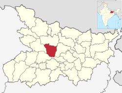
Vaishali district

Last updated

Vaishali district
N-BR-68 Relic Stupa Vaishali (2).jpg
Relic Stupa in Vaishali
Bihar district location map Vaishali.svg
CountryFlag of India.svg  India
State Bihar
Division Tirhut
Established10 December 1972
Headquarters Hajipur [1]
Government
  EducationistShri Rajdeo Ray
   Lok Sabha constituencies Hajipur, Vaishali
   Vidhan Sabha constituencies Hajipur, Lalganj, Vaishali, Mahua, Raja Pakar, Raghopur, Mahnar, Patepur
Area
  Total2,036 km2 (786 sq mi)
Elevation
51 m (167 ft)
Population
 (2011)
  Total3,495,021
  Density1,700/km2 (4,400/sq mi)
Demographics
   Literacy 66.60%
  Sex ratio1.895 /
Language
  Official Hindi
  Additional official Urdu
  Regional Languages Maithili
Time zone UTC+05:30 (IST)
PIN
8441xx (Vaishali) [2]
Major highways NH 22, NH 31, NH 322
HDI (2016)Increase2.svg 0.407 [3]
Website Official website

Vaishali district is a district of Mithila region in the Indian state of Bihar. It is a part of Tirhut division. [4] Vaishali is known for being the birthplace of Mahavira of the Jain religion. Hajipur, its largest city and district headquarters, is known for its banana forest. The district is connected via the NH-77 and NH-322 highways, which connect the state capital Patna, the division headquarters Muzaffarpur, and the eastward district Samastipur.

Contents

History

Ancient Vaishali

According to legend, Vaishali derives its name from King Vishala, a son of Ikshvaku who founded the city. Vaishali was the capital of the vibrant Licchavi republic and was closely associated with the early histories of both Buddhism and Jainism. [5] In that period, Vaishali was an ancient metropolis and the capital city of the republic of the Vajji confederation of Mithila, which covered most of the Himalayan Gangetic region of present-day Bihar. Magadha rulers of the Shishunaga dynasty shifted its capital from Pataliputra to Vaishali.

Post-Independence

Vaishali became a district when it was split from Muzaffarpur in 1972. [6]

Geography

The Vaishali district occupies an area of 2,036 square kilometres (786 sq mi), [7]

Economy

In 2006 the Ministry of Panchayati Raj named Vaishali one of the country's 250 most backward districts (out of a total of 640). [8] It is one of the 38 districts in Bihar currently receiving funds from the Backward Regions Grant Fund Programme (BRGF). [8]

Demographics

Historical population
YearPop.±% p.a.
1901737,793    
1911761,720+0.32%
1921737,475−0.32%
1931787,287+0.66%
1941868,565+0.99%
1951942,472+0.82%
19611,133,086+1.86%
19711,348,990+1.76%
19811,662,527+2.11%
19912,146,065+2.59%
20012,718,421+2.39%
20113,495,021+2.54%
source: [9]
Religions in Vaishali district (2011) [10]
ReligionPercent
Hinduism
90.20%
Islam
9.56%
Other or not Stated
0.24%

According to the 2011 census Vaishali district has a population of 3,495,021, [11] roughly equal to the nation of Panama [12] or the US state of Connecticut. [13] This gives it a ranking of 86th in India (out of a total of 640). [11] The district has a population density of 1,717 inhabitants per square kilometre (4,450/sq mi) . [11] Its population growth rate over the decade 2001-2011 was 28.58%. [11] Vaishali has a sex ratio of 892 females for every 1000 males, [11] and a literacy rate of 66.60%. 6.67% of the population lives in urban areas. Scheduled Castes and Scheduled Tribes make up 21.12% and 0.07% of the population respectively. [11]

Languages

Languages of Vaishali district (2011) [14]

  'Other' Hindi (69.88%)
   Hindi (25.10%)
   Urdu (4.80%)
  Others (0.22%)

At the time of the 2011 Census of India, 95.09% of the population in the district spoke Hindi and 4.80% Urdu as their first language. 69.88% of the population recorded their language as 'Other' under Hindi, while Hindi itself was only reported by 25.10%. The dialect of the region is Bajjika, variously regarded as a dialect of Maithili language. [14]

Flora and fauna

In 1997, the district became home to the Barela Salim Ali Zubba Saheni Wildlife Sanctuary, which has an area of 2 km2 (0.8 sq mi). [15]

Politics

DistrictNo.ConstituencyNamePartyAllianceRemarks
Vaishali 123 Hajipur Awadhesh Singh BJP NDA
124 Lalganj Sanjay Kumar Singh BJP NDA
125 Vaishali Siddharth Patel JD(U) NDA
126 Mahua Mukesh Raushan Yadav RJD MGB
127 Raja Pakar Pratima Kumari INC MGB
128 Raghopur Tejashwi Yadav RJD MGB
129 Mahnar Bina Singh RJD MGB
130 Patepur Lakhendra Kumar Raushan BJP NDA

See also

Related Research Articles

<span class="mw-page-title-main">Muzaffarpur</span> City in Bihar, India

Muzaffarpur is a city located in Muzaffarpur district in the Tirhut region of the Indian state of Bihar. It serves as the headquarters of the Tirhut division, the Muzaffarpur district and the Muzaffarpur Railway District. It is the fourth most populous city in Bihar.

<span class="mw-page-title-main">Sheohar district</span> District of Bihar in India

Sheohar is an administrative district in the state of Bihar in India. The district headquarters are located at Sheohar, and the district is a part of Tirhut Division. This district was carved out of Sitamarhi district in 1994 due to the extreme efforts of Raghunath Jha, former Union Minister. Eminent Hindi Novelist, Dr. Bhagwati Sharan Mishra was the first District magistrate of Sheohar . Sivas used to have a guest house in the Mehsi town of his time, which is still located in the name of Raja Bazar in East Champaran.The district occupies an area of 349 km2 and has a population of 656,246. Sheohar is known for its greenery and cleanliness. Cadamba and teak are the principal trees of this district. Nilgai or blue bull is the regional animal of this area.

<span class="mw-page-title-main">West Champaran district</span> District in Bihar, India

West Champaran is an administrative district in the state of Bihar in India, located just 60 km (37 mi) west of Birgunj. It is the largest district in Bihar with an area of 5,228 km²(2,019sq mi). It is a part of Tirhut Division. The district headquarters are located in Bettiah. The district is known for its open border with Nepal. One of the major location in West Champaran is Kumar Bagh for SAIL Special Processing Unit and Bhitiharwa where Mahatma Gandhi started Satyagrah Aandolan.

<span class="mw-page-title-main">East Champaran district</span> District of Bihar in India

East Champaran is an administrative district in the state of Bihar in India.The district headquarters are located at Motihari. Prior to 1971, there was a single district called "Champaran". On 1 December 1971, the district was divided into 2 parts East Champaran and West Champaran. In early days the land of East Chamapran was ruled by different kingdoms as Videha, Sunga, Kanvas. It is also believed that Champaran used to be a major part of King Janak's empire. Mahatma Gandhi started his famous Satyagraha movement from here.

<span class="mw-page-title-main">Samastipur district</span> District in Bihar, India

Samastipur is one of the thirty-eight districts of Bihar in India. The district headquarters are located at Samastipur. The district occupies an area of 2904 km² and has a population of 4,261,566.

<span class="mw-page-title-main">Araria district</span> District of Bihar in India

Araria district is one of the thirty-eight districts of Bihar state, India. Araria district is a part of Purnia division. The district occupies an area of 2,830 km2 (1,090 sq mi). Araria town is the administrative headquarters of this district. Distance from Nepal border is only about 8 km from Forbesganj head quarter.

<span class="mw-page-title-main">Madhepura district</span> District of Bihar in India

Madhepura district is one of the thirty-eight districts of Bihar state, India, and Madhepura town is the administrative headquarters of this district. Madhepura district is a part of Kosi division.

<span class="mw-page-title-main">Darbhanga district</span> District in Bihar, India

Darbhanga district is one of the thirty-eight districts of Bihar state in eastern India, and Darbhanga city is the administrative headquarters of this district and 5th largest city of Bihar as well. Darbhanga district lies in Historical Mithila region. Darbhanga district is a part of Darbhanga Division. The district is bounded on the north by Madhubani district, on the south by Samastipur district, on the east by Saharsa district and on the west by Sitamarhi and Muzaffarpur districts. The district covers an area of 2,279 km2 (880 sq mi).

<span class="mw-page-title-main">Khagaria district</span> District of Bihar in India

Khagaria district is an administrative district in Mithila region in the state of Bihar in India. The district headquarters are located at Khagaria. Earlier it was a part of Munger District as a sub-division that was created in 1943–44. It was upgraded to the status of a district on 10 May 1981. Khagaria district is a part of Munger Division.

<span class="mw-page-title-main">Madhubani district</span> District in Bihar, India

Madhubani district is one of the thirty-eight districts of Bihar, India, and is a part of Darbhanga division. Its administrative headquarters are located in Madhubani. The district has an area of 3,501 square kilometres (1,352 sq mi) and has a population of 4,487,379.

<span class="mw-page-title-main">Supaul district</span> District of Bihar in India

Supaul district is one of the thirty-eight districts of Bihar, India. The town Supaul is the district's administrative headquarters. The district, which was split from the former Saharsa district on 14 March 1991, occupies 2,410 km2 (931 sq mi).

<span class="mw-page-title-main">Sheikhpura district</span> District in Bihar, India

Sheikhpura district is one of the thirty-eight districts of the Indian state of Bihar. Sheikhpura is the administrative headquarter of this district. Sheikhpura district is a part of the Munger division. Sheikhpura was split from the Munger district into a separate district with headquarters in Sheikhpura on 31 July 1994 due to political efforts of Rajo Singh. As of 2011 it was the least populous district of Bihar.

<span class="mw-page-title-main">Katihar district</span> District of Bihar in India

Katihar district is one of the thirty-eight districts of Bihar state in India, and Katihar city is the administrative headquarters of this district. The district is a part of Purnia Division. It is prominently known for its Katihar Junction Railway Station, which is a Category A station on the Barauni–Guwahati line. It has been included in the Aspirational Districts Program of the Government of India since 2018, to improve its socio-economic indicators.

<span class="mw-page-title-main">Sitamarhi district</span> District of Bihar in India

Sitamarhi is one of the districts in the Mithila region of the Indian state of Bihar, India. Dumra is the administrative headquarters of this district. The district is a part of the Tirhut Division and is located along the border of Nepal.

<span class="mw-page-title-main">Munger district</span> District of Bihar in India

Munger district is one of the thirty-eight districts of Bihar state in eastern India. The city of Munger is the administrative headquarters of this district. The district is a part of Munger Division. Its literacy rate of 73.3% is higher than the state literacy rate of 63.8%, but lower than national rate of 74.04%.

<span class="mw-page-title-main">Bhagalpur district</span> District of Bihar in India

Bhagalpur district is one of the thirty-eight districts of Bihar state, India. Bhagalpur is the oldest district of Bihar. Bhagalpur city is the administrative headquarters of this district.

<span class="mw-page-title-main">Kishanganj district</span> District in Bihar, India

Kishanganj district is one of the thirty-eight districts of Bihar state, India, and Kishanganj town is the administrative headquarters of this district. Kishanganj district is a part of Purnia division (Seemanchal).

<span class="mw-page-title-main">Muzaffarpur district</span> District of Bihar in India

Muzaffarpur District is one of the thirty-eight districts of Bihar state, India. Muzaffarpur district is part of and also the headquarters of Tirhut Division Tirhut is the ancient name of all of northern Bihar.

<span class="mw-page-title-main">Lakhisarai district</span> District of Bihar in India

Lakhisarai district is one of the thirty-eight districts of Bihar state, India, and Lakhisarai town is the administrative headquarters of this district. Lakhisarai district is a part of Munger Division. The district occupies an area of 1,228 km2 (474 sq mi).

<span class="mw-page-title-main">Saran district</span> District in Bihar, India

Saran district is one of the thirty-eight districts of Indian state of Bihar. The district, part of Saran Division, is also known as Chhapra district after the headquarters of the district, Chhapra. It is considered as one of the richest Zamindari of Bihar after Raj Darbhanga, Hathwa Raj, Bettiah Raj and Raj Najarganj, Saran Raj.

References

  1. "District headquarter of Vaishali". Archived from the original on 17 May 2021. Retrieved 3 June 2021. vaishali.nic.in
  2. Vaishali
  3. "Development of Human Development Index at District Level for EAG States" (PDF). March 2016. Archived (PDF) from the original on 2 June 2021. Retrieved 31 May 2021.
  4. Official website of Tirhut Division Archived 2015-03-16 at the Wayback Machine
  5. "Vaisali -- Britannica Online Encyclopedia". Archived from the original on 14 April 2022. Retrieved 31 October 2022.
  6. Law, Gwillim (25 September 2011). "Districts of India". Statoids. Archived from the original on 17 October 2011. Retrieved 11 October 2011.
  7. Dayawanti Srivastava, ed. (2010). "States and Union Territories: Bihar: Government". India 2010: A Reference Annual (54th ed.). New Delhi, India: Additional Director General, Publications Division, Ministry of Information and Broadcasting (India), Government of India. pp. 1118–1119. ISBN   978-81-230-1617-7.
  8. 1 2 Ministry of Panchayati Raj (8 September 2009). "A Note on the Backward Regions Grant Fund Programme" (PDF). National Institute of Rural Development. Archived from the original (PDF) on 5 April 2012. Retrieved 27 September 2011.
  9. "Table A-02 Decadal Variation in Population Since 1901: Bihar" (PDF). census.gov.in. Registrar General and Census Commissioner of India.
  10. "Table C-01 Population by Religion: Bihar". censusindia.gov.in. Registrar General and Census Commissioner of India. 2011.
  11. 1 2 3 4 5 6 "District Census Handbook: Vaishali" (PDF). Census of India . Registrar General and Census Commissioner of India. 2011.
  12. US Directorate of Intelligence. "Country Comparison:Population". Archived from the original on 27 September 2011. Retrieved 1 October 2011. Panama 3,460,462 July 2011 est.
  13. "2010 Resident Population Data". U. S. Census Bureau. Archived from the original on 19 October 2013. Retrieved 30 September 2011. Connecticut 3,574,097
  14. 1 2 "Table C-16 Population by Mother Tongue: Bihar". censusindia.gov.in. Registrar General and Census Commissioner of India. 2011.
  15. Indian Ministry of Forests and Environment. "Protected areas: Bihar". Archived from the original on 23 August 2011. Retrieved 25 September 2011.