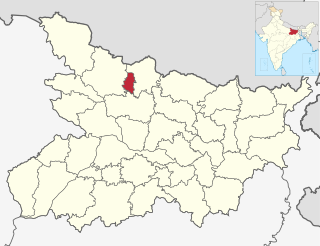
Sheohar is an administrative district in the state of Bihar in India. The district headquarters are located at Sheohar, and the district is a part of Tirhut Division. This district was carved out of Sitamarhi district in 1994 due to the extreme efforts of Raghunath Jha, former Union Minister. Eminent Hindi Novelist, Dr. Bhagwati Sharan Mishra was the first District magistrate of Sheohar. Sivas used to have a guest house in the Mehsi town of his time, which is still located in the name of Raja Bazar in East Champaran.The district occupies an area of 443 km2 and has a population of 656,246. Sheohar is known for its greenery and cleanliness. Cadamba and teak are the principal trees of this district. Nilgai or blue bull is the regional animal of this area.

West Champaran is an administrative district in the state of Bihar in India, located just 60 km (37 mi) west of Birgunj. It is the largest district in Bihar with an area of 5,228 km²(2,019sq mi). It is a part of Tirhut Division. The district headquarters are located in Bettiah. The district is known for its open border with Nepal. One of the major location in West Champaran is Kumar Bagh for SAIL Special Processing Unit and Bhitiharwa where Mahatma Gandhi started Satyagrah Aandolan.

Bettiah is a city and administrative headquarters of West Champaran district - (Tirhut), near Indo-Nepal border, 225 kilometres (140 mi) north-west of Patna, in Bihar state of India.
Motihari is a city and headquarters of East Champaran district in the Indian state of Bihar. It is located 80 kilometres west of Muzaffarpur and 152 kilometres northwest of the state capital Patna.
Areraj is a town and a notified area in East Champaran district in the state of Bihar, India. District entry point Mehsi City
Bagaha is a city and a municipality in the district of Pashchim Champaran in the state of Bihar, India. It is a subdivision of Pashchim Champaran district and is a Police District. It is located around 64 kilometres (40 mi) northwest of its district headquarters Bettiah. It is 294 km (183 mi) away from Bihar's state capital Patna.
Chikrand is a census town in Chanditala II CD Block in Srirampore subdivision of Hooghly district in the state of West Bengal, India.
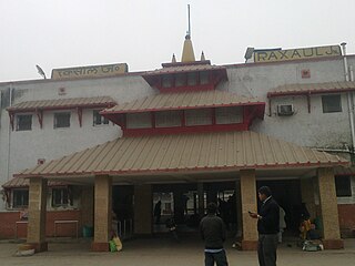
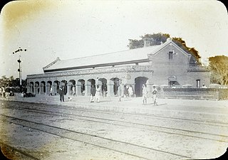
Raxaul is a sub-divisional town in the East Champaran district of the Indian state of Bihar. It is situated at the India-Nepal border with Birgunj city (Nepal). Raxaul is a major railway junction.
Purba Tajpur is a census town in Chanditala II CD Block in Srirampore subdivision of Hooghly district in the Indian state of West Bengal.
Chakia is a town and a subdivision in East Champaran district in the Indian state of Bihar. Chakia is a sub division of East Champaran district. It is located approximately 48 Kilometres northwest of Muzaffarpur. 32 kilometers southeast of its District headquarters Motihari.
Krishnapur is a census town in Chanditala II CD Block in Srirampore subdivision of Hooghly district in the Indian state of West Bengal.
Baghmundi is a village, with a police station, in the Baghmundi CD block in the Jhalda subdivision of the Purulia district in the state of West Bengal, India.
Barwa is a village in West Champaran district in the Indian state of Bihar. It is located in the Narkatiaganj block.
Barwa is a village in West Champaran district in the Indian state of Bihar. It is located in the Narkatiaganj block.
Barwa Barauli is a village in West Champaran district in the Indian state of Bihar. It is located in the Narkatiaganj block.
Mathura is a village in West Champaran district in the Indian state of Bihar. Specially recognized for champaran meat.
Thakraha, or Thakrahan, is a town and the seat of government of Thakrahan Block, Pashchim Champaran, Bihar, India. It is located near the state border with Uttar Pradesh, about 25 kilometres west of the district seat Bettiah. In the year 2011, the town has a total population of 35,734.
Pachrukha is a village in Banjaria Block, East Champaran District, Bihar, India. It is located near the Indian border with Nepal, about 11 kilometres north of the district seat Motihari, and 7 kilometres north of the block seat Banjaria. In 2011, it has a total population of 39,140.
Banjaria is a community development block in East Champaran District, Bihar, India. The administrative center of the block is the town of Banjaria. In the year 2011, the block has a population of 162,684.
Khartari is a village in Chiraia Block, East Champaran District, Bihar, India. It is located near the border with Nepal, about 14 kilometres east of the district capital Motihari, and 3 kilometres southwest of the block capital Chiraia. In 2011, its population is 38,978.

