Bihar is a state in Eastern India. It is the third largest state by population, the 12th largest by area, and the 15th largest by GDP in 2021. Bihar borders Uttar Pradesh to its west, Nepal to the north, the northern part of West Bengal to the east, and Jharkhand to the south. Bihar is split by the river Ganges, which flows from west to east. On 15 November 2000, southern Bihar was ceded to form the new state of Jharkhand. Only 11.27% of the population of Bihar lives in urban areas as per a 2020 report. Additionally, almost 58% of Biharis are below the age of 25, giving Bihar the highest proportion of young people of any Indian state. The official language is Hindi, which shares official status alongside that of Urdu. The main native languages are Maithili, Magahi and Bhojpuri. But there are several other languages being spoken at smaller levels.

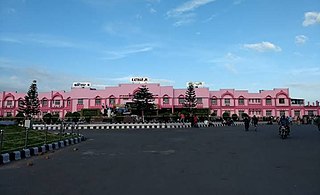
Katihar is the tenth largest city in the state of Bihar in India in terms of population, Along with being one of the largest economic, educational and administrative centre in the eastern part of Bihar. It is the headquarters of Katihar district and Katihar railway division. The main railway station of the city is Katihar Junction, a very important railway station on the Guwahati - Barauni railway line.

Munger, formerly spelt as Monghyr, is a twin city and a Municipal Corporation situated in the Indian state of Bihar. It is the administrative headquarters of Munger district and Munger Division. Munger was one of the major cities in Eastern India and undivided Bengal during Mughal period and British Raj. It is one of the major political, cultural, educational and commercial center of Bihar and Eastern India. Munger is situated about 180km from east of capital city Patna, about 480km west of Eastern India's largest city Kolkata and 1200km from country's capital New Delhi.

Muzaffarpur is a city located in Muzaffarpur district in the Tirhut region of the Indian state of Bihar. It serves as the headquarters of the Tirhut division, the Muzaffarpur district, and the Muzaffarpur Railway District. It is the fourth most populous city in Bihar.

Hajipur is the headquarters and largest city of Vaishali district of the state of Bihar in India. Hajipur is the 16th most populous city of Bihar, besides being the second-fastest developing city, next to Patna. It had a total population of 1.47 lakh as per census 2011. Vaishali district is ranked 8th among 38 districts in Bihar in terms of growth.

Motihari is a city and headquarters of East Champaran district in the Indian state of Bihar. It is located 80 kilometres west of Muzaffarpur and 152 kilometres northwest of the state capital Patna. In early days the land of Motihari was ruled by different kingdoms as Videha, Sunga, Kanvas. It is also believed that Champaran used to be a major part of King Janak's empire. Mahatma Gandhi started his famous Satyagraha movement from here.

Madhepura district is one of the thirty-eight districts of Bihar state, India, and Madhepura town is the administrative headquarters of this district. Madhepura district is a part of Kosi division.

Begusarai District is one of the thirty-eight districts of the Indian state of Bihar. The city of Begusarai is its administrative headquarters and is part of the Munger division.

Bhagalpur district is one of the thirty-eight districts of Bihar state, India. Bhagalpur is the oldest district of Bihar. Bhagalpur city is the administrative headquarters of this district.

Dinhata is a city and a municipality in Cooch Behar district in the state of West Bengal, India. It is the headquarters of the Dinhata subdivision. Dinhata is known for arranging one of the best Durga Puja in North Bengal. Dinhata is famous for Sastho Mela and Dinhata Utsav, Sanghati Mela, Janmastami Mela. Apart from the city area, Dinhata consists of 3 blocks.
Haldibari is a city and a municipality in the Mekhliganj subdivision of the Cooch Behar district in the Indian state of West Bengal.
Mathabhanga is a city along Jaldhaka River and a municipality in Cooch Behar district in the Indian state of West Bengal. It is the headquarters of the Mathabhanga subdivision.

Mekhliganj is a city and a municipality in Cooch Behar district in the Indian state of West Bengal. It is the headquarters of the Mekhliganj subdivision. Earlier it was a Zamindari divided mainly in 3 parts under the Cooch Behar Kingdom. Sikarwar Rajputs, the trading clan along with other local clans started the process of rehabilitation in Mekliganj. It is said that the elephant in the Royal Symbol of Koch Kingdom, was a gift from the Sikarwar Rajputs to the Koch King, Shri Shri Maharaja Shivendra Narayan, in return of fertile land near the Teesta River and 2 Rupees as nazrana. Later the Rajputs established Chattradhari Estate here. After the succession by Shri Shri Maharaja Narendra Narayan named this place to Mekhliganj, a place where 'Mekhla' also people stays.

Bhojpur District is one of the 38 districts of the Indian state of Bihar. Arrah city is the administrative headquarters of this district. Bhojpur district came into existence in 1972. Earlier it was the part of Shahabad district. This district is named "Bhojpur" after great Parmara King Bhoja as most early settlers were Rajput rulers of Parmara dynasty then called as Ujjainiya.
Bihar has been a major centre of learning and home to one of the oldest universities of India dating back to the fifth century and the tradition of learning which had its origin from ancient times was lost during the medieval period when it is believed that marauding armies of the invaders destroyed these centres of learning.

Patna, historically known as Pāṭaliputra, is the capital and largest city of the state of Bihar in India. According to the United Nations, as of 2018, Patna had a population of 2.35 million, making it the 19th largest city in India. Covering 250 square kilometres (97 sq mi) and over 2.5 million people, its urban agglomeration is the 18th largest in India. Patna also serves as the seat of Patna High Court. The Buddhist, Hindu and Jain pilgrimage centres of Vaishali, Rajgir, Nalanda, Bodh Gaya and Pawapuri are nearby and Patna City is a sacred city for Sikhs as the tenth Sikh Guru, Guru Gobind Singh was born here. The modern city of Patna is mainly on the southern bank of the river Ganges. The city also straddles the rivers Son, Gandak and Punpun. The city is approximately 35 kilometres (22 mi) in length and 16 to 18 kilometres wide.
At the 2011 Census, Bihar was the third most populous state of India with total population of 104,099,452, nearly 89% of it rural. It was also India's most densely populated state, with 1,106 persons per square kilometre. The sex ratio was 918 females per 1000 males. Almost 58% of Bihar's population was below 25 years age, which is the highest in India. At 11.3%, Bihar has the second-lowest urbanisation rate in India after Himachal Pradesh.
Bihpur is a block in Bhagalpur district of Bihar, India. It is one of sixteen blocks under Bhagalpur district. According to Census 2011, the sub-district code of Bihpur Block (CD) is 01330.It lies in the Anga Region of Bihar.

Maner is one of 243 constituencies of legislative assembly of Bihar. It comes under Pataliputra Lok Sabha constituency along with other assembly constituencies viz. Danapur, Masaurhi, Phulwari, Paliganj and Bikram.
Dayalpur is a Gram Panchayat in Gajipur, Vaishali District, Bihar, India.


