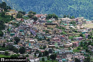
Sitamarhi is an Indian city in the Mithila region of Bihar. It is the district headquarters of the Sitamarhi district in Tirhut Division. The city was named in honour of the goddess Sita, who was born in Sitamarhi in Hindu mythology.

Muzaffarpur is a city located in Muzaffarpur district in the Tirhut region of the Indian state of Bihar. It serves as the headquarters of the Tirhut division, the Muzaffarpur district and the Muzaffarpur Railway District. It is the fourth most populous city in Bihar.

Madhepura district is one of the thirty-eight districts of Bihar state, India, and Madhepura town is the administrative headquarters of this district. Madhepura district is a part of Kosi division.

Sitamarhi is one of the districts in the Mithila region of the Indian state of Bihar, India. Dumra is the administrative headquarters of this district. The district is a part of the Tirhut Division and is located along the border of Nepal.

Kaimur district is one of the 38 districts of Bihar, India. The district headquarters are at Bhabua. Before 1991, it was part of Rohtas District. Till 1764 the region was a part of Ghazipur District and was a part of Kamsaar Raj and later it was a part of Chainpur Estate till 1837.

Koderma district is one of the twenty-four districts of Jharkhand state, India, and Koderma is the administrative headquarters of this district.

Chamoli Gopeshwar is a township in the Garhwal hills and a municipal board within Chamoli district. It is the administrative headquarters of the Chamoli District of Uttarakhand in India. Located 1,550 m (5,090 ft) above sea level. It is famous for its weather which is pleasant most of the year but very cold in December and January. Chamoli Gopeshwar is known for his very beautiful temple, Gopinath that has a deffinate special feeling to it. Chamoli Gopeshwar has a very beautiful water storage facility (kund) called Vaitrani.
Daudnagar is a town and the subdivisional headquarter of Daudnagar Subdivision in Aurangabad district in the state of Bihar, India under the Magadh division. Until 1991, there was only one Subdivision in the Aurangabad district: Aurangabad Sadar. On 31 March 1991, one other subdivision, Daudnagar, was created. Daudnagar is a 200-year-old historical city and its living proof is Daudnagar has an old historical fort situated on the eastern bank of the Son River. National Highway NH139 which connects Jharkhand's Palamu district to Patna, passes through the town.
Lalganj is an important town and Nearest City, (60 kilometres Morden Old City Mehsi), and river port situated in Vaishali district, Bihar.

Patnagarh is a town and a Notified Area Council in Bolangir district in the Indian state of Odisha. Its original name is Patnāgarh, and it is pronounced verbally as Patnāgad. The official language is Odia. Patnagarh bears historical significance as it was the epicentre of power in middle age. Patnagarh was the capital of 18 garh that come under south Koshal. In 12th century AD the progenies of the famous King of Delhi, Prithviraj Chauhan came and settled down in Patnagarh. They came here because Mohammad Ghori defeated Prithviraj Chauhan in 2nd battle of Tarai in 1193. The first child of the royal scion who ruled Patnagarh as per recorded history was Ramai Deo. However after 16th century onwards when Balangir and Sambalpur came in to being, the city lost its charm.

Renukoot is a town and a nagar panchayat in Sonbhadra district in the Indian state of Uttar Pradesh. It is 68 km south from the district headquarters Robertsganj.
Ratwara a village in Sitamarhi district of Bihar, India also known as Vishnupur Ratwara or Bishunpur Ratwara.
Runni Saidpur is a town and a block located in Sitamarhi district, Bihar, India. It is situated on the southern bank of the Lakhandei River. National Highway 77 passes through Runni Saidpur. The regional language is Bajjika dialect of Maithili language.

Sitamarhi Assembly constituency is an assembly constituency in Sitamarhi district in the Indian state of Bihar. In 2015 Bihar Legislative Assembly election, Sitamarhi will be one of the 36 seats to have VVPAT enabled electronic voting machines.
Majorganj (community development block) is an administrative division in Sitamarhi district in the Indian state of Bihar.It is a town more than 200 years old. It has been mentioned in the District Gazetteer of Muzzafurpur "page no.23",that during the Anglo- Gurkha war of 1814, A British battalion was stationed there and Captain Blackney who was killed at samanpur (in now sitamarhi District) during a Gurkha ambush, is buried at Majorganj cemetery. He died on 1 January 1815.
Manik Chowk is a village in the Indian state of Bihar.
Jawabipur is a Colony/Nagar in Sitamarhi Municipal Corporation of Sitamarhi District, in Bihar, India. It is administered by the Sitamarhi Nagar nigam Nagar Nigam of Tirhut Division. Some are the Localities/Landmark in Jawabipur are Durga Chowk, Shakya Chowk, Hanuman Chowk, Utkramit Madhya Vidhyalaya, Hanuman Mandir, Brahm Sthan, Maharani Sthan, Athani and Bholahiya. It is situated 7 km (4.3 mi) away from sub-district headquarter Dumra and 6 km (3.7 mi) away from district headquarter Sitamarhi. Maithili and Vajjika is the Local Language here. JDU, BJP, RJD, and INC are the major political parties in this area. Nearest cities are Sitamarhi, Muzaffarpur, Darbhanga, Patna and Motihari. Most residents from Jawabipur having surname Mahto, Kushwaha, Shakya, Singh, Paswan, Sharma and Ram. Kushwaha family from Jawabipur claim that they are descent from Emperor Ashoka. Samrat Ashoka the great belongs to the Maurya dynasty, which was one of the dynasties in ancient Indian history. Chandragupt Maurya was the founder of Maurya dynasty and the first emperor to unify most of the Indian subcontinent.
Pokhraira is a village in Bokhra block of Sitamarhi District in Bihar state of India. It is surrounded by three main cities of Bihar, which are Muzaffarpur, Darbhanga and Sitamarhi. Pokhraira is 27 km distance from district main city Sitamarhi and 97 km distance from state capital Patna.


