Hajipur is the headquarters and largest city of Vaishali district of the state of Bihar in India. Hajipur is the seventh leading city and the 16th most populous city of Bihar, making it the second-fastest developing city, next to Patna. It had a total population of 1.47 lakh as per census 2011. Hajipur is one of the major industrial city in Bihar. Vaishali district is ranked 6th on a list of 38 districts in Bihar in terms of growth.

Supaul district is one of the thirty-eight districts of Bihar state, India, and Supaul town is the administrative headquarters of this district. This district occupies an area of 2,410 km2 (931 sq mi). The district was carved out from the erstwhile Saharsa district on 14 March 1991.
Rohtas district is one of the thirty-eight districts of Bihar state, India. It came into existence when Shahabad District was bifurcated into Bhojpur & Rohtas in 1972. Administrative headquarter of the district is Sasaram.

Bairgania is a town and notified area in the Sitamarhi district in the state of Bihar, India. Bairgania is one of the blocks of Sitamarhi districts and is a border of India that links Nepal via Rautahat District through a custom checkpoint. Bairgania is the first town of India that is located on the bank of the Bagmati River.
Lalganj was an important town and river port. Sharda Sadan Pushtakalya (Library) is one of the biggest libraries in Bihar. It was the center of an independence movement, also Gandhiji came here.
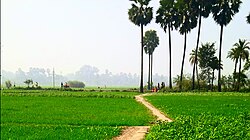
Mokama is a town and a municipal council in Patna district in the Indian state of Bihar. It is located 90 km (56 mi) east of Patna on the southern banks of the river Ganges. Mokama is the connecting town of north and south Bihar and has 2nd highest amount of lentil production in India. It was emerged as a industrial area in State of Bihar after independence.
Islampur is a city and Notified area in Nalanda district in the Indian state of Bihar.

Nokha is a nagar panchayat town and corresponding community development block in Rohtas district in the Indian state of Bihar. As of 2011, the population of the town of Nokha was 27,302 in 4,381 households. The rural population of Nokha block was 146,025, thus bringing the total block population 173,327. The economic situation of this region is mainly dependent on parboiled rice processed by number of rice mills in this area.

Tilothu, also spelled Tilauthu or Tilothu, is a village and corresponding community development block in Rohtas district, Bihar, India. It is located 15 km from Dehri-on-Sone on the west bank of the Son River. As of 2011, the population of Tilouthu was 16,402, in 2,745 families, while the corresponding block population was 109,249.
Sihaul is a village with population of about 11,000 in the sub-district of Satar Kataiya, where it ranks as the third most populous village. The sub-district forms a part of Saharsa district in the state Bihar, India. The geographical area of the village is 9 km2 (3.5 sq mi) and it is the third biggest village by area in the sub-district. Population density of the village is 1287 persons per km2.
Narahia is a large village in Madhubani district of the Indian state of Bihar. Narahia is also called for the Mithalanchal land of Bihar.
Mahuari is a village in Akorhi Gola in Pakidya Pancahyat in the Rohtas district of the Indian state of Bihar. Most of the inhabitants belong to the Brahmin and Yadav castes. It has a temple of the Goddess Durga and Khadeswari Maharaj.
Sono is a 'tehsil'/block in the Jamui district of the Indian state of Bihar. It lies in the southern part of Bihar very close to the Jharkhand border. Sono block is divided into 19 Gram panchayats.
Nayadih is a village among a block of villages in Derhgaon of the Kashichak Block, Nawada District, in Bihar, India. The main villages of Nayadih, Derhgaon and Bishwanathpur together have been referred to as Derhgaon.
Ekwari is a village in the Sahar Block of the Bhojpur district and belongs to the Patna division in the Indian state of Bihar.
Bagmusa is a colony of Hajipur city of Bihar. Bagmusa is very nearest of Hajipur junction and NH 31.

Puduvoyal is a village panchayat located in the Thiruvallur district of Indian state of Tamil Nadu.
Rajepur Nawada is a village in the East Champaran District of Bihar.
Nauhatta is a large village in Nauhatta Block in Saharsa District of Bihar state, India. It belongs to Kosi Division. It is located 20 km towards North from District headquarters Saharsa. 165 km from State capital Patna. It comes under Mahisi constituency. The village had a population of 25,347 of which 13,124 were male while 12,223 were females as per Population Census 2011.