
Sitamarhi is an Indian city and the district headquarters of the Sitamarhi district in the Mithila region of Bihar and is a part of the Tirhut Division. It dates back to the time of Ramayana and is considered as the place where Janaka found Sita. The Bihar government declared Sitamarhi a municipal council.

Muzaffarpur is a city located in Muzaffarpur district in the Tirhut region of the Indian state of Bihar. It serves as the headquarters of the Tirhut division, the Muzaffarpur district and the Muzaffarpur Railway District. It is the fourth most populpus city in Bihar.
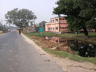
Bairgania is a town and notified area in the Sitamarhi district in the state of Bihar, India. Bairgania is one of the blocks of Sitamarhi districts and is a border of India that links Nepal via Rautahat District through a custom checkpoint. Bairgania is the first town of India that is located on the bank of the Bagmati River.It has a good government medical hospital and experience doctors such as alumni from PMCH.
Sarmastpur, also known as Shrawastipuram, is a village located in Muzaffarpur District, Bihar state, India. The village has a population of around 10,000.
Jajuara, also written Jajuar and Yajuar, is the largest village in the Muzaffarpur district of Bihar in India, and the second-largest village in Bihar.
Benibad is a village in Gaighat Block, Muzaffarpur district and a notified area in the Indian state of Bihar. It is located 28 37 km from Muzaffarpur city, situated at the bank of the river Baghmati and national highway number 57, East- West expressway Bihar 76 m NE 26.146212,85.691085 google map. More than 20000 people are living here. Benibad is also famous for the Baghmati river which has given the villagers much sorrow through flooding and land erosion. Benibad though having a police post (Naka) comes under Giaghat Police Station which is nearly 3-4 kilometers away from the village towards Muzaffarpur on NH-27.
Saghari Rampur is a village in Aurai block in Muzaffarpur district in the India state of Bihar. It is located about 45 km away from Muzaffarpur, the district headquarters.
Pakri pakohi is a village in Muzaffarpur district of Bihar, India. This village is about 5 km west of Bhagwanpur and is located under the Marwan block. The village is connected with a road from Muzaffarpur to Rewa called Rewa road. The nearest railway station is Muzaffarpur and the nearest airport is Muzaffarpur Airport. The postal code is 843113.
Geyaspur is a Panchyat and village. It is located in Muzaffarpur District, Bihar state, India. The Panchyat has a population of around 20,000.
Dullipatti is a village, situated in Madhubani district of Bihar, near the Nepal international border. National Highway 105 passes through this village and is 6 kilometers away from Jainagar, sub-division.
Manik Chowk is a village in the Indian state of Bihar.
Tengraha is a village in Minapur Block in Muzaffarpur district of Bihar, India. It belongs to Tirhut Division. It is located 26 km north of the Muzaffarpur district headquarters, 8 km from Minapur, and 91 km from the state capital, Patna. It is surrounded by Gandak and Bagmati rivers. Most of the people in this village are farmers. This village, as well as the rest of Muzaffarpur district, is famous for its Lichee trees, which grow litchis fruit. Tengrari has a small shopping market. Balua Bazar is near Tengrari, which has a shopping market and Rishabh Vastralaya.
Ismailpur (Harauli) is a village in Vaishali district of Bihar state in India.
Rajepur Nawada is a village in the East Champaran District of Bihar.
Kubauli,(Urdu : کوبولی)(pronunciation ) also known as Kubauli Dhala, is a village located in the Muzaffarpur District of Bihar state, India. The village, situated about 47 km west of Muzaffarpur city, has a population of around 2,260.
Matiya is a village of Vaishali district in the Bihar state of India. It is surrounded by four district of Bihar, which are Samastipur in East, Saran in West, Muzaffarpur in North and Patna in South. The nearest city Hajipur is about 23 km and 31 km away from here. Nearest Railway Station from here is Desari in West and Sahadai Buzurg in East.
Pokhraira is a village in Bokhra block of Sitamarhi District in Bihar state of India. It is surrounded by three main cities of Bihar, which are Muzaffarpur, Darbhanga and Sitamarhi. Pokhraira is 27 km distance from district main city Sitamarhi and 97 km distance from state capital Patna.
In June 2019, an outbreak of acute encephalitis syndrome (AES) occurred in Muzaffarpur and the adjoining districts in Bihar state of India resulting in deaths of more than 150 children, mainly due to hypoglycemia. In subsequent months more cases and deaths were reported. The cause of outbreak is unclear. Malnutrition, climate, hygiene, inadequate health facilities, and lack of awareness are considered as contributing factors. The lychee fruit toxins are also cited as plausible cause of AES.

The first COVID-19 case in the Indian state of Bihar was reported in Munger on 22 March 2020, a 38-year-old tested positive for COVID-19, he was also the first victim. He had travel history to Qatar. The Ministry of Health and Family Welfare has confirmed a total of 62,031 cases as of 4 August 2020, including 20,922 active cases, 349 deaths and 40,760 recoveries. The virus has spread in 38 districts of the state, of which Patna district has the highest number of cases.
