Ekara

Last updated

Ekara
Village
CountryIndia
State Bihar
District Vaishali
Gram PanchayatThathan Buzurg
Block Hajipur
Area
  Total38 km2 (15 sq mi)
Elevation
55 m (180 ft)
Population
  Total878
  Density23/km2 (60/sq mi)
Languages
  Official Hindi, Maithili
Time zone UTC+5:30 (IST)
Area code(s) 844125
ISO 3166 code IN-BR

Ekara is a small village in Hajipur Tehsil/Block in Vaishali District in Indian state of Bihar, India. It comes under Ekara Panchayat. It belongs to Tirhut Division. It is located 9 km towards North from District headquarters Hajipur. As per 2009 stats, Thathan Buzurg [1] is the gram panchayat of Ekara village [2] . And 23 km from State capital Patna. Sonpur, Hajipur, Lalganj are the nearby Cities to Ekara. This Place is in the border of the Vaishali District and Saran District. Saran District Sonpur is west towards this place. Also it is in the Border of other district Patna.

Contents

Geography

The total geographical area of Ekara village is 38 hectares. Ekara has a total population of 878 peoples. There are about 140 houses in Ekara village. Hajipur is the nearest town to Ekara which is approximately 9 km away.

Demography

Ekara local Language is Maithili. According to Census 2011 information the location code or village code of Ekara village is 235643. Ekara village total population is 878 and number of houses are 140. Female Population is 46.8%. village total literacy rate is 62.2% and the female literacy rate is 24.5%. Scheduled Tribes population is 0.0% and Scheduled Caste population is 25.9%.

Transportation and Connectivity

Rail

Sarai railway station, Chakmakrand railways station are the very nearby railway stations to Ekara. Sonpur junction railway station (near to Hajipur), Hajipur junction railway station reachable from nearby towns. The Patna junction railway station is major railway station 22 km near to Ekara.

Road

Ekara National Highway no. 22 Ekara National Highway.png
Ekara National Highway no. 22

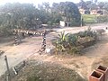
Ekara has good road communications due to development efforts by the government. Hajipur are the nearby by towns to Ekara having road connectivity to Ekara. At the village nearest city is Hajipur approximately 9 km away.

Infrastructure

The Ekara village have a comprehensive regular electricity supply that efforts of local governing bodies have been introduced to provide power for street lighting.

Images

Related Research Articles

Hajipur City in Bihar, India

Hajipur ( Hājīpur) is the largest city and headquarters of Vaishali district of Tirhut Division in the Indian state of Bihar. Hajipur is the 10th leading city and 17th most populous city of Bihar, making it the second-fastest developing city, next to Patna. It had a total population of 1.47 lakh as per census 2011. Vaishali district is ranked 8th on a list of 38 districts in Bihar in terms of growth.

Lalganj, Bihar Town in Bihar, India

Lalganj was an important town and river port. Sharda Sadan Pushtakalya (Library) is one the biggest libraries in Bihar. It was the center of an independence movement, also Gandhiji came here.

Baniapur is a town in Saran district of Bihar state, India.

Raghopur, Vaishali Community development block in Bihar, India

Raghopur is a community development block in Vaishali district of Bihar. Situated between two streams of the Ganges river, it is a river island. It is connected to Patna by Pipa pul.

Govindpur Jhakhraha village in Bihar, India

Govindpur Jhakhraha is a small village in the historical Vaishali district of Bihar, India. It is located across NH 322 at 13 km east of district headquarters Hajipur. The village falls under Bakarpur Panchayat of Rajapakar community development block. The population of the village is approximately 1800. Bajjika is the main dialect but Hindi and Urdu is the medium of study. English is understood and spoken by a few elites of the village.

Hajipur Junction railway station Railway station in Bihar, India. Also the headquaters of East Centeral Railway zone.

Hajipur Junction, station code HJP, is a railway station in the Sonpur division of East Central Railway. Hajipur Junction is located in Hajipur city in Vaishali district in the Indian state of Bihar.

Sonpur Junction railway station

Sonpur Junction, station code SEE, is a railway station and the headquarters of the Sonpur railway division of East Central Railway. Sonpur Junction is located in Sonpur city in Saran district in the Indian state of Bihar.

Pojhi Kapoor Village in Bihar, India

Pojhi Kapoor is a village and part of Bhualpur Panchayat of Saran district, Bihar, India.

Ismailpur Village in Bihar, India

Ismailpur (Harauli) is a village in Vaishali district of Bihar state in India.

Raj Narain College, Hajipur

Raj Narain College Hajipur, which has recently been accredited by the NAAC with high ‘B’ grade, is one of the premier constituent units of B.R.A. Bihar University, Muzaffarpur. It is the oldest institution of the higher education in the district of Vaishali which is known for its glory. Vaishali has the distinction of being the birth place of Lord Mahavir and "Karm Kshetra" of Lord Buddha. It was here that the great "Lichchavis" established a democratic system of governance, which is rightly considered the first example of ‘democracy’ in the world. Amrapali, the rare blend of beauty and art, added to the glory of the magnificent land

Vaishali Mahila College

Vaishali Mahila College is a constituent college of Babasaheb Bhimrao Ambedkar Bihar University. This government college is in Hajipur, Vaishali District.

Bagmusha Place in Bihar, India

Bagmusha is a village of Hajipur Block and Tirhut Division of Bihar.Bagmusha is very nearest of Hajipur junction and NH 19.

Intermediate Womens College, Hajipur

Intermediate Women's College or Women's College, Hajipur is a private College offering Intermediate education for girls affiliated to BSEB is in Hajipur, Vaishali district, Bihar, India. It’s college code issued by BSEB is 33008. The college is known for its quality education and very good administration in the City. College host number of cultural programs, seminar, workshops and conference every academic years as part of extra curricular activities to promote globalization and empowerment in the girls students, which mostly comes from rural areas. College has strictly maintented good administration and proper functioning of classes since its inception. Many passed out girls from the college is serving into different fields work in the Govt. and various private organisation.

Loma (Jandaha) Village in India in Bihar

Loma is a village in the Jandaha block of Vaishali district in the Indian state of Bihar. It is located more than 10 km from the nearest city of Hajipur.

Nayagaon, Bihar semi-urban area in Bihar, India

Nayagaon is a census town and semi-urban area in Sonpur Block in Saran in Bihar, India. Nayagaon is part of Sonpur and Saran. New townships are being built in Nayagaon, N G Town by Phenomenal Projects Pvt., The Sai Green Mega Township Project by TCW Realty under Greater Patna Project, Natural City by Bold India Infra Private Limited Devkripa Green city Shital Green City Project Of Shital Buildtech Pvt Ltd, Kazari infra tech pvt ltd, Rav Residency and Aryavart Group. The distance of Nayagaon to Patna(Patliputra) has been reduced from earlier 45 km to 15 km due to Digha–Sonpur rail–road bridge. Nayagaon is located on NH 19, Nayagaon Sarai. Nayagaon is located at Mouza/Mauja Rasulpur. It is located along river Ganges. It is also near the under construction Hajipur-Chhapra-Ghazipur four-lane Highway. The distance to AIIMS Patna in Phulwari Sharif will also be reduced due to under-construction Digha-AIIMS speedway. Census code of Nayagaon is 234491. A power sub-station is being planned in Nayagaon under Deen Dayal Upadhyaya Gram Jyoti Yojana. An ITI is also planned in Nayagaon. Nayagaon is 12 km from Rail Wheel Plant, Bela, Dariapur Block in Saran. A stadium is being constructed at the cost of Rs 55 lakhs in the sports ground of Gogal Singh Intermediate College, Nayagaon. An inter-modal terminal at Kalughat, Nayagaon is being constructed as part of National Waterway 1 under the government's Jal Marg Vikas project.

Kalyanpur is a small village and, It is a located in the Sonpur tehsil (Block) of Saran district of the state of Bihar, India. It is an altitude of 43 meters (141 ft). Kalyanpur village is situated at an 8 km (4 mi) away from the Sub-district headquarters of Sonpur and the 47 km (29 mi) away from the district headquarter of Chhapra. As per 2009 stats, Kalyanpur is the gram panchayat of Kalyanpur village. Nearby the Gularia Chowk is the small market in a kalyanpur village. Sonpur is the nearest town is an approximately 8 km away from the kalyanpur. Kalyanpur village connected by Sonpur Darihara Rewaghat road to Gandak baandh road.

Amnour is a Block in Saran District of Bihar State, India. Amnour Block Headquarters is Amnour town. It belongs to Saran Division. It is located 32 km towards North from District headquarters Chhapra. And 52 km from State capital Patna towards South. The Amnour Block is bounded by the Marhaurah Block towards west, Isuapur Block towards west, Maker Block towards East, Taraiya Block towards North. Marhaura City, Dighwara City, Lalganj City, Lalganj City are the nearby Cities to Amnour. Amnour consist of 19 Villages and 19 Panchayats. Arna, Chak is the smallest Village and Amnaur Harnaraen is the biggest Village. It is in the 57 meter elevation (altitude). This Place is in the border of the Saran District and Vaishali District.

Matiya Village in Bihar, India

Matiya is a village of Vaishali district in the Bihar state of India.It is surrounded by four district of Bihar, which are Samastipur in East, Saran in West, Muzaffarpur in North and Patna in South. The nearest city Hajipur is about 23 km and 31 km away from here. Nearest Railway Station from here is Desari in West and Sahadai Buzurg in East.

Chakjamal Village in Bihar, India

ChakJamal village is located in Sahdai Buzurg block of Vaishali district in Bihar, India. It is situated 1 km away from sub-district headquarter Sahdai Buzurg and 25 km away from district headquarter Hajipur. As per 2009 stats, ChakJamal village is also a gram panchayat.

Sahadai Buzurg railway station

Sahadai Buzurg railway station, station code SDG, is a railway station in the Sonpur railway division of East Central Railway. It is located in Sahadai Buzurg block of Vaishali district in the Indian state of Bihar.

References

  1. "Thathan Buzurg in Ekara". brandbharat.com. Retrieved 25 February 2018.
  2. "Pincode of Hajipur District in State of , India". etrace.in. Retrieved 25 February 2018.