Nawada district

Last updated
Nawada district
Phulwaria reservoir.jpg
Phulwaria reservoir
Bihar district location map Nawada.svg
Location of Nawada district in Bihar
CountryFlag of India.svg  India
State Bihar
Division Magadh
Headquarters Nawada
Government
   Lok Sabha constituencies Nawada
   Vidhan Sabha constituencies Nawada, Hisua, Rajauli, Gobindpur & Warisaliganj.
Area
  Total2,494 km2 (963 sq mi)
Population
 (2011) [1]
  Total2,219,146
  Density890/km2 (2,300/sq mi)
   Urban
215,579
Demographics
   Literacy 59.76%
  Sex ratio939
Time zone UTC+05:30 (IST)
Major highways NH 20, NH 120
Website nawada.nic.in

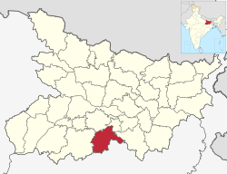
Nawada district is one of the thirty-eight districts of the Indian state of Bihar. Nawada is its administrative headquarters. The district is the easternmost district of the Magadh division, one of the nine administrative divisions of Bihar. The area of the modern district was historically part of the Magadha, Shunga and Gupta empires. Koderma and Giridih districts of the state of Jharkhand lie on the southern border of the district; it also shares borders with the Gaya, Nalanda, Sheikhpura, and Jamui districts of Bihar.

Contents

History

In 1845, Nawada was made a subdivision of Gaya district. Nawada district was separated from Gaya district on January 26, 1973.

Kakolat Falls are mentioned in Hindu Pauranik History as the abode of a king turned into a python by a Rishi's curse. [2]

Geography

Nawada district occupies an area of 2,494 square kilometres (963 sq mi), [3] comparatively equivalent to Chile's Navarino Island. [4] Most parts of the district are plain but some areas are hilly. The main rivers are the Sakri, Khuri, Panchane, Bhusri by Kakolat and Tilaiya. [5]

Administrative divisions

Nawada District is divided into two Sub-divisions and then into 14 blocks. [1] These blocks in their respective sub-divisions are as follows : [6]

typical winter in Nawada Delhua Village.jpg
typical winter in Nawada

Nawada sub-division

  1. Hisua – Bagodar, Chhatihar, Chitarghati, Dhanwa, Dona, Eknar, Hadsa, Hisua Nagar Panchayat, Kaithir, Pachra, Sonsa, Tekpur, Tungi
  2. Warisaliganj –Gopalpur, Makanpur, Apsarh, Baghi Bardiha, Pakribarawan, Chakwae, Dosut, Hajipur, Kochgawn, Kumbhi, Kutri, Manjaur, Masudha, Mohiuddin Pur, Mosima, Naromurar, Paingari, Gorapar, Saur, Shahpur, Thera, Warisaliganj Nagar Panchayat, maafi, simri, may, chainpur, chandipur, balyari, baali, bilaari.
  3. Nawada – Bhadauni, Akauna Minhai, Amthi, Bhadokhra, Bhagwanpur, Didaur, Gonawa, Jamuawa,Patwa Sarai,Gopal Ganj, Jhunathi, Kharant, Loharpura, Mahuli, Nanaura, Nawada Nagar Parishad, Oraina, Paura, Kadirganj, Samai, Sonsiahri
  4. Kawakol – Chhabail, Darawa, Debnagar, Kawakol, Kebali, Khadshari, Lalpur, Mahudar, Manjhila, Nawadaih, Paharpur, Pali, Pandegangot, Saroni, Shekhodewra
  5. Nardiganj – Dohra, Handiya, Ichua Karna, Kahuara, Kosla, Masaurha, Nardiganj, Nanaura, Odo, Parma, Pesh
  6. Kashichak – Parwati, Revera, Jagdishpur, Chandinama, Khakhari, Belar, Birnawa, Subhanpur, Derhgaon, Sarkatti
  7. Pakari Barawan – Belkhunda, Budhaul, Dioura, Okaura, Dewdha, Dhodha, Dumrawan, Dumari, Lilo, Sundari, Euri, Jiuri, Kewala, Kunanpur, Pakri Barawan, Poksi

Rajauli sub-division

  1. Akbarpur – Baksanda, Baliya Buzurg, Barail, Barew, Bhanail, Bhudhuwa, Fattehpur, Gobind Bigha, Kulna, Ladaha, Malikpur,Rajhat Sharif Nemdarganj, Mankhar, Pachgawan, Pachrukhi, Paijuna, Panti, Parto Karahri, Pharaha, Sakarpura, Diri
  2. Narhat – Babhnaur, Jamuara, Khanwa, Konibar, Narhat, Pali Kurd, Punaul, Punthar, Saidapur Goasa, Shekhpura
  3. Meskaur – Akri Pandebigha, Barat, Barosar, Biju Bigha, Meskaur, Mairzapur, Pasarhi, Rasulpur, Saraye, Tetariya, Mahugay
  4. Sirdala – Abdul, Akauna, Bandhi, Bargawan, Chaube, Chaukia, Dhiraundh, Ghaghat, Khalkhu, Khanpura, Khatangi, Laund, Rajan, Sanrh Majhgawn, Sirdala, Upardih
  5. Rajauli – Amawa East, Amawa West, Andharbari, Bahadurpur, Chitarkoli, Dhamni, Hardiya, Jogya Maran, Lengura, Murhena, Parka Buzurg, Rajauli Nagar Panchayat, Sawaiya Tand, Sirodabar, Takua Tand
  6. Govindpur – Baksoti, Baniya Bigha, Budhwara, Madhopur, Bisunpur, Bhawanpur, Delhua, Sarkanda, Sughri, Govindpur
  7. Roh – Nazardih, Ohari, Marui

Nawada also has 5 Assembly constituencies: Nawada, Hisua, Rajauli, Gobindpur and Warisaliganj.

Economy

The main crops harvested in the district are paddy, wheat, pulses, and vegetables. Industrial facilities in the district include bidi factories and silk handlooms. [5] Formerly, sugar cane farming and processing also took place; the district's single sugar mill, located in Warisaliganj, is currently non-functional. [7] Kadirganj, located 6 km from Nawada, has a small scale (Handloom Silk) Industry where more than 100 weavers families involved in weaving handloom silk clothes. [8]

Rajauli Hisua and Warsaliganj are emerging as significant market hubs for the hinterland regions bordering Jharkhand state, and have also produced many professionals including physicians, surgeons, engineers who are working in many parts of India. [8] The Nuclear Power Corporation of India identified Rajauli as the possible site for creating an additional 2,800 MW of nuclear power capacity in the state. [9]

In 2006 the Ministry of Panchayati Raj named Nawada one of the country's 250 most backward districts (out of a total of 640). [10] It is one of the 38 districts in Bihar currently receiving funds from the Backward Regions Grant Fund Programme (BRGF). [11]

Transport

National Highway 20 runs roughly north–south through the western side of district, serving many villages and towns, including the administrative center of Nawada. [12] National Highway 120 follows a 30 km route in the far northwestern corner of the district, passing through the town of Hisua. [13] Including state highways and other routes connecting villages, the district has approximately 420 km of paved roads. [14] Deluxe buses are available from Nawada to cities like Patna, Bihar Shariff, Bodh Gaya, Rajgir, Koderma and major cities Patna, Kolkata, Ranchi, Bokaro,Jamshedpur etc. [15]

The district lies in the East Central Railway of Indian Railways; the Gaya–Kiul line crosses the district roughly east–west, and connects with the Bakhtiyarpur–Tilaiya line at Tilaiya Junction. Two express trains and several local trains run on the Gaya-Kiul line via Nawada railway station. [16] Though electrification is complete, doubling of railway line is under process. This would provide alternative route for Kolkata and North-East bound trains and would enhance passenger services and freight trains. Currently a Delhi bound train is already scheduled and running from Godda to New Delhi and vice versa has halt at Nawada railway station. [17]

Demographics

Historical population
YearPop.±% p.a.
1901412,119    
1911431,938+0.47%
1921430,323−0.04%
1931477,400+1.04%
1941554,733+1.51%
1951613,724+1.02%
1961741,633+1.91%
1971893,937+1.89%
19811,099,177+2.09%
19911,359,694+2.15%
20011,809,696+2.90%
20112,219,146+2.06%
source: [18]
Religions in Nawada district (2011) [19]
ReligionPercent
Hinduism
88.53%
Islam
11.01%
Other or not stated
0.46%

According to the 2011 census Nawada district has a population of 2,219,146, [20] roughly equal to the nation of Latvia [21] or the US state of New Mexico. [22] [ why? ] This gives it a ranking of 205th in India (out of a total of 640). [20] The district has a population density of 889 inhabitants per square kilometre (2,300/sq mi). [20] Its population growth rate over the decade 2001-2011 was 22.49%. [20] Nawada had a sex ratio of 936 females for every 1000 males, [20] and a literacy rate of 61.63%. 9.71% of the population lives in urban areas. Scheduled Castes and Scheduled Tribes make up 25.47% and 0.09% of the population respectively. [20]

Languages in Nawada district (2011) [23]

   Magahi (55.52%)
   Hindi (36.64%)
   Urdu (7.57%)
  Others (0.27%)

At the time of the 2011 Census of India, 55.52% of the population in the district spoke Magahi, 36.64% Hindi and 7.57% Urdu as their first language. [23]

Politics

DistrictNo.ConstituencyNamePartyAllianceRemarks
Nawada 235 Rajauli Prakash Veer RJD MGB
236 Hisua Nitu Kumari INC MGB
237 Nawada Vibha Devi Yadav RJD MGB
238 Gobindpur Md Kamran RJD MGB
239 Warsaliganj Aruna Devi BJP NDA

Education

The district has good literacy percentage. There are numerous institution for Higher education and secondary education.

Higher educational institutes

Secondary educational institutes

* TPS International School, Pipra Kushahan, Sirdalla

See also

Tourism

Nawada district has its own tourism splendour and has the potential to develop as a tourist destination. In the town's immediate surroundings, there are various points of interest. The Kakolat Waterfall (24 km from town) and the Sekho Devra Ashram are among them (Sarvodaya Ashram was established here in Kowakole block by Jaiprakash Narayan and inaugurated by Dr. Rajendra Prasad), Baba Majaar and Hanuman Temple (located on NH 31, a shrine of Hazrat Saiyyad Shah Jalaluddin Bukhari and a Hanuman temple), Jarra Baba (found in Sirdalla), Hanuman Mandir (located in Kendua village), and Maa Bageshwari Mandir (located in Kendua village) (located in Jamuawa, in 3 km of Jamui road of Nawada in side of Sakri River). [24]

Related Research Articles

<span class="mw-page-title-main">Nawada</span> City in Bihar, India

Nawada is a city and a Municipality in Bihar, India. It is also the Headquarters of the Nawada district. It is situated on both sides of the Khuri River at 24º 53’ N and 85º 33’ E. The name evolved from Nau-abad, meaning the new town. In 1845, it was established as a Subdivision of Gaya district. On 26 January 1973, Nawada was formed as a separate district from Gaya district. It is a part of Magadh Division.

<span class="mw-page-title-main">Magadh University</span> University in Bihar, India

Magadh University is a public state university and institution of higher education in Bodhgaya, Bihar, India. It is recognised by the University Grants Commission (UGC).

<span class="mw-page-title-main">Madhepura district</span> District of Bihar in India

Madhepura district is one of the thirty-eight districts of Bihar state, India, and Madhepura town is the administrative headquarters of this district. Madhepura district is a part of Kosi division.

<span class="mw-page-title-main">Sitamarhi district</span> District of Bihar in India

Sitamarhi is one of the districts in the Mithila region of the Indian state of Bihar, India. Dumra is the administrative headquarters of this district. The district is a part of the Tirhut Division and is located along the border of Nepal.

<span class="mw-page-title-main">Kaimur district</span> District of Bihar in India

Kaimur district is one of the 38 districts of Bihar, India. The district headquarters are at Bhabua. Before 1991, it was part of Rohtas District. Till 1764 the region was a part of Ghazipur District and was a part of Kamsaar Raj and later it was a part of Chainpur Estate till 1837.

<span class="mw-page-title-main">Jehanabad district</span> District of Bihar in India

Jehanabad district is one of the thirty-eight districts of Bihar state, India. Jehanabad town is the administrative headquarters of this district. Jehanabad district is a part of Magadh Division, and is located on the confluence of two small rivers called Dardha and Yamunaiya.

<span class="mw-page-title-main">Koderma district</span> District of Jharkhand in India

Koderma district is one of the twenty-four districts of Jharkhand state, India, and Koderma is the administrative headquarters of this district.

<span class="mw-page-title-main">Gaya district</span> District in Bihar, India

Gaya district is one of the thirty-eight districts of the Indian state of Bihar. It was officially established on 3 October 1865. The district has a common boundary with the state of Jharkhand to the south. Gaya city is both the district headquarters and the second-largest city in Bihar.

Barbigha is a city and a municipality in the Sheikhpura district of Bihar, India. It is well connected by road to the state capital of Patna. National highways NH33 and NH333A also pass through Barbigha, and Bihta-Sarmera four lane state highway passes from Gopalbad near it.

Daudnagar is a town and the subdivisional headquarter of Daudnagar Subdivision in Aurangabad district in the state of Bihar, India under the Magadh division. Until 1991, there was only one Subdivision in the Aurangabad district: Aurangabad Sadar. On 31 March 1991, one other subdivision, Daudnagar, was created. Daudnagar is a 200-year-old historical city and its living proof is Daudnagar has an old historical fort situated on the eastern bank of the Son River. National Highway NH139 which connects Jharkhand's Palamu district to Patna, passes through the town.

Hisua is a city and a municipality in Nawada district in the India state of Bihar. It is situated on the right bank of the Tilaiya river along Gaya and Nawada road, 9 miles (14 km) west of Nawada and 27 miles (43 km) east of Gaya. The city lies adjacent to the Tilaiya Junction railway station on the Southern Bihar Railway. The primary occupation of Hisua's residents is agriculture, and the town is known for its pottery and local poetry. Hisua is also known for gold jewellery shops. Tilkut, lai, anarsa and khaja are among the traditional sweets from Hisua that are popular in Bihar.

Warisaliganj is a Community Development block and a Municipal Council in Nawada district in the Indian state of Bihar.

<span class="mw-page-title-main">Rajauli</span> Place in Bihar, India

Rajauli is a tehsil, block and subdivision (sub–district) in Nawada district of Magadh division of the Indian state of Bihar. The tehsil of Rajauli is located at a distance of about 30 kilometres (19 mi) from Nawada city on National Highway 20 and is situated on the bank of Dhanarjay river. Rajauli, a Scheduled Caste (SC) reserved Assembly Constituency (AC) seat, had a total of 302900 electors during the 2015 Bihar Legislative Assembly election. Rajauli subdivision consists of 95 panchayats and 688 revenue villages while Rajauli block consists of 17 panchayats and 169 revenue villages.

<span class="mw-page-title-main">Harnaut</span> City in Bihar, India

Harnaut is a Nagar panchayat and corresponding Block in the Nalanda District of Bihar, India. The Hindu, Buddhist and Jain pilgrim centres of Nalanda, Pawapuri, Rajgir, Bodh Gaya and Vaishali are all near Harnaut. The incumbent Chief Minister of Bihar, Nitish Kumar, is from Kalyan Bigha village near Harnaut.

The Gaya–Kiul line is a railway line connecting Gaya on the Howrah–Gaya–Delhi line and Kiul on the Howrah–Delhi main line both in the Indian state of Bihar.

<span class="mw-page-title-main">Bihar Sharif Junction railway station</span> Railway junction station in Nalanda District, Bihar, India

Bihar Sharif Junction railway station, station code BEHS, is a railway station under Danapur railway division of East Central Railway. Bihar sharif is connected to metropolitan areas of India, by the Delhi–Kolkata main line via Mughalsarai–Patna route. Station is located in Bihar Sharif city in Nalanda district in the Indian state of Bihar. Due to its location on the Bakhtiyarpur–Tilaiya line, many trains from Patna and other cities via Bakhtiyarpur Junction, and trains coming from Rajgir and Gaya Junction stops here. Bihar Sharif has well connected trains running frequently to New Delhi, Patna Junction, Varanasi Junction, and Howrah Junction and with nearby cities Gaya Junction, Rajgir railway station, Tilaiya railway station, Bhagalpur railway station, Kiul Junction through daily passenger and express train services.

<span class="mw-page-title-main">Naromurar</span> Village in India - 257587 in Bihar

Naromurar is a Village in Warisaliganj Tehsil, located 10 km (6.2 mi) from National Highway 31 and 8 km (5.0 mi) from State Highway 59, making it the only village of the area well connected to both Nawada and Nalanda districts of Bihar.
Literally the word Nar means water and Murar means Lord Krishna who appeared as the 8th avatara of Lord Vishnu in Dvapara Yuga as mentioned in Garuda Purana, that is the word Naromurar means the house of lord Vishnu -Kshirsagar.
Naromurar is a village of great traditions. It is one of the ancient villages of India having a four hundred year older Thakur Wadi dedicated to Maryada Purushottam Ram and Lord Shiva.
Along with the Rajkiyakrit Madhya Vidyalay having established in 1920 AD, 27 years before the freedom of India, a Janta Pustakalay the Public Library is also started in the year of 1956 AD which was inaugurated by the Education Minister of Bihar during the time of Krishna Singh.

<span class="mw-page-title-main">Warisaliganj railway station</span> Railway station in Bihar

Warisaliganj railway station is a major railway station in Nawada district, Bihar. Its code is WRS.

Akauna is a large village located in Sirdala block, Nawada district, Bihar, India.

Sheikhpura Junction railway station, station code SHK, is a railway station under Danapur railway division of East Central Railway. Sheikhpura is connected to metropolitan areas of India, by the Gaya–Kiul line. Station is located in Sheikhpura city in Sheikhpura district in the Indian state of Bihar. Due to its location on the Gaya–Kiul line, many trains coming from Gaya and other cities stops here. Sheikhpura is well connected with nearby cities Gaya, Nawada, Bhagalpur, Howrah and Kiul through daily passenger and express train services.

References

  1. 1 2 District Census Handbook – Nawada (PDF). Census of India 2011. Vol. Part B: Village and Town wise Primary Census Abstract. Patna: Directorate of Census Operations, Bihar.
  2. "Destinations". Bihar State Tourism Development Corporation . Patna: Government of Bihar. Eco Circuit. Archived from the original on 2015-07-06. Retrieved 2015-08-21.
  3. Srivastava, Dayawanti; et al., eds. (2010). "States and Union Territories: Bihar: Government". India 2010: A Reference Annual (54th ed.). New Delhi: Additional Director General, Publications Division, Ministry of Information and Broadcasting (India), Government of India. pp. 1118–1119. ISBN   978-81-230-1617-7.
  4. "Island Directory Tables: Islands by Land Area". United Nations Environment Program. 1998-02-18. Archived from the original on 2018-02-20. Retrieved 2011-10-11. Navarino Island 2,473 km2
  5. 1 2 "District Nawada". rainrays.com.
  6. "Subdivision & Blocks | Welcome to Nawada District Web Portal" . Retrieved 2019-02-13.
  7. "Five closed sugar mills in state likely to be opened soon". The Times of India . 5 January 2012.
  8. 1 2 "Nawada District". bihar.com.
  9. BP Staff (4 February 2013). "Bihar's first Nuclear Power Plant to come up at Rajauli". biharprabha.com.
  10. "BRGF Overview". New Delhi: Ministry of Panchayati Raj. Retrieved 2017-02-07.[ dead link ]
  11. "BRGF Districts". New Delhi: Ministry of Panchayati Raj. 6 June 2014. Retrieved 2017-02-07.[ dead link ]
  12. ASL Advanced Systems Pvt. Ltd. Road Division Map: District - Nawada (PDF) (Map). Patna: Government of Bihar. Archived from the original (pdf) on 2012-02-24. Retrieved 2015-08-20.
  13. "National Highways passing through Bihar" (PDF). Bihar Road Construction Department. Patna: Government of Bihar. 2009-08-26. p. 3. Archived from the original (PDF) on 2012-02-24. Retrieved 2015-08-20.
  14. "State Highways and Major District Roads across State of Bihar" (PDF). Bihar Road Construction Department. Patna: Government of Bihar. March 2013. p. 28. Archived from the original (PDF) on 2015-08-21. Retrieved 2015-08-21.
  15. "Patna to Nawada Volvo bus service". bus-service.in.
  16. "Arrivals at Nawada". indiarailinfo.com.
  17. "Arrivals at Nawada". indiarailinfo.com.
  18. "Table A-02 Decadal Variation in Population Since 1901: Bihar" (PDF). census.gov.in. Registrar General and Census Commissioner of India.
  19. "Table C-01 Population by Religion: Bihar". censusindia.gov.in. Registrar General and Census Commissioner of India. 2011.
  20. 1 2 3 4 5 6 "District Census Handbook: Nawada" (PDF). Census of India . Registrar General and Census Commissioner of India. 2011.
  21. US Directorate of Intelligence. "Country Comparison: Population". Archived from the original on June 13, 2007. Retrieved 2011-10-01. Latvia 2,204,708 July 2011 est.
  22. "2010 Resident Population Data". U. S. Census Bureau. Retrieved 2011-09-30. New Mexico - 2,059,179
  23. 1 2 "Table C-16 Population by Mother Tongue: Bihar". censusindia.gov.in. Registrar General and Census Commissioner of India. 2011.
  24. "Tourism | District Administration, Nawada | India".

24°45′N85°00′E / 24.750°N 85.000°E / 24.750; 85.000