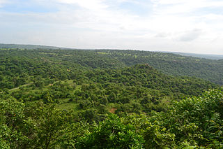
Sonbhadra or Sonanchal is the second largest district by area of Uttar Pradesh after Lakhimpur Kheri. The district headquarters is in the town of Robertsganj. Sonbhadra is also known as the "Energy Capital of India" because there are multiple power plants.

Arwal district is one of the thirty-eight districts of Bihar state, India, and Arwal town is the administrative headquarters of this district. It was earlier part of Jehanabad district.
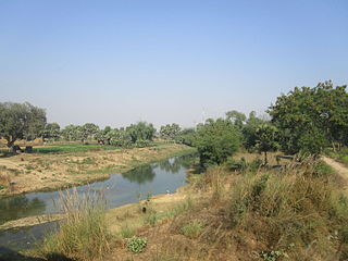
Aurangabad district is one of the thirty-eight districts of Bihar state, India. It is currently a part of the Red Corridor.

Kaimur district is one of the 38 districts of Bihar, India. The district headquarters are at Bhabua. Before 1991, it was part of Rohtas District. Till 1764 the region was a part of Ghazipur District and was a part of Kamsaar Raj and later it was a part of Chainpur Estate till 1837.
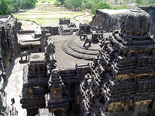
Aurangabad district, officially known as Chhatrapati Sambhaji Nagar district, is one of the 36 districts of the state of Maharashtra in western India. It borders the districts of Nashik to the west, Jalgaon to the north, Jalna to the east, and Ahmednagar to the south. The city of Aurangabad houses the district's administrative headquarters. The district has an area of 10,100 km2, of which 37.55% is urban and the rest is rural. Aurangabad District is a major tourism region in Marathwada.

Etah district is one of the districts of Uttar Pradesh, India, since 1854. Etah City is the district headquarters. Etah district is a part of Aligarh Division.

Siwan is a city and nagar parishad in the Indian state of Bihar. It is the administrative headquarters of Siwan district and one of the urban settlements out of three in the district. It is located close to Uttar Pradesh.

Gopalganj is a town, municipality and headquarters of Gopalganj district in the Indian state of Bihar.
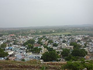
Yadgiri is a city and the administrative headquarters of Yadgir district in the Indian state of Karnataka. It is also the administrative headquarters of Yadgir Taluka, one of the six taluks of Yadgir.
Daudnagar is a town and the subdivisional headquarter of Daudnagar Subdivision in Aurangabad district in the state of Bihar, India under the Magadh division. Until 1991, there was only one Subdivision in the Aurangabad district: Aurangabad Sadar. On 31 March 1991, one other subdivision, Daudnagar, was created. Daudnagar is a 200-year-old historical city and its living proof is Daudnagar has an old historical fort situated on the eastern bank of the Son River. National Highway NH139 which connects Jharkhand's Palamu district to Patna, passes through the town.
Kannad is a Taluka and a Municipal Council City in Aurangabad District in the Indian state of Maharashtra. Kannad has located 58 km from Aurangabad. It is located 24 km away from the Ellora Caves and Grishneshwar Temple. It is 45 Km from Daulatabad / Deogiri Fort.

Koilwar or Koelwar is a nagar panchayat (town) and one of the 14 community development block in Bhojpur district in the Indian state of Bihar. As of 2011, the population of Koilwar town was 17,725, in 2,893 households. Koilwar lies on the Arrah-Patna highway (NH-922).

Rafiganj is a town and a notified area in Aurangabad district in the Indian state of Bihar. It is the district's second-largest town in population after Aurangabad, and also the second-largest town in area. Rafiganj is located 25 km away from the District Administration.
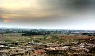
Taoru or Tauru is a town, near Nuh city in Nuh district in the Indian state of Haryana.
Warisaliganj is a Community Development block and a Municipal Council in Nawada district in the Indian state of Bihar.

Piro is a nagar parishad town and corresponding community development block in Bhojpur District, in the Indian state of Bihar.

Shahpur is a town and a notified area in Bhojpur district in the Indian state of Bihar.
Bhalu Khaira is a village and a notified area in Aurangabad district in the Indian state of Bihar.
Shamshernagar is a large village in the Daudnagar subdivision and block in Aurangabad district, located in Bihar, India. The town falls under the jurisdiction of the Magadh division. Situated on the bank of the Sone River, the National Highway 139 passes through the village. The Indrapuri Barrage canal is a local waterway. Shamshernagar is densely populated. It has adequate infrastructure, including a middle school, an intermediate high school, an additional Primary Health Centre, and a Regional Rural Bank (MBGB). Shamshernagar is an electrified village. and possesses a water tank for its water supply. It shares a border between Aurangabad and Arwal districts. Buses, auto-rickshaws and e-rickshaws provide regional transportation.

Umga Sun Temple also known as a Umga Surya Mandir is a Hindu temple in Madanpur, Aurangabad, Bihar. The temple is a Sun shrine, dedicated to Lord Sun for Chhath Puja. The temple is located in Madanpur, Aurangabad in the Indian State of Bihar. Umga Sun Temple is situated on Umga hills, Umga hills famous as a tourist place in Aurangabad Bihar. According to religious belief, After Deo Sun Temple, Umga temple is second in important temples for Chhath Puja.


