Rajgurunagar, formerly known as Khed is a census town in the Pune Metropolitan Region of the Indian state of Maharashtra. It is situated on the bank of the Bhima River and on the Pune-Nasik National Highway. It is the headquarters of Khed taluka in the Pune district. Rajgurunagar is about 10 km from Chakan.
Walwa is a taluka in Sangli district in the Indian state of Maharashtra. It is also known as Walwa-Islampur Taluka. There are ninety-five panchayat villages in Walwa Taluka.
Kadegaon is a village and taluka of Sangli district of Maharashtra in India.

Rahata taluka, is a taluka in Shrirampur subdivision of Ahmednagar district in Maharashtra State of India.

Shrirampur taluka, is a taluka in Shrirampur subdivision of Ahmednagar district in Maharashtra state of India.

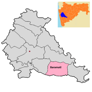
Baramati taluka is a taluka in Baramati subdivision of Pune district of state of Maharashtra in India.

Bhor taluka is a taluka in Haveli subdivision of Pune district of state of Maharashtra in India. There are 195 villages and 1 town in Bhor Taluka.

Daund taluka is a taluka or subdivision of Pune district of the state of Maharashtra in India. The town of Daund is the only major urban area in this predominantly rural area. Daund railway station is a major railway junction. All southern railways are connected to this route, and also divided the Nagar railway to north Indian railway, like Delhi, Solapur division, Daund junction and then joined to the Pune district junction. To reach the Siddhi Vinayak Siddhatek Ganpati temple, one has to travel 14 km to Daund by road.

Taluka Haveli is a subdivision of the district of Pune, Maharashtra. The Pune Municipal Corporation & Pimpri Chinchwad Municipal Corporation, Pune are at the center of & entirely surrounded by the taluka for administrative purposes. The region of Pune Metropolitan Region has claimed the major part of the same.

Indapur taluka is a taluka in Baramati subdivision of Pune district of state of Maharashtra in India.

Junnar taluka is a taluka of the Pune district in the Indian state of Maharashtra. It is northernmost taluka of the District.The area is well known for two of the Ashtavinayak temples at Lenyadri and Ozar respectively. The taluka is also the home of Shivneri Fort, GMRT (Khodad), and Vikram Sarabhai Earth Station at Arvi. There is also a tomb (Samadhi) at Ale of the buffalo that recited Vedas when requested by the 12th century Sant Dnyaneshwar. The five main dams are named Yedgaon, Pimapalgaon Joga, ManikDoha, Chilhewadi and Wadaj. An ancient place called Naneghat is there. It is known for historical evidence that was written in Bramhi Lipi, on the walls of the caves. Darya Ghat is 21 km from Junnar Which is famous for waterfalls. Kukdeshwar an ancient temple of lord Shiva is in Junnar.

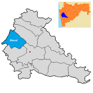
Maval taluka is a taluka in Mawal subdivision of Pune district of state of Maharashtra in India.

Taluka Bhor is a taluka in Maval subdivision of Pune district of state of Maharashtra in India. Mulshi consists of Pune Metropolitan Region & Villages.

Purandar taluka is a taluka of Pune district of state of Maharashtra in India. There are 108 villages and 3 towns in Purandhar Taluka.

Shirur taluka, is a taluka in Haveli subdivision of Pune district of state of Maharashtra in India. The town is situated on the bank of river Ghod and hence it was also known as Ghodnadi in 20th Century. The town is on the border of Pune & Ahmed Nagar District and hence, main trading center for Shirur Taluka as well as Parner Taluka located in Ahmed Nagar District.

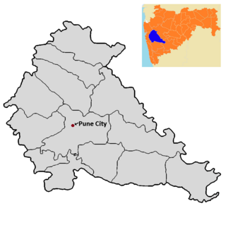
Pune City taluka is the main taluka in the Pune district of state of Maharashtra in India.

Velhe Taluka, officially renamed as, Rajgad Taluka, is a taluka in Haveli subdivision of Pune district of state of Maharashtra in India. The Taluka is entirely rural, and consists of 130 villages.
Chas is a panchayat village in the state of Maharashtra, India, on the left (east) bank of the Bhima River. Administratively, Chas is under Khed Taluka of Pune District in Maharashtra. There is only the single village of Chas in the Chas gram panchayat. The village of Chas is 16 km southeast of the Chas-Kaman Dam, and 14 km by road northwest of the town of Rajgurunagar (Khed).
Pimpalgaon Tarf Khed is a panchayat village in the state of Maharashtra, India, on the left (east) bank of the Bhima River. Administratively, Pimpalgaon Tarf Khed is under Khed Taluka of Pune District in Maharashtra. The village is 11 km east of the town of Chakan, and 23 km by road south of the town of Rajgurunagar (Khed).
Vikramgad taluka is a taluka in Palghar district of Maharashtra an Indian state.


