Maval taluka

Last updated
Maval taluka
Maval tehsil in Pune district.png
Location of Maval in Pune district in Maharashtra
CountryFlag of India.svg  India
State Maharashtra
District Pune district
Population
 (2011)
  Total377,559

Maval taluka (also spelled as Mawal tehsil) is a taluka in Mawal subdivision of Pune district of state of Maharashtra in India.

Contents

At the time of the 2011 Census of India, the taluka comprised 187 villages, a figure that was unchanged from 2001. [1] There were also three census towns at that time - Wadagaon, Khadkale and Kusgaon Budruk. [2] The census towns had their own governing bodies, whilst the gram panchayats which governed the villages numbered 100; there were two villages - Ahirvade and Kamshet - which had no official governing body. [3]

Demographics

Religions in Maval taluk (2011) [4]
ReligionPercent
Hinduism
85.62%
Buddhism
7.12%
Islam
4.38%
Jainism
1.27%
Christianity
0.89%
Other or not stated
0.72%

Maval taluka has a population of 377,559 according to the 2011 census. Maval had a literacy rate of 82.38% and a sex ratio of 902 females per 1000 males. 46,644 (12.35%) are under 7 years of age. 157,775 (41.79%) lived in urban areas. Scheduled Castes and Scheduled Tribes make up 9.62% and 7.74% of the population respectively. [5]

Languages of Maval taluk (2011) [6]

   Marathi (82.93%)
   Hindi (8.90%)
   Marwari (1.24%)
   Gujarati (0.97%)
   Kannada (0.95%)
  Others (5.01%)

At the time of the 2011 Census of India, 82.93% of the population in the district spoke Marathi, 8.90% Hindi, 1.24% Marwari, 0.97% Gujarati and 0.95% Kannada as their first language. [6]

See also

Related Research Articles

<span class="mw-page-title-main">Baramati taluka</span>

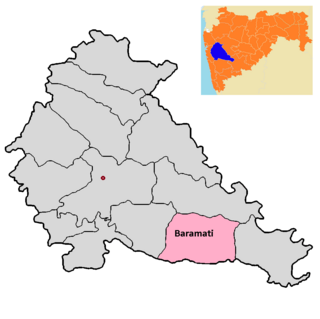
Baramati taluka is a taluka in Baramati subdivision of Pune district of state of Maharashtra in India.

<span class="mw-page-title-main">Bhor taluka</span> Taluka in Maharashtra, India

Bhor taluka is a taluka in Haveli subdivision of Pune district of state of Maharashtra in India. There are 195 villages and 1 town in Bhor Taluka.

<span class="mw-page-title-main">Daund taluka</span> Taluka in Maharashtra, India

Daund taluka is a taluka or subdivision of Pune district of the state of Maharashtra in India. The town of Daund is the only major urban area in this predominantly rural area. Daund railway station is a major railway junction. All southern railways are connected to this route, and also divided the Nagar railway to north Indian railway, like Delhi, Solapur division, Daund junction and then joined to the Pune district junction. To reach the Siddhi Vinayak Siddhatek Ganpati temple, one has to travel 14 km to Daund by road.

<span class="mw-page-title-main">Indapur taluka</span> Taluka in Maharashtra, India

Indapur taluka is a taluka in Baramati subdivision of Pune district of state of Maharashtra in India.

<span class="mw-page-title-main">Khed taluka</span> Tehsil in Maharashtra, India

Khed taluka is a taluka in the subdivision, near Pune city in Pune district of the state of Maharashtra in India. Rajgurunagar is the headquarter of the taluka. The taluka is known for being the birthplace of Santaji Jagnade.The name of city is rajgurunagar on the name of Shaheed Shivram Hari Rajguru.

<span class="mw-page-title-main">Mulshi taluka</span> Tehsil in Maharashtra, India

Taluka Bhor is a taluka in Maval subdivision of Pune district of state of Maharashtra in India. Mulshi consists of Pune Metropolitan Region & Villages.

<span class="mw-page-title-main">Purandar taluka</span> Tehsil in Maharashtra, India

Purandar taluka is a taluka of Pune district of state of Maharashtra in India. There are 108 villages and 3 towns in Purandhar Taluka.

<span class="mw-page-title-main">Shirur taluka</span> Taluka in Maharashtra, India

Shirur taluka, is a taluka in Haveli subdivision of Pune district of state of Maharashtra in India. The town is situated on the bank of river Ghod and hence it was also known as Ghodnadi in 20th Century. The town is on the border of Pune & Ahmed Nagar District and hence, main trading center for Shirur Taluka as well as Parner Taluka located in Ahmed Nagar District.

<span class="mw-page-title-main">Pune City taluka</span> Tehsil in Maharashtra, India

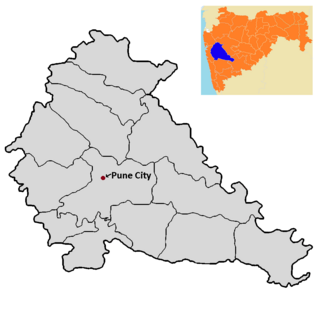
Pune City taluka is the main taluka in the Pune district of state of Maharashtra in India.

<span class="mw-page-title-main">Velhe taluka</span> Tehsil in Maharashtra

Velhe Taluka, officially renamed as, Rajgad Taluka, is a taluka in Haveli subdivision of Pune district of state of Maharashtra in India. The Taluka is entirely rural, and consists of 130 villages.

Ahirvade is a village in Mawal taluka of Pune district in the state of Maharashtra, India. It encompasses an area of 322.27 ha.

Dahivali is a village in India, situated in Mawal taluka of Pune district in the state of Maharashtra. It encompasses an area of 320 ha.

<span class="mw-page-title-main">Devghar</span> Village in Maharashtra

Devghar is a village in India, situated in Mawal taluka of Pune district in the state of Maharashtra. It encompasses an area of 157.08 ha.

Gevhande Apati is a village in India, situated in Mawal taluka of Pune district in the state of Maharashtra. It encompasses an area of 1,210 ha.

Jambavade is a village in India, situated in Mawal taluka of Pune district in the state of Maharashtra. It encompasses an area of 311.78 ha.

Jambhul is a village in India, situated in Mawal taluka of Pune district in the state of Maharashtra. It encompasses an area of 673.21 ha.

Kamshet is a village in India, situated in Mawal taluka of Pune district in the state of Maharashtra. It encompasses an area of 242.96 ha.

Kune Nane Mawal is a village in India, situated in Mawal taluka of Pune district in the state of Maharashtra. It encompasses an area of 944 ha.

Malawali Pawan Mawal is a village in India, situated in Mawal taluka of Pune district in the state of Maharashtra. It encompasses an area of 315.33 ha.

Varu is a village in Mawal taluka of Pune district in the state of Maharashtra, India. It encompasses an area of 312.59 ha.

References

  1. "Census of India 2011: Maharashtra: District Census Handbook Part B: Pune" (PDF). Directorate of Census Operations. p. 10. Archived from the original (PDF) on 2016-03-11. Retrieved 2019-05-19.
  2. "Census of India 2011: Maharashtra: District Census Handbook Part B: Pune" (PDF). Directorate of Census Operations. p. 420. Archived from the original (PDF) on 2016-03-11. Retrieved 2019-05-19.
  3. "Census of India 2011: Maharashtra: District Census Handbook Part A: Pune" (PDF). Directorate of Census Operations. p. 1202. Archived from the original (PDF) on 2019-04-11. Retrieved 2019-05-23.
  4. "Table C-01 Population by Religion: Maharashtra". censusindia.gov.in. Registrar General and Census Commissioner of India. 2011.
  5. "District Census Hand Book – Pune" (PDF). Census of India . Registrar General and Census Commissioner of India.
  6. 1 2 "Table C-16 Population by Mother Tongue: Maharashtra". censusindia.gov.in. Registrar General and Census Commissioner of India.

Further reading