Annavaram is a village in the Kakinada district of the Indian state of Andhra Pradesh, renowned for its religious and cultural significance. The village is best known for the Sri Veera Venkata Satyanarayana Swamy Temple, dedicated to Lord Satyanarayana, an incarnation of Vishnu.[1] Situated on Ratnagiri Hill, the temple, constructed initially in 1891 and rebuilt in 1933–34, is a major pilgrimage site in Andhra Pradesh and is second only to the Tirumala Venkateswara Temple in terms of prominence.[2] The temple's unique rituals, especially the collective Satyanarayana Vratam, attract thousands of devotees, particularly during the Karthika month.[3]
Annavaram is located approximately 18 km from Tuni, 51 km from Kakinada and 120 km from Visakhapatnam, with access via National Highway 16 and a B-category railway station on the Howrah–Chennai main line.[4] According to the 2011 Census, the village has a population of 6,865. The village hosts a range of educational facilities and basic healthcare services, although more comprehensive medical care is available in nearby towns.[5]
Etymology
The name Annavaram is derived from the Telugu word Anna, meaning food, symbolizing the village's longstanding reputation as a centre for food distribution. Another explanation suggests the origin from Anina varam (bestowed boon), referring to the divine blessings said to be granted by the presiding deity of the temple.[2]
According to the 2011 Census of India, Annavaram spans an area of 324 hectares with a population of 6,865, encompassing 1,835 households. The male population totals 3,458 and the female population is 3,407, resulting in a nearly balanced sex ratio. The village includes 269 individuals from Scheduled Castes and 5 from Scheduled Tribes. The PIN code for Annavaram is 533406.[5]
As per the Census 2011, the literacy rate of Annavaram is 75.1%. The male literacy rate is 81.09% and the female literacy rate is 69.05% in Annavaram village.[5]
Religious Significance
Gopuram of Satynarayana Swamy TempleView of the entire temple
Annavaram is widely known for its religious significance, primarily due to the Sri Veera Venkata Satyanarayana Swamy Temple located atop Ratnagiri Hill. Dedicated to Lord Satyanarayana, an incarnation of the Hindu god Vishnu, the temple was initially constructed in 1891 and later reconstructed in stone during 1933–34.[2] The temple features unique iconography and attracts numerous visitors, making it one of the most frequented and wealthiest religious sites in Andhra Pradesh.[9] It is considered the second most important pilgrimage centre in the state after the Tirumala Venkateswara Temple.[10]
The temple's location on Ratnagiri Hill provides a scenic view overlooking the Pampa River and the surrounding landscape. Pilgrims can reach the temple via a ghat road or by climbing a series of steps.[2] The temple is particularly known for the collective performance of the Satyanarayana Vratam, a ritual observed by hundreds of devotees at once, which fosters a strong sense of community. The month of Karthika is notable for drawing large numbers of worshippers who participate in special rituals and celebrations.[2]
A legend associated with the temple recounts the story of Meru, a great mountain, and his wife Menaka, who were blessed by Vishnu after performing penance. Their sons, Bhadra and Ratnakara, were transformed into Bhadrachalam Hill, dedicated to Lord Rama, and Ratnagiri, where Lord Satyanarayana manifested. This legend underlines the temple's significance, with devotees believing in the blessings (anina varam) received from the deity, enhancing Annavaram's religious importance.[2]
Education
Annavaram hosts a range of educational institutions, including one private kindergarten, three government primary schools, two private primary schools, one government upper primary school, one private upper primary school, one government secondary school, and one private secondary school. Higher education is available at one government junior college, one private junior college, and one private arts and science degree college.
The nearest engineering, medical, management, and polytechnic colleges are located in Kakinada. Vocational training centers are accessible in Jaggampeta, while specialized schools for differently-abled students are available in Kakinada.
Healthcare
Public healthcare facilities in Annavaram are limited. The village has two sub-centers without doctors but staffed by paramedics. The nearest primary health center is located within a 5–10 km radius. Other healthcare options include veterinary and mobile health services within the same distance. More comprehensive medical facilities, such as community health centers, maternal and child health services, allopathy hospitals, and centers for alternative medicine, are located more than 10 km away.
Annavaram has two private healthcare facilities and three unqualified practitioners providing services. There are ten pharmacies to meet the needs of the local population.
Gallery
Annavaram railway station
Annavaram bus stand
Ratnagiri mountain range
Pushkarini at the temple
Annavaram hill view
Entrance arch on new Ghat road
Paddy fields near Annavaram
Related Research Articles
East Godavari is a district in the Coastal Andhra region of Andhra Pradesh, India. Its district headquarters is at Rajamahendravaram.
Coastal Andhra, also known as Kosta Andhra, is a geographic region in the Indian state of Andhra Pradesh, comprising the coastal districts of the state between the Eastern Ghats and the Bay of Bengal, from the northern border with Orissa to Rayalaseema in the south. It includes major cities such as Visakhapatnam and Vijayawada as well as the state capital Amaravati and is recognized for its fertile lands, rich cultural heritage, and economic importance. Coastal Andhra plays a significant role in the state's agricultural output, particularly in rice and tobacco production, supported by abundant water resources from the Godavari, Krishna, and Penna rivers.
Bhimavaram is a city and headquarters of West Godavari district of the Andhra Pradesh state of India. It is the administrative headquarters of Bhimavaram mandal in Bhimavaram revenue division. It is a part of Eluru Urban Development Authority. As of 2011 census, it is the most populous urban area in the district with a population of 163,875. It is one of the major pilgrimage centers in the state, which is home to Somaramam, one of the five great Pancharama Kshetras.
Narsipatnam is a census town in Anakapalle district of the Indian state of Andhra Pradesh. It was upgraded from a gram panchayat into municipality in 2012. The town is spread over an area of 42 km2 (16 sq mi) The resting place of the revolutionary Indian freedom fighter Alluri Sitarama Raju is located in Krishna Devi Peta village of From Narsipatnam to labasingi Village 30 km only.. labasingi most popular winter tourism place..so many Tourists enjoy -2 degree's temparature there.. Narsipatnam town is 43 km away from Tuni. And it is 72 km away from Visakhapatnam.
Parvathipuram is a municipality located at Parvathipuram Manyam district of Indian state of Andhra Pradesh. It is the administrative headquarters of Parvathipuram Manyam district and headquarters of Parvathipuram revenue division and Parvathipuram mandal. This revenue division shares a border with various districts in Odisha.
Tuni is a City in Kakinada district of the Indian state of Andhra Pradesh. It is a second biggest city in Kakinada district. Freedom fighter Alluri Sitaramaraju studied here. It is a major commercial marketing centre for more than 200+ surrounding villages in the district. Tuni is a border point for the district of Kakinada. It is known for mango production, with nearly 250 varieties being exported from the area. Tuni City is also known as "Mango City". Tuni is also famous for the production of betel leaves and jute bags. A variety of cashew nuts are also produced in Tuni.
Avanigadda is a town in Krishna district of the Indian state of Andhra Pradesh. It is the mandal headquarters of Avanigadda mandal in Machilipatnam revenue division.
Kaikaluru is a town in Eluru district of the Indian state of Andhra Pradesh. Kaikalur is home to Kolleru Lake, one of the largest freshwater lakes in India, covering about 90,100 hectares and is a tourist attraction.
Kotabommali is a mandal in the Srikakulam district of the Indian state of Andhra Pradesh.
Payakaraopeta is a City in anakapalli district in the state of Andhra Pradesh in India. Payakaraopeta City is a gate Way of Visakhapatnam. Tuni and Payakaraopeta Cities are Twin Cities in Andhra Pradesh. Payakaraopeta City is fastest growing City in Andhra Pradesh. In the year 2011, The first AC library in united Andhra Pradesh was opened here.
Elamanchili is a town in Anakapalli district of the Indian state of Andhra Pradesh. It is a municipality and also the mandal headquarters of Elamanchili mandal. The town is spread over an area of 39 km2 (15 sq mi), which is under the jurisdiction of Visakhapatnam Metropolitan Region Development Authority. This town has historical importance dating back to 7th Century AD.
Andhra Pradesh is a state in India. Andhra Pradesh Tourism Development Corporation (APTDC) is a state government agency which promotes tourism in Andhra Pradesh, describing the state as the Koh-i-Noor of India. Andhra Pradesh has a variety of tourist attractions including beaches, hills, caves, wildlife, forests and temples.
Tetagunta is one of the villages in Tuni mandal in Kakinada district in Andhra Pradesh State and is located 14.1 km from its Mandal main town Tuni. It is 44.3 km from its district main city Kakinada. It has a population of 11,967 and people mostly depend on farming. Tetagunta village of Tuni Mandal is having the largest area of 4,033 hectares in the East Godavari District.It is located at a distance of 120 km from the state main city Visakhapatnam. Pincode:533406
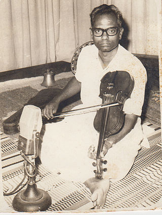
Malladi Venkata Satyanarayana Rao was a violinist and radio artist, honoured with the title Sangeetha Kalanidhi.
Balive is a village in the Eluru district of the Indian state of Andhra Pradesh. It is located in Musunuru Mandal, of Nuzvid revenue division. It is approximately 15 km from district headquarters Eluru city in Eluru District.
Ratnachal Express is a daily Superfast Intercity Express train that runs between Vijayawada Junction and Visakhapatnam Junction in Andhra Pradesh. This train belongs to Vijayawada Division of South Central Railway Zone.
Sri Veera Venkata Satyanarayana Swamy Temple is a Hindu-Vaishnavite temple located in Annavaram in Kakinada district of Andhra Pradesh, India. Dedicated to Lord Satyanarayana Swamy, an incarnation of Lord Vishnu, the temple is situated on Ratnagiri Hill. It is one of the most visited religious sites in Andhra Pradesh and is recognized as one of the state's wealthiest temples. The temple holds significant importance as a major pilgrimage centre and is regarded by many as the second most prominent in the state after the Tirumala Venkateswara Temple.
South Coast Railway Zone (SCoR) has been announced as the newest railway zone of the Indian Railways and is headquartered at Visakhapatnam, Andhra Pradesh. The formal notification for operationalization of this Zone is yet to be issued.
Talupulamma Temple is a Hindu pilgrimage site located in the village of Lova in Kakinada district of Andhra Pradesh, India. The presiding deity is a gramadevatha known as Talupulamma Thalli.
This page is based on this Wikipedia article Text is available under the CC BY-SA 4.0 license; additional terms may apply. Images, videos and audio are available under their respective licenses.