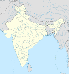
Seraikela-Kharsawan district or Saraikella and Kharaswan district is one of the twenty-four districts of Jharkhand state in eastern India. Seraikela town is the district headquarters of Saraikela Kharsawan district. The district is well known for Seraikela Chhau, one of the three distinctive styles of the chhau dance. This district was carved out from West Singhbhum district in 2001. The district was formed from the princely states of Seraikela and Kharaswan, after the independence of India.

Rewa State, also known as Rewah, was a Rajput princely state of India, surrounding its eponymous capital, the town of Rewa.
The Darbhanga Raj, also known as Raj Darbhanga and the Khandwala dynasty, was a Maithil Brahmin dynasty and the rulers of territories, not all contiguous, that were part of the Mithila region, now divided between India and Nepal.
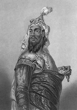
Kunwar Singh, also known as Babu Kunwar Singh, was a leader and military commander during the Indian Rebellion of 1857. He led a selected band of armed soldiers against the troops under the command of the British East India Company. He was the chief organiser of the fight against the British in Bihar.
The Bettiah Raj, also known as the Bettiah Empire, was the second-largest zamindari in the Bettiah region of Bihar, India. It generated annual land revenue rentals of more than 2 million rupees.

Saraikela State also spelt Seraikela, Saraikella or Seraikella, was a princely state in India during the era of the British Raj, in the region that is now the Jharkhand state. Its capital was at Saraikela.

Kashipur is a village, with a police station, in the Kashipur CD block in the Raghunathpur subdivision of the Purulia district in West Bengal, India. Kalloli, where the CD Block headquarters are located, is close to Kashipur.

Kharsawan State, also spelt Kharsua or kharaswan, (Odia:ଖରସୁଆଁ)was a princely state in India during the era of the British Raj. The state had a privy purse of 33,000 Rs.It was one of the Odia Princely states of India during the period of the British Raj and the major language spoken in the area is Odia.
Maharaja Harendra Kishore Public Library is a depository library in Bettiah in West Champaran district in the Indian state of Bihar. It was established in 1905 as Victoria Memorial Library and was renamed to its present name, Maharaja Harendra Kishore Public Library on Maharaja Sir Harendra Kishore Singh's birthday in 1955.

Jaitpur State was a princely state in the Bundelkhand region. It was centered on Jaitpur, in present-day Mahoba district, Uttar Pradesh, which was the capital of the state. There were two forts in the area.

The Nagvanshis of Chotanagpur, also known as the Khokhra chieftaincy, was an Indian dynasty which ruled the parts of Chota Nagpur plateau region during much of ancient, medieval and modern period. Phani Mukut Rai is considered the first king of dynasty claim to be son of Pundrika Naga, a mythical Naga. Lal Chintamani Sharan Nath Shahdeo (1931–2014) was last ruling king of the dynasty, until the estate was merged to the Republic of India.

Deo also known as "Dev", is a city council, town and a notified area in Deo community development block in Aurangabad subdivision in Aurangabad district in the Indian state of Bihar. Deo is located 10 km to the southeast of District Administrative Aurangabad Bihar.
Rajputs in Bihar are members of the Rajput community living in the eastern Indian state Bihar. They are popularly known as Babu Saheb, a term that is mainly used in Bihar, the Purvanchal region of Uttar Pradesh, and Jharkhand. They traditionally formed part of the feudal elite in Bihari society. Rajputs were pressed with the Zamindari abolition and Bhoodan movement in post-independence India; along with other Forward Castes, they lost their significant position in Bihar's agrarian society, leading to the rise of Other Backward Classes (OBCs).
Deo Raj, was a zamindari (estate) situated in what is now Aurangabad district of Bihar. The Deo Raj family were notable for being the protectors of Deo Sun shrine.
Deo Surya Mandir is a Hindu temple in Bihar, India. The temple is a solar shrine, dedicated to Surya, the sun god, for Chhath Puja. The temple is located in Deo Town, Aurangabad. The Temple is unique as it faces west, the setting sun, not the usual rising sun. It is considered to be one of the most sacred places for sun worshiping and Chhath Puja.

The Gidhaur Chieftaincy was a principality which controlled parts of South Bihar for much of the medieval period in India. The chieftaincy was named after the town of Gidhaur in Jamui district but its territory extended into the wider region.

Umga Sun Temple also known as a Umga Surya Mandir is a Hindu temple in Madanpur, Aurangabad, Bihar. The temple is a Sun shrine, dedicated to Lord Sun for Chhath Puja. The temple is located in Madanpur, Aurangabad in the Indian State of Bihar. Umga Sun Temple is situated on Umga hills, Umga hills famous as a tourist place in Aurangabad Bihar. According to religious belief, After Deo Sun Temple, Umga temple is second in important temples for Chhath Puja.

Bhojpur Kadim is a historic village in Dumraon block of Buxar district, Bihar, India. As of 2011, its population was 18,243, in 3,024 households. Together with the neighboring Bhojpur Jadid, it lends its name to the surrounding Bhojpuri region.
Raja Jagannath Prasad Singh Kinkar was an Indian ruler of Deo Raj, a princely estate in present day Aurangabad district of Bihar. He was noted for producing Bihar's first film, Chhat Mela, in 1930. It was a silent documentary film on the Chhath festival of Deo.