This article needs additional citations for verification .(July 2013) |
Paharpur | |
|---|---|
town | |
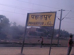 Paharpur railway station | |
 Paharpur Location in Bihar, India | |
| Coordinates: 24°36′26″N85°12′29″E / 24.607106°N 85.207943°E | |
| Country | |
| State | Bihar |
| District | Gaya |
| Population (2001) | |
• Total | 5,758 |
| Languages | |
| • Official | Magahi, Hindi |
| Time zone | UTC+5:30 (IST) |
| ISO 3166 code | IN-BR |
Paharpur is a census town in Gaya district in the Indian state of Bihar.
