Katihar district

Last updated
Katihar District
Grassland besides Katihar highway, 2017.jpg
Fields in Katihar district
Bihar district location map Katihar.svg
Location of Katihar district in Bihar
CountryFlag of India.svg  India
State Bihar
Region Mithila
Division Purnia
Headquarters Katihar
Tehsils 17
Government
   Lok Sabha constituencies Katihar
   Vidhan Sabha constituencies Katihar, Kadwa, Balrampur, Pranpur, Manihari, Barari Korha
Area
  Total3,056 km2 (1,180 sq mi)
Population
 (2011)
  Total3,071,029
  Density1,000/km2 (2,600/sq mi)
Demographics
  Sex ratio916
Language
  Official Hindi, Urdu
  Regional Languages Maithili, Surjapuri, Bengali
Time zone UTC+05:30 (IST)
Vehicle registration BR-39
Major highways NH-31, NH-81, NH-131A
Website http://katihar.bih.nic.in/

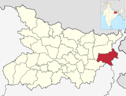
Katihar district is one of the thirty-eight districts of Bihar state in India, and Katihar city is the administrative headquarters of this district. The district is a part of Purnia Division. It is prominently known for its Katihar Junction Railway Station, which is a Category A1 station on the Barauni–Guwahati line. It has been included in the Aspirational Districts Program of the Government of India since 2018, to improve its socio-economic indicators. [1]

Contents

Katihar is the largest maize producing district of Bihar in 2022. [2]

History

Katihar district is a part of the Mithila region. [3] Mithila first gained prominence after the establishment of the Mithila Kingdom (also called Kingdom of the Videhas).

During the late Vedic period (c. 1100–500 BCE), Kingdom of the Videhas became one of the major political and cultural centers of South Asia, along with Kuru and Pañcāla. The kings of the Kingdom of the Videhas were called Janakas. [4] The Mithila Kingdom was later incorporated into the Vajjika League, which had its capital in the city of Vaishali, which is also in Mithila. [5]

Later it was dominated by Chaudhary family who were the biggest landlords of Katihar district. Khan Bahadur Mohammad Baksh was the founder of the Chaudhary family. They held 15000 acres of land in Katihar district and 8500 acres of land in Purnia district. His great grandsons Chaudhary Mohammad Ashraf and Chaudhary Taj Mohammad live in a haveli known as Taj Dehori. Katihar became a district when it was split from Purnia in 1973. [6]

Geography

Katihar district occupies an area of 3,057 square kilometres (1,180 sq mi), [7] comparatively equivalent to Canada's Akimiski Island. [8]

Rivers: Mahananda, Ganges, Koshi, Righa

Katihar district is situated in the plains of North Eastern part of Bihar State, surrounded by Purnia district (Bihar) in the north and the west, Bhagalpur district (Bihar) and Sahebganj district (Jharkhand) in the south and Malda district and Uttar Dinajpur district (Paschim Bengal) in the east.

Politics

DistrictNo.ConstituencyNamePartyAllianceRemarks
Katihar 63 Katihar Tarkishore Prasad BJP NDA
64 Kadwa Shakeel Ahmad Khan INC MGB
65 Balrampur Mahbub Alam CPI(ML)L MGB
66 Pranpur Nisha Singh BJP NDA
67 Manihari Manohar Prasad Singh INC MGB
68 Barari Bijay Singh JD(U) NDA
69 Korha Kavita Devi BJP NDA

Economy

In 2006, the Ministry of Panchayati Raj named Katihar one of the country's 250 most backward districts (out of a total of 640). [9] It is one of the 36 districts in Bihar currently receiving funds from the Backward Regions Grant Fund Programme (BRGF). [9] It has also been included in the Aspirational Districts Program of the Government of India since 2018, to improve its socio-economic indicators. [1]

The main source of economy in Katihar is agriculture, and most of its industries are agro-based. Rice is the main crop, while banana, jute and maize are the chief cash crops of the district. Makhana Phodi, an agro-industry where edible makhana (foxnuts) is produced from raw makhana, is a rapidly-rising industry in Katihar. [10]

Katihar was once known as the "jute capital" of Bihar and boasted of two major jute mills, Sunbio Manufacturing Private Limited (also known as Old Jute Mill) and Rai Bahadur Hardutroy Motilal Chamria (RBHM) Jute Mill (also known as New Jute Mill). [11]

Political history

The district has seen immense activity during freedom struggle. There has been renowned freedom fighters like Alhaj Azhar Ali after whose name there is a village called Ajhrail. The busiest market square, Shaheed Chowk, has been named so in the memory of martyrs of 1942 Quit India Movement. [13] Among notable freedom fighters from Katihar are, Dhrub Kundu, his father Dr Kishori Lal Kundu, Nakshtra Malakar (known as Robinhood of the Kosi belt).

The Katihar Lok Sabha constituency has been represented by politicians like Sitaram Kesri former Teasurer and President of AICC, Tariq Anwar, Nikhil Choudhary, Mohammad Yunus Saleem. Kashmiri veteran politician Mufti Mohammad Sayeed also unsuccessfully tried his luck in 1996 Lok Sabha elections.

Sub-divisions

Katihar District comprises 3 Sub-divisions:

Katihar sub-division is further divided into 10 blocks: Katihar, Korha, Falka, Sameli, Barari, Kursela, Pranpur, Hasanganj, Dandkhora and Mansahi. Barsoi sub-division consists 4 blocks: Barsoi, Kadwa, Azamnagar and Balrampur. Manihari sub-division has 2 blocks: Manihari and Amdabad.

Hasanganj being the largest block which was under Zamindari rule with acres of land under the possession of then Late Shri Jogendranarayan Roy Choudhury. The entire landmass with school, temple and market has been donated to the people from the predecessors who remain in Katihar now with little of the possession under the Paul Choudhury fame. Mansahi was also very active Zamindari estate which was at par with Kursela and Falka.

Villages

Harnathpur Bhaisbandha Sonapur

Demographics

Historical population
YearPop.±% p.a.
1901484,667    
1911520,805+0.72%
1921556,136+0.66%
1931601,533+0.79%
1941654,841+0.85%
1951694,986+0.60%
1961911,037+2.74%
19711,136,994+2.24%
19811,428,622+2.31%
19911,825,380+2.48%
20012,392,638+2.74%
20113,071,029+2.53%
source: [15]

According to the 2011 census, Katihar district has a population of 3,071,029, [16] roughly equal to the nation of Oman [17] or the US state of Iowa. [18] This gives it a ranking of 117th in India (out of a total of 640). [16] The district has a population density of 1,004 inhabitants per square kilometre (2,600/sq mi). [16] Its population growth rate over the decade 2001–2011 was 28.23%. [16] Katihar has a sex ratio of 916 females for every 1000 males, [16] and a literacy rate of 53.56%. 8.92% of the population lives in urban areas. Scheduled Castes and Scheduled Tribes make up 8.57% and 5.86% of the population respectively. [16]

Religion

Religions in Katihar district (2011) [19]
ReligionPercent
Hinduism
54.85%
Islam
44.47%
Other or not stated
0.68%
CD block Hinduism Islam Others
Falka69.94%29.38%0.68%
Korha59.16%39.78%1.06%
Hasanganj62.91%36.66%0.43%
Kadwa47.33%52.27%0.40%
Balrampur45.67%53.45%0.88%
Barsoi 27.61%72.06%0.33%
Azamnagar43.48%56.21%0.31%
Pranpur61.37%38.17%0.46%
Dandkhora85.89%12.76%1.35%
Katihar 70.91%28.08%1.01%
Mansahi55.87%43.79%0.34%
Barari52.28%46.70%1.02%
Sameli91.30%8.57%0.13%
Kursela 92.25%7.51%0.24%
Manihari 62.86%35.67%1.47%
Amdabad45.57%54.13%0.30%

Hinduism is the majority religion, although in rural areas Hindus and Muslims are in equal numbers. In the eastern part of the district Muslims are in majority. [19]

Tourist places

Katihar is a district in the state of Bihar, India, and while it may not be as well-known as some other tourist destinations, it does have a few places of interest for visitors.[ original research? ] Here are some tourist places in and around Katihar:

1. Kosi River Katihar is located near the Kosi River, which is known as the "Sorrow of Bihar" due to its history of flooding. The river offers scenic views, and there are some spots along its banks where you can enjoy a peaceful time.

2. Manihari Ghat Manihari is a town near Katihar and is known for its historical significance as a trade center during the British colonial period. Manihari Ghat is a common spot for taking a boat ride on the Ganges River.[ citation needed ]

3. Kalki Mandir: This is a well-known temple dedicated to Goddess Kali. It's a place of religious importance and is often visited by locals and tourists alike.

4. Barari Park: Barari Park is located in the neighboring town of Bhagalpur.[ citation needed ]

5. Sikarganj Wildlife Sanctuary: Situated about 60 kilometers from Katihar, this sanctuary is home to various species of wildlife, including deer, tigers, and various bird species

6. Kastaharni Ghat: This ghat on the Ganges River is believed to have the power to relieve people of their sufferings and sins. It's a place of religious importance and tranquility.

7. Durga Mandir: Katihar is known for its Durga Puja celebration.[ citation needed ] During the Puja, the whole of Katihar is decorated as best can be seen different types of pandals at each other step.[ clarification needed ] Each year, pandals are created using different types of materials and with different themes.

8. Bhagalpur: This nearby city has attractions like the Vikramshila Gangetic Dolphin Sanctuary, the Bhagalpur Museum, and the Vikramshila University ruins.[ citation needed ]

Languages

Languages in Katihar district (2011) [20]

   Surjapuri (25.86%)
  'Other' Hindi (25.46%)
   Hindi (19.73%)
   Bengali (12.04%)
   Urdu (9.11%)
   Santali (2.97%)
   Bhojpuri (2.29%)
  Others (2.54%)

At the time of the 2011 Census of India, 25.86% of the population in the district spoke Surjapuri, 19.73% Hindi, 12.04% Bengali, 9.11% Urdu, 2.97% Santali and 2.29% Bhojpuri as their first language. 25.46% spoke languages recorded as 'Others' under Hindi on the census. Surjapuri speakers are largely concentrated in Kadwa, Azamnagar, Barsoi and Balrampur blocks bordering West Bengal, while Bengali is nearly in majority in Amdabad block. [20]

Related Research Articles

Araria is a city and a municipality that is the headquarters of Araria district in the Indian state of Bihar. Araria is situated in the northern part of Bihar.

<span class="mw-page-title-main">Kishanganj</span> Town in Bihar, India

Kishanganj is a city and district headquarters of Kishanganj district in Purnia division of Bihar state in India.

<span class="mw-page-title-main">Katihar</span> City in Bihar, India

Katihar is a city situated in the eastern part of the state of Bihar in India. It is the headquarters of Katihar district and Katihar railway division. It is one of the important cities of Bihar. It is also a main stop on the Barauni–Guwahati line.

Madhepura is a municipality in Madhepura district in the Indian state of Bihar. It stands at the centre of Kosi ravine, It was called Madhyapura- a place centrally situated which was subsequently transformed as Madhipura into present Madhepura. It is surrounded by Araria and Supaul districts in the north, Khagaria and Bhagalpur districts in the south, Purnia district in the east and Saharsa district in the West.

<span class="mw-page-title-main">Purnia</span> Urban Agglomeration in Bihar, India

Purnia is the fourth largest city of Bihar and is emerging as the largest economic hub in North Bihar. It serves as the administrative headquarters of both Purnia district and Purnia division in the Indian state of Bihar. It is well known for its favourable climate like Darjeeling and has an abundance of resources for human settlements and economic activities.

<span class="mw-page-title-main">Saharsa</span> City and municipal corporation in Bihar, India

Saharsa is a city and municipal corporation in the Saharsa District in the eastern part of the state of Bihar, India. It is situated near the eastern banks of the Kosi River. It serves as the administrative headquarters for the Saharsa District and is also the Divisional headquarters of the Kosi Division.

<span class="mw-page-title-main">Araria district</span> District of Bihar in India

Araria district is one of the thirty-eight districts of Bihar state, India. Araria district is a part of Purnia division. The district occupies an area of 2,830 km2 (1,090 sq mi). Araria town is the administrative headquarters of this district. Distance from Nepal border is only about 8 km from Forbesganj head quarter.

<span class="mw-page-title-main">Purnia district</span> District in Bihar, India

Purnia District is one of the thirty-eight districts of the Indian state of Bihar. The city of Purnia is the administrative headquarters of this district. The city of Purnia has continued its tradition of hoisting the national flag at 12:07 am on every Independence Day since 1947. Purnia district is a part of Purnia Division. The district extends northwards from the Ganges river.

<span class="mw-page-title-main">Kishanganj district</span> District in Bihar, India

Kishanganj district is one of the thirty-eight districts of Bihar state, India, and Kishanganj town is the administrative headquarters of this district. Kishanganj district is a part of Purnia division (Seemanchal).

<span class="mw-page-title-main">Saharsa district</span> District of Bihar in India

Saharsa is one of the thirty-eight districts of Bihar, India. Saharsa city is the administrative headquarters of this district. Saharsa district is a part of the Kosi Division and it became a district on 1 April 1954 and has subsequently become smaller with other districts being carved from it, most notably Madhepura in 1981.

<span class="mw-page-title-main">Kosi division</span> Division of Bihar in India

Kosi division is an administrative geographical unit of Bihar state of India. Saharsa is the administrative headquarters of the division. Currently (2022), the division consists of Saharsa district, Madhepura district, and Supaul district.

<span class="mw-page-title-main">Purnia division</span> Administrative Division in Bihar, India

Purnia division is an administrative geographical unit of Bihar state of India. Purnia is the administrative headquarters of the division. The division consists of Purnia district, Katihar district, Araria district, and Kishanganj district. It was established in 1990. It is also known as Seemanchal. It is a part of the Kosi—Seemanchal subregion of the cultural Mithila region.

<span class="mw-page-title-main">Forbesganj</span> City in Bihar, India

Forbesganj is a city with municipality in the Araria District in the state of Bihar, India, situated at the border of Nepal.

<span class="mw-page-title-main">Kasba, Purnia</span> Satellite Town in Bihar, India

Kasba is a satellite town of Purnia city and part of Purnia Urban Agglomeration in Purnia district in the Indian state of Mithila region of Bihar.

Korha is a town and tehsil (sub-district) in the Katihar district, Bihar state, India. The name is sometimes spelled Kora.

Kursela is a village situated in the bank of Trimohini Sangam, which is the confluence of the river Ganga and Kosi. It is the de facto financial centre of Katihar district. As per the Indian government population census of 2011, Kursela was reported to have city proper population of 63,928. Being a major wheat and maize producing village, around 40% of its production is transported to neighbouring districts. Kursela is also famous for its grand Chhath celebration at the bank of river Kosi and Ganga. Kursela consist of majorly 10 villages: Gobrahi Diara, Balthi, Basuhar, Debipur Kathi, Dhobinia Milik Dakhinwari, Gobrahi Diara, Tingharia, Shahpur Dharmi Milik, Muradpur, Madhaili and Jarlahi. 45.99% population of Kursela subdivision is literate, out of which 52.83% males and 38.44% females are literate. There are about 12,533 houses in the sub-district. Kursela Day is celebrated on 8 September every year in Kursela and neighbouring villages.

The Barauni–Katihar, Saharsa and Purnia sections of the Barauni–Guwahati line connects Barauni, Saharsa, Purnia and Katihar in the Indian state of Bihar.

<span class="mw-page-title-main">North Bihar</span> Geographic Region in Bihar, India

North Bihar is a term used for the region of Bihar, India, which lies north of the Ganga river.

<span class="mw-page-title-main">Kolasi</span> Semi Town in Bihar, India

Kolasi is a village situated near Katihar Town (5.0 km) of Bihar state in India. It is located on the banks of the Kosi river, surrounded by temples and agriculture lands and gathering a harmonized society above cast and religion. Generally, this village is known for having a common market place for nearby villages people and for its peaceful environment.

<span class="mw-page-title-main">Purnea University</span> State University in Bihar

Purnea University is a collegiate public state university located in Purnia, Bihar, India. It has jurisdiction over Purnia, Araria, Kishanganj and Katihar districts. It was established by an act of State Legislature in 2018. As a collegiate university, its main functions are divided between the academic departments of the university and affiliated colleges.

References

  1. 1 2 "vikaspedia Domains". vikaspedia.in. Retrieved 2021-06-13.
  2. "Bihar Economic Survey 2022-23". state.bihar.gov.in. Retrieved 2023-05-07.
  3. "Bihar assembly elections 2020: BJP eyes winning push from Mithila | Bihar Assembly Elections 2020 Election News - Times of India". The Times of India .
  4. Witzel, M. (1989). "Tracing the Vedic dialects". In Caillat, C. (ed.). Dialectes dans les litteratures Indo-Aryennes. Paris: Fondation Hugot. pp. 141–143.
  5. Hemchandra, R. (1972). Political History of Ancient India. Calcutta: University of Calcutta.
  6. Law, Gwillim (2011-09-25). "Districts of India". Statoids. Retrieved 2011-10-11.
  7. Srivastava, Dayawanti, ed. (2010). "States and Union Territories: Bihar: Government". India 2010: A Reference Annual (54th ed.). New Delhi, India: Additional Director General, Publications Division, Ministry of Information and Broadcasting (India), Government of India. pp. 1118–1119. ISBN   978-81-230-1617-7.
  8. "Island Directory Tables: Islands by Land Area". United Nations Environment Program. 1998-02-18. Retrieved 2011-10-11. Akimiski Island 3,001km2
  9. 1 2 Ministry of Panchayati Raj (September 8, 2009). "A Note on the Backward Regions Grant Fund Programme" (PDF). National Institute of Rural Development. Archived from the original (PDF) on April 5, 2012. Retrieved September 27, 2011.
  10. "Economy | Katihar | India" . Retrieved 2021-06-13.
  11. 1 2 "Katihar Jute Mills' Closure Pushes Workers, Farmers to a Dead-End". NewsClick. 2020-09-07. Retrieved 2021-06-13.
  12. Sanjay Ojha (Nov 2, 2015). "Closed mills, not caste, on Katihar priority list | Patna News - Times of India". The Times of India. Retrieved 2021-06-13.
  13. "ध्रुव कुंडू की शहादत पर टाक शो, ताजा हुई स्वतंत्रता संग्राम की कहानियां". Dainik Jagran (in Hindi). Retrieved 2021-06-13.
  14. "BHARRI Pin Code - 855105, Katihar All Post Office Areas PIN Codes, Search KATIHAR Post Office Address". news.abplive.com. ABP Network Private Limited. Retrieved 22 December 2023.
  15. "Table A-02 Decadal Variation in Population Since 1901: Bihar" (PDF). census.gov.in. Registrar General and Census Commissioner of India.
  16. 1 2 3 4 5 6 "District Census Handbook: Katihar" (PDF). Census of India . Registrar General and Census Commissioner of India. 2011.
  17. US Directorate of Intelligence. "Country Comparison:Population". Archived from the original on June 13, 2007. Retrieved 2011-10-01. Oman 3,027,959
  18. "2010 Resident Population Data". U. S. Census Bureau. Archived from the original on 2011-01-01. Retrieved 2011-09-30. Iowa 3,046,355
  19. 1 2 "Table C-01 Population by Religion: Bihar". censusindia.gov.in. Registrar General and Census Commissioner of India. 2011.
  20. 1 2 "Table C-16 Population by Mother Tongue: Bihar". censusindia.gov.in. Registrar General and Census Commissioner of India. 2011.

25°33′00″N87°34′12″E / 25.55000°N 87.57000°E / 25.55000; 87.57000