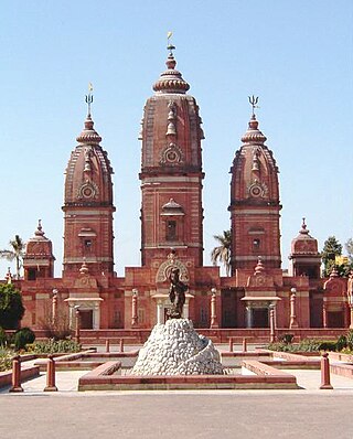
Meerut district

Last updated

Meerut district
Jain Prachin Bada Mandir - side view.jpg
Khair nagar gate built by Nawab Khair Andesh Khan cambo in 1616 AD 2013-11-19 10-44.jpg
Top: Jain Pracha Bada Mandir in Hastinapur
Bottom: Khair Nagar Gate in Meerut
India Uttar Pradesh districts 2012 Meerut.svg
Location of Meerut district in Uttar Pradesh
Coordinates(Meerut): 28°59′02″N77°42′14″E / 28.984°N 77.704°E / 28.984; 77.704
Country Flag of India.svg  India
State Uttar Pradesh
Division Meerut division
Headquarters Meerut
Tehsils 3
Government
   Lok Sabha constituencies Meerut
   Vidhan Sabha constituencies 7
Area
  Total2,522 km2 (974 sq mi)
Population
 (2011)
  Total3,443,689
  Density1,400/km2 (3,500/sq mi)
   Urban
51.07 %
Demographics
   Literacy 74.80 %
  Sex ratio885
Time zone UTC+05:30 (IST)
Major highways NH-58,NE-3
Website http://meerut.nic.in/

Meerut district, is one of the districts of Uttar Pradesh state of India, and Meerut is the district headquarters. Meerut district is also a part of the Meerut division. [1] The administrative head of district of Meerut is a District Magistrate [2] while the administrative head of Meerut Division is Divisional Commissioner, an IAS officer. [3]

Contents

History

The district was established under British rule in 1818 and, on establishment, constituted the then tehsils of Meerut, Ghaziabad, Mawana, Baghpat, Sardhana and Hapur. [4] [5] These now constitute the districts of Meerut, Ghaziabad, Hapur, Bagpat, Muzaffarnagar, Bulandshahr and a part of Gautam Buddh Nagar district. [4]

Geography

Meerut district lies between 28°57’ to 29°02’ North latitude and 77°40’ to 77°45’ East longitude in the Indo-Gangetic plains of India. [6] It is bound on the north by Muzaffarnagar district, in the south by Bulandshahar district while Ghaziabad and Baghpat districts form the southern and western limits. [7] The river Ganges forms the eastern boundary and separates the district from Moradabad district and Bijnor district. The Hindon forms the western boundary and separates the district from Baghpat. [7] The ground is not rocky and there are no mountains. The soil is composed of pleistocene and sub-recent alluvial sediments transported and deposited by river action from the Himalayan region. These alluvial deposits are unconsolidated. Lithologically, sediments consist of clay, silt and fine to coarse sand. Land is very fertile for growing crops, especially wheat, sugarcane and vegetables. [6]

Administration

The administrative head of district of Meerut is a District Magistrate [2] while the administrative head of Meerut Division is Divisional Commissioner, an IAS officer. [3]

Tehsil

The District administration comprises three tehsils, namely: [8]

Block

District is divided into 12 blocks, namely: [8]

Politics

Meerut is in part served by the Meerut-Hapur constituency for elections to the Lok Sabha of the Parliament of India.

As of 25 January 2017, the district has seven Vidhan Sabha(Legislative Assembly) constituencies, which return members of the Legislative Assembly of Uttar Pradesh. These are Siwalkhas, Sardhana, Hastinapur (which is reserved for candidates from the Scheduled Castes), Kithore, Meerut Cantonment, Meerut, and Meerut South. [9]

Demographics

Historical population
YearPop.±% p.a.
1901675,150    
1911666,027−0.14%
1921663,961−0.03%
1931709,677+0.67%
1941840,218+1.70%
19511,010,618+1.86%
19611,201,058+1.74%
19711,492,928+2.20%
19811,897,593+2.43%
19912,397,099+2.36%
20012,973,877+2.18%
20113,443,689+1.48%
source: [10]

According to the 2011 census Meerut district has a population of 3,443,689, [11] roughly equal to the nation of Panama [12] or the US state of Connecticut. [13] This gives it a ranking of 94th in India (out of a total of 640). [11] The district has a population density of 1,346 inhabitants per square kilometre (3,490/sq mi). Its population growth rate over the decade 2001-2011 was 1.489%. Meerut has a sex ratio of 886 females for every 1000 males, lower than the state average of 908; while the child sex ratio is 852, lower than the state average of 899. The district has a literacy rate of 72.84%, higher than the state average of 69.72%. 51.08% of the population lived in urban areas. Scheduled Castes made up 18.12% of the population. [11]

According to the 2001 census, the district ranked 6th in terms of population density [14] in Uttar Pradesh. The district had an average literacy rate of 65.96%, higher than the national average of 64.8% and the state average of 57.36%. [15] [16] [17] 16.66% of the population was under 6 years of age. [18] The percentage of Muslim population over 36% (one of the largest among the cities of India). [19]

Languages of Meerut district (2011) [20]

   Hindi (86.55%)
   Urdu (12.43%)
  Others (1.02%)

At the time of the 2011 Census of India, 86.55% of the population of the district spoke Hindi, 12.43% Urdu and 0.47% Punjabi as their first language. [20]

Area-Based

Demographics of Meerut District (2011 Census) [21] [8]
Tehsil Town/Village [lower-roman 1]

Population

Sex Ratio

Literacy Rate

[lower-roman 2]

MaleFemaleTotalMaleFemaleTotal
MeerutKharkhoda (NP)7584678014,36489485.68%67.51%76.99%
Sewalkhas (NP)130731180924,88290366.52%45.94%56.74%
Meerut (CB)530244028893,31276087.99%79.48%84.33%
Meerut (M Corp.)6881186173111,305,42989780.97%69.79%75.66%
Mohiuddinpur (CT)281123895,20085089.17%69.63%80.13%
Aminagar Urf Bhurbaral (CT)331428276,14185391.01%69.68%81.02%
Amehra Adipur (CT)284426415,48592985.68%68.05%77.14%
Sindhawali (CT)278225535,33591879.92%64.44%72.53%
Tehsil Meerut Total11147019874562,102,15788681.54%67.26%74.81%
MawanaKithaur (NP)144881344527,93392869.85%51.71%61.11%
Parikshitgarh (NP)10385944519,83090987.83%70.92%79.73%
Mawana (NPP)430293841481,44389377.81%62.49%70.55%
Hastinapur (NP)140101244226,45288882.50%63.47%73.48%
Bahsuma (NP)6307544611,75386384.14%66.12%75.70%
Phalauda (NP)10423948519,90891071.54%51.01%61.79%
Tehsil Mawana Total409829362612772,44188580.30%59.27%70.40%
SardhanaLawar (NP)115991042522,02489969.82%47.92%59.37%
Daurala (NP)10565921119,77687287.64%69.71%79.23%
Sardhana (NPP)301712808158,25293170.96%54.88%63.18%
Karnawal (NP)6296536711,66385286.81%66.50%77.36%
Tehsil Sardhana Total301213267878569,09188978.34%58.05%68.74%
District - Meerut Total1,825,7431,617,9463,443,68988680.74%63.98%72.84%
  1. M Corp. = Municipal Corporation, NP = Nagar panchayat, NPP = Nagar Palika Parishad, CB = Cantonment Board, CT = Census Town
  2. For Literacy rate, population aged 7 and above only is considered in India.
Population Statistics
YearUrbanRuralTotalGrowth rateSex ratio [lower-alpha 1] Density [lower-alpha 2]
MaleFemaleTotalMaleFemaleTotalMaleFemaleTotal
1971 [22] [23] [lower-alpha 3] [lower-alpha 4] NANA817,445NANA2,546,204NANA3,363,64924.04%830563
1981 [23] [24] [25] [lower-alpha 4] NANA863,280NANA1,903,280NANA2,767,24628.43% [lower-alpha 5] 841 (+11)708 (+145)
1991 [lower-alpha 6] [15] [26] [27] NANA849,799NANA1,567,7141,301,137 (53.82%)[ citation needed ]1,116,376 (46.18%)[ citation needed ]2,417,51324.91%858 (+17)959 (+251)
2001 [15] [18] [19] [28] 774,670677,3131,451,983826,908718,4701,545,3781,601,578 (53.43%)1,395,783 (46.56%)2,997,36124.16% [lower-alpha 5] 871 (+13)1190 (+231)
2011[ citation needed ]932,736829,8371,762,573896,456788,3761,684,8321,829,192 (53.06%)1,618,213 (46.94%)3,443,68915.92%885 (+14)1347 (+157)
  1. In females per 1000 males
  2. In persons per square kilometer
  3. Includes Ghaziabad and Gautam Buddh Nagar districts
  4. 1 2 Includes Bagpat district
  5. 1 2 Ghaziabad district (including parts of Gautam Buddh Nagar district) was separated from Meerut district in 1976. Baghpat district was separated in 1998. Growth rates in the 1971-1981 and 1991-2001 periods exclude the populations of these districts.
  6. Does not include Bagpat district
Change in the population of Meerut, 2001-2011 Meerut District population Charts.png
Change in the population of Meerut, 2001–2011
Literacy Rate (Percentage)
YearMaleFemaleTotal
1991 [lower-alpha 1] [15] 64.8837.6752.41
2001 [15] [18] 76.31 (+11.43)54.12 (+16.45)65.96 (+13.55)
2011[ citation needed ]82.91 (+6.6)65.69 (+11.57)74.80 (+8.84)
  1. Does not include Bagpat district

Religion

Religions in Meerut district (2011) [29]
ReligionPercent
Hinduism
63.40%
Islam
34.43%
Sikhism
0.72%
Jainism
0.54%
Other or not stated
0.91%
Distribution of religions

Hindus are the majority community in the district, although Muslims are a significant minority. There are small numbers of Sikhs, Jains and Christians in the district. There were 1987 Meerut communal riots and 2014 Meerut riots.

The Roman Catholic Diocese of Meerut is active in the district.

Areas

Cities

Towns

Villages

Related Research Articles

<span class="mw-page-title-main">Meerut</span> Metropolis In Uttar Pradesh, India

Meerut is a city in Meerut district of the western part of the Indian state of Uttar Pradesh. The city lies 80 km (50 mi) northeast of the national capital New Delhi, within the National Capital Region and 480 km (300 mi) west of the state capital Lucknow.

<span class="mw-page-title-main">National Capital Region (India)</span> Planning region in India

The National Capital Region (NCR) is a planning region centred upon the National Capital Territory (NCT) of Delhi in India. It encompasses Delhi and several districts surrounding it from the states of Haryana, Uttar Pradesh and Rajasthan. The NCR and the associated National Capital Region Planning Board (NCRPB) were created in 1985 to plan the development of the region and to evolve harmonized policies for the control of land-uses and development of infrastructure in the region. Prominent cities of NCR include Delhi, Faridabad, Ghaziabad, Gurugram, Noida and Meerut.

Hapur is a city in, as well as the headquarters of, Hapur district, in Uttar Pradesh, India. Located about 60 kilometres (37 mi) east of New Delhi, the city is part of the Delhi National Capital Region (NCR). National Highway 9 passes through the city, connecting it to Delhi.

<span class="mw-page-title-main">Bulandshahr district</span> District of Uttar Pradesh in India

Bulandshahr district is a district in the Meerut region in the North Indian state of Uttar Pradesh (UP), situated between the two rivers Ganga and Yamuna. It is a part of the National Capital Region of India, and Bulandshahr is the district headquarters.

<span class="mw-page-title-main">Bagpat district</span> District of Uttar Pradesh in India

Bagpat district, also spelled as Baghpat district, is one of the 75 districts of the Indian state of Uttar Pradesh, with headquarters at the town of Baghpat. It is within the National Capital Region. Created in 1997, the district has an area of 1,321 square kilometres (510 sq mi). Bhagpat has a population of 1,303,048 as of 2011 census.

<span class="mw-page-title-main">Kanpur Nagar district</span> District of Uttar Pradesh in India

Kanpur Nagar district, meaning Urban Kanpur District is one of the districts of the Uttar Pradesh state of India. It is a part of Kanpur division and its district headquarters is Kanpur. Kanpur was formerly spelled Cawnpore.

<span class="mw-page-title-main">Meerut division</span> Division of Uttar Pradesh state of India

Meerut division is one of the 18 administrative divisions of Uttar Pradesh state in India. Meerut city is the administrative headquarters of the division. It consists of six districts, namely Baghpat, Bulandshahr, Gautam Buddha Nagar, Ghaziabad, Hapur and Meerut.

<span class="mw-page-title-main">Moradabad district</span> District of Uttar Pradesh in India

Moradabad district is one of the districts of Uttar Pradesh, India. Moradabad is the district headquarters. Moradabad district is a part of Moradabad division. It is used to be the second most populous district of Uttar Pradesh, after Prayagraj till a new district Sambhal was carved out of it in 2011.

<span class="mw-page-title-main">Ghaziabad district</span> District of Uttar Pradesh in India

Ghaziabad district is a largely suburban district of Uttar Pradesh state in northern India. It is also a core part of the National Capital Region. The city of Ghaziabad is the administrative headquarters of the district. This district is part of Meerut Division. It has become a major bedroom community for Delhi.

<span class="mw-page-title-main">Amroha district</span> District of Uttar Pradesh in India

Amroha district is one of the 75 districts of Uttar Pradesh state in northern India. Amroha town is the district headquarters. According to the Government of India, the district is one of the Minority Concentrated Districts on the basis of the 2001 census data on population, socio-economic indicators and basic amenities indicators.

Baghpat is a city in the Indian state of Uttar Pradesh. It is the administrative headquarters of Bagpat district, which was established in 1997. It is part of the National Capital Region, surrounding New Delhi.

<span class="mw-page-title-main">Baraut</span> City in Uttar Pradesh, India

Baraut is a city and municipal board in Baghpat district, Uttar Pradesh, India.

Gulaothi is a town, near Bulandshahr city in the Bulandshahr district that falls under the Meerut division of the Indian state of Uttar Pradesh.

Mawana is a city in Meerut district in the Uttar Pradesh state of India. It is 26 km from the district headquarters Meerut. Its name comes from the word "Muhana" which means gateway. It is supposed to be the Muhana of Hastinapur kingdom. Hastinapur is a Mahabharata period town situated 9 km from the city center.

Pilkhuwa is a town and a municipal board in Hapur district in the Indian state of Uttar Pradesh. It is located 12 km from Hapur, the district headquarters. It is famous for its textile products and handloom industry.

Jalalabad (Jalālābād) is a town and a nagar panchayat in Shamli district in the Indian state of Uttar Pradesh. It is a historical town situated on Delhi Saharanpur road. Dating back to the Mughal period, situated close to the borders of Haryana and Uttarakhand states, and surrounded by a very fertile agricultural region namely famous for plentiful yields in grains and fruits, Jalalabad is internationally famous for its wood carving work cottage industry. It is a thriving market of local agricultural produce, including basmati rice and mangoes. A variety of agro-based industrial enterprises - such as textile, sugar, paper and cigarette factories - are located around it. It is 41 km from Saharanpur and 40 km from Muzaffarnagar.

North West Delhi is an administrative district of the National Capital Territory of Delhi in India.

<span class="mw-page-title-main">Shamli district</span> District of Uttar Pradesh in India

Shamli is a district in the Indian state of Uttar Pradesh. This district was carved out from Muzaffarnagar District on 28 September 2011 as Prabudh Nagar and renamed Shamli in July 2012. Shamli is the headquarters of the district. Shamli is located along the Delhi-Saharanpur-Dehradun Expressway, Ambala-Shamli Expressway, Gorakhpur-Shamli Expressway, Delhi–Saharanpur, Meerut-Karnal and Panipat-Khatima Highways.

<span class="mw-page-title-main">Sambhal district</span> District of Uttar Pradesh in India

Sambhal district is a district of Uttar Pradesh state in India. The district headquarter is Bahjoi town. 993 Villages and 16 Police stations fall under Sambhal district.

<span class="mw-page-title-main">Hapur district</span> District of Uttar Pradesh in India

Hapur district is a recently formed district in the Indian state of Uttar Pradesh with a population of 1,338,211 at the 2011 Census. It arose as an area leading in the trade of grains and jaggery. This district on the Ganges river is 60 kilometres (37 mi) from New Delhi. Being located on the river could be a reason for its prosperity in trade.It is the smallest district of Uttar Pradesh.

References

  1. For Literacy rate, population aged 7 and above only is considered in India.
  2. 1 2 "District Magistrates of Meerut". meerut.nic.in. Archived from the original on 11 August 2017. Retrieved 15 June 2017.
  3. 1 2 "Commissioners of Meerut Division". meerut.nic.in. Archived from the original on 11 August 2017. Retrieved 15 June 2017.
  4. 1 2 Meerut District – History The Imperial Gazetteer of India , 1909, v. 17, p. 256-257, 261.
  5. Sylvia Vatuk (1972). Kinship and Urbanization: White Collar Migrants in North India . University of California Press. p.  2. ISBN   9780520020641.
  6. 1 2 "Chapter 3 – Findings: Metro Cities of India" (PDF). Central Pollution Control Board. p. 63. Archived from the original (pdf) on 23 September 2015. Retrieved 1 April 2011.
  7. 1 2 "Consultancy Services for preparation of the City Development Plan(CDP) for Meerut in the state of Uttar Pradesh under JNNURM" (PDF). Jawaharlal Nehru National Urban Renewal Mission, Ministry of Urban Development, Government of India. August 2006. p. 209. Archived from the original (pdf) on 31 October 2012. Retrieved 30 September 2012.
  8. 1 2 3 "DISTRICT MEERUT DETAILS". meerut.nic.in. Retrieved 13 June 2017.
  9. "VOTER LIST 2017 ELECTION". meerut.nic.in. Retrieved 13 June 2017.
  10. Decadal Variation In Population Since 1901
  11. 1 2 3 "District Census Handbook: Meerut" (PDF). censusindia.gov.in. Registrar General and Census Commissioner of India. 2011.
  12. US Directorate of Intelligence. "Country Comparison:Population". Archived from the original on 13 June 2007. Retrieved 1 October 2011. Panama 3,460,462 July 2011 est.
  13. "2010 Resident Population Data". U. S. Census Bureau. Archived from the original on 19 October 2013. Retrieved 30 September 2011. Connecticut 3,574,097
  14. "Ranking of districts by population density". Government of Uttar Pradesh. Archived from the original on 22 November 2011.
  15. 1 2 3 4 5 "Census-2001: Literacy Rates by sex for State and Districts". Government of Uttar Pradesh. Archived from the original on 22 December 2011. Retrieved 8 April 2011.
  16. "CENSUS-2001". Government of Uttar Pradesh. Archived from the original on 22 November 2011. Retrieved 6 April 2011.
  17. Census of India 2001
  18. 1 2 3 "Population in the age group 0-6, number of literates and literacy rate for state and districts". Government of Uttar Pradesh. Archived from the original on 22 November 2011.
  19. 1 2 "Basic data sheet, District Meerut, Uttar Pradesh. Census of India 2001" (pdf).
  20. 1 2 "Table C-16 Population by Mother Tongue: Uttar Pradesh". www.censusindia.gov.in. Registrar General and Census Commissioner of India.
  21. "Census of India Website : Office of the Registrar General & Census Commissioner, India". www.censusindia.gov.in. Retrieved 15 June 2017.
  22. Basant Lal Bhatia (1992). Existence of Cooperation & Consumers-cooperatives. Sarup & Sons. pp. 21–22. ISBN   9788185431178 . Retrieved 20 August 2013.
  23. 1 2 "Sex Ratio since 1901 for state and districts". Government of Uttar Pradesh. Archived from the original on 24 December 2001. Retrieved 17 October 2013.
  24. Jagdish Kumar Pundir (1998). Banking, Bureaucracy, and Social Networks: Scheduled Castes in the Process of Development. Sarup & Sons. p. 50. ISBN   9788176250245.
  25. "Percentage decadal variation in population since 1901 for state and districts". Government of Uttar Pradesh. Archived from the original on 22 November 2011. Retrieved 19 July 2013.
  26. "Census-2001: Ranking of Districts by population size in 1991 and 2001". Government of Uttar Pradesh. Archived from the original on 22 December 2011. Retrieved 8 April 2011.
  27. "Population distribution, percentage decadal growth, sex ratio and Population Density". Government of Uttar Pradesh. Archived from the original on 22 December 2011. Retrieved 8 April 2011.
  28. Archived 28 November 2011 at the Wayback Machine . Census of India.
  29. "Table C-01 Population by Religion: Uttar Pradesh". censusindia.gov.in. Registrar General and Census Commissioner of India. 2011.