Mainpuri district

Last updated

Mainpuri district
Rameshwer Dham Shiv Mandir Dilaha - panoramio (5).jpg
Rameshwar Dham Shiv Mandir, Dilaha
India Uttar Pradesh districts 2012 Mainpuri.svg
Location of Mainpuri district in Uttar Pradesh
CountryFlag of India.svg  India
State Uttar Pradesh
Division Agra
Headquarters Mainpuri
Tehsils 6
Government
   Lok Sabha constituencies Mainpuri
Area
  Total2,745 km2 (1,060 sq mi)
Population
 (2011)
  Total1,868,529 [1]
Demographics
   Literacy 78.26%. [1]
Time zone UTC+05:30 (IST)
Website http://mainpuri.nic.in/

Mainpuri district is one of the districts in the Agra division of Uttar Pradesh, India. Mainpuri town is the district headquarters. It consists of six tehsils, namely Mainpuri, Bhongaon, Karhal, Kishni, Kurawali and Ghiror.

Contents

Mainpuri forms part of the ancient legendary region of Lord Krishna's land called Braj. [2] It is bounded on the north by Etah district, on the east by the districts Farrukhabad and Kannauj, on the south by Etawah district and on the west by the districts Firozabad and Etah. It lies between north latitude 260 53′ to 270 31′ and east longitude 780 27′ to 790 26′. According to the 2011 census, Mainpuri district has a population of 1,847,194. The district has a population density of 670 inhabitants per square kilometre (1,700/sq mi). Mainpuri has a sex ratio of 876 females for every 1000 males, and a literacy rate of 78.26%.

History

Mainpuri district was formed in 1837, when the massive Etawah district was divided. Mainpuri itself had previously been the seat of Etawah district since 1801, when the British had annexed the territory from the Nawab of Awadh. Another major change was when Etah district was split off in 1845. [3] :115

Several copper harpoons and antenna swords have been found in Ganeshpur village in 2022 which are from Copper Hoard Culture. [4] Mainpuri formed part of the kingdom of Kanauj, and after its fall it was divided into a number of petty principalities, of which Rapri and Bhongaon were chief. In 1194 Rapri was made the seat of a Muslim governor. Mainpuri fell to the Mughal's on Baber’s invasion in 1526, and, although temporarily wrested from them by the short-lived Afghan dynasty of Shere Shah, was again occupied by them on the reinstatement of Humayun after the victory of Panipat. Like the rest of the lower Doab, towards the end of the 18th century Mainpuri passed into the power of the Maratha Empire and finally became a portion of the province of Oudh. When this part of the country was ceded to the British in 1801, Mainpuri town became the headquarters of the extensive district of Etawah, which was in 1856 reduced by the formation of Etah and Mainpuri into separate collectorates. On the outbreak of the mutiny in 1857, the regiment stationed at Mainpuri revolted and attacked the town, which was successfully defended by the few Europeans of the station for a week, until the arrival of the Jhansi mutineers made it necessary to abandon the district. [5]

Kak Nadi, Senghar Nadi, and Sehar Nadi were some of the rivers in the area which have since dried up.

Administration

The Mainpuri district is headed by an IAS officer of the rank of District Magistrate (DM). The district is further sub-divided into sub-divisions or Tehsils, each headed by a Sub Divisional Magistrate (SDM).

These Tehsils are further divided into Blocks, each headed by a Block development officer (BDO). [6]

Tehsils

The six sub-divisions or Tehsils in Mainpuri are as follows:

  1. Mainpuri
  2. Bhogaon
  3. Karhal
  4. Kishni
  5. Ghiror
  6. Kurawali

Blocks

The nine Blocks in Mainpuri are as follows:

  1. Mainpuri
  2. Ghiror
  3. Bewar
  4. Jagir
  5. Sultanganj
  6. Karhal
  7. Kurawali
  8. Kishni
  9. Barnahal

Geography

The district generally gives the appearance of an extensive level plain broken only by the sand ridges on the western border, the rolling sand hills and undulations of the Kali and Isan rivers, and the ravines along the Yamuna to the southwest. The Kali Nadi forms the boundary of this plain on the north and northeast and the Yamuna encloses it on the southwest. Both these rivers flow towards the southeast and between them. The general slope of the country is from northwest to southeast, taking the district from north to south.

Generally speaking, the soils of the district are typical of those found elsewhere in the Indo-Gangetic plain, and are classified on two principles according to whether the distinctions recognised are natural or artificial. Both are well-understood and commonly employed by the cultivator. Of the natural divisions bhur is the name for soil containing a large proportion of sand, while matyar is the name of soil containing a large proportion of clay. Between these two is a loamy soil called domat with clay and sand more evenly divided. A lighter soil is known as pilia, coming between domal and bhur. The barren soil known as usher is found at the heads and partly down the courses of the smaller rivers such as Ahnaiya and Puraha, the Sengar and Arind and the numerous minor esteems. It appears to be a clay deposit too compact to permit cultivation in places too impregnated with Reh and other deleterious mineral substances to permit the growth of even grass.

Wasteland: The barren land consists for the most part of usar plains.

Forests: The total area covered in the district is 2,154 hectares (5,320 acres). A considerable area of the barren land is covered with dark jungle. A great deal of wasteland is covered with the coarse grass known locally as ganra (gandhar) or sinkh. Ganra is used for thatching and making ropes and mats. The babul grows in large clumps on the usar plains and is, indeed, the only tree which flourishes on them. Its cultivation has for some time been encouraged by the increase of moisture due to the canals and the great demand for wood both for fuel and carpentry. Its timber is hard and close-grained and is used for building purposes, fuel and charcoal. [7]

Water Bodies

Kali Nadi

The Kali Nadi forms the northeastern boundary of the district separating it from Etah and Farukkhabad. It is a narrow stream, but perennial, and even during the spring and summer months is only fordable at certain places. There is a bridge with a 545-foot span on the Farukkhabad Road.

Isan

Next to the Kali comes the Isan, which is here a considerable stream, fordable only in a few places during the rainy season. During the remainder of the year the volume of running water is small, and in years of unusual drought there is no apparent stream, but the pools that remain are fed by the springs. During the first part of its course and to within four miles of its junction with Kali Nadi about three miles northwest of Mainpuri, it runs through a loam and usar country, has a comparatively shallow bed, and often overflows the neighbouring lands in times of flooding.

The Arind or Rind

The Arind (or Rind as it is called further down its course) is an insignificant stream in this district, which it enters to the north of pargana Mustafabad, between the Etawah and Kanpur branches of the Ganges Canal, and traverses in an exceedingly sinuous course from the northwest to the southeast corner. A straight line from its point of entry to its point of exit is almost the longest which could be drawn on the district map. It presents a striking contrast to the Kali and Isan.

Lakes

Mainpuri abounds in swamps and marshes, particularly in its central portion, but few of them are of sufficient size or permanence to be considered lakes. Mention will only be made here of the more considerable ones, and for the others reference should be made to the accounts of parganas. In all 36,870 acres are recorded in the revenue record as underwater, even the largest, as they are seldom supplied by springs. There is also a long narrow lake of considerable size to the southwest of Mainpuri city, between it and the Kanpur branch of the Ganges canal, which drains by two cuts towards the Isan.

Drainage

The general slope of the country, is from northwest to southeast, and this is the direction in which the rivers run and which is therefore followed in the main by the drainage. There are however, numerous inequalities of surface caused by the greater or less elevation of the river beds and by sand bridges, and the general disposition of the drainage differs somewhat in different portions of the district. In the center tract, which lies highest, the main drainage arteries are the Isan and the Arind. Pargana Karhal has been seriously affected by the canal. The Kali and Isan and their catchment basins all belong to the Ganges system, and all the other rivers to that of the Yamuna.

Demographics

Historical population
YearPop.±% p.a.
1901509,051    
1911489,575−0.39%
1921459,132−0.64%
1931460,118+0.02%
1941535,595+1.53%
1951610,041+1.31%
1961726,012+1.76%
1971880,629+1.95%
19811,057,344+1.85%
19911,311,026+2.17%
20011,596,718+1.99%
20111,868,529+1.58%
source: [8]

According to the 2011 census Mainpuri district has a population of 1,868,529, [1] roughly equal to the nation of Kosovo [9] or the US state of West Virginia. [10] This gives it a ranking of 255th in India (out of a total of 640). [1] The district has a population density of 670 inhabitants per square kilometre (1,700/sq mi). [1] Its population growth rate over the decade 2001-2011 was 15.69%. Mainpuri has a sex ratio of 876 females for every 1000 males, [1] and a literacy rate of 78.26%. 15.44% of the population lived in urban areas. Scheduled Castes made up 19.71% of the population. [1] Hindi is the predominant language, spoken by 99.57% of the population. [11]

Religions in Mainpuri district (2011) [12]
ReligionPercent
Hinduism
93.48%
Islam
5.39%
Buddhism
0.47%
Other or not stated
0.66%
Distribution of religions

Mainpuri is a predominantly Hindu district, with Muslims as the largest minority. In rural areas Hindus are nearly 96% of the population. There are around 8,800 Buddhists in the district.

In Mainpuri, the total population is approximately 12.3 lakh and 35 percent of this population is composed of Yadav caste. Other dominant castes of the district are Shakya and Thakurs. [13]

Amenities

All the following tables are as of 2011.

Drinking water

The following table shows how households get their main source of drinking water: [14] :198–9

Source of drinking waterRuralUrbanTotal
Tap water (treated source)12.71%31.44%15.65%
Tap water (untreated source)4.01%8.08%4.65%
Well (covered or uncovered)1.36%0.57%1.23%
Hand pump81.3%52.1%76.7%
Tube well/borehole0.34%6.87%1.37%
All others0.3%0.9%0.39%

Lighting

The following table shows how households get their main source of lighting: [14] :200–1

Type of lightingRuralUrbanTotal
Electricity16.4%73.7%25.4%
Kerosene82.3%24.9%73.3%
Solar0.6%0.1%0.5%
Other oil0.4%0.35%0.39%
All others0.2%0.36%0.2%
No lighting0.12%0.54%0.19%

Toilets

The following table shows how households mainly go to the bathroom: [14] :202–3

ToiletRuralUrbanTotal
Flush/pour toilet, connected to sewer system0.9%6.6%1.8%
Flush/pour toilet, connected to septic tank 7.35%62.6%16.0%
Other flush/pour toilet1.2%2.1%1.35%
Pit latrine, with slab/ventilated improved3.0%1.7%2.8%
Pit latrine, without slab/open0.51%0.44%0.5%
Night soil (disposed of by self or others)0.48%1.97%0.7%
No toilet at home, use public toilets instead1.1%0.8%1.0%
Open defecation 85.5%23.8%75.8%

Possessions

The following table sorts households by whether they have the following possessions: [14] :208–9

ItemRuralUrbanTotal
Radio16.6%13.3%16.2%
Television18.5%58.1%24.67%
Computer (with internet)0.5%2.6%0.9%
Computer (without internet)6.7%8.7%7.0%
Cell phone61.9%68.8%63.0%
Bicycle72.0%56.5%69.5%
Scooter/motorcycle/moped14.9%29.3%17.2%
Car1.7%6.0%2.4%
None of the above12.0%11.9%12.0%

Culture

The ethnic city Mainpuri was ruled by the Mughals, Marathas, Afghans and Nawabs in various time periods. Among them, the Mughal and Nawabs vastly influenced the culture of the city. Music, dance, architecture, arts and crafts flourished under their rule. Hindus, Muslims, Jains, Buddhists, Christians and Sikhs were the principal communities residing in the city. How festival created unity among Hindus and Muslims is a question? The Hindu culture of the joint family system was once adored in the city, which has slowly disintegrated due to rapid industrial development, urban development, economic issues and social features.

The rituals of the Vedic religion manifest themselves in the various festivals that are celebrated in this city. People usually do not consume non-vegetarian food on Thursdays. Its annual Janardhan Swami Temple, and Sivagiri Mutt festivals feature vibrant colors and spiritual expression. These festivals which last for days attract locals and tourists alike by the thousands. On Tuesdays the city celebrates the birth day of Lord Hanuman. Devotees flock to the local temples to offer prayers. The city fair is held at Sheetla Devi Temple in March or April; the nine days of worshiping the various avatars of the goddess Durga (i.e. Chaitra Navratri) occurs during these months. During these nine days, many of the locals also keep fasts where they eat only fruits during this period and men do not shave their beards or mustaches. [15]

  1. Languages in Mainpuri : About two dozen languages were present in Mainpuri by 1971. At present about 97% of people speak Hindi, 2% muslims speak Urdu and the remaining 1% who came from Pakistan and Bangladesh speak other languages such as Bengali, Sindhi, Punjabi, and English. The Hindi dialect forms Braj Bhasha, Bhadauri and Bundeli are also spoken in the city.
  2. Arts in Mainpuri: Traditional art such as wooden sculptures, glassware, classic zari-worked silk sarees, pottery, rugs, and chikan embroidery depict Mainpuri culture and are available in the markets. Most of the Mainpuri arts and craft forms depict the Mughal designs. Hindustani, Ghazal and Qauwwali music are the traditional forms of music enjoyed by Mainpuris. The rasiya genre which portrays the divine love of Lord Krishna and Radha is also popular. Classical and folk dance such as Kathak and Charukala symbolise the cultural heritage of the city and state. The play Ramlila which describes the life of Lord Rama is staged during festive seasons.
  3. Fairs in Mainpuri: Cultural fairs, religious fairs and trade fairs are popular as they invite people of all backgrounds to celebrate. With Mainpuri being the district headquarters, the fairs attract large number of visitors and tourists from around the district. Fairs are also common during the festival seasons like Dusshera and Ramlila. The Devji fair in the village of Uddetpur under Mainpuri Tehsil falls on Chaitra and attracts nearly 20,000 people. The village Bidhuna hosts the biggest bathing fair in Mainpuri to celebrate Kaitiki purnima, which brings a lot of devotees to the area. Mainpuri hosts the Kans ka mela on Chaitra and the popular Narain ka mela which attracts nearly 10,000 people. The 20-day exhibition-cum-trade fair organised at Sheetla Mata Mandir on April in Udetpur Abhai village is also popular. Fairs in gurudwaras on the occasion of Baisakhi are also attended by people of all religions and castes.
  4. Notable temples: The city has some very old and popular Hindu temples. These include Sheetla Devi Temple, where every year during March/April, a rural exhibition-cum-trade fair is held for 20 days. Bhimsen Mandir is an ancient Shiva temple and Falahari Ashram situated on Jyoti-Devi Road has very a rare statue of the goddess Durga with 18 arms. Another ancient Shiv temple is Chandeshwar Mandir situated on Chandeshwar Road. Also located on Devi Road are the twin Shiv temples of Kale Mahadev and Shweat Mahadev. Hanuman Temple situated on old Tehsil Road is visited by thousands on Tuesdays and Saturdays.[ citation needed ]

Economy

The primary exports from Mainpuri district are agricultural products: wheat, pulses, potatoes, oilseeds and oil, rice, and ghee. Fish are also exported to Kolkata. Some manufactured goods are also exported: glassware, lightbulbs, and leather products. Major imports include cloth, chemicals, utensils, fertilizers, electrical goods, paper, and fuels like petrol and kerosene, as well as general consumer goods. The main commercial centres in Mainpuri district are Shikohabad, Bewar, Kusmara, Sirsaganj, and Ghiror. [16] :10

Places of interest

Krouncha, sarus crane (Grus antigone) AsianOpenbillWithPilaglobosa Mainpuri.JPG

Fort/Garhi of Mainpuri is situated at old Mainpuri. The fort is not a spot of tourist interest. It is the private property of erstwhile raja of two estates, Mainpuri and Lawan (Dausa, Rajasthan) and repaired, maintained and restored by him.

Attractions include the parks Phoolbagh and Lohia Park. Phoolbagh is situated at Jail Chauraha while Lohia Park is situated at District Collectorate. Both have green lawns and fountains.

Mainpuri is also known for the sarus crane ( Grus antigone ). This bird, called krouncha in India, is revered as a symbol of marital fidelity and is celebrated in myth and legend.[ citation needed ] There are estimated to be 8,000-10,000 sarus cranes in India. Two-thirds of its population resides in the village Andani of Karhal.

Another place of interest in the Mainpuri District is the Saman Bird Sanctuary. The Siberian crane comes here in its migration cycle and stays for 3–4 months from November to February. Part-time wildlife photographer Mr. Shashank Raghav has contributed his photos to depict the wildlife of the Mainpuri District, especially the different species of birds which can be found in nearby areas of the Saman Bird Sanctuary within the Mainpuri district.

Education

Government Engineering College, Mainpuri is a government engineering college in Mainpuri. It is a constituent college of Dr. A.P.J. Abdul Kalam Technical University (formerly Uttar Pradesh Technical University) in Lucknow.

See also

Related Research Articles

<span class="mw-page-title-main">Etawah</span> City in Uttar Pradesh, India

Etawah, also known as Ishtikapuri, is a city on the banks of Yamuna River in the state of Western Uttar Pradesh in India. It is the administrative headquarters of Etawah District. Etawah's population of 256,838 makes it the 180th most populous city in India. The city lies 300 km (190 mi) southeast of the national capital New Delhi, 230 km (140 mi) northwest of the state capital Lucknow, 120 km east of Agra and 140 km west of Kanpur. The city was an important centre for the Indian Rebellion of 1857. It is also the sangam or confluence of the Yamuna and Chambal rivers. It is the 26th most populous city in Uttar Pradesh.

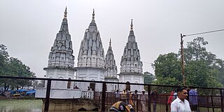
Mainpuri is a city in Mainpuri district in the Indian state of Uttar Pradesh. It is the administrative headquarters of Mainpuri district and is situated to the north-east of Agra and is 270 km from New Delhi. Mainpuri is located in the Braj region, which holds special religious significance to Hindus as the homeland of Krishna.

<span class="mw-page-title-main">Etah district</span> District of Uttar Pradesh in India

Etah district is one of the districts of Uttar Pradesh, India, since 1854. Etah City is the district headquarters. Etah district is a part of Aligarh Division.

<span class="mw-page-title-main">Firozabad district</span> District of Uttar Pradesh in India

Firozabad district is one of the western districts of the Indian state of Uttar Pradesh, which has Firozabad city as its district headquarters. The district is a part of the Agra division.

<span class="mw-page-title-main">Kannauj district</span> District of Uttar Pradesh in India

Kannauj district is an administrative district of Uttar Pradesh state in northern India, along the river Ganges. The historic town of Kannauj, northwest of Kanpur, is the administrative center. The district was carved out of Farrukhabad district on 18 September 1997. The native dialect of this district is Kannauji.

Ghiror, also spelled Ghiraur, is a town and a nagar panchayat in Mainpuri district in the state of Uttar Pradesh, India. It is also the headquarters of a community development block comprising 74 villages. As of 2011, Ghiror has a population of 15,911, in 2,687 households.

Karhal is a town and Nagar Panchayat in Mainpuri district in the Indian state of Uttar Pradesh. It is also a Tehsil, that is subdivided into two blocks, Karhal and Barnahal. It is one of the Vidhan Sabha constituency of Uttar Pradesh.

Kishni is a town in Bhongaon tehsil of Mainpuri district in the Indian state of Uttar Pradesh. It is also the seat of a community development block. As of 2011, the town of Kishni has a population of 11,098, in 5,832 households.

Shikohabad is a city and a municipal board in the Firozabad district of the Indian state of Uttar Pradesh.

Aryapur Khera is the village. Mainpuri city is an administrative headquarters of this village. Mainpuri is located to the north-east of Agra.

<span class="mw-page-title-main">Saifai</span> Village in Uttar Pradesh, India

Saifai is a large village and university town in the Etawah district of the Indian state of Uttar Pradesh. It is also a sub-division (Tehsil) and Block of the Etawah district. It is the birthplace of Mulayam Singh Yadav, the founding president of the Samajwadi Party, former Minister of Defence, in India and former Chief Minister of Uttar Pradesh.

Kishni is one of the 403 constituencies of the Uttar Pradesh Legislative Assembly, India. It is a part of the Mainpuri district and one of the five assembly constituencies in the Mainpuri Lok Sabha constituency. First election in this assembly constituency was held in 1962 after the "DPACO (1961)" was passed in 1961. After the "Delimitation of Parliamentary and Assembly Constituencies Order" was passed in 2008, the constituency was assigned identification number 109.

<span class="mw-page-title-main">Karhal Assembly constituency</span> Constituency of the Uttar Pradesh legislative assembly in India

Karhal Assembly constituency is one of the 403 constituencies of the Uttar Pradesh Legislative Assembly, India. It is a part of the Mainpuri district and one of the five assembly constituencies in the Mainpuri Lok Sabha constituency. First election in this assembly constituency was held in 1957 after the "DPACO (1956)" was passed in 1956. After the "Delimitation of Parliamentary and Assembly Constituencies Order" was passed in 2008, the constituency was assigned identification number 110.

Patara is a village in Karhal block of Mainpuri district, Uttar Pradesh, India. As of 2011, it had a population of 9,430, in 1,544 households.

Kurra Jarawan is a village in Karhal block of Mainpuri district, Uttar Pradesh. The village technically encompasses some 25 separate hamlets, which are grouped together for administrative purposes. A market is held in the village twice per week. As of 2011, Kurra Jarawan has a total population of 9,014, in 1,568 households.

Saman is a large village in Kishni block of Mainpuri district, Uttar Pradesh. It is the site of the Saman Bird Sanctuary, a large wetland area designated as a protected Ramsar site since 2019. The village lands occupy a large area, and there are many distinct hamlets counted as part of its administrative jurisdiction. As of 2011, Saman had a total population of 14,522, in 2,382 households.

Jamlapur is a village in Kuraoli block of Mainpuri district, Uttar Pradesh. As of 2011, it had a population of 1,344, in 223 households.

Sakat Bewar is a village in Bewar block of Mainpuri district, Uttar Pradesh. As of 2011, it had a population of 3,736, in 636 households.

Dayantnagar Mata, also spelled Dayanatnagar Mata or Dayanatnagar Mota, is a village in Bewar block of Mainpuri district, Uttar Pradesh. As of 2011, it has a population of 1,657, in 271 households.

Madhan is a village in Ghiror block of Mainpuri district, Uttar Pradesh, India. It is located on the road from Ghiror to Kuraoli, where it crosses the Isan river. There is an old fort in the village. As of 2011, Madhan had a population of 8,099, in 1,266 households.

References

  1. 1 2 3 4 5 6 7 "District Census Handbook: Mainpuri" (PDF). censusindia.gov.in. Registrar General and Census Commissioner of India. 2011.
  2. Subodh Kapoor (2002). The Indian Encyclopaedia: India (Central Provinces)-Indology. Genesis Publishing Pvt Ltd. p. 3432. ISBN   9788177552683.
  3. Neave, E. R., ed. (1929). Mainpuri: A Gazetteer, Being Volume X of the District Gazetteers of the United Provinces of Agra and Oudh. Allahabad: Government Press. Retrieved 19 June 2023.
  4. "More than 3800 years old copper weapons discovered in UP's Mainpuri". theprint. 13 August 2022. Retrieved 30 August 2022.
  5. "History | District Mainpuri, Government Of Uttar Pradesh | City of Cyavan Rishi | India" . Retrieved 29 May 2020.
  6. "Administrative setup, District: Mainpuri" . Retrieved 10 October 2022.
  7. "Geography | District Mainpuri, Government Of Uttar Pradesh | City of Cyavan Rishi | India" . Retrieved 29 May 2020.
  8. Decadal Variation In Population Since 1901
  9. US Directorate of Intelligence. "Country Comparison:Population". Archived from factbook/rankorder/2119rank.html the original on 13 June 2007. Retrieved 1 October 2011. Kosovo 1,825,632 July 2011 est.{{cite web}}: Check |url= value (help)
  10. "2010 Resident Population Data". U. S. Census Bureau. Archived from the original on 28 October 2011. Retrieved 30 September 2011. West Virginia 1,852,994
  11. "Table C-16 Population by Mother Tongue: Uttar Pradesh". www.censusindia.gov.in. Registrar General and Census Commissioner of India.
  12. "Table C-01 Population by Religion: Uttar Pradesh". censusindia.gov.in. Registrar General and Census Commissioner of India. 2011.
  13. "Mulayam trying hard to recapture west UP". hindustantimes.com. 23 August 2014. Archived from the original on 24 August 2014. Retrieved 17 March 2018.
  14. 1 2 3 4 "Census of India 2011: Uttar Pradesh District Census Handbook - Mainpuri, Part B (Village and Town Wise Primary Census Abstract)" (PDF). Census of India. Retrieved 19 June 2023.
  15. "Culture & Heritage | District Mainpuri, Government Of Uttar Pradesh | City of Cyavan Rishi | India" . Retrieved 29 May 2020.
  16. "Census of India 2011: Uttar Pradesh District Census Handbook - Mainpuri, Part A (Village and Town Directory)" (PDF). Census of India. Retrieved 19 June 2023.

27°10′N79°00′E / 27.167°N 79.000°E / 27.167; 79.000