Bijnor district

Last updated

Bijnor district
SAHANPUR FORT.jpg
Sahanpur Fort
India Uttar Pradesh districts 2012 Bijnor.svg
Location of Bijnor district in Uttar Pradesh
CountryIndia
State Uttar Pradesh
Division Moradabad
Headquarters Bijnor
Area
  Total4,049 km2 (1,563 sq mi)
Population
 (2011) [1]
  Total3,682,713
  Density910/km2 (2,400/sq mi)
Demographics
   Literacy 70.43%
  Sex ratio917
Time zone UTC+05:30 (IST)
Website http://bijnor.nic.in/

Bijnor district is one of the 75 districts in the state of Uttar Pradesh in India. Bijnor city is the district headquarters. The government of Uttar Pradesh seeks its inclusion in National Capital Region (NCR) due to its close proximity to NCT of Delhi. [2]

Contents

Bijnor is notable for its sugarcane production and sugar mills, with two of the top five sugar mills situated in the district. [3]

History

Bijnor district was created in 1817 out of part of Moradabad district, and it was originally called Nagina district after its headquarters at Nagina. [4] The headquarters was relocated to Bijnor in 1824, although the district was still called "Nagina district" until 1837, when it officially became known as Bijnor district. [4]

Medieval history

In 1399, the district was ravaged by Timur. Later, during the time of Akbar, Bijnor was part of his Mughal Empire. In the early 18th century, the Rohilla Pashtuns established their independence in the area called by the Rohilkhand. Around 1748, the Rohilla chief Ali Mohammed Khan made his first annexations in Bijnor, the rest of which soon fell under the Rohilla domination. The northern districts were granted by Ali Mohammed Khan to Khurshid Ahmed Baig, who gradually extended his influence west of the Ganges and at Delhi, receiving the title of Najib-ud-daula with the position of the paymaster of the Mughal forces. Marathas invaded Bijnor who was also instigated by enemies of Rohillas, leading to several battles. Rohilla chief, Najib, who sided with Ahmad Shah Abdali in Panipat, was made vizier of the empire. [5]

Colonial era

In 1772 the Nawab of Oudh made a treaty with the Rohillas, to expel the Marathas in return for a money payment. Nawab of Oudh carried out his part of the bargain, but the Rohilla chieftains refused to pay. In 1774 the Nawab concluded with the East India Company government of Calcutta a treaty of alliance, and he then called upon the British, in accordance with its terms, to supply a brigade to assist him in enforcing his claims against the Rohillas. This was done; in the Rohilla War, the Rohillas were driven beyond the Ganges to the east, and Bijnor was incorporated in the territories of the nawab, who in the same year (1774) ceded it to the British East India Company. During the rebellion of 1857, Bijnor was occupied by the Nawab of Najibabad, a grandson of Zabita Khan, on 1 June. The Barha Sayyids of Bijnor, who were hereditary enemies of the Rohillas, threw their hat in their lot with the Rohillas Pashtuns and fought on their side almost to the last man during the rebellion. [6] In spite of fighting between the Hindus and the Muslim Pashtuns, the Nawab succeeded in maintaining his position until 21 April 1858, when he was defeated by the British at Nagina. [5]

Geography

Bijnor, or more correctly Bijnaur, occupies the north-west corner of the Moradabad Division (historically, Rohilkhand or Bareilly region). The western boundary is formed throughout by the deep stream of the river Ganges, beyond which lie the four districts of Haridwar, Saharanpur, Muzaffarnagar, and Meerut. To the north and north-east in the hill country of Garhwal, the dividing line being the submontane road, which runs from Haridwar along the foot of the Himalayas to Ramnagar, Nainital, Haldwani, and Tanakpur. This road, popularly known as the Kandi Sadak, belongs throughout its length to Garhwal, the transfer having taken place a few years since. On the east the Phika river for the greater part of its course constitutes the boundary, separating this district from Nainital and Moradabad, as far as its junction with the Ramganga; and to the south lie the Thakurdwara Tehsil of Moradabad. Amroha and Hasanpur tahsils of Amroha District. The boundary being conventional and undetermined by natural features. The extreme parallels of north latitude are 29° 2' and 29° 58' and of east longitude 78° 0' and 78° 57' from Lalitpur, the most northerly point, to koti Rao in the furthest eastern corner the distance in 56 miles (90 km); and from Koti Rao to Kamharia in the south-westerly angle 57 miles (92 km); and from Kamharia to Lalitpur 62 miles (100 km). The total area of the district is liable to change slightly from time to time by reason of the erratic action of the Ganges and Ramganga: In 1906 it amounted to 1,145,272 acres (1,789.488 sq mi; 4,634.75 km2), the average for the last five years being 1,147,967 acres (1,793.698 sq mi; 4,645.66 km2).

There remains the low fringe of Khadir along the Ganges to the west. This generally resembles the lowlands that skirt the rivers of the interior, the low flats which adjoin the stream itself being purely alluvial in character, while above them rises a terrace of higher ground extending inland as far as the chain of stagnant morasses lying immediately under the bangar cliff.

Demographics

Historical population
YearPop.±% p.a.
1901776,308    
1911802,166+0.33%
1921736,765−0.85%
1931831,403+1.22%
1941905,793+0.86%
1951979,406+0.78%
19611,184,306+1.92%
19711,480,734+2.26%
19811,927,023+2.67%
19912,454,521+2.45%
20013,131,619+2.47%
20113,682,713+1.63%
source: [7]

According to the 2011 census Bijnor district has a population of 3,682,713, [8] [1] roughly equal to the nation of Liberia [9] or the US state of Oklahoma. [10] This gives it a ranking of 74th in India (out of a total of 640). [8] The district has a population density of 808 inhabitants per square kilometre (2,090/sq mi). [8] Its population growth rate over the decade 2001-2011 was 17.64%. [8] Bijnor has a sex ratio of 913 females for every 1000 males, [8] and a literacy rate of 70.43%. 25.13% of the population lived in urban areas. Scheduled Castes and Scheduled Tribes make up 21.38% and 0.08% of the population respectively. [8]

Religion

Religions in Bijnor district (2011) [11]
ReligionPercent
Hinduism
53.18%
Islam
45.04%
Sikhism
1.37%
Others†
0.41%
Distribution of religions
Includes Jains (0.17%), Christians (0.17%), Buddhists (<0.05%).

Majority of the people of the district follow Hinduism followed closely by adherents of Islam. Sikhism is followed by a little more than one per cent of the population. Jainism, Christianity and Buddhism have small number of adherents. [11]

Tehsil Hindus Muslims Others
Najibabad 48.44%50.37%1.19%
Bijnor 63.46%35.66%0.88%
Nagina 50.73%46.10%3.17%
Dhampur 54.99%42.93%2.08%
Chandpur 58.15%40.14%1.71%

Languages

Languages of Bijnor district (2011) [12]

   Hindi (76.33%)
   Urdu (22.53%)
   Punjabi (0.96%)
  Others (0.18%)

Hindi and Urdu are the official languages. [13] At the time of the 2011 Census of India, 76.33% of the population of the district spoke Hindi, 22.53% Urdu and 0.96% Punjabi as their first language. [12]

Government and administration

Politics

The Member of Parliament from Bijnor Lok Sabha constituency is Chandan Chauhan, since 4 June 2024. He represents Rashtriya Lok Dal. [14]

Assembly constituencies

Najibabad, Chandpur, Noorpur, Dhampur, Nagina (reserved), Bijnor, Barhapur, Nehtaur (Reserved)

Settlements

Rural

Economy

Bijnor district has a vast sugar industry with total nine sugar mills of which Dhampur mill and Bundki mill are among India's top sugar mills. Approximately 2.09 lakh hectares of land is dedicated to sugarcane farming. [3]

Cuisine

Bijnor Urad Chawal

Bijnor Urad Chawal is a notable rice-based dish of the region. It is served in special occasions like marriage. [15]

Notable people

Related Research Articles

<span class="mw-page-title-main">Rampur, Uttar Pradesh</span> City in Uttar Pradesh, India

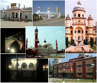
Rampur is a town and the municipality headquarter of Rampur District in the Indian state of Uttar Pradesh. It was formerly known for its various industries, like sugar refining and cotton milling. Its library has more than 12,000 rare manuscripts and a fine collection of Mughal miniature paintings. It is located 322 kilometres north-west of the state capital Lucknow.

<span class="mw-page-title-main">Rohilkhand</span> Region in Uttar Pradesh, India

Rohilkhand is a region in the northwestern part of Uttar Pradesh, India, that is centered on the Bareilly and Moradabad divisions. It is part of the upper Ganges Plain, and is named after the Rohilla tribe of Afghans. The region was called Madhyadesh and Panchala in the Sanskrit epics Mahabharata and Ramayana. During the colonial era in India, the region was governed by the Royal House of Rampur.

<span class="mw-page-title-main">Rohilla</span> Pashtun-descended ethnic group of Uttar Pradesh, India

Rohillas are a mixed Indian community of Pashtun heritage, historically found in Rohilkhand, a region in the state of Uttar Pradesh, India. It forms the largest Pashtun diaspora community in India, and has given its name to the Rohilkhand region. The Rohilla military chiefs settled in this region of northern India in the 1720s, the first of whom was Ali Mohammed Khan.

<span class="mw-page-title-main">Moradabad</span> City in Uttar Pradesh, India

Moradabad is an industrial city, commissionerate, and municipal corporation in Moradabad district of the Indian state of Uttar Pradesh. It is situated on the banks of the Ramganga river, at a distance of 167 km (104 mi) from the national capital, New Delhi and 344 km north-west of the state capital, Lucknow. Based on the 2011 census, it is 10th most populous city in the state and 54th most populous city in the country. It is one of the largest cities in the Western UP region, serving as a crucial hub for employment, education, industry, culture, and administration.

<span class="mw-page-title-main">Bareilly district</span> District of Uttar Pradesh in India

The Bareilly district belongs to the state Uttar Pradesh in northern India. Its capital is Bareilly city and it is divided in six administrative division or tehsils: Aonla, Baheri, Bareilly city, Faridpur, Mirganj, and Nawabganj. The Bareilly district is a part of the Bareilly Division and occupies an area of 4120 km2 with a population of 4,448,359 people according to the census of 2011.

<span class="mw-page-title-main">Bijnor</span> City in Uttar Pradesh, India

Bijnor is a city and a municipal board in Bijnor district in the state of Uttar Pradesh, India.

<span class="mw-page-title-main">Moradabad district</span> District of Uttar Pradesh in India

Moradabad district is one of the districts of Uttar Pradesh, India. The city of Moradabad is the district headquarters. Moradabad district is part of Moradabad division. It used to be the second most populous district of Uttar Pradesh out of 75 after Prayagraj till a new district Sambhal was carved out of it in 2011.

<span class="mw-page-title-main">Amroha district</span> District in Uttar Pradesh, India

Amroha is one of the 75 districts of Uttar Pradesh state in northern India. Amroha town is the district headquarters. According to the Government of India, the district is one of the Minority Concentrated Districts on the basis of the 2001 census data on population, socio-economic indicators and basic amenities indicators.

Nagina is a town and a municipal board in Bijnor district in the Indian state of Uttar Pradesh.

<span class="mw-page-title-main">Najibabad</span> Town in Uttar Pradesh, India

Najibabad is a town in the Bijnor district of the Indian state of Uttar Pradesh, located near the city of Bijnor. It is a major industrial centre and has national transport links via rail and roadways such as NH 119 and NH 74.

<span class="mw-page-title-main">Najib ad-Dawlah</span> Afghan Rohilla Chief and Mughal serviceman

Najib ad-Dawlah, also known as Najib Khan Yousafzai, was a Rohilla Yousafzai Afghan who earlier served as a Mughal serviceman but later deserted the cause of the Mughals and joined Ahmad Shah Abdali in 1757 in his attack on Delhi. He was also a House Chief of Rohilkhand, and in the 1740s founded the city of Najibabad in Bijnor district, India. He was instrumental in winning the Third Battle of Panipat.

Chandpur is a town and a municipal board in Bijnor district in the Indian state of Uttar Pradesh, India.

Dhampur is a city and a municipal board in Bijnor district in the state of Uttar Pradesh, India. It is located at 29.51°N 78.50°E, and lies in Northern India.

Kiratpur, also known as Basi Kiratpur, is a town and a Municipal Board in Bijnor district of Uttar Pradesh.

Noorpur is a City and a Municipal Board in Bijnor District in the Indian State of Uttar Pradesh.

<span class="mw-page-title-main">Auraiya district</span> District of Uttar Pradesh in India

Auraiya district is one of the districts of Uttar Pradesh state of India, and Auraiya town is the district headquarters. It lies on the south-western portion of Uttar Pradesh and also forms a part of the Kanpur Division.

<span class="mw-page-title-main">History of Bareilly</span>

According to the epic Mahābhārata, Bareilly region (Panchala) is said to be the birthplace of Draupadi, who was also referred to as 'Panchali' by Kṛṣṇā. When Yudhishthira becomes the king of Hastinapura at the end of the Mahābhārata, Draupadi becomes his queen. The folklore says that Gautama Buddha had once visited the ancient fortress city of Ahicchattra in Bareilly. The Jain Tirthankara Parshva is said to have attained Kaivalya at Ahichhatra.

Barhapur Assembly constituency is one of the 403 constituencies of the Uttar Pradesh Legislative Assembly, India. It is a part of the Bijnor district and one of the five assembly constituencies in the Moradabad Lok Sabha constituency. First election in this assembly constituency was held in 2012 after the "Delimitation of Parliamentary and Assembly Constituencies Order, 2008" was passed in the year 2008.

Ruchi Vira is an Indian politician and current Member of Parliament of Lok Sabha from Moradabad. She is former member of the 16th Legislative Assembly of Uttar Pradesh of India. She represented the Bijnor constituency of Uttar Pradesh and is a member of the Samajwadi Party.

Kotwali Dehat is a large block and village in the Bijnor district and Tehsil Nagina of the Indian state of Uttar Pradesh.

References

  1. 1 2 "Census of India: Bijnor district". censusindia.gov.in. Retrieved 18 April 2021.
  2. "UP seeks to include 6 districts in NCR". indianexpress.com. 11 January 2015. Retrieved 18 March 2018.
  3. 1 2 Dabas, Harveer (12 December 2016). "sugarcane: Bijnor has 2 of India's top 5 sugar mills". The Times of India. Retrieved 24 November 2021.
  4. 1 2 Nevill, H.R. (1908). Bijnor: A Gazetteer, Being Volume XIV Of The District Gazetteers Of The United Provinces Of Agra And Oudh. Allahabad: Government Press. pp. 124–5. Retrieved 15 April 2021.
  5. 1 2 Wikisource-logo.svg One or more of the preceding sentences incorporates text from a publication now in the public domain :  Chisholm, Hugh, ed. (1911). "Bijnor". Encyclopædia Britannica . Vol. 3 (11th ed.). Cambridge University Press. pp. 928–929.
  6. District Gazetteers of the United Provinces of Agra and Oudh: Volume 14. United Provinces of Agra and Oudh (India). 1908. p. 189.
  7. Decadal Variation In Population Since 1901
  8. 1 2 3 4 5 6 "District in Uttar Pradesh". www.citypopulation.de. 2019. Retrieved 19 June 2019.
  9. US Directorate of Intelligence. "Country Comparison:Population". Archived from the original on 13 June 2007. Retrieved 1 October 2011. Liberia 3,786,764 July 2011 est.
  10. "2010 Resident Population Data". U. S. Census Bureau. Archived from the original on 1 January 2011. Retrieved 30 September 2011. Oklahoma 3,751,351
  11. 1 2 "Table C-01 Population by Religion: Uttar Pradesh". censusindia.gov.in. Registrar General and Census Commissioner of India. 2011.
  12. 1 2 "Table C-16 Population by Mother Tongue: Uttar Pradesh". www.censusindia.gov.in. Registrar General and Census Commissioner of India.
  13. "52nd Report of the Commissioner for Linguistic Minorities in India" (PDF). nclm.nic.in. Ministry of Minority Affairs. Archived from the original (PDF) on 25 May 2017. Retrieved 29 April 2019.
  14. Saxena, Vinay (5 March 2024). "Chandan Singh Chauhan: जीत के पुराने जाट-गुर्जर फॉर्मूले के साथ मैदान में युवा पीढ़ी, कौन हैं ब‍िजनौर से RLD प्रत्‍याशी चंदन चौहान - RLD candidate from bijnor lok sabha seat chandan singh chauhan profile". Jagran (in Hindi). Retrieved 8 July 2024.
  15. Aasid, Aasid (9 April 2022). "बिजनौर के मशहूरउड़द चावल सिर्फ बिजनौरी ही बता सकते हैं कि उड़द चावल का महत्त्व क्या है". Bijnor Express (in Hindi). Retrieved 13 July 2023.

29°25′N78°31′E / 29.417°N 78.517°E / 29.417; 78.517