History
According to local accounts, Bahupura village was named by a British surveyor who stayed in the village. A Bhuiyar bride (as called in Hindi "Bahu" बहु) prepared bent grass greens and rice bread (धान की रोटी) for the surveyor. Impressed by her cooking he gave the name "Bahupura" to the village.
A great social meeting was held in the village of Bahupura on date 28 May 1938 by All India Dhiman Maha Sabha (Branch District Bijnor). The conference was attended by Dhiman community (carpenter) members from across the country . The main objective of the conference was to take part in the Freedom movement of India by society. The convention was held in the mangoes garden (called as "Paudha Bag") near the village, which was located in the west of the village. Nowadays the canal is operating here.
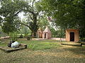
Bahupura is surrounded by natural beauty. There are a Shiv Mandir and an old well (पुराना कुआँ) also.

Kauravi, also known as Khaṛībolī, is a set of Western Hindi dialects of Shauraseni Prakrit mainly spoken in Northwestern Uttar Pradesh.

Bareilly is a city in Bareilly district in the Indian state of Uttar Pradesh. It is among the largest metropolises in Western Uttar Pradesh and is the centre of the Bareilly division as well as the historical region of Rohilkhand. The city lies in the Indo-Gangetic Plains, about 252 kilometres (157 mi) north west of the state capital, Lucknow, and 265 kilometres (165 mi) east of the national capital, New Delhi. With a population of 898,167 in 2011, it is the eighth most populous city in the state, seventeenth in northern India and fifty-fourth in India. It is located on the bank of Ramganga River and is the site of the Ramganga Barrage built for canal irrigation.
Saharanpur is a city and a municipal corporation in Uttar Pradesh, India. It is also the administrative headquarters of Saharanpur district.

Bijnor district is one of the 75 districts in the state of Uttar Pradesh in India. Bijnor city is the district headquarters. The government of Uttar Pradesh seeks it to be included in National Capital Region (NCR) due to its close proximity to NCT of Delhi.

Etah district is one of the districts of Uttar Pradesh, India, since 1854. Etah City is the district headquarters. Etah district is a part of Aligarh Division.
Nagina is a town and a municipal board in Bijnor district in the Indian state of Uttar Pradesh.
Afzalgarh is a city and a municipal board in Bijnor district in the Indian state of Uttar Pradesh. It is located at the border with the state of Uttarakhand.
Kiratpur, also known as Basi Kiratpur, is a city and a Municipal Board in Bijnor district of Uttar Pradesh.
Nehtaur is a city, near Bijnor city in Bijnor district in the northern Indian state of Uttar Pradesh. Nehtaur is an ancient and well known town because of its culture and educational backgrounds. Nehtaur Town was established by the Taga Minister family of Ajmer state when they came from Ranthambhor, Rajasthan after it was captured by Qutubuddin Aibak and the place was called Nai+thour = NEHTAUR. This is how Nehtaur derived its name [Ref. Book-History of Islam in India].
Sahaspur is a town and a nagar panchayat in Bijnor district in the Indian state of Uttar Pradesh.
Ratangarh is a village in the northwestern Rohilkhand region of Uttar Pradesh state of India. It is located in the administrative district of Bijnor.
Nagina Lok Sabha constituency is one of the 80 Lok Sabha (parliamentary) constituencies in Uttar Pradesh state in northern India. This constituency came into existence in 2008, as a part of delimitation of parliamentary constituencies based on the recommendations of the Delimitation Commission of India constituted in 2002.
Harewali is a village located at Bijnor district of Uttar Pradesh.
Pakhanpur is a village in Nagina, Bijnor district, Uttar Pradesh, India. Pincode of Pakhanpur is 246762. Head (Pradhan) of Village Pakhanpur is Amit Chauhan
The Muslim Chhipi are Muslim community found mainly in the states of Bihar, Madhya Pradesh and Uttar Pradesh in India. They are Muslim converts from the Hindu Chhipi caste.
Nagina Assembly constituency is one of the 403 constituencies of the Uttar Pradesh Legislative Assembly, India. It is a part of the Bijnor district and one of the five assembly constituencies in the Nagina Lok Sabha constituency. First election in this assembly constituency was held in 1957 after the delimitation order was passed in 1956. The constituency was assigned identification number 18 after "Delimitation of Parliamentary and Assembly Constituencies Order, 2008" was passed in the year 2008.
Alampur is a small village in Najibabad Tehsil in Bijnor District of Uttar Pradesh State, India. It comes under Kalanpur Buzurg Urf Bahupura Panchayath. It belongs to Moradabad Division. It is located 7 km towards Kiratpur Railway Station and 19 km from the District headquarters, Bijnor.
Madhusudanpur Nand Urf Jhalra is a large village and near Meerut Pauri Highway National Highway 34 (India) Jhalra Gram Panchayat in Bijnor district block Mohammadpur Deomal of Uttar Pradesh in India.

Kotwali Dehat is a large Block and village in the Bijnor district and Tehsil Nagina of Uttar Pradesh in India. It is 7 kilometers from Nagina, 23 kilometers from Najibabad, 25 kilometers from Dhampur, and 8 kilometers from Nehtour, with these 4 roads in this village being historical
This page is based on this
Wikipedia article Text is available under the
CC BY-SA 4.0 license; additional terms may apply.
Images, videos and audio are available under their respective licenses.