
The Brahmaputra, also known as the Yarlung Tsangpo in Tibet, the Siang/Dihang River in Arunachal Pradesh, Luit in Assamese, and Jamuna River in Bangladesh, is a trans-boundary river which flows through Tibet, India, and Bangladesh. It is the 9th largest river in the world by discharge, and the 15th longest.

Son River is a perennial river located in central India. It originates near Amarkantak Hill in Annupur district of Madhya Pradesh and finally merges with the Ganges River near Patna in Bihar. Sone river is the second-largest southern tributary of the Ganges' after Yamuna River. India's oldest river bridge Koilwar Bridge over Sone River connects Arrah with Patna. Sone river is famous for its sand across country.
The Northern Railway (NR) is one of the 18 Railway zones of India and the northernmost zone of the Indian Railways. It is headquartered at the Baroda House in New Delhi.

The East Central Railway is one of the 18 railway zones in India. It is headquartered at Hajipur and comprises Sonpur, Samastipur, Danapur, Pt. Deen Dayal Upadhyaya, and Dhanbad divisions.

Barmouth Bridge, or Barmouth Viaduct is a Grade II* listed single-track wooden railway viaduct across the estuary of the Afon Mawddach near Barmouth, Wales. It is 820 metres (900 yd) long and carries the Cambrian Line. It is the longest timber viaduct in Wales and one of the oldest in regular use in Britain.

Raebarelipronunciation (help·info) is a city in Indian state of Uttar Pradesh. It is the administrative headquarters of Raebareli district and a part of Lucknow Division. The city is situated on the banks of the Sai river, 82 km (51 mi) southeast of Lucknow. It possesses many architectural features and sites, chief of which is a strong and spacious fort. As of 2011, Raebareli has a population of 191,316 people, in 35,197 households.

The Foxton Branch was a railway line in New Zealand. It began life as a tramway, reopened as a railway on 27 April 1876, and operated until 18 July 1959. At Himatangi there was a junction with the Sanson Tramway, a line operated by the Manawatu County Council that was never upgraded to the status of a railway.
The Outram Branch was a branch line railway near Dunedin, Otago, that operated from 1877 to 1953 and formed part of New Zealand's national rail network.

Delhi has significant reliance on its transport infrastructure. The city seeks to develop a highly efficient public transport system with the introduction of the Delhi Metro, which is undergoing a rapid modernization and expansion as of 2006. There are 16.6 million registered vehicles in the city as of 30 June 2014, which is the highest in the world among all cities, most of which do not follow any pollution emission norm, while the Delhi metropolitan region has 11.2 million vehicles. Delhi and NCR lose nearly 42 crore man-hours every month while commuting between home and office through public transport, due to the traffic congestion. Therefore, serious efforts, including a number of transport infrastructure projects, are under way to encourage usage of public transport in the city.

The Godavari Bridge or Kovvur–Rajahmundry Bridge is truss bridge spanning Godavari River in Rajahmundry, India. It is India's third longest road-cum-rail bridge crossing a water body, first one is The Bogibeel Bridge is rail-cum-road bridge over the Brahmaputra river in the Dibrugarh district of Assam state in north-east India, and second is Digha–Sonpur Bridge over Ganges in Bihar.
Martin's Light Railways (MLR) consisted of seven narrow-gauge railway lines in the states of West Bengal, Bihar and Uttar Pradesh in India. The railways were built and owned by Martin & Co., which was a British company. After britisher's it was being operated by Indian government and was permanently shut down in 80's.

The Digha–Sonpur bridge or J. P. Setu is a rail-cum-road bridge across river Ganga, connecting Digha Ghat in Patna and Pahleja Ghat in Sonpur, Saran district in the Indian state of Bihar. It is named after Indian independence activist Jayaprakash Narayan. The rail-cum-road bridge provides easy roadway and railway link between northern and southern parts of Bihar. It is a steel truss bridge. Regular scheduled passenger rail service was inaugurated on this route on 3 February 2016. This bridge of 4,556 metres (14,948 ft) length is the second longest rail-cum-road bridge in India, after Bogibeel Bridge in Assam.

The Howrah–New Jalpaiguri line is a railway line connecting Howrah with New Jalpaiguri in North Bengal in the Indian state of West Bengal. The line continues through North Bengal and western part of Assam to connect with Guwahati. The Naihati–Bandel link allows trains from another terminus Sealdah in Calcutta to use this route. The line uses a major part of the Barharwa–Azimganj–Katwa loop. Many trains use an alternative line between Howrah and New Farakka, via Bardhaman and Rampurhat. Other parts of West Bengal and Bihar are well-connected to this line. It is under the administrative jurisdiction of Eastern Railway and Northeast Frontier Railway.

The Barauni–Gorakhpur, Raxaul and Jainagar lines are a set of three lines connecting Barauni in the Indian state of Bihar with Gorakhpur in Uttar Pradesh. The lines run in an east–west direction between the Ganges and India-Nepal border, covering northern Bihar west of the Kosi river and eastern Uttar Pradesh. The southernmost of the lines connects via Hajipur Junction, Sonpur Junction and Chhapra. The central line connects via Muzaffarpur, Motihari and Sugauli. The northern line connects via Darbhanga, Sitamarhi and Raxaul. The lines have interconnections between them and the northern line has extensions to places near the India–Nepal border.
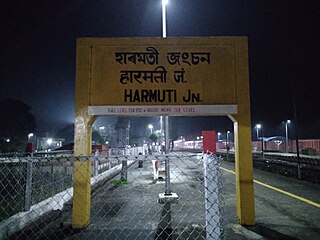
The Rangiya-Murkongselek section is a 450 km (280 mi) long railway line connecting Rangiya in Kamrup district with Murkongselek in Dhemaji district in the Indian state of Assam. The entire section is under the jurisdiction of Northeast Frontier Railway.
The state of Bihar has a number of bridges, extending from few metres to a few kilometres. The history of long bridges goes back to the British Empire when the site for the Koilwar bridge was surveyed in 1851. Since then a number of small and large bridges have crept up. Some are even largest of their kind. Mahatma Gandhi Setu, joining Patna and Hajipur was India's longest river bridge from 1982 to 2017.
The Mau–Ghazipur–Dildarnagar main line connects Mau Junction and Dildarnagar Junction in the Indian state of Uttar Pradesh and comes under the jurisdiction of North Eastern Railway zone & East Central Railway zone.

The Barsoi–New Farakka section is an Indian railway line connecting Barsoi with New Farakka junction on the Howrah–New Jalpaiguri line. This 126-kilometre (78 mi) track is under the jurisdiction of Eastern Railway and Northeast Frontier Railway.

New Koilwar Bridge, at Koilwar in Bhojpur is a 1.52 km long, 6-lane wide road bridge over the Sone river. It connects Arrah with Patna, the capital of Bihar state in India and also carries Buxar-Arrah-Patna national highway (NH-922). New Koilwar Bridge is named after Indian mathematician and Padma Shri awardee Vashishtha Narayan Singh (1946-2019). New Koilwar Bridge is 500 metres north and parallel to the existing 2-lane wide Koilwar Bridge. The construction work of all 6-lanes completed and Bridge is fully opened to public on 14 May 2022.


