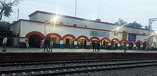
Bareilly is a city in Bareilly district in the Indian state of Uttar Pradesh. It is among the largest metropolises in Western Uttar Pradesh and is the centre of the Bareilly division as well as the historical region of Rohilkhand. The city lies in the Indo-Gangetic Plains, about 252 kilometres (157 mi) northwest of the state capital, Lucknow, and 265 kilometres (165 mi) east of the national capital, New Delhi. With a population of 903,668 in 2011, it is the eighth most populous city in the state, 17th in northern India and 54th in India. It is located on the bank of Ramganga River and is the site of the Ramganga Barrage built for canal irrigation.
Saharanpur is a city and a municipal corporation in Uttar Pradesh, India. It is also the administrative headquarters of Saharanpur district.

Rohillas are a community of Pashtun heritage, historically found in Rohilkhand, a region in the state of Uttar Pradesh, India. It forms the largest Pashtun diaspora community in India, and has given its name to the Rohilkhand region. The Rohilla military chiefs settled in this region of northern India in the 1720s, the first of whom was Ali Mohammed Khan.

Moradabad is an industrial city, commissionerate, and municipal corporation in Moradabad district of the Indian state of Uttar Pradesh. It is situated on the banks of the Ramganga river, at a distance of 192 km (119 mi) from the national capital, New Delhi and 356 km north-west of the state capital, Lucknow. Based on the 2011 census, it is 10th most populous city in the state and 54th most populous city in the country. It is one of the largest cities in the Western UP region, serving as a crucial hub for employment, education, industry, culture, and administration.

Amroha is a city in the state of Uttar Pradesh in India. It is located north-west of Moradabad, near the Ganga River. It is the administrative headquarters of Amroha district.

Bijnor district is one of the 75 districts in the state of Uttar Pradesh in India. Bijnor city is the district headquarters. The government of Nagar Palika Parishad Bijnor Uttar Pradesh seeks its inclusion in National Capital Region (NCR) due to its close proximity to NCT of Delhi.

Mahoba district is a district of the Indian state of Uttar Pradesh. Headquartered in the city of Mahoba, the district had a population of a population of 875,958 as of the 2011 Indian census and occupies 2884 km2 within the Chitrakoot division of Uttar Pradesh. As of 2011 it was the least populous district of Uttar Pradesh. Mahoba District is also known as Alha-Udal Nagari.

Moradabad district is one of the districts of Uttar Pradesh, India. The city of Moradabad is the district headquarters. Moradabad district is part of Moradabad division. It used to be the second most populous district of Uttar Pradesh out of 75 after Prayagraj till a new district Sambhal was carved out of it in 2011.
Baghpat, historically known as Vyaghraprastha, is a city in the Indian state of Uttar Pradesh. It is the administrative headquarters of Bagpat district, which was established in 1997. It is part of the National Capital Region, surrounding New Delhi.
Nagina is a town and a municipal board in Bijnor district in the Indian state of Uttar Pradesh.

Najibabad is a town in the Bijnor district of the Indian state of Uttar Pradesh, located near the city of Bijnor. It is a major industrial centre and has national transport links via rail and roadways such as NH 119 and NH 74.
Bahjoi is a Nagar Palika Parishad city in Sambhal district, Moradabad division, in the Indian state of Uttar Pradesh. Bahjoi is the headquarter of Sambhal district. In the past years of its life it was famous for the glass factory during the british colonisation.
Chandpur is a town and a municipal board in Bijnor district in the Indian state of Uttar Pradesh, India.
Kiratpur, also known as Basi Kiratpur, is a town and a Municipal Board in Bijnor district of Uttar Pradesh.
Noorpur is a City and a Municipal Board in Bijnor District in the Indian State of Uttar Pradesh.
Sarsawa is a town at the border of Haryana and a municipal board in Saharanpur district in the Indian state of Uttar Pradesh.

The Government of Uttar Pradesh is the subnational government of the Indian state of Uttar Pradesh with the governor as its appointed constitutional head of the state by the President of India. The Governor of Uttar Pradesh is appointed for a period of five years and appoints the Chief Minister of Uttar Pradesh and their council of ministers, who are vested with the executive powers of the state. The governor remains a ceremonial head of the state, while the chief minister and their council are responsible for day-to-day government functions.
Bhikanpur Asdalpur is situated on the Moradabad-Bijnor state highway in Moradabad district in Uttar Pradesh in India. It is the headquarters of the block administration and has a distribution unit of 37.5 KW under Uttar Pradesh Viduth Nigam Limited.
Google map of Village Bhikanpur, Moradabad.
Alamgirpur is an archaeological site of the Indus Valley civilization that thrived along the Ganga-Yamuna Doab from the Harappan-Bara period, located in Meerut district, Uttar Pradesh, India. It is the easternmost known site of the civilization.

Western Uttar Pradesh is a region in India that comprises the western districts of Uttar Pradesh state, including the areas of Rohilkhand and those where Hindi, Urdu and Braj are spoken; it is in the region of Western Uttar Pradesh that Hindi-Urdu originated. The region has some demographic, economic and cultural patterns that are distinct from other parts of Uttar Pradesh, and more closely resemble those of Haryana and Rajasthan states. The largest city of the region is Ghaziabad, while the second-largest city, Agra, is a major tourist destination.


