Hailakandi district

Last updated

Hailakandi district
Hailakandi
1939581463big 25 230.jpg
Kendriya Vidyalaya, Panchgram
Hailakandi in Assam (India).svg
Location in Assam
CountryFlag of India.svg  India
State Assam
Division Barak Valley
District created1 October 1989
Government
   Lok Sabha constituencies Karimganj (shared with Karimganj district)
   Vidhan Sabha constituencies Hailakandi, Katlicherra, Algapur
Area
  Total1,327 km2 (512 sq mi)
Elevation
21 m (69 ft)
Population
 (2011) [1]
  Total659,296
  Density497/km2 (1,290/sq mi)
Demonym(s) Hailakandian, Hailakandiya
Time zone UTC+5:30 (IST)
PIN
78815X
Telephone code91 – (0) 3844
ISO 3166 code IN-AS
Vehicle registration AS-24
Official language Bengali
Associate official language Meitei (Manipuri)
Website hailakandi.assam.gov.in

Hailakandi district is one of the 33 districts of Assam state in north-eastern India. It makes up the Barak Valley alongside Cachar and Karimganj. It was constituted as a civil subdivision on 1 June 1869. Subsequently, it was upgraded to a district in 1989, when it was split from Cachar district. [2]

Contents

History

It was constituted as a civil subdivision on 1 June 1869. Subsequently, it was upgraded to a district in 1989. According to some scholars, the name "Hailakandi" has been derived from the Sylheti word "Hailakundi". The later history of Hailakandi is intricately linked to Abdul Matlib Mazumdar (1890–1980), Late Nagendranath Choudhury, Late (Capt.) Manmatha Choudhury, Late (Capt.) Subodh Kumar Dutta and Late Sunil Chakravorty who lead the freedom movement in the erstwhile Sub-division. Nagendranath Choudhury was a prominent Congress-leader; Pandit Jawaharlal Nehru called on him in his house during his visit to Hailakandi in 1939. His brother Manmatha Choudhury was a captain in the Azad Hind Fauj formed by Subhash Chandra Bose. In 1946, when India was still under British rule, Mr. Abdul Matlib Majumder became an MLA and also Cabinet Minister of Assam. [3] He was one of the prominent Muslim leaders of eastern India to support Hindu-Muslim unity, opposing the partition of India on communal lines. Mazumdar along with Fakhruddin Ali Ahmed (who later became the 5th President of India) became the most prominent Muslim opponents of the demand for a separate Muslim state of Pakistan, especially in the eastern part of the country. Mazumdar took Master of Arts Degree in English literature from Dhaka University in 1921 and B.L. from Calcutta in 1924. He started legal practice at Hailakandi Bar in 1925. He rose to prominence as a lawyer serving the people of Hailakandi. The then government offered him the post of a Magistrate, which he refused. [4] He joined the Indian National Congress in 1925. He founded the Hailakandi Congress Committee in 1937 and became its first President. Netaji Subhash Chandra Bose and Pandit Jawaharlal Nehru visited Hailakandi in 1939 and 1945 respectively at the invitation of Mazumdar to strengthen the freedom movement as well as the Congress party in southern Assam. It was Netaji who initiated establishment of contact between Maulana Abul Kalam Azad and Matlib Mazumdar for gearing up nationalist Muslims against a growing Muslim League in the region. [5] Mazumdar became the first Chairman of Hailakandi township in 1939 and in 1945 he became the first Indian Chairman of the Hailakandi Local Board, a post always held by the European tea planters. [6]

The Muslim League proved its might in the Muslim-dominated areas of India in 1937 elections. To counter the rising popularity of Muslim League, he successfully organised the Jamiat Ulema-e-Hind movement in Assam. Jamiat was an ally of the Congress having a mass following among the Indian nationalist Muslims. In the very crucial 1946 General Elections just on the eve of India's independence, he wrested the Muslim majority Hailakandi seat from the hold of Muslim League. That victory virtually sealed the hopes and aspirations of the Muslim League to include southern Assam in Pakistan. It may be mentioned here that in that election, the bulk of the Muslim nominees of the Indian National Congress including Fakhruddin Ali Ahmed (5th President of India in later years) had lost to their Muslim League rivals miserably.

Assam's Surma Valley (now partly in Bangladesh) had Muslim-majority population. On the eve of partition, hectic activities intensified by the Muslim League as well Congress with the former having an edge. A referendum had been proposed for Sylhet District (now in Bangladesh). Mazumdar along with Basanta Kumar Das (then Home Minister of Assam) travelled throughout the valley organising the Congress and addressing meetings educating the masses about the outcome of partition on the basis of religion. On 20 February 1947, Moulvi Mazumdar inaugurated a convention – Assam Nationalist Muslim's Convention at Silchar. There after another big meeting was held at Silchar on 8 June 1947. [7] Both the meetings, which were attended by a large section of Muslims paid dividend. He was also among the few who were instrumental in retaining the Barak Valley region of Assam with India. [6] [8] Mazumdar was the leader of the delegation that pleaded before the Radcliffe Commission that ensured that a part of Sylhet (now in Bangladesh) remains with India despite being Muslim-majority (present Karimganj district). [9]

Moulvi Mazumdar joined as a Cabinet Minister of Assam in 1946 with the portfolios of Local Self-Government, Agriculture and Veterinary. In 1947, India became free from British rule, when Mazumdar again took charge of the same departments in Gopinath Bordoloi's cabinet as the only Muslim minister (Moulana Tayyebulla was inducted in 1948) and also the lone member from the entire Barak valley region. The entire eastern India was swept by violence just after India's partition and independence on 15 August 1947, scores of Hindus fled the newly created East Pakistan (now Bangladesh) for India, and Muslims fled Assam for East Pakistan. A large number of people lost their lives owing to violence, which resurfaced with more ferocity in 1950. Mazumdar, the only Muslim in the cabinet, along with his cabinet and party colleagues took up responsibility for the safety of both Hindus and Muslims in Hailakandi, touring affected areas and arranging camps and rehabilitation for the refugees, organising supplies and security.

He continued as a Cabinet Minister in Bishnuram Medhi's cabinet till 1957. [10] His last election was in 1967 when at the age of 77, Mazumdar reached Assam Assembly victorious. He then became the Minister for Law, Social Welfare and Political Sufferers in Bimala Prasad Chaliha's cabinet. As Law minister, he initiated the separation of executive and judiciary at the district level. During the Bangladesh's war of liberation in 1970–71, he was in charge of relief-&-rehabilitation of the thousands of refugees who fled the then East Pakistan. He resigned from active politics in 1971. Other posts held by him during his long career are the Chairman, Assam Madrassa Board; Chairman, State Haj Committee and the Pro tem Speaker of the Assam Legislative Assembly (in 1967). He was instrumental in setting up the hajj house [haji musafir khana] at Guwahati. As Chairman of Madrassah Board, he initiated modernisation of these theological schools and is also credited for the introduction of English and science in the curriculum of madrassas of Assam. [11] He was the key person to set up centres of higher education at Hailakandi. [12]

Another prominent person from Hailakandi was Late Raj Mohan Nath, a noted Engineer, whose authored many books on different subjects apart from engineering. One of his books was a text-book for the students of civil engineering in the Bengal Engineering College, Shibpur (West Bengal). Today's "Assam-type house" is entirely his concept which gained vast popularity in the earthquake zones. One of the roads in Moscow has been named after him

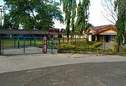
Hailakandi Airfield is a former wartime United States Army Air Forces airfield in India, used during the Burma Campaign 1944-1945. It is now abandoned. Hailakandi is a district of the Indian state of Assam.

Geography

Hailakandi district occupies an area of 1,327 square kilometres (512 sq mi), [13] comparatively equivalent to Qeshm Island of Iran. [14] Out of this, more than 50% is reserve forest. There are total of two reserve forests in Hailakandi district viz. Inner line reserve forest and Katakhal reserve forest. The district has got inter-state border with Mizoram on its south having a length of 76 km besides inter district border on other sides with Karimganj district and Cachar district. As per 2001 census, it has a population of 542978. It comprises two notified towns viz. Hailakandi (district headquarters) and Lala and one industrial town ship viz. Panchgram a Municipal Board governs Hailakandi town & a town Committee governs Lala. It has five development blocks viz. Algapur, Hailakandi, Lala, Katlicherra & South Hailakandi development Block. There is a Mahkuma Parishad named Hailakandi Mahkuma Parishad covering these 5 Development Blocks. There are total of 62 Nos. of Gaon Panchayat under these five blocks. The district is divided into four revenue circles comprising a total of 393 villages (including 27 forest villages). Nearly half the district consists of forests. Out of the remaining half, 33.2% is under cultivation. Rice is the main crop. District has got 17 tea gardens. The District has 4 Police stations, 2 Police out post, 2 Colleges, 43 H/E, H/School, 247 ME/ MV Schools and 937 LP schools.

The forests of Hailakandi district were once rich in wildlife but now vanishing due to human onslaught. rare species found are Hoolock gibbon, Phayre's leaf monkey, Pig-tailed macaque, White-winged Wood Duck, Purple Wood Pigeon, etc., have been recorded. [15] [16] The southern part was also recommended as 'Dhaleswari' wildlife sanctuary. [17] [18]

Economy

In 2006, the Indian government named Hailakandi as one of the country's 250 most backward districts (out of a total of 640). [19] It is one of the eleven districts in Assam currently receiving funds from the Backward Regions Grant Fund Programme (BRGF). [19]

Divisions

There are three Assam Legislative Assembly constituencies in this district: Hailakandi, Katlicherra, and Algapur. [20] The whole district comes under the Karimganj Lok Sabha constituency. [21]

Villages

Demographics

Historical population
YearPop.±% p.a.
1901112,897    
1911131,060+1.50%
1921141,012+0.73%
1931150,992+0.69%
1941166,536+0.98%
1951195,650+1.62%
1961248,927+2.44%
1971307,695+2.14%
1991449,048+1.91%
2001542,872+1.92%
2011659,296+1.96%
source: [22]
Religion in Hailakandi district (2011) [23]
ReligionPercent
Islam
60.31%
Hinduism
38.10%
Christianity
1.29%
Other or not stated
0.30%
Population of circles by religion [23]
CircleMuslimsHindusChristiansOthers
Algapur 67.66%31.72%0.28%0.34%
Hailakandi 71.08%28.28%0.44%0.2%
Katlichara 50%47.01%2.58%0.41%
Lala 55.61%42.61%1.51%0.27%

According to the 2011 census, Hailakandi district has a population of 659,296, [1] roughly equal to the nation of Montenegro [24] or the US state of North Dakota. [25] Population in the age group of 0–6 years was 111,278. The district has a population density of 497 inhabitants per square kilometre (1,290/sq mi). Hailakandi has a sex ratio of 946 females for every 1000 males. 7.30% of the population lives in urban areas. The Scheduled Castes and Scheduled Tribes had a population of 70,659 (10.72%) and 691 (0.10%) respectively. There were 407,366 literates as of 2011, giving it a Crude literacy rate of 61.8% and an Effective literacy (7+ population) of 74.3%. There were 143350 households as of 2011. [1]

Languages in Hailakandi district (2011) [26]

   Bengali (84.64%)
   Hindi (7.74%)
   Kokborok (2.11%)
   Manipuri (1.92%)
   Bhojpuri (1.65%)
  Others (1.94%)

Bengali and Meitei (Manipuri) are the official languages of this place. [27] [28]

Bengalis formed the majority of the district population, but the district is also home to a large number of different communities. There are Dimasa Kachari, Reang Kachari, Meitei, Bishnupriya, Kuki, Chakma and immigrant populations from erstwhile East Pakistan. [29] As per the 2011 census, the majority of the population speaks Bengali (84.64%), followed by Hindi (7.74%), Tiprasa Kachari (2.11%), Manipuri (1.92%), Dimasa Kachari (1.81%) and Bhojpuri (1.65%). [26]

Notable people

Magazines which are published from the district

Related Research Articles

<span class="mw-page-title-main">Assam</span> State in northeastern India

Assam is a state in northeastern India, south of the eastern Himalayas along the Brahmaputra and Barak River valleys. Assam covers an area of 78,438 km2 (30,285 sq mi). It is the second largest state in northeastern India by area and the largest in terms of population. The state is bordered by Bhutan and Arunachal Pradesh to the north; Nagaland and Manipur to the east; Meghalaya, Tripura, Mizoram and Bangladesh to the south; and West Bengal to the west via the Siliguri Corridor, a 22-kilometre-wide (14 mi) strip of land that connects the state to the rest of India. Assamese and Boro are the official languages of Assam. Meitei (Manipuri) is the official language of Hojai district and the entirety of the Barak Valley districts, while Bengali is an official language in the three districts of Barak Valley.

<span class="mw-page-title-main">Cachar district</span> District of Assam in India

Cachardistrict is an administrative district in the state of Assam in India. After independence, the pre-existing undivided Cachar district was split into four districts: Dima Hasao, Hailakandi, Karimganj, and the current Cachar district. Silchar is Cachar district's center of government.

<span class="mw-page-title-main">Karimganj district</span> District of Assam in India

Karimganj district is one of the 31 districts of the Indian state of Assam. Karimganj town is both the administrative headquarters district and the biggest town of this district. It is located in southern Assam and borders Tripura and the Sylhet Division of Bangladesh. It makes up the Barak Valley alongside Hailakandi and Cachar. Karimganj was previously part of the Sylhet District before the Partition of India. It became a district in 1983.

<span class="mw-page-title-main">Silchar</span> City in Assam, India

Silchar is a city and the headquarters of the Cachar district of the state of Assam, India. It is second largest city of Assam after Guwahati in terms of area, population and GDP. It is also administrative capital of Barak Valley division. It is located 343 kilometres south east of Guwahati. It was founded by Captain Thomas Fisher in 1832 when he shifted the headquarters of Cachar to Janiganj in Silchar. It earned the moniker "Island of Peace" from Indira Gandhi, the then Prime Minister of India. Silchar is the site of the world's first polo club and the first competitive polo match. In 1985, an Air India flight from Kolkata to Silchar became the world's first all-women crew flight. Silchar was a tea town and Cachar club was the meeting point for tea planters.

<span class="mw-page-title-main">Barak Valley</span> Region in the Indian state of Assam

The Barak Valley is the southernmost region and administrative division of the Indian state of Assam. It is named after the Barak river. The Barak valley consists of three administrative districts of Assam namely - Cachar, Karimganj, and Hailakandi. The main and largest city is Silchar, which seats the headquarter of Cachar district and also serves as administrative divisional office of Barak valley division. The valley is bordered by Mizoram and Tripura to the south, Bangladesh and Meghalaya to the west and Manipur to the east respectively. Once North Cachar Hills was a part of Cachar district which became a subdivision in 1951 and eventually a separate district. On 1 July 1983, Karimganj district was curved out from the eponymous subdivision of Cachar district. In 1989 the subdivision of Hailakandi was upgraded into Hailakandi district.

<span class="mw-page-title-main">Assam University</span> Indian university in Silchar, Assam

Assam University is a central public university located at Silchar, Assam, India. It was founded in the year 1994 by the provisions of an act enacted by the Parliament of India. Air Chief Marshal Arup Raha is the Chancellor, the Governor of Assam is the Chief Rector and the President of India is acting as the Visitor of the university. The university has sixteen schools which offer Humanities, Languages, Environmental Sciences, Information Sciences, Life Sciences, Physical Sciences, Social Sciences, Law, Technology and Management Studies. There are 42 departments under these sixteen schools. The five districts under the jurisdiction of Assam University have 73 undergraduate colleges as of 31 March 2020. Assam University is an institutional signatory to the Global Universities Network for Innovation (GUNI), Barcelona and United Nations Global Compact (UNGC) for its commitment to educational social responsibilities.

Abdul Matlib Mazumder (1890–1980) was an Indian freedom fighter and political leader based in undivided Assam State. In 1946, when India was still under British rule, he became an MLA and also Cabinet Minister of Assam. He was one of the prominent Muslim leaders of eastern India to support Hindu-Muslim unity, opposing the partition of India on communal lines. Mazumder along with Fakhruddin Ali Ahmed became the most prominent Muslim opponents of the demand for a separate Muslim state of Pakistan, especially in the eastern part of the country.

<span class="mw-page-title-main">Bengali Language Movement (Barak Valley)</span> Protest against Assamese as the sole official language

The Bengali Language Movement of Barak Valley was a protest against the decision of the Government of Assam to make Assamese the only sole official language of the state, even though most Barak Valley residents speak Bengali. About 80% of the Valley's residents are ethnic Bengalis. In the Barak Valley region, the ethnic Bengali population consists of both Hindus and Muslims, who are almost equal in population and constitute the overwhelming majority of the population. There is also a substantial minority of native tribals and immigrants from other parts of India. The main incident took place on 19 May 1961 at Silchar railway station in which 11 ethnic Bengalis were killed by the Assam police.

<span class="mw-page-title-main">Moinul Hoque Choudhury</span> Indian politician (1923-1976)

Moinul Hoque Choudhury was an Indian politician from Assam. A five-time MLA; he was the Minister of Commerce and Industrial Development during Indira Gandhi regime in 1971. He is also known as the Industrial Reformer of the Barak Valley.

<span class="mw-page-title-main">Undivided Cachar district</span>

The Undivided Cachar district is a former administrative district of Assam Province that is largely congruous to the Kachari kingdom of Govinda Chandra, the last king of the kingdom before its division and annexation by the British Raj. It has been divided into the present-day districts of Cachar, Dima Hasao and Hailakandi. Dima Hasao is an autonomous hill district of present-day Assam. The Cachar and Hailakhandi districts are a part of the Barak Valley region in Assam.Karimganj is a part of Sylhet, which was allocated to East Pakistan during the Partition of India.

<span class="mw-page-title-main">Islam in Assam</span> Islam in the Indian state of Assam

Islam is the second largest and fastest-growing religion in Assam. The Muslim population was approximately 10.68 million, constituting over 34.22% of the total population of the state as of the 2011 census, giving Assam, the second-largest Muslim percentage in the country after Jammu and Kashmir (state). After Jammu and Kashmir became Union Territory, Assam became the state with largest Muslim percentage in the country. Islam reached the region in the 13th century and Muslims are a majority in almost eleven districts of Assam and highly concentrated in four districts. In 2021, estimations have predicted that the Muslim population in the state has reached 40%, numbering 14 million, out of total population of 35 million.

Assam – 16th largest, 15th most populous and 26th most literate state of the 28 states of the democratic Republic of India. Assam is at 14th position in life expectancy and 8th in female-to-male sex ratio. Assam is the 21st most media exposed states in India. The Economy of Assam is largely agriculture based with 69% of the population engaged in it. Growth rate of Assam's income has not kept pace with that of India's during the Post-British Era; differences increased rapidly since the 1970s. While the Indian economy grew at 6 percent per annum over the period of 1981 to 2000, the same of Assam's grew only by 3.3 percent.

<span class="mw-page-title-main">Sonai</span> Municipality in Assam, India

Sonai is a town in the Cachar district in the Indian state of Assam. It is also the name of a circle and block in the town. Government of Assam declared it as a municipal area on 2016 with 11 wards. The River Sonai flows through the town of Sonai joining with Barak River near Dungripar Village of Sonai. The Chandragiri Park and an Archeological site, a temple of Kachari Kingdom at Shivtilla (Changutilla) near Madhab Chandra Das College is a famous place to visit.

<span class="mw-page-title-main">Badarpur, Assam Assembly constituency</span> Constituency of the Assam legislative assembly in India

Badarpur Assembly constituency is one of the 126 constituencies of the Legislative Assembly of Assam state in northeastern India.

<span class="mw-page-title-main">Hailakandi Assembly constituency</span> Constituency of the Assam legislative assembly in India

Hailakandi Assembly constituency is one of the 126 constituencies of the Legislative Assembly of Assam state in northeastern India.

<span class="mw-page-title-main">1947 Sylhet referendum</span> Referendum in British India

The 1947 Sylhet referendum was held in the Sylhet District of the Assam Province of British India to decide whether the district would remain in Undivided Assam and therefore within the post-independence Dominion of India, or leave Assam for East Bengal and consequently join the newly-created Dominion of Pakistan. The referendum's turnout was in favour of joining the Pakistani union; however, the district's Karimganj subdivision remained within the Indian state of Assam.

<span class="mw-page-title-main">Bengali Hindus in Assam</span> Bengali Hindu community in Assam.

Bengali Hindus are the second-largest Hindu community just after Assamese Hindus in Assam. As per as estimation research, around 6–7.5 million Bengali Hindus live in Assam as of 2011, majority of whom live in Barak Valley and a significant population also resides in Assam's mainland Brahmaputra/Assam valley. Most Bengalis in Assamese-dominated Brahmaputra valley are immigrants from neighbouring East Bengal and Tripura, while Bengalis in Barak Valley region of Assam are mostly native. Assam host the second-largest Bengali Hindu population in India after West Bengal.

Moulvi Abdul Munim Choudhury was an Indian Bengali politician and Islamic scholar. He was the former two-time member of the Assam Legislative Assembly for the Karimganj South constituency.

<span class="mw-page-title-main">Barak state movement</span> Movement for proposed separate Barak state in India

The Barak state movement includes political activities organised by various individuals, organizations and political parties, for creation of a separate state of Barak, within the republic of India, with Silchar as the capital. The proposed state corresponds to the 5 southern districts of the state of Assam namely: Cachar, Hailakandi, Karimganj, Dima Hasao, Hojai's and Jiribam of Manipur respectively. The total area and population of proposed state is 13,379 km2 and 4.5 million as per 2011 Census. The area is covered by thick tropical forests and is surplus in natural resources like tea, oil, natural gas and jute. There are around 125 tea gardens across the Valley. The Minister of Petroleum and Natural Gas of India Mr. Hardeep Singh Puri on a visit have stated that the region is rich in natural gas and have further said that, "If those huge reserve is properly used, then it will definitely boost local industry & employment.

References

  1. 1 2 3 "District Census Handbook: Hailakandi" (PDF). censusindia.gov.in. Registrar General and Census Commissioner of India. 2011.
  2. Law, Gwillim (25 September 2011). "Districts of India". Statoids. Retrieved 11 October 2011.
  3. "Assam Legislative Assembly - MLA 1946-1952". www.assamassembly.gov.in. Retrieved 31 December 2019.
  4. Abdul Matlib Mazumdar- a centenary tribute Archived 11 August 2011 at the Wayback Machine Choudhury, A. (1990). The Assam Tribune, 1 June, Guwahati, India.
  5. Bhattacharyya, N. (1998). Hailakandite Netaji. Hailakandi – smaranika (in Bengali). (Souvenir of the 50th year of independence). District Administration, Hailakandi, India.
  6. 1 2 Barua, D. C. (1990). Moulvi Matlib Mazumdar- as I knew him. Abdul Matlib Mazumdar – birth centenary tributes, pp. 8–9.
  7. Bhattacharjee, J. B. (1977). Cachar under British Rule in North East India. Radiant Publishers, New Delhi.
  8. Purkayashta, M. (1990). Tyagi jananeta Abdul Matlib Mazumdar. The Prantiya Samachar (in Bengali). Silchar, India.
  9. Roy, S. K. (1990). Jananeta Abdul Matlib Mazumdar (in Bengali). Abdul Matlib Mazumdar – birth centenary tributes, pp. 24–27.
  10. http://www.eci.nic.in/eci_main/statistical reports/SE.../StatRep_51_ASSAM.pdf[ permanent dead link ]
  11. Mazumdar, A. M. (1990). Abdul Matlib Mazumdar- remembrance by a son : down the momory lane. Abdul Matlib Mazumdar – birth centenary tributes, pp. 10–12.
  12. "1". 5 March 2006. Archived from the original on 5 March 2006. Retrieved 31 December 2019.
  13. Srivastava, Dayawanti, ed. (2010). "States and Union Territories: Assam: Government". India 2010: A Reference Annual (54th ed.). New Delhi, India: Additional Director General, Publications Division, Ministry of Information and Broadcasting (India), Government of India. p. 1116. ISBN   978-81-230-1617-7.
  14. "Island Directory Tables: Islands by Land Area". United Nations Environment Program. 18 February 1998. Retrieved 11 October 2011. Qeshm 1,336
  15. Choudhury, A.U. (1986). Discovery of Pharye's leaf monkey in Assam. The Sentinel 31 August.
  16. Choudhury, A.U. (1987). Notes on the distribution and conservation of Phayre's leaf monkey and hoolock gibbon in India. Tigerpaper 14(2): 2–6.
  17. Choudhury, A.U. (1983). Plea for a new wildlife refuge in eastern India. Tigerpaper 10(4):12–15.
  18. Choudhury, A.U. (1983). Plea for a new wildlife sanctuary in Assam. WWF – India Newsletter 4(4):15.
  19. 1 2 Ministry of Panchayati Raj (8 September 2009). "A Note on the Backward Regions Grant Fund Programme" (PDF). National Institute of Rural Development. Archived from the original (PDF) on 5 April 2012. Retrieved 27 September 2011.
  20. "List of Assembly Constituencies showing their Revenue & Election District wise break – up" (PDF). Chief Electoral Officer, Assam website. Archived from the original (PDF) on 22 March 2012. Retrieved 26 September 2011.
  21. "List of Assembly Constituencies showing their Parliamentary Constituencies wise break – up" (PDF). Chief Electoral Officer, Assam website. Archived from the original (PDF) on 22 March 2012. Retrieved 26 September 2011.
  22. "Census of India Website : Office of the Registrar General & Census Commissioner, India". www.censusindia.gov.in. Retrieved 31 December 2019.
  23. 1 2 "Table C-01 Population By Religion: Assam". census.gov.in. Registrar General and Census Commissioner of India. 2011.
  24. US Directorate of Intelligence. "Country Comparison:Population". Archived from the original on 27 September 2011. Retrieved 1 October 2011. Montenegro 661,807 July 2011 est.
  25. "2010 Resident Population Data". U. S. Census Bureau. Archived from the original on 23 August 2011. Retrieved 30 September 2011. North Dakota 672,591
  26. 1 2 "Table C-16 Population By Mother Tongue: Assam". censusindia.gov.in. Registrar General and Census Commissioner of India. 2011.
  27. "Govt withdraws Assamese as official language from Barak valley". Business Standard India. Press Trust of India. 9 September 2014. Retrieved 1 August 2019.
  28. Purkayastha, Biswa Kalyan (24 February 2024). "Assam recognises Manipuri as associate official language in four districts". Hindustan Times. Retrieved 26 February 2024.
  29. Ahmed, Sahabuddin. "Political Phenomena in Barak-Surma Valley during Medieval Period" (PDF). thecho.in. Retrieved 6 January 2021.

24°41′00″N92°34′00″E / 24.6833°N 92.5667°E / 24.6833; 92.5667