The word "Chirang" has derived from Garo word – "chi" means water and "rang" means "rain".[2] It may also be a copy of Tsirang District of neighbouring Bhutan. On the other hand, most of the people regarded the word Chirang is derived from the Bodo word Chirang or Sirang. Si means life and Rang means Money.
Chirang district falls under the Eastern Duars which includes the region between the Sankosh River and the Manas River. Guma, Bijni and Chirang Dooars are three important Dooars in Chirang district.[3]
Under the Kingdom of Bhutan
Southern Boundary of Bhutan contained the present Chirang district before the 1865 Duar War
The Druk Desi (Dzongkha: འབྲུག་སྡེ་སྲིད་) of Bhutan appointed ParoPenlop to look after the Duars, who in turn appointed local people as Subah or Laskar, below this was an officer called Kamta who was appointed directly by the Deb Raja of Bhutan.[5]
Present
It is a relatively new district in the Bodoland Territorial Region of Assam. Chirang district has been carved out from Bongaigaon district in 2004.[6] Sirang was an area which is covered by valuable soil, plants, trees, flora and fauna or the things which are necessary for human life. Thus, it is a place which is important for human life or the place which is just like money or valuable for life and is later come to know Si + Rang = Sirang. After some time, the word articulated to Chirang from Sirang. And thus, the word Sirang is latter known as Chirang.[citation needed]
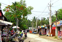
Geography
Chirang is located in the lower part of Assam.It is located between longitudes 26.58°N (North) 90.61°E(East). The Chirang region has a plain geology. It additionally has undulating regions and the northern pieces of the area lie on the lower regions of Bhutan that has somewhat higher height, which is diminishing towards the southern pieces of the locale. The four sorts of soil found here are Entisols, Inceptisols, Alfisols and Ultisols. The region goes under Lower Brahmaputra Valley Agro-Climatic Zone. The environment is sub-tropical in nature with warm and sticky summer followed by dry and cool winter. The pre and post-storm months are eccentric and experience whimsical precipitation. Champabati River, Aie River and Manas River move through the area and join the Brahmaputra Waterway. Numerous different feeders, little creeks and streams course through locale.[citation needed]
In 1990 Chirang district became home to Manas National Park, which has an area of 500km2 (193.1sqmi).[7] It shares the park with four other districts.
Climate
Chirang has a moderate climate. There is a lot of rainfall in the summer, and in the winter it is quite dry again. The average annual temperature for Chirang is 33° (degrees)and there is about 248 mm of rain in a year. It is dry for 282 days a year with an average humidity of 42% and an UV-index.[8]
According to the 2011 census Chirang district has a population of 482,162,[10] roughly equal to the nation of Suriname.[11] This gives it a ranking of 547th in India (out of a total of 640).[10] The district has a population density of 244 inhabitants per square kilometre (630/sqmi) .[10] Its population growth rate over the decade 2001-2011 was 11.26%.[10] Chirang has a sex ratio of 969 females for every 1000 males,[10] and a literacy rate of 64.71%. 7.33% of the population lives in urban areas. Scheduled Castes and Scheduled Tribes make up 7.29% and 37.06% of the population respectively.[10]
Hindus are the largest with 66.50%,good amount of Bodos do follow Bathouism but there is no official data predicting their numbers, they are counted under Hindus. Muslims are second with 22.66%.[12]
Gelephu, India-Bhutan International border Gelephu, India-Bhutan crossing Gelephu is 41 km from Kajalgaon, the headquarter of Chirang, 7 km from Bongaigaon, 340 km from Siliguri.[14]
↑"While Bhutan generally enjoyed absolute possession of the eleven Bengal duars, its control over the seven Assam duars was not straightforward. Even during the Ahom rule, the Bhutanese did not gain full possession of the duar tracts. As a result, they are said to have harassed the population along the Assam frontiers with persistent incursions and raids."(Phuntsho 2013:394)
This page is based on this Wikipedia article Text is available under the CC BY-SA 4.0 license; additional terms may apply. Images, videos and audio are available under their respective licenses.