Bongaigaon district (Prpn:ˈbɒŋgaɪˌgãʊ) is an administrative district in the state of Assam in northeastern India. The district headquarters are located at Bongaigaon. The district occupies an area of 1,093 km2.

Kokrajhar district is an administrative district in Bodoland Territorial Region of Assam. It is predominantly inhabited by the Boro tribe. The district has its headquarters located at Kokrajhar Town and occupies an area of 3,169.22 km2 (1,223.64 sq mi). It has two civil sub-divisions namely Parbatjhora and Gossaigaon and five revenue circles namely Kokrajhar, Dotma, Bhaoraguri, Gossaigaon and Bagribarilll

Vairengte is a town located in the Kolasib district of the Indian state of Mizoram. It is situated in the northeastern part of the state, at the border with the state of Assam. Vairengte is known for being the location of the Counter Insurgency and Jungle Warfare School (CIJWS), which is operated by the Indian Army. Due to its strategic location at the Assam-Mizoram border and its association with the CIJWS, Vairengte holds a unique position in the state of Mizoram.

Barpeta is a major city in Barpeta district of the state of Assam in India and is district headquarters. The city is located 90 kilometres (56 mi) north west of Guwahati and is one of the major cities in Western Assam. It is also called Satra Nagari of Assam due to the presence of various Vaishnavite Satras in the vicinity.
Chirang District is an administrative district in the Bodoland Territorial Region of Assam state in the North-East of India.
Barpeta Road or Athiyabari as known earlier is a town and Commercial City of Assam a municipal board in Barpeta district in the state of Assam, India.
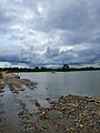
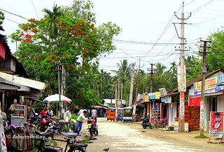
Gossaigaon is one of the fastest-developing towns and the hometown of the state's youngest Raimona National Park in the Bodoland region of Assam, India. This is a sub-divisional headquarter of Kokrajhar district. It shares its boundaries with the neighboring state of West Bengal in the west and Dhubri district to the south. It is one of the BTR's proposed districts. Gossaigaon is well connected by ground transportation and rails. The town serves as a direct route by road to the state's youngest Rupsi Airport located in the southernmost part of the town. Madati and Sankosh are some of the prominent rivers that flow through the heart of the town, and forested areas include such saleable trees as Shorea robusta (sal), Tectona grandis (teak). This place practices organic farming as well as modern agriculture, following recent scientific developments.

Baksa district is an administrative district in the Bodoland Territorial Region of Assam, one of the North-Eastern states of India. The administrative headquarters is at Mushalpur. Manas National Park is a part of this district.
Dumuria is a village and a Gaon Panchayat in Barpeta district in the Indian state of Assam.

Lower Assam division is one of the 5 administrative divisions of Assam in India. It was formed in 1874, consisting of the undivided Kamrup district of Western Assam, undivided Darrang and Nagaon districts of Central Assam and Khasi & Jaintia hills of Meghalaya, created for revenue purposes. The division is under the jurisdiction of a Commissioner, who is stationed at Guwahati. The division currently covers the Western Brahmaputa Valley. Shri Jayant Narlikar, IAS is the current Commissioner of Lower Assam division.
Puduvoyal is a village panchayat located in the Thiruvallur district of Indian state of Tamil Nadu.
Awang Kasom is a village located north of Ukhrul in Ukhrul district, Manipur state, India. The village falls under Chingai sub division. National Highway 150 that connect Imphal-Kohima via Ukhrul and Jessami passes through the village. Awang Kasom is about 50 kilometers from Ukhrul; and is flanked by kuirei in the south, Peh in the west, Chingai in the north and poi in the east. Locally, the inhabitants speak Awang Kasom dialect that belongs to the Tibeto-Burman language family.
Kukurghati, also known as Kukur Ghati, is a village of the Bhatpar Rani Vidhan Sabha Constituency in Deoria district in the state of Uttar Pradesh, India.
Gakhirkhowa Para is a village located in the west side of the Mangaldai town under Danhee Mouza of Darrang district state Assam. Its residents practice both Hinduism and Islam. The historical Darrangi Koch Raja's Raj Howly is situated in this village. The road distance from Mangaldai to Gakhirkhowapara is nearly 3 km (1.9 mi). The village connects with the city of Mangaldai through Mangaldai Patharughat Khairabari Road. The village operates under the post office of Janaramchowka( জনাৰামচৌকা ), and its PIN No is 784529. Gakhirkhowa Para has a population of 1639, 805 of which are male and 834 are female as per Population Census 2011.
Gelapukhuri is a famous place in Biswanath Chariali, India. It is a medium-sized village located 10 km from Biswanath Chariali City of Biswanath district, Assam with a total of 183 families residing. The Gelapukhuri village has a population of 872 of which 458 are males while 414 are females, as per Population Census 2011. In Gelapukhuri, the majority of people are Indian Gorkhas along with Assamese, Bodo, Adibasi etc.
Chaita is a village and a gram panchayat in Basirhat II CD Block in Basirhat subdivision of North 24 Parganas district, West Bengal, India
Muwamari is a medium size village located in Dhing of Nagaon district, Assam, India with total 156 families residing. The Muwamari village has population of 826 of which 428 are males while 398 are females as per Population Census 2011.
Barapujia or most appropriately, Niz Barapujia is a large village located in Raha of Nagaon district, Assam, India. It had a total of 1245 families residing there as of the 2011 census. It is approximately 5 km from Raha, 25 km from Nagaon and 18.6 km from Morigaon. According to Census 2011 information the location code or village code of Niz Barapujia village is 284826.
Bengtol is a town in Chirang District in the Indian state of Assam. It is governed by Bengtol Gram Panchayat. The nearest city is Bongaigaon, about 25 kilometers away.

Rongpur is a village in Katlicherra subdivision of Hailakandi district, Assam India. It is located 25 km south of Hailakandi town and 3 km from Katlicherra..The village falls in Hailakandi district with a population 2068. The male and female populations are 1093 and 975 as of census 2011. The size of the area is about 3.17 square kilometre.