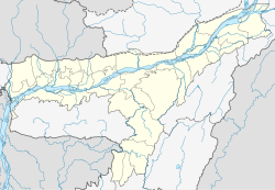
Bengtol

Last updated

Bengtol
Nickname: 
BengtolBazar
India Assam location map.svg
Red pog.svg
Bengtol
Location in Assam, India
India location map.svg
Red pog.svg
Bengtol
Bengtol (India)
Coordinates: 26°38′17″N90°28′34″E / 26.63806°N 90.47611°E / 26.63806; 90.47611
CountryFlag of India.svg India
State Assam
Languages
  Official Boro/Assamese
Time zone UTC+5:30 (IST)
Postal code
783394
ISO 3166 code IN-AS-26

Bengtol is a town in Chirang District in the Indian state of Assam. It is governed by Bengtol Gram Panchayat. The nearest city is Bongaigaon, about 25 kilometers away. [1]

Contents

Demographics

Bengtol Town or Bengtol Bazaar Town had a 2011 population of 543 of which 276 are males while 267 are females. Children age 0-6 number 77 or 14.18% of the total. Average Sex Ratio is 967, higher than other town average of 958. Child Sex Ratio 711, lower than Assam average of 962 [2] Bengtol has a lower literacy rate compared to other towns. In 2011, the literacy rate was 69.31% compared to 72.19% of Assam. Male literacy stood at 77.92% while female literacy rate was 60.85%. Boro and Assamese are the main languages. Bengali, Nepali and Hindi are also common.

Education

Geography

Patabari, Kajalgaon, and Bongaigaon are nearby towns. Aie River flows near the town. [3]

References

  1. "Bengtol-I Chirang, Assam, India" . Retrieved 21 May 2023.
  2. "Bengtol-I Population - Chirang, Assam" . Retrieved 21 May 2023.
  3. "Officials assess eroded embankment in Chirang district - Sentinelassam". www.sentinelassam.com. 10 June 2021. Retrieved 29 September 2023.