
Prayagraj division, formerly known as Allahabad division, is one of the 18 administrative geographical units of the northern Indian state of Uttar Pradesh, with the city of Prayagraj being the administrative divisional headquarters.

Azamgarh division is one of the 18 administrative geographical units of the northern Indian state of Uttar Pradesh. It was formed on 15 November 1994 after being separated from Gorakhpur division and Varanasi division, with Azamgarh city being the divisional headquarters. Azamgarh division consists of 3 districts:-

Bareilly division is one of the 18 administrative geographical unit of the northern Indian state of Uttar Pradesh. Bareilly city is the administrative headquarters of the division. Part of the Rohilkhand region, Bareilly division consists of four major districts in western Uttar Pradesh - Bareilly, Badaun, Pilibhit and Shahjahanpur.

Chitrakoot division is one of the 18 administrative geographical units of the northern Indian state of Uttar Pradesh. Chitrakoot Dham is the administrative headquarters of this division. Historically part of the Bundelkhand region, it includes the 4 districts of:-

Bahraich district is one of the districts of Uttar Pradesh state of India, and Bahraich town is the district headquarters. Bahraich District is a part of Devipatan Division.

Shravasti district is one of the districts of the Uttar Pradesh state of India, with Bhinga town as its district headquarters. Shravasti district is a part of Devipatan Division. According to Government of India, it is among the 121 minority concentrated districts in India. It is the fourth most backward district in India, according to the 2018 Niti Aayog ranking. This district is the most poverty stricken district in the country.
Gonda district is one of the districts of Uttar Pradesh, India. The city of Gonda is the district headquarters, and also the administrative centre for the Devipatan Division. The total area of Gonda district is 4,003 km2 (1,546 sq mi).
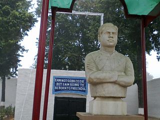
Balrampur district is one of the district of the Indian state of Uttar Pradesh and is a part of Devipatan division as well as the historic Awadh regions. It has been cut from the adjacent district Gonda in 1997. Located on the banks of the West Rapti River. Balrampur is known for the temple of Pateshwari Devi, a Shakti Pitha, and for the ruins of the nearby ancient city of Sravasti, now a pilgrimage site for Buddhists and Jains. The nearest airport is Shravasti airport 23.3 kilometres (14.5 mi) from the town but it is not an international and regular airport; the nearest international and regular airport is Chaudhary Charan Singh International Airport in Lucknow, 235 kilometres (146 mi) away. Lucknow is the capital city of Uttar Pradesh and is 220 kilometres (140 mi) from Balrampur district headquarters.

Aligarh division is one of the 18 administrative geographical units of the northern Indian state of Uttar Pradesh. Aligarh city is the divisional headquarters.
Kaiserganj Lok Sabha constituency is one of the 80 Lok Sabha (parliamentary) constituencies in Uttar Pradesh state in northern India.
Gonda Junction railway station is a railway station in Devipatan division, Gonda district, Uttar Pradesh. Its code is GD. It serves Gonda city. The station consists of five platforms.
Bhinga is a constituency of the Uttar Pradesh Legislative Assembly covering the city of Bhinga in the Shravasti district of Uttar Pradesh, India.
Utraula is a constituency of the Uttar Pradesh Legislative Assembly covering the city of Utraula in the Balrampur district of Uttar Pradesh, India.
Mehnaun is a constituency of the Uttar Pradesh Legislative Assembly covering the city of Mehnaun in the Gonda district of Uttar Pradesh, India.
Gonda is a constituency of the Uttar Pradesh Legislative Assembly covering the city of Gonda in the Gonda district of Uttar Pradesh, India.
Mankapur is a constituency of the Uttar Pradesh Legislative Assembly covering the city of Mankapur in the Gonda district of Uttar Pradesh, India.
Gaura is a constituency of the Uttar Pradesh Legislative Assembly covering the city of Gaura in the Gonda district of Uttar Pradesh, India.
Katra Bazar is a constituency of the Uttar Pradesh Legislative Assembly covering the city of Katra Bazar in the Gonda district of Uttar Pradesh, India.
Colonelganj is a constituency of the Uttar Pradesh Legislative Assembly covering the town of Colonelganj in the Gonda district of Uttar Pradesh, India.
Tarabganj is a constituency of the Uttar Pradesh Legislative Assembly covering the city of Tarabganj in the Gonda district of Uttar Pradesh, India. It is one of five assembly constituencies in the Kaiserganj Lok Sabha constituency. Since 2008, this assembly constituency is numbered 299 amongst 403 constituencies.
