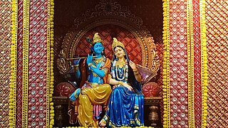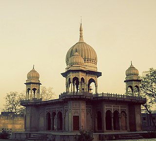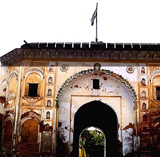
Braj, also known as Vraj, Vraja, Brij or Brijbhumi, is a region in India on both sides of the Yamuna river with its centre at Mathura-Vrindavan in Uttar Pradesh state encompassing the area which also includes Palwal, Ballabhgarh and Nuh in Haryana state, Deeg, Bharatpur, Karauli, and Dholpur in Rajasthan state and Morena District in Madhya Pradesh. Within Uttar Pradesh, it is very well demarcated culturally, the area stretches from the Mathura, Aligarh, Agra, Hathras and districts up to the Farrukhabad, Mainpuri and Etah districts. Braj region is associated with Radha and Krishna who according to scriptures were born in Barsana and Mathura respectively. It is the main centre of Krishna circuit of Hindu pilgrimage.

Hathras is a historical city in Uttar Pradesh, India. It is also the headquarters of Hathras district, formed on 3 May 1997 by merging parts of Aligarh, Mathura and Agra. It is a part of the Aligarh Division.

Firozabad is a city near Agra in Firozabad district in the state of Uttar Pradesh in India. It is the centre of India's glassmaking industry and is known for the quality of the bangles and also glasswares produced there.

The Braj language, Braj Bhasha, also known as Vraj Bhasha or Brij Bhasha or Braj Boli, is a Western Hindi language. Along with Awadhi, it was one of the two predominant literary languages of North-Central India before the switch to Hindustani in the 19th century.

Agra district is one of the 75 districts of Uttar Pradesh, India. The district headquarters is the historical city of Agra. Agra district is a part of Agra division.

Aligarh district is a district in the state of Uttar Pradesh, India. This district is a part of Aligarh Division. The districts which adjoin Aligarh are Gautam Buddha Nagar, Bulandshahr, Sambhal, Badaun, Kasganj, Hathras and Mathura.

Etah district is one of the districts of Uttar Pradesh, India, since 1854. Etah City is the district headquarters. Etah district is a part of Aligarh Division.

Firozabad district forms one of the western districts of the Indian state of Uttar Pradesh, which has Firozabad city as its district headquarters. The district is a part of the Agra division.

Hathras district is a district of Uttar Pradesh state of India. The city of Hathras is the district headquarters. Hathras district is a part of Aligarh division. The district occupies an area of 1,840 square kilometres (710 sq mi) and has a population of 1,564,708 as of the 2011 census.
Jalesar is a Nagar Palika in Etah Sub District, Etah district in the Indian state of Uttar Pradesh. There is a fort of Awagarh near Jalesar, Awagarh is 15 kilometres (9.3 mi) from Jalesar It is connected by road to other towns such as Hathras, Etah, Aligarh, Firozabad and Agra.
Raja Ka Rampur is a town, and one of oldest nagar panchayat in Etah district in the Indian state of Uttar Pradesh.

Sadabad is a town and a nagar panchayat in Hathras district in the Indian state of Uttar Pradesh.
Sahawar is a town and a nagar panchayat, as well as Tehsil in Kasganj district in the Indian State of Uttar Pradesh. Previously, it was part of district Etah. Ms. Nashi Khan D/o Mrs. Najeeba Khan Zeenat is the present chairperson of Sahawar Town. The Block Sahawar was established in 01/04/1958.
Shikohabad is a city and a municipal board in the Firozabad district of the Indian state of Uttar Pradesh.

Aligarh division is one of the 18 administrative geographical units of the northern Indian state of Uttar Pradesh. Aligarh city is the divisional headquarters.

The Roman Catholic Archdiocese of Agra is a Latin Metropolitan archdiocese in northern India's Uttar Pradesh state. It comproses the following districts in Uttar Pradesh: Agra, Aligarh, Auraiya, Budaun, Bulandshahr, Etah, Etawah, Farrukabad, Firozabad, Gautambudha Nagar, Hathras, Kannauj, Mainpuri, Mathura and in Rajasthan: Bharatpur and Dholpur.

The Aryavart Bank (AB) is an Indian Regional Rural Bank (RRB) in Uttar Pradesh established on 1 April 2019. The bank was formed by the amalgamation of Gramin Bank of Aryavart and Allahabad UP Gramin Bank. It currently has 1365 branches and 22 regional offices in rural areas of Uttar Pradesh, around Lucknow.

Western Uttar Pradesh is a region in India that comprises the western districts of Uttar Pradesh state, including the areas of Rohilkhand and those where Khariboli, Braj and Kannauji are spoken. The region has some demographic, economic and cultural patterns that are distinct from other parts of Uttar Pradesh, and more closely resemble those of Haryana and Rajasthan states. Western Uttar Pradesh has experienced rapid economic growth, in a fashion similar to Haryana and Punjab, due to the successes of the Green Revolution. A significant part of western Uttar Pradesh is a part of National Capital Region of India. The largest city of the region is Ghaziabad, while the second-largest city, Agra, is a major tourist destination.

Etah railway station is on the Barhan–Etah branch line. It is located in Etah district in the Indian state of Uttar Pradesh. It serves Etah and the surrounding areas.
Agar Graduates constituency is one of the 8 graduates seats and one of 100 Legislative Council seats in Uttar Pradesh. This constituency covers Agra, Firozabad, Mathura, Aligarh, Hathras, Etah, Mainpuri, Etawah, Kannauj, Auraiya, Kasganj and Farrukhabad districts.


