Madhepura district | |
---|---|
Country | India |
State | Bihar |
Region | Mithila [1] [2] [3] |
Division | Kosi |
Headquarters | Madhepura |
Government | |
• Lok Sabha constituencies | Madhepura |
• Vidhan Sabha constituencies | Alamnagar, Bihariganj, Singheshwar, Madhepura |
Area | |
• Total | 1,787 km2 (690 sq mi) |
Population (2011) | |
• Total | 2,001,762 |
• Density | 1,100/km2 (2,900/sq mi) |
Demographics | |
• Literacy | 53.78 per cent |
• Sex ratio | 914 |
Time zone | UTC+05:30 (IST) |
Major highways | NH 106 |
HDI (2016) | 0.110 [4] (low) |
Website | madhepura |
Madhepura district is one of the thirty-eight districts of Bihar state, India, and Madhepura town is the administrative headquarters of this district. Madhepura district is a part of Kosi division.
Madhepura district is part of the Kosi—Seemanchal subregion of Mithila region [5] of Bihar [6] [7] and the people here speak the Maithili language.
Madhepura was a part of Maurya Empire, this fact is asserted by the Mauryan pillar at Uda-kishunganj. [8]
During British Raj, the district of Madhepura was dominated by the Yadav Zamindars of Murho Estate, who were the biggest landlords of the district. [9] [10]
Madhepura district as it stands now was carved out of Saharsa district and got the status of revenue district on 9 May 1981. Prior to that, Madhepura was a sub-division under Bhagalpur district with effect from 3 September 1845. [11] It was on 1 April 1954 that Saharsa district was carved out with three subdivision Saharsa, Madhepura and Supaul of Bhagalpur district. [12] The munsif court was established in 1865 at Madhepura, earlier it was in Kishanganj. Sub Judge Court was established here in 1944.
Madhepura district occupies an area of 1,788 square kilometres (690 sq mi), [13] comparatively equivalent to Russia's Bolshoy Shantar Island. [14] Madhepura district is surrounded by Araria and Supaul district in the north, Khagaria and Bhagalpur district in the south, Purnia district in the east and Saharsa district in the West. It is situated in the Plains of River Koshi and located in the Northeastern part of Bihar at latitude between 25°. 34 to 26°.07' and longitude between 86° .19' to 87°.07'.
The district has 2 sub-divisions - Madhepura and Uda Kishunganj, 13 blocks, 13 police stations, 170 panchayats and 434 revenue villages. The total population of Madhepura, as per census of the year 2001 is 15,24,596 of which 7,96,272 are male and 7,29,324 are female. Literacy rate is 36.9% as against the national rate of 64.8% and state rate of 47%. The density of population is 859 per km2.
The maximum temperature of this district ranges from 35 to 45 degree Celsius and the minimum temperature varies from 7 to 9 degree Celsius. The average rain fall in this district is 1300mm.
District | No. | Constituency | Name | Party | Alliance | Remarks | ||
---|---|---|---|---|---|---|---|---|
Madhepura | 70 | Alamnagar | Narendra Narayan Yadav | JD(U) | NDA | |||
71 | Bihariganj | Niranjan Kumar Mehta | JD(U) | NDA | ||||
72 | Singheshwar | Chandrahas Chaupal | RJD | MGB | ||||
73 | Madhepura | Chandra Shekhar Yadav | RJD | MGB |
In 2006 the Ministry of Panchayati Raj named Madhepura one of the country's 250 most backward districts (out of a total of 640). [15] It is one of the 36 districts in Bihar currently receiving funds from the Backward Regions Grant Fund Programme (BRGF). [15]
An electric locomotive factory has been set up at Madhepura by the Indian Railways in a joint venture with Alstom SA of France. The factory has the distinction of manufacturing the most powerful railway engine in India, the WAG-12.
Madhepura district comprises the following Sub-Divisions:
Year | Pop. | ±% p.a. |
---|---|---|
1901 | 429,692 | — |
1911 | 442,985 | +0.31% |
1921 | 427,735 | −0.35% |
1931 | 452,600 | +0.57% |
1941 | 456,140 | +0.08% |
1951 | 528,845 | +1.49% |
1961 | 642,346 | +1.96% |
1971 | 774,477 | +1.89% |
1981 | 964,033 | +2.21% |
1991 | 1,177,706 | +2.02% |
2001 | 1,526,646 | +2.63% |
2011 | 2,001,762 | +2.75% |
source: [16] |
According to the 2011 census Madhepura district has a population of 2,001,762, [18] roughly equal to the nation of Slovenia. [19] This gives it a ranking of 232nd in India (out of a total of 640). [18] The district has a population density of 1,116 inhabitants per square kilometre (2,890/sq mi) . [18] Its population growth rate over the decade 2001-2011 was 30.65%. [18] Madhepura has a sex ratio of 914 females for every 1000 males, [18] and a literacy rate of 53.78%. 4.42% of the population lives in urban areas. Scheduled Castes and Scheduled Tribes make up 17.30% and 0.63% of the population respectively. [18]
At the time of the 2011 Census of India, 38.43% of the population spoke Maithili, 37.15% Hindi and 5.71% Urdu as their first language. 18.04% were classified as speaking a language under 'Other' Hindi in the census. [20] Around 25% of total population of the district are of Yadav caste.
Madhepura is also in the limelight for Singheshwar Temple that the Istha Linga of Lord Shiva established in it. The Barah Purana also refers to Singheshwar as Shringeshwar. Mahakavi Vidyapati also refers to it in his literature in the 14th century. The Valmiki Ramayana gives due reference of Rishi Shringa (Rishyasringa) Ashram. Lord Shiva has been imagined to be residing on the bank of his favourite and affectionate river Kosi in the epic Kumar Shambhavam written by Mahakavi Kalidas. As per another belief, Lord Vishnu himself established this linga. The present temple was erected by Kushan dynasty. In early survey, the temple is recorded in the name of one Bhanu Das. They say that a night's stay at Singheswar gives the fruit of the gift of thousand cows.
Nayanagar Bhagwati Sthan, Nayanagar, Gwalpara Block
Baba Vishu Raut, Lowalagan. Chousa
Kali mandir, Ramnagar [kumarkhand block]
Governmental institutions in Madhepura include:
Healthcare is provided by a combination of public and private-sector hospitals.
834 Govt. schools are imparting education in the district. Bhupendra Narayan Mandal University is situated at the district headquarter, Madhepura and adding glory to the educational atmosphere of this district.
(Website)
Madhepura is connected with road ways and railways.
The district is connected with neighbouring districts and with nearby cities outside the state. National highway No.107 and National Highway No.106 passes through the district.
Daily buses carry passengers inter-state as well as within the city.
The district is linked with broad gauge Rail of North Eastern Railway. It is connected to Patna, Bihar. The Town is a halt for around 4 trains.
Nearest Airport is at 116.8 km in Darbhanga via SH-56 and supaul.
The Radio Stations are following:
Shivratri is the most celebrated festival of Madhepura. Common Indian Festivals such as Holi, Diwali, Durga Puja, Vijayadashami, Saraswati puja and Moharram are celebrated with great pomp and show in the city.
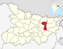
Madhepura is a municipality in Madhepura district in the Indian state of Bihar. It stands at the centre of Kosi ravine, It was called Madhyapura- a place centrally situated which was subsequently transformed as Madhipura into present Madhepura. It is surrounded by Araria and Supaul districts in the north, Khagaria and Bhagalpur districts in the south, Purnia district in the east and Saharsa district in the West.
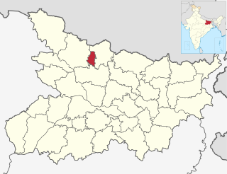
Saharsa is a city and municipal corporation in the Saharsa District in the eastern part of the state of Bihar, India. It is situated near the eastern banks of the Kosi River. It serves as the administrative headquarters for Saharsa District and is also the Divisional headquarters of the Kosi Division.
Supaul is a town and a municipality that is headquarters of Supaul district in the Indian state of Bihar. Supaul is the administrative headquarters of this district. There Are 11 block under the Supaul district Supaul, Kishanpur, Saraigarh-Bhaptiyahi, Pipra, Triveniganj, Raghopur, chhatapur, Nirmali, Marauna, Basantpur and pratapganj.
Darbhanga district is one of the thirty-eight districts of Bihar state in eastern India, and Darbhanga city is the administrative headquarters of this district and 5th largest city of Bihar as well. Darbhanga district lies in Historical Mithila region. Darbhanga district is a part of Darbhanga Division. The district is bounded on the north by Madhubani district, on the south by Samastipur district, on the east by Saharsa district and on the west by Sitamarhi and Muzaffarpur districts. The district covers an area of 2,279 km2 (880 sq mi).
Supaul district is one of the thirty-eight districts of Bihar, India. The town Supaul is the district's administrative headquarters. The district, which was split from the former Saharsa district on 14 March 1991, occupies 2,410 km2 (931 sq mi).
Katihar district is one of the thirty-eight districts of Bihar state in India, and Katihar city is the administrative headquarters of this district. The district is a part of Purnia Division. It is prominently known for its Katihar Junction Railway Station, which is a Category A station on the Barauni–Guwahati line. It has been included in the Aspirational Districts Program of the Government of India since 2018, to improve its socio-economic indicators.
Bhagalpur district is one of the thirty-eight districts of Bihar state, India. Bhagalpur is the oldest district of Bihar. Bhagalpur city is the administrative headquarters of this district.
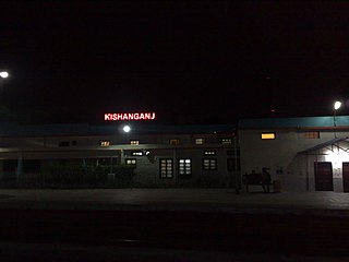
Lakhisarai district is one of the thirty-eight districts of Bihar state, India, and Lakhisarai town is the administrative headquarters of this district. Lakhisarai district is a part of Munger Division. The district occupies an area of 1,228 km2 (474 sq mi).
Saharsa is one of the thirty-eight districts of Bihar, India. Saharsa city is the administrative headquarters of this district. Saharsa district is a part of the Kosi Division and it became a district on 1 April 1954 and has subsequently become smaller with other districts being carved from it, most notably Madhepura in 1981.
Sant Kabir Nagar district is one of the 75 districts of Uttar Pradesh state in northern India. Khalilabad is the district headquarters. Sant Kabir Nagar district is a part of Basti division. The total area of Sant Kabir Nagar district is 1,646 km2 (636 sq mi).
Kosi division is an administrative geographical unit of Bihar state of India. Saharsa is the administrative headquarters of the division. Currently (2022), the division consists of Saharsa district, Madhepura district, and Supaul district.
Udakishunganj is one of the administrative divisions of Madhepura district in the Indian state of Bihar. The block headquarters are located at a distance of 35 km from the district headquarters, namely, Madhepura.
Forbesganj is a city with municipality in the Araria District in the state of Bihar, India, situated at the border of Nepal.
Nirmali is a town and a notified area in Supaul district in the Indian state of Bihar.
Bhupendra Narayan Mandal University is the state government university situated at district headquarters, Madhepura. B. N. Mandal University, Madhepura came into existence on 10 January 1992. It acts as an affiliating institution and offers undergraduate,post graduate and PhD programs through its constituents, affiliated colleges, and institutes in Madhepura and nearby cities. The university conducts various vocational [BBA Honors,BCA,MBA,MCA] and technical courses in Science, commerce, arts and also in engineering and Medical science.
National Highway 31 previously known National Highway 106 a national highway in India. It starts from Birpur in Supaul district to Bihpur in Bhagalpur district and passes through Madhepura district and terminates at Bihpur in Bhagalpur district of Bihar. This National Highway is major Highway of Madhepura district which starts from Birpur passes through Simrahi connects National Highway 57, Singheshwar, Madhepura junction to National Highway 231 previously known National Highway 107, Reshna, Gwalpara, Udakisunganj and terminates at Bihpur connects National Highway 31.
Saharsa Junction railway station is a main railway station in Saharsa district, Bihar. Its code is SHC. It serves Kosi Division area. The station consists of 5 platforms.This railway junction has been certified by ISO:14001:2015 for environmental management. Due to less railway facility, less expansion of rail network in Supaul & Madhepura district's people used to catch trains from Saharsa instead of their own stations. It is the main railway junction of Kosi division.
The Murho Estate was a Chieftaincy and later a Zamindari (estate) of Yadav (Ahir) in erstwhile Bhagalpur district of Bihar.
Yadavs in Bihar refers to the people of Yadav community of the Indian state of Bihar. They are also known as Ahir, Gope, etc. The Yadavs form nearly 14.26 % of the state's population and are included in the Other Backward Class category in the Bihar state of India. Ahirs are among the land owning caste in the plains of Bihar.
The Majhraut or Majraut is a clan of Ahir (Yadav) that inhabits the Indian state of Bihar and Jharkhand. They are also found in different parts of Nepal. They are believed to be descended from the Yadav king Madhu who ruled Mathura.
{{cite book}}
: |last1=
has generic name (help)Bolshoy Shantar Island 1,766km2
Slovenia 2,000,092 July 2011 est.