Chhapra

Last updated

Chhapra
City
Rajendra College Chhapra.jpg
Chhapra Railway Station built under Nitish Kumar.jpg
India Bihar location map.svg
Red pog.svg
Chhapra
Location of Chapra in Bihar
India location map 3.png
Red pog.svg
Chhapra
Chhapra (India)
Coordinates: 25°47′05″N84°43′39″E / 25.7848°N 84.7274°E / 25.7848; 84.7274
CountryFlag of India.svg  India
State Bihar
Division Saran
District Saran
Ward45
Government
  Type Mayor–Council
  BodyChhapra Municipal Corporation
  MayorLaxmi Narayan Gupta [1]
  Deputy MayorRagini Devi
Elevation
36 m (118 ft)
Population
 (2011)
  City201,597
   Urban
212,955
Demonym Chaprahiya
Language
  Official Hindi [2]
  Additional official Urdu [2]
  Regional Bhojpuri [3]
Time zone UTC+5:30 (IST)
Pincode(s)
84120X
Area Code(s) +91-(0)6152
Vehicle registration BR-04
Sex ratio (2011)1015(females per 1000 males) [4] /
Literacy (2011)81.30%
Lok Sabha constituencies Saran
Vidhan Sabha constituencies Chapra (118)
Avg. annual temperature26 °C (79 °F)
Avg. summer temperature32 °C (90 °F)
Avg. winter temperature20 °C (68 °F)
Website saran.bih.nic.in
chapra.biharurban.in

Chhapra is a city and headquarters of the Saran District in the Indian state of Bihar. It is situated near the junction of the Ghaghara River and the Ganges River.

Contents

Chhapra grew in importance as a river-based market in the 18th century when the Dutch, [5] [6] French, Portuguese, and English established saltpeter refineries in the area. It was recognised as a municipality in 1864.[ citation needed ] The major railway station is Chhapra Junction. There is a well known [7] Shaktipeeth temple in Chhapra named Ambika Bhavani.

Geography

Chhapra is located at 25°47′05″N84°43′39″E / 25.7848°N 84.7274°E / 25.7848; 84.7274 . [8] It has an average elevation of 36 metres (118 ft).

India's biggest double-decker flyover is being constructed in Chhapra. [9] This 3.5 km long double-decker flyover from Bhikhari Chowk to Bus Stand, [10] is being constructed at the cost of 411.31 crore from the central road fund (CRF) under engineering procurement construction (EPC) mode by Bihar Rajya Pul Nirman Nigam Limited (BRPNNL). [11] [12] It is longer than 1.8 km double-decker flyover in Santa Cruz–Chembur Link Road. [13] Chief Minister Nitish Kumar laid the foundation stone of this double-decker flyover in July 2018, which is set to be completed by June 2022. [14]

Climate

Climate data for Chhapra
MonthJanFebMarAprMayJunJulAugSepOctNovDecYear
Mean daily maximum °C (°F)23.1
(73.6)
25.8
(78.4)
31.0
(87.8)
35.1
(95.2)
35.0
(95.0)
34.9
(94.8)
32.5
(90.5)
32.8
(91.0)
32.5
(90.5)
31.6
(88.9)
29.0
(84.2)
24.8
(76.6)
30.7
(87.2)
Mean daily minimum °C (°F)9.2
(48.6)
11.0
(51.8)
15.1
(59.2)
19.1
(66.4)
21.2
(70.2)
22.9
(73.2)
23.8
(74.8)
24.2
(75.6)
23.8
(74.8)
21.2
(70.2)
15.8
(60.4)
10.6
(51.1)
18.2
(64.7)
Average precipitation mm (inches)13.0
(0.51)
14.0
(0.55)
9.0
(0.35)
29.0
(1.14)
76.0
(2.99)
139.0
(5.47)
353.0
(13.90)
254.0
(10.00)
193.0
(7.60)
73.0
(2.87)
6.0
(0.24)
7.0
(0.28)
1,166
(45.9)
Source: Accuweather [15]

Demographics

As per 2011 census, Chapra Urban Agglomeration had a population of 212,955. [16] Chapra Urban Agglomeration includes Chapra (Nagar Panchayat) and Sandha (Census Town). [17] Chapra Nagar Panchayat had a total population of 201,597, out of which 106,250 were males and 95,347 were females. It had a sex ratio of 897 females to 1000 males. The population in the age range of 0–6 years was 27,668. The effective literacy rate of those aged 7 years and older in Chhapra was 81.30% as of 2011. [18]

Religion

Religion in Chhapra city (2011)
ReligionPer cent
Hinduism
81.45%
Islam
18.11%
Others
0.44%

Hinduism is the largest religion in Chhapra city with 164,811 Hindus (81.45%). Islam is the second largest religion in Chhapra city with 36,639 Muslims (18.11%). Other religions includes 219 Christians (0.11%), 100 Jains (0.05%), 55 Sikhs (0.03%), 14 Buddhists (0.01%), 514 did not answer (0.25%). [19]

Notable people

See also

Related Research Articles

<span class="mw-page-title-main">Gaya (India)</span> City in Bihar, India

Gaya is a city, municipal corporation and the administrative headquarters of Gaya district and Magadh division of the Indian state of Bihar. Gaya is 116 kilometres (72 mi) south of Patna and is the state's second-largest city, with a population of 470,839. The city is surrounded on three sides by small, rocky hills, with the Phalgu River on its eastern side.

<span class="mw-page-title-main">Katihar</span> City in the state of Bihar (India)

Katihar is a city situated in the eastern part of the state of Bihar in India. It is the regional headquarters of Katihar district. It is one of the important cities of Bihar. It is also a main stop on the Barauni–Guwahati line.

<span class="mw-page-title-main">Muzaffarpur</span> City in Bihar, India

Muzaffarpur is a city located in Muzaffarpur district in the Tirhut region of the Indian state of Bihar. It serves as the headquarters of the Tirhut division, the Muzaffarpur district and the Muzaffarpur Railway District. It is the fourth most populous city in Bihar.

<span class="mw-page-title-main">Bettiah</span> City in Bihar, India

Bettiah is a city and the administrative headquarters of West Champaran district - (Tirhut). It is near the Indo-Nepal border, 225 kilometres (140 mi) northwest of Patna, in the state of Bihar, India.

<span class="mw-page-title-main">Arrah</span> City in Bihar, India

Arrah is a city and a municipal corporation in Bhojpur district in the Indian state of Bihar. It is the headquarters of Bhojpur district, located near the confluence of the Ganges and Sone rivers, some 24 mi (39 km) from Danapur and 36 mi (58 km) from Patna.

<span class="mw-page-title-main">Bhagalpur district</span> District of Bihar in India

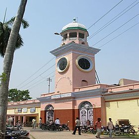
Bhagalpur district is one of the thirty-eight districts of Bihar state, India. Bhagalpur is the oldest district of Bihar. Bhagalpur city is the administrative headquarters of this district.

<span class="mw-page-title-main">Ramgarh Cantonment</span> Place in Jharkhand, India

Ramgarh Cantonment, usually referred to as Ramgarh Cantt or just Ramgarh is a cantonment town, belonging to the Ramgarh district of the Indian state of Jharkhand. Historically, a subdivision of the larger Hazaribag district, Ramgarh was finally elevated to a district status on 12 September 2007 largely to ease administrative hardships.

<span class="mw-page-title-main">Maner, Bihar</span> Indian town in Patna district, Bihar

Maner also spelled Maner Sharif, is a Block and satellite town in Patna Metropolitan Region. It is part of the Patna district in the Indian state of Bihar. Maner Sharif lies 24 km west of Patna, the capital of Bihar on NH-922. The town has tombs of Sufi saints Makhdoom Yahya Maneri and Makhdoom Shah Daulat, known as Bari Dargah and Chhoti Dargah.

At the 2011 Census, Bihar was the third most populous state of India with total population of 104,099,452, nearly 89% of it is rural. It was also India's most densely populated state, with 1,106 persons per square kilometre. The sex ratio was 918 females per 1000 males. Almost 58% of Bihar's population was below 25 years age, which is the highest in India. At 11.3%, Bihar has the second-lowest urbanisation rate in India after Himachal Pradesh.

<span class="mw-page-title-main">Saran district</span> District in Bihar, India

Saran district is one of the thirty-eight districts of Indian state of Bihar. The district, part of Saran Division, is also known as Chhapra district after the headquarters of the district, Chhapra. It is considered as one of the richest Zamindari of Bihar after Raj Darbhanga, Hathwa Raj, Bettiah Raj and Raj Najarganj, Saran Raj.

<span class="mw-page-title-main">Bhikhari Thakur</span> Founder of Bhojpuri Song

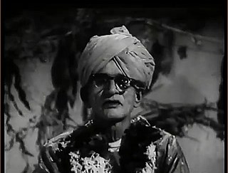
Bhikari Thakur was an Indian Bhojpuri language poet, playwright, lyricist, actor, folk dancer, folk singer and social activist. He is widely regarded as one of the greatest writers in the Bhojpuri language and most popular folk writer of Purvanchal and Bihar. Thakur is often called the "Shakespeare of Bhojpuri" and "Rai Bahadur". His works consist of more than a dozen plays, Monologues, poems, and Bhajans, which were printed in nearly three dozen books. His noteworthy works include Bidesiya, Gabarghichor, Beti Bechwa and Bhai Birodh. Gabarghichor is often compared with Bertolt Brecht's play The Caucasian Chalk Circle. Thakur is known as the father of the naach folk theatre tradition. He is also credited as the first person to cast male actors in female roles.

<span class="mw-page-title-main">Chapra, Bihar Assembly constituency</span> Vidhan Sabha constituency

Chapra is an assembly constituency in Saran district in the Indian state of Bihar. In 2015 Bihar Legislative Assembly election, Chapra was one of the 36 seats to have VVPAT enabled electronic voting machines.

The Bhojpuri people, also known as Bhojpuriya-sawb are an Indo-Aryan ethnic group from the Indian subcontinent who speak the Bhojpuri-language and inhabit the Bhojpur-Purvanchal region. This area is now divided between the western part of the Indian state of Bihar, the eastern part of the Indian state of Uttar Pradesh, western Jharkhand, along with some neighbouring districts in the Madhya Pradesh and Madhesh and Lumbini of Nepal. A significant diaspora population of Bhojpuris can be found in Trinidad and Tobago, Netherlands, Guyana, Jamaica, Suriname, other parts of the Caribbean, Fiji, South Africa, and Mauritius.

<span class="mw-page-title-main">Brahmpur, Bihar</span> Village in Bihar, India

Brahmpur is a large village and corresponding community development block in Buxar district of Bihar. It is known for its temple of Shiva, its religious practices, and its cattle fair. People visit Brahmapur to perform religious rituals in the temple of Shiva.

<span class="mw-page-title-main">2015 Bihar Legislative Assembly election</span> Election in India

The Legislative Assembly election was held over five phases in Bihar through October–November 2015 before the end of the tenure of the prior Legislative Assembly of Bihar on 29 November 2015.

<span class="mw-page-title-main">Arrah–Chhapra Bridge</span> 4.35 Km bridge over Ganga river in Bihar, India

Arrah–Chhapra Bridge is the longest multi-span extradosed bridge in the world with a main bridge length of 1,920 m (6,300 ft). The bridge crosses over the Ganges River in India, connecting Arrah in Bhojpur district to Chhapra in Saran district of Bihar state. The bridge provides a roadway link between the northern and southern parts of Bihar. The bridge opened for public use on 11 June 2017.

C. N. Gupta is an Indian politician from Bihar and a Member of the Bihar Legislative Assembly.

References

  1. नाथ, आशुतोष (24 January 2024). "छपरा में मेयर उपचुनाव के परिणाम ने चौंकाया, लालू यादव और तेज प्रताप ने अलग-अलग कैंडिडेट का किया था समर्थन". ABP (in Hindi). Retrieved 26 January 2024.
  2. 1 2 "52nd Report of the Commissioner for Linguistic Minorities in India" (PDF). nclm.nic.in. Ministry of Minority Affairs. Archived from the original (PDF) on 25 May 2017. Retrieved 9 March 2019.
  3. "Bhojpuri". Ethnologue. Retrieved 22 September 2020.
  4. "Chapra City Census 2011 data". www.census2011.co.in.
  5. Heritage, Atlas of Mutual. "Atlas of Mutual Heritage". www.nationaalarchief.nl.[ permanent dead link ]
  6. Heritage, Atlas of Mutual. "Atlas of Mutual Heritage". www.nationaalarchief.nl.[ permanent dead link ]
  7. "जानिए बिहार के तीन शक्तिपीठों में से एक सारण की अंबिका भवानी की महिमा". 29 September 2014. Archived from the original on 9 August 2016.
  8. "Maps, Weather, and Airports for Chapra, India". www.fallingrain.com. Archived from the original on 10 May 2008.
  9. "Chhapra to get Bihar's first double-decker flyover". The Times of India.
  10. "Two-deck flyover cost: Rs 411cr". Archived from the original on 12 July 2018.
  11. "CM to open highway at Chhapra". The Times of India. 10 July 2018. Retrieved 27 December 2020.
  12. "Chhapra road bounty". Archived from the original on 12 July 2018.
  13. "Saran to beat Mumbai marvel". Archived from the original on 12 July 2018.
  14. "Flyover first on Lalu's once turf". Archived from the original on 12 July 2018.
  15. "Accuweather: Weather for Chhapra, India". Accuweather. 2011. Archived from the original on 3 September 2014. Retrieved on 22 November 2011.
  16. "Urban Agglomerations/Cities having population 1 lakh and above" (PDF). Provisional Population Totals, Census of India 2011. Archived (PDF) from the original on 13 November 2011. Retrieved 16 April 2012.
  17. "Constituents of urban Agglomerations Having Population 1 Lakh & above" (PDF). Provisional Population Totals, Census of India 2011. Archived (PDF) from the original on 17 June 2016. Retrieved 16 April 2012.
  18. "Cities having population 1 lakh and above" (PDF). Provisional Population Totals, Census of India 2011. Archived (PDF) from the original on 7 May 2012. Retrieved 16 April 2012.
  19. "Chapra City Population 2022 - Sex Ratio, Population Density, Literacy". www.indiacensus.net. Retrieved 13 July 2022.