Palwal

Last updated

Palwal
Palwal railway station.jpg
Palwal railway station in Palwal, Haryana
India Haryana location map.svg
Red pog.svg
Palwal
Location in Haryana, India
India location map 3.png
Red pog.svg
Palwal
Palwal (India)
Coordinates: 28°08′35″N77°19′44″E / 28.143°N 77.329°E / 28.143; 77.329
Country Flag of India.svg  India
State Haryana
District Palwal
Elevation
199.49 m (654.49 ft)
Population
 (2011)
  Total131,926
Language
  Official Hindi, Regional Braj Bhasha, Haryanvi
Time zone UTC+5:30 (IST)
PIN
121102
Telephone code 01275
ISO 3166 code IN-HR
Vehicle registration HR-30
Sex ratio 879 /
Website haryana.gov.in

Palwal is a city and a municipal council. It is the headquarters of Palwal district, the 21st district of Haryana state in northern India. It is a centre of the cotton trade in the area. It is part of Braj region. It is also a part of National Capital Region. [1]

Contents

Etymology and legend

The origin of Palwal is related to the local legend related to the Mahabharata, according to which the town is named after an asura called "Palwasura" who was slain by Balarama, the brother of Krishna. To commemorate this event an annual festival called "Baldev Chhat Ka Mela" is held here, and a "Dauji temple" in honor of Balrama is situated in Banchari village 25 km from Palwal on Grand Trunk Road. [2]

History

The local tradition identifies Palwal with the Apelava town mentioned in the Mahabharata, which was later restored by Vikramaditya. [3]

Kos Minar at Palwal along Grand Trunk Road Kos Minar 001.jpg
Kos Minar at Palwal along Grand Trunk Road

Matia Fort or Palwal Fort was built during Sher Shah Suri's reign. Excavations have unearthed evidence of a grand palace at the bottom of the fort. As of 2021, it lies in ruins. [4]

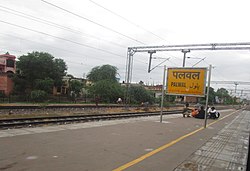
A historical building by the name 'Gandhi Seva Ashram' and a Museum was made in the memory of Mahatma Gandhi. The Gandhi Museum is close to Palwal Railway Station. Mahatma Gandhi was arrested on 10 April 1919 at Palwal railway station while going to Punjab against the Rowlatt Act. Keeping this memory alive lasting on October 2, 1938, Netaji Subhas Chandra Bose had kept it. Gandhi exhibition was established in Gandhi Seva Ashram in the year 1962. In it, history related to Gandhiji was preserved. Pictures for the exhibition were brought from the National Gandhi Museum of Delhi. Later, they started getting damaged, they were upgraded and the exhibition site was changed to the museum. [5]

Post-independence

On 15 August 1979, Gurgaon district was further divided to form a new Faridabad district, and Palwal became a part of it. [6] On 15 August 2008, Palwal became the administrative headquarters of the newly formed Palwal district, the 21st district of Haryana.

Geography

Palwal is located at 28°07′N77°20′E / 28.12°N 77.33°E / 28.12; 77.33 . It has an average elevation of 195 metres (640 ft).

Palwal is 60 kilometres (37 mi) from Delhi, 29 kilometres (18 mi) from Faridabad, 314 kilometres (195 mi) from Chandigarh and 143 kilometres (89 mi) from Agra.The latitude of the town is 28° 40' N and longitude is 76° 59' E. The area of town is 22.10 square kilometres (8.53 sq mi). [7]

Demography

Religion in Palwal City
ReligionPopulation
(1911) [8] :20
Percentage
(1911)
Population
(1941) [9] :30
Percentage
(1941)
Hinduism Om.svg [lower-alpha 1] 6,0618,831
Islam Star and Crescent.svg 3,2804,404
Christianity Christian cross.svg 53244
Sikhism Khanda.svg 130
Others [lower-alpha 2] 6397
Total Population9,45813,606

See also

Related Research Articles

<span class="mw-page-title-main">Haryana</span> State in northern India

Haryana is an Indian state located in the northern part of the country. It was carved out of the former state of East Punjab on 1 November 1966 on a linguistic basis. It is ranked 21st in terms of area, with less than 1.4% of India's land area. The state capital is Chandigarh, which it shares with the neighbouring state of Punjab; and the most populous city is Faridabad, which is a part of the National Capital Region. The city of Gurgaon is among India's largest financial and technology hubs. Haryana has 6 administrative divisions, 22 districts, 72 sub-divisions, 93 revenue tehsils, 50 sub-tehsils, 140 community development blocks, 154 cities and towns, 7,356 villages, and 6,222 villages panchayats.

<span class="mw-page-title-main">Faridabad</span> Metropolitan City in Haryana, India

Faridabad(Hindi pronunciation:[fəɾiːdɑːbɑːd]) is the most populous city in the Indian state of Haryana and a part of Delhi National Capital Region. It is one of the major satellite cities around Delhi and is located 284 kilometres south of the state capital Chandigarh. The river Yamuna forms the eastern district boundary with Uttar Pradesh. The Government of India included it in the second list of Smart Cities Mission on 24 May 2016. As per the 2021 Delhi Regional Plan, Faridabad is a part of the (CNCR) Central National Capital Region or (DMA) Delhi metropolitan area.

Mewat is a historical and cultural region which encompasses parts of the modern-day states of Haryana, Rajasthan, and Uttar Pradesh in north-western India.

<span class="mw-page-title-main">National Capital Region (India)</span> Planning region in India

The National Capital Region (NCR) is a planning region centered upon the National Capital Territory (NCT) of Delhi in India. It encompasses Delhi and several districts surrounding it from the states of Haryana, Uttar Pradesh, and Rajasthan. The NCR and the associated National Capital Region Planning Board (NCRPB) were created in 1985 to plan the development of the region and to evolve harmonized policies for the control of land-uses and development of infrastructure in the region. Prominent cities of NCR include Delhi, Faridabad, Ghaziabad, Gurgaon and Noida.

<span class="mw-page-title-main">Faridabad district</span> District of Haryana in India

Faridabad district is one of the 22 districts of the Indian state of Haryana with Faridabad city being the district headquarters.The District is a Part of Central National Capital Region of Delhi.The Delhi-Mathura-Agra National Highway 44 passes through the centre of the district, which occupies an area of 741 square kilometres (286 sq mi) and as of the 2011 census of India had a population of 1,809,733. Haryana government has created a new Faridabad division which would cover the districts – Faridabad, Nuh and Palwal.

<span class="mw-page-title-main">Gurgaon district</span> District in Haryana, India

Gurgaon district, officially known as Gurugram district, is one of the 22 districts of Haryana in northern India. The city of Gurgaon is the administrative headquarters of the district. The population is 1,514,432. It is one of the southern districts of Haryana. On its north, it is bounded by the district of Jhajjar and the Union Territory of Delhi. Faridabad district lies to its east. To its south lie the districts of Palwal and Nuh. To the west lies Rewari district.

<span class="mw-page-title-main">Rohtak</span> City in Haryana, India

Rohtak is a city and the administrative headquarters of the Rohtak district in the Indian state of Haryana. It lies 70 kilometres (43 mi) north-west of New Delhi and 250 kilometres (160 mi) south of the state capital Chandigarh on NH 9. Rohtak forms a part of the National Capital Region (NCR) which helps the city in obtaining cheap loans for infrastructure development from the NCR Planning Board.

<span class="mw-page-title-main">Nuh district</span> District of Haryana in India

Nuh district is one of the 22 districts in the Indian state of Haryana. There are four sub-divisions in this district: Nuh, Ferozepur Jhirka, Punahana, and Taoru. The district is known for having the largest Muslim population in Haryana.

Hathin is a town and a Municipal Committee in Palwal district of Haryana in India.

<span class="mw-page-title-main">Ballabhgarh</span> Town in Haryana, India

Ballabgarh, officially Balramgarh, is a large town, nearby Faridabad city and a tehsil (subdistrict) in Faridabad district of Haryana, India, and is part of the National Capital Region. The town was founded by Raja Balram Singh, in 1739, who also built the Nahar Singh Mahal palace in the same year. Raja Nahar Singh (1823–1858) was the last king of the princely state. He was executed for taking part in the 1857 war of independence in 1858. The town of Ballabhgarh is only 17 miles (27 km) from Delhi, and today lies on the National Highway 19, a major portion of historical Grand Trunk Road. It is connected to Faridabad and south-east Delhi by the Delhi Metro. Ballabhgarh is the fourth city in Haryana to get metro connectivity after Gurgaon, Faridabad and Bahadurgarh.

Nuh(Hindi/Urdu pronunciation: [nũːɦ]) is a city in the Indian state of Haryana. It is the administrative headquarter of the Nuh sub-division in Nuh district of Haryana and lies within in the National Capital Region of India.

<span class="mw-page-title-main">Taoru</span> Town in Haryana, India

Taoru or Tauru is a town, near Nuh city in Nuh district in the Indian state of Haryana.

Delhi, a major metropolitan region of India, is connected to various parts of country through several national highways and expressways. All the highways and expressways from Delhi lead to Haryana or Uttar Pradesh and continue from there.

<span class="mw-page-title-main">Palwal district</span> District of Haryana in India

Palwal district was created on 15 August 2008. It is the 21st district of Haryana state in northern India. Palwal City is the headquarters of the district. It is part of the Braj region.

Gandhi Gram Ghasera or Ghasera is a village in Nuh district of Haryana state in northern India. It is dominated by Meos. Gandhi was added to its name after it was visited by Mahatma Gandhi who asked the predominantly Muslim Meos to not migrate to Pakistan.

<span class="mw-page-title-main">Outline of Haryana</span> Overview of and topical guide to Haryana

The following outline is provided as an overview of and topical guide to Haryana.

Ranhera is a village and a Gram Panchayat in Jewar block of Gautam Buddha Nagar District in the Indian state of Uttar Pradesh.

Ujina is a Village located in Hodal-Nuh road in Nuh district in Haryana. In Ancient time, Ujina was popular with the name of Ujina Lake as in rainy season it totally covered with water and people of nearby territories often came here for sightseeing. Ujina has 100% Hindu population. The People of Ujina actively participated in every war of Independence of India, whether it was the 1857 war; The First war of Independence or the Satyagrah by Mahatma Gandhi.

Tourism in Haryana relates to tourism in the state of Haryana, India. There are 21 tourism hubs created by Haryana Tourism Corporation (HTC), which are located in Ambala, Bhiwani Faridabad, Fatehabad, Gurgaon, Hisar, Jhajjar, Jind, Kaithal, Karnal, Kurukshetra, Panchkula, Sirsa, Sonipat, Panipat, Rewari, Rohtak, Yamunanagar, Palwal and Mahendergarh.

Bisahan is a village in the Beri tehsil of Jhajjar district of Haryana, India. The village lies roughly 5 kilometres (3.1 mi) from the town of Beri.

References

  1. "National Capital Region Planning Board".
  2. Haryana’s Palwal town is closely linked to a demon, the Pandavas and Gandhi, India Times, 23 Sept 2019.
  3. Palwal Town The Imperial Gazetteer of India, 1909, v. 19, p. 375.hh
  4. Sohan Singh Khattar and Reena Kar, 2021, Know Your State Haryana, Arihant Publications, pp 308.
  5. "Gandhi Museum | District Palwal". palwal.gov.in. GOVERNMENT OF HARYANA. Retrieved 17 September 2018.
  6. History Archived 13 October 2007 at the Wayback Machine Official website Gurgaon.
  7. Palwal Geography Archived 16 April 2009 at the Wayback Machine Yamuna Action Plan official website.
  8. "Census of India 1911. Vol. 14, Punjab. Pt. 2, Tables" . Retrieved 21 August 2022.
  9. "CENSUS OF INDIA, 1941 VOLUME VI PUNJAB PROVINCE" . Retrieved 21 August 2022.
  1. 1941 census: Including Ad-Dharmis
  2. Including Jainism, Buddhism, Zoroastrianism, Judaism, others, or not stated