Ganaur

Last updated

Ganaur
Town
Gupti Dham (4).jpg
Gupti Dham Jain temple (Ganaur), Sonipat, H.R.
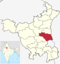
India Haryana location map.svg
Red pog.svg
Ganaur
Location in Haryana, India
India location map 3.png
Red pog.svg
Ganaur
Ganaur (India)
Coordinates: 29°04′N77°00′E / 29.07°N 77.00°E / 29.07; 77.00
CountryFlag of India.svg  India
State Haryana
District Sonipat
Government
  MLANirmal Rani
Elevation
226 m (741 ft)
Population
 (2011 census)
  Total35,603
Languages
  Official Hindi, English
Time zone UTC+5:30 (IST)
Telephone code0130 24
ISO 3166 code IN-HR
Vehicle registration HR-42
Website www.ganaur.in

Ganaur is a town located, just 23 km from Sonipat City in Sonipat district in the state of Haryana, India.

Contents

History

Battle of Ghanaur was fought between Mughals and Sikhs at this place. [1]

Demographics

Ganaur Railway Station Ganaur Rail Station.jpg
Ganaur Railway Station

As of 2011 India census, [2] Ganaur had a population of 35,603 with 18,991 males and 16,612 females. Population of Children with the age of 0-6 is 4459 which is 12.52% of total population of Ganaur (MC). In Ganaur Municipal Committee, Female Sex Ratio is of 875 against state average of 879. Moreover, Child Sex Ratio in Ganaur is around 804 compared to Haryana state average of 834. Literacy rate of Ganaur city is 83.56% higher than state average of 75.55%. In Ganaur, Male literacy is around 90.15% while female literacy rate is 76.12%. Ganaur Municipal Committee has total administration over 6,863 houses. It has a great connectivity to the national capital through National Highway and Railway. Every train from ganaur connect with the national capital. The craze for government jobs is paramount in the town. Most of the government employees work in the central government department located in delhi. Around 10 private libraries have been opened in the town.

Related Research Articles

<span class="mw-page-title-main">Sonipat district</span> District of Haryana in India

Sonipat district is one of the 22 districts of Haryana state in North India. Sonipat town is the district headquarters. It is a part of National Capital Region. It is bordered by Delhi, Panipat, Rohtak, Jind, Jhajjar and Baghpat.

<span class="mw-page-title-main">Jind district</span> District of Haryana in India

Jindo district is one of the 22 districts of Haryana state in northern India. Jind town is the administrative headquarters of the district. It is part of Hisar Division and was created in 1966.

<span class="mw-page-title-main">Jind</span> City in Haryana, India

Jind is one of the largest and oldest city in Jind district in the Indian state of Haryana. It is administrative headquarter of Jind district. Rani Talab is the main destination for tourists while Pandu Pindara and Ramrai are the main religious spots, attracting devotees for the holy bath during Amavasya.

Jhajjar is a town in Jhajjar district in the Indian state of Haryana.It is a part of Delhi National Capital Region and situated on the road connecting Rewari to Rohtak (NH-352), Loharu to Meerut (NH334B), Charkhi Dadri to Delhi and Gurgaon to Bhiwani. Jhajjar is located 55 km (34 mi) west of Delhi.

<span class="mw-page-title-main">Sonipat</span> City in Haryana, India

Sonipat is a planned industrial city & administrative headquarter in Sonipat district of Haryana state of India. It comes under the National Capital Region and is around 44 kilometres (27 mi) from New Delhi. It lies 214 km southwest of Chandigarh, the state capital. The Yamuna River runs along its eastern boundary.

<span class="mw-page-title-main">Nalwa</span> Village in Haryana, India

Nalwa is a village, as well as an Assembly Constituency in Haryana Legislative Assembly, located in Hisar district in the state of Haryana in India.

<span class="mw-page-title-main">Bahadurgarh</span> City in Haryana, India

Bahadurgarh is a city and municipal council within Jhajjar district in the Indian state of Haryana and Part of National Capital Region or NCR of Delhi.The city comprises 31 wards and is approximately 21 km from National Capital Territory (NCT) of Delhi and 31 km from Jhajjar, the district headquarter.

Chandpur is a town and a municipal board in Bijnor district in the Indian state of Uttar Pradesh, India.

<span class="mw-page-title-main">Gharaunda</span> Town in Haryana, India

Gharaunda is a town and a municipal committee in Karnal district in the state of Haryana, India. It is situated at a distance of sixty-five miles to the northwest of New Delhi. It is eleven miles from Karnal, the district headquarters. The Amritsar-Delhi main broad-gauge railway line passes through the town. Indo-Israel Centre For Excellence in Vegetables and one of the leading footwear industries of India 'Liberty Shoes' has its manufacturing unit in Gharaunda. This has given fame to the place. Gharaunda serves as a big Grain market for the state.

Gohana is a city and a municipal council, near Sonipat city in the Sonipat district of the Indian state of Haryana.

Ratia is a city and a municipal committee on the banks of Ghaggar River, 23 north of district headquarter, Fatehabad City, in the Fatehabad district of the Indian state of Haryana.

Safidon is a city and a municipal committee in Jind district in the Indian state of Haryana.Safidon was anciently known as "Sarp Daman"

Sarsawa is a town at the border of Haryana and a municipal board in Saharanpur district in the Indian state of Uttar Pradesh.

<span class="mw-page-title-main">Tohana</span> City in Haryana, India

Tohana is a city and a municipal council, just 56 km from Fatehabad City in Fatehabad district in the Indian state of Haryana. Its name comes from the Sanskrit 'Taushayana'. It is known as the City of Canals.

North West Delhi is an administrative district of the National Capital Territory of Delhi in India.

<span class="mw-page-title-main">Ramnagar, Udhampur</span> Town in India

Ramnagar is a town and notified area committee in Udhampur District in the Indian union territory of Jammu and Kashmir.

Fatehabad is a town and a municipal council in Fatehabad district in the state of Haryana, India. It is the administrative headquarters of Fatehabad district.

Julana is a municipal committee town in the Jind district in the Haryana state of India. It is positioned in the Interior of Haryana and is usually known as the Heart of Haryana. It is the administrative headquarters of Julana Tehsil, located in the middle of Rohtak and Jind on NH 71.

Kharkhoda is a city and municipal committee in Sonipat district in the Indian state of Haryana and is a part of National Capital Region (NCR). In Kharkhoda Chhapadeshwar Mahadev Mandir is very popular within the connected villages. At the time of Maha Shivratri festival a large number of tourists comes for visiting the temple. Due to the proximity of UT of Delhi, there is a lot of scope of industrial and residential development in the area. Haryana State Industrial and Infrastructure Development Corporation acquired 3,200 acres of land to develop Industrial Model Township (IMT). Western Peripheral Expressway (KMP) is just 1 km and Delhi–Amritsar–Katra Expressway is 5 km away from the city. On 28 August 2022 Shri Narendra Modi laid foundation stone of Maruti Suzuki's new manufacturing plant in Kharkhoda. Khanda village of Kharkhoda block have a statue of Baba Banda Singh Bahadur which was inaugurated by CM of Haryana Manohar Lal Khattar on Shaurya Diwas celebrated in Khanda, Sonipat.

Jakhauli is a village of in the city of Sonipat in Hariyana.

References

  1. "Dal Khalsa raps 'Badalisation' of Sikh politics". The Indian Express. Express News Service. 16 March 2009. Apart from being a brave warrior, Bhai Baghel Singh was a strategist and statesman who succeeded in forcing the then Delhi rulers into submission in the battle at Ghanaur, near Patiala in 1778.{{cite news}}: CS1 maint: others (link)
  2. "Census of India 2001: Data from the 2001 Census, including cities, villages and towns (Provisional)". Census Commission of India. Archived from the original on 16 June 2004. Retrieved 1 November 2008.