This article needs additional citations for verification .(August 2025) |
Sehri | |
|---|---|
Village | |
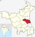
 Sehri Location in Haryana, India  Sehri Sehri (India) | |
| Coordinates: 28°56′9.174″N76°53′12.262″E / 28.93588167°N 76.88673944°E | |
| Country | |
| State | Haryana |
| District | Sonipat |
| Tehsil | Kharkhoda |
| Government | |
| • Body | Gram Panchayat |
| Area | |
• Total | 6.92 km2 (2.67 sq mi) |
| Population (2011) | 2,819 [1] |
| Languages | |
| • Regional | Haryanvi |
| • Official | Hindi, English |
| Time zone | IST (UTC+5:30) |
| PIN | 131402 |
| Phone | 0130 |
| Vehicle registration | HR 79 |
| Ethnic groups | Dahiya Jats |
| Literacy | 79.44% [1] |
| Website | http://sonipat.nic.in/ |

Sehri is a village in Kharkhoda Tehsil, within the Sonipat district of the Indian state of Haryana. [2] [3]