Naraingarh

Last updated

Naraingarh
Narayangarh
Town
Mc-park-naraingarh.jpg
Mc-park-naraingarh
India Haryana location map.svg
Red pog.svg
Naraingarh
Location in Haryana, India
India location map 3.png
Red pog.svg
Naraingarh
Naraingarh (India)
Coordinates: 30°28′35″N77°07′40″E / 30.47639°N 77.12778°E / 30.47639; 77.12778
CountryFlag of India.svg  India
State Haryana
District Ambala
Founded byRaja Lakshmi Narain King of Sirmaur
Named for Raja Lakshmi Narain of Sirmaur State
Government
  BodyMunicipal Corporation
Area
  Total481 km2 (186 sq mi)
Population
 (2011) [1]
28,832
Demonym Naraiangarhiye
Languages [2] [3]
  Official Hindi
  Additional official English, Punjabi
Time zone UTC+5:30 (IST)
PIN
134203
Telephone code91 1734
ISO 3166 code IN-HR
Vehicle registration HR-04
Sex ratio 890
Website haryana.gov.in

Naraingarh (also: Narayangarh) is a town, municipal committee and assembly constituency in the Ambala district of the Indian state of Haryana, located on the border with the Indian state of Himachal Pradesh. Due to its geographical location, the Naraingarh plays an important role in local tourism, being located 39 km from Ambala, the district headquarter, 52 km (32 miles) of Chandigarh, the state capital, 144 km (89 miles) of Shimla, and 230 km (142 miles) of New Delhi.

Contents

Etymology

The name Naraingarh (Narayangarh) is a portmanteau of Narayana and Garh. Narayana refers to Hindu god Narayana, is the supreme absolute being in Hinduism and is considered as the supreme deity in Vaishnavism, while Garh means fort.

Raja Lakshmi Narain of Sirmur State, during the time of the disintegration of the Mughal empire, built a fort at Kulsan, which he named after himself, Naraingarh. The fort has been now encroached upon by the tahsil offices and police station. [4]

Geography and ecology

Location

Naraingarh is located near the foothills of the Sivalik range of the Himalayas in northwest India. It covers an area of approximately 481 km2. [5] It shares its borders with the states of Himachal Pradesh. The exact cartographic co-ordinates of Narayangarh are 30°28′N77°08′E / 30.47°N 77.13°E / 30.47; 77.13 .It has an average elevation of 325 metres (1065 ft).

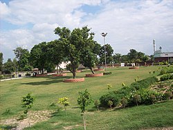
Naraingarh, lying in the northern plains, has vast fertile and flat land. It has portions of Bhabar in the north east and Terai in rest of the area.

Climate

Naraingarh
Climate chart (explanation)
J
F
M
A
M
J
J
A
S
O
N
D
 
 
33
 
 
16
3
 
 
39
 
 
20
5
 
 
30
 
 
25
10
 
 
9
 
 
32
16
 
 
28
 
 
35
20
 
 
145
 
 
36
22
 
 
280
 
 
31
21
 
 
308
 
 
30
20
 
 
133
 
 
30
19
 
 
22
 
 
29
14
 
 
9
 
 
24
8
 
 
22
 
 
19
4
Average max. and min. temperatures in °C
Precipitation totals in mm
Imperial conversion
JFMAMJJASOND
 
 
1.3
 
 
62
38
 
 
1.5
 
 
68
42
 
 
1.2
 
 
78
51
 
 
0.4
 
 
89
61
 
 
1.1
 
 
96
68
 
 
5.7
 
 
96
72
 
 
11
 
 
88
70
 
 
12
 
 
85
69
 
 
5.2
 
 
86
66
 
 
0.9
 
 
84
57
 
 
0.4
 
 
76
46
 
 
0.9
 
 
66
39
Average max. and min. temperatures in °F
Precipitation totals in inches

Naraingarh has a humid subtropical climate (Köppen: Cwa) characterised by a seasonal rhythm: very hot summers, mild winters, unreliable rainfall and great variation in temperature (−1 °C to 46 °C OR 30.2 °F to 114 °F). The town also receives occasional winter rains from the Western Disturbance originating over the Mediterranean Sea.

The western disturbances usually brings rain predominantly from mid-December till end of April which can be heavier sometimes with strong winds and hails if the weather turns colder (during March–April months) which usually proves disastrous to the crops. Cold winds usually tend to come from the north near Shimla, capital of Himachal Pradesh and from the state of Jammu and Kashmir, both of which receive their share of snowfall during wintertime.

The town experiences the following seasons and the respective average temperatures:

Climate data for Naraingarh
MonthJanFebMarAprMayJunJulAugSepOctNovDecYear
Record high °C (°F)27.7
(81.9)
32.8
(91.0)
37.8
(100.0)
42.7
(108.9)
44.6
(112.3)
45.3
(113.5)
42.0
(107.6)
39.0
(102.2)
37.5
(99.5)
37.0
(98.6)
34.0
(93.2)
28.5
(83.3)
45.6
(114.1)
Mean daily maximum °C (°F)20.4
(68.7)
23.1
(73.6)
28.4
(83.1)
34.5
(94.1)
38.3
(100.9)
38.6
(101.5)
34.0
(93.2)
32.7
(90.9)
33.1
(91.6)
31.8
(89.2)
27.3
(81.1)
22.1
(71.8)
30.4
(86.7)
Mean daily minimum °C (°F)6.1
(43.0)
8.3
(46.9)
13.4
(56.1)
18.9
(66.0)
23.1
(73.6)
25.4
(77.7)
23.9
(75.0)
23.3
(73.9)
21.8
(71.2)
17.0
(62.6)
10.5
(50.9)
6.7
(44.1)
16.5
(61.7)
Record low °C (°F)0.0
(32.0)
0.0
(32.0)
4.2
(39.6)
7.8
(46.0)
13.4
(56.1)
14.8
(58.6)
14.2
(57.6)
17.2
(63.0)
14.3
(57.7)
9.4
(48.9)
3.7
(38.7)
0.0
(32.0)
0.0
(32.0)
Average rainfall mm (inches)33.1
(1.30)
38.9
(1.53)
30.4
(1.20)
8.5
(0.33)
28.4
(1.12)
145.2
(5.72)
280.4
(11.04)
307.5
(12.11)
133.0
(5.24)
21.9
(0.86)
9.4
(0.37)
21.9
(0.86)
1,059.3
(41.70)
Average rainy days2.62.82.61.12.16.312.311.45.01.40.81.449.8
Source: India Meteorological Department (record high and low up to 2010) [6] [7]

Demographics

Population

As of 2011 Indian Census, Naraingarh had a total population of 22,832, of which 12,016 were males and 10,816 were females. Population within the age group of 0 to 6 years was 2,589. The total number of literates in Naraingarh was 17,512, which constituted 76.7% of the population with male literacy of 79.6% and female literacy of 73.4%. The effective literacy rate of 7+ population of Naraingarh was 86.5%, of which male literacy rate was 90.8% and female literacy rate was 81.8%. The Scheduled Castes population was 5,834. Naraingarh had 4677 households in 2011. [1]

Languages

Hindi is the official language of Naraingarh. Punjabi and English are additional official languages. [2] [3]

Politics

Naraingarh (Vidhan Sabha constituency) is the assembly constituency.

Transport

Naraingarh is connected by road to all of the other major cities of north India including Delhi, Dehradun, Chandigarh, Jalandhar, Paonta Sahib and Shimla.

NH 72 passes through Naraingarh and connects it to Ambala , Shahzadpur, Nahan, Paonta Sahib and Haridwar. NH 73 passes through Naraingarh and connects it to Punchkula, Shahzadpur, Saha, Yamunanagar, SaharanPur and Haridwar. State Highway 1 connects it to state capital Chandigarh and Raipur Rani.

Villages by Population

Following is a list of villages by population in Naraingarh Tehsil according to 2011 Census of India

Villages by Population (2010)
NoVillageTotal Population
1Dera7,872
2Shahzadpur7,278
3Pathreri5,645
4Gadhauli4,949
5Badhauli4,442
6Jatwar4,230
7Kurali(B.S)4,222
8Dhanana4,052
9Panjlasa3,203
10Korwa Khurd2,957

Related Research Articles

<span class="mw-page-title-main">Chandigarh</span> Union territory and capital of Punjab and Haryana, India

Chandigarh is a union territory and planned city in northern India, serving as the shared capital of the surrounding states, namely Punjab to the north, west and the south, and Haryana to the east. Chandigarh constitutes the bulk of the Chandigarh Capital Region or Greater Chandigarh, which also includes the adjacent satellite cities of Panchkula in Haryana and Mohali in Punjab. It is situated near the foothills of the Himalayas, 260 km north of New Delhi and 229 km southeast of Amritsar.

<span class="mw-page-title-main">Kalka</span> Town in Haryana, India

Kalka is a town in the Panchkula district of Haryana, India. It is near Panchkula city. The name of the town is derived from the Hindu goddess Kali. It is situated in the foothills of the Himalayas and is a gateway to the neighbouring state of Himachal Pradesh. It is on the National Highway 5 between Chandigarh and Shimla, and it is the terminus of the Kalka-Shimla Railway. To the south of Kalka is Pinjore, and the industrial village of Parwanoo is to the north on NH 22. Railways and Industrial development have led to a continuous urban belt from Pinjore to Parwanoo, but Kalka gained major economic benefits due to only highway until 2010, Shimla. It is the tehsil of 253 nearby sub-villages. Nearby is Chandimandir Cantonment, where the Western Command of the Indian army is based. In 2013, the municipal committee of Kalka was dissolved and the administration was reassigned to Panchkula Municipal Corporation.

<span class="mw-page-title-main">Manali, Himachal Pradesh</span> Town in India

Manali is a town, near Kullu town in Kullu district in the Indian state of Himachal Pradesh. It is situated in the northern end of the Kullu Valley, formed by the Beas River. The town is located in the Kullu district, approximately 270 kilometres (170 mi) north of the state capital of Shimla and 544 kilometres (338 mi) northeast of the national capital of New Delhi. With a population of 8,096 people recorded in the 2011 Indian census Manali is the beginning of an ancient trade route through Lahaul (H.P) and Ladakh, over the Karakoram Pass and onto Yarkand and Hotan in the Tarim Basin of China. Manali is a popular tourist destination in India and serves as the gateway to the Lahaul and Spiti district as well as the city of Leh in Ladakh.

<span class="mw-page-title-main">Yamunanagar</span> City in Haryana, India

Yamunanagar, is a city and a municipal corporation in Yamunanagar district in the Indian state of Haryana. This town is known for the cluster of plywood units and paper factories. It provides timber to larger industries. The older town is called Jagadhri. The Yamunanagar-Jagadhri railway station (YJUD) services the city. Despite its name, Jagadhri Railway is situated in Yamunanagar. There is also another railway station called Jagadhri Workshop in Yamunanagar.

<span class="mw-page-title-main">Nahan</span> A town in Himachal Pradesh, India

Nahan is a town in Himachal Pradesh in India and is the headquarters of the Sirmaur District It was the capital of the former Sirmur princely state.Nahan is also known as the Town of ponds.

<span class="mw-page-title-main">Pathankot</span> City in Punjab, India

Pathankot is a city and the district headquarters of the Pathankot district in Punjab, India. Pathankot is the 6th most populous city of Punjab, after Ludhiana, Amritsar, Jalandhar, Patiala and Bathinda. Its local government is a municipal corporation.

<span class="mw-page-title-main">Panchkula</span> City in Haryana, India

Panchkula is a planned city and district headquarter in the Panchkula district in Haryana, India. Panchkula is a border city with Punjab, Chandigarh and Himachal Pradesh. The origin of the name Panchkula came from the place where five irrigation canals meet. At present, it forms a part of an adjoining area to Chandigarh, Mohali, and Zirakpur. It is approximately 4 km (2.5 mi) southeast of Chandigarh, 105 km (65 mi) southwest of Shimla, 44 km (27 mi) from Ambala and 259 km (161 mi) northeast of New Delhi, the national capital. It is a part of the Chandigarh capital region or Greater Chandigarh. The Chandigarh-Mohali-Panchkula metropolitan region collectively forms a Chandigarh Tricity, with a combined population of over two million.

<span class="mw-page-title-main">Ambala district</span> District of Haryana in India

Ambala district is one of the 22 districts of Haryana state in the country of India with Ambala town serving as the administrative headquarters of the district. District Ambala lies on the North-Eastern edge of Haryana and borders Punjab and Himachal Pradesh. Ambala district is a part of Ambala Division.

Paonta Sahib is an industrial town of Himachal Pradesh in India. It is located in the south of Sirmaur district, on National Highway 72. Paonta Sahib is an important place of worship for Sikhs, hosting a large Gurdwara named Gurudwara Paonta Sahib, on the banks of the river Yamuna. The river is the boundary between the states of Himachal Pradesh and Uttarakhand.

<span class="mw-page-title-main">Shimla district</span> District of Himachal Pradesh in India

Shimla district is one of the twelve districts of the state of Himachal Pradesh in northern India. Its headquarters is the state capital of Shimla. Neighbouring districts are Mandi and Kullu in the north, Kinnaur in the east, Uttarakhand in the southeast, Solan to the southwest and Sirmaur in the south. The elevation of the district ranges from 987 metres (3,238 ft) to 4,500 metres (14,764 ft).

Chhachhrauli is a tehsil and Gram Panchayat town consisting of 20 wards in Yamuna Nagar district in the state of Haryana, India. It is 11 km north-east of Jagadhari. Chachhraulli is often known as "Cherapunjii of Haryana" as it receives the most rain in the whole of Haryana . It was a municipal committee until 1998. Before independence in 1947, it was the capital of the princely state of Kalsia. The origin of word Chhachhrauli is believed to be "Sat Sherawali" due to a temple located near bus terminus.

Dera Bassi is a satellite city of Chandigarh and a municipal council in Mohali district in the state of Punjab, India. Dera Bassi is located on the Chandigarh – Delhi National Highway, 8 km from Chandigarh. It is located within 20 km from Chandigarh, Mohali and Panchkula. It is strategically located near the boundary of Haryana, Punjab and Union territory of Chandigarh. Derabassi is most famous for its industrial belt, situated for the most part on Ramgarh and Barwala Road. The nearby sub town of Lalru was once a famous market for red chilli powder. The city and the nearby area host eight Engineering, B.Ed., Paramedical and Management institutes.

<span class="mw-page-title-main">Raipur Rani</span> Census Town in Haryana, India

Raipur Rani is a census town in Panchkula district in the Indian state of Haryana. It is located on the Panchkula city-Chandigarh-Nahan-Paonta Sahib-Dehradun highway 30 kilometres east from the Chandigarh-Mohali-Panchkula urban cities combine. It is about 20 kilometres from the Dera Bassi Industrial belt and 10 kilometres from the Barwala industrial estate. Narayangarh in the Ambala District is the next large town in its proximity.

Himachal Pradesh, although railways and airways serve very limited transport needs, the road network of the state serves the transport needs of the people. Although, the geography of Himachal presents considerable challenge to the development of transport infrastructure, it has the highest road density among all the Hill States of India. Himachal also has 3 airports, 2 narrow gauge rail tracks and couple of other under-construction broad gauge railway tracks, but roads remain the main mode of transport.

<span class="mw-page-title-main">Puadh</span> Historic region in north India

Puadh is a historic region in north India that comprises parts of present-day Punjab, Haryana, Uttar Pradesh, Himachal Pradesh and the U.T. of Chandigarh, India. It has the Sutlej river in its north and covers the regions immediately south of the Ghaggar river. The people of the area are known as Puadhi and speak the Puadhi dialect of Punjabi. The capital cities of Puadh region are Rupnagar, Fatehgarh Sahib, Mohali, Patiala, Chandigarh, Nalagarh,Panchkula, Baddi ,Ambala, Yamunanagar

<span class="mw-page-title-main">Totu, Shimla</span> Suburb in Shimla, Himachal Pradesh, India

Totu is one of the major suburbs of Shimla city, in the state of Himachal Pradesh, India. It is under the administration of the Shimla Municipal Corporation.

<span class="mw-page-title-main">National Highway 7 (India)</span> National highway in India

National Highway 7 is a highway connecting Fazilka (Punjab) to Mana (Uttarakhand) in India. It passes through the Indian states of Punjab, Haryana, Himachal Pradesh, and Uttarakhand.

Harbon is the notified area and village in Naraingarh Tehsil of Ambala district in the Indian State of Haryana. It is known for the cultivation of rice, wheat, barley and sugarcane. The production of the crops so obtained is supplied all over North India.

Shahzadpur is a Town in Shahzadpur Tehsil in Ambala District of Haryana State, India. It belongs to Ambala Division. It is located 30 km towards East from District headquarters Ambala. It is a Tehsil headquarter. Shahzadpur Pin code is 134202 and postal head office is Shahzadpur.

Sountli village Situated in Tehsil Shahzadpur Tehsil in Ambala District of Haryana State, India.It is located 26 km towards East from District headquarters Ambala. 3 km from Shahzadpur. 47 km from State capital Chandigarh.

References

  1. 1 2 "Census of India: Naraingarh". www.censusindia.gov.in. Retrieved 24 November 2019.
  2. 1 2 "Report of the Commissioner for linguistic minorities: 52nd report (July 2014 to June 2015)" (PDF). Commissioner for Linguistic Minorities, Ministry of Minority Affairs, Government of India. pp. 85–86. Archived from the original (PDF) on 15 November 2016. Retrieved 24 March 2019.
  3. 1 2 IANS (28 January 2010). "Haryana grants second language status to Punjabi". Hindustan Times . Retrieved 24 March 2019.
  4. Haryana Gazetteer, Revenue Dept of Haryana, Chapter-V.
  5. "About Chandigarh". Government of Chandigarh. Retrieved 12 March 2015.
  6. "Naraingarh Climatological Table Period: 1971–2000". India Meteorological Department.{{cite web}}: Missing or empty |url= (help)
  7. "Ever recorded Maximum and minimum temperatures up to 2010" (PDF). India Meteorological Department. Archived from the original (PDF) on 16 March 2014. Retrieved 25 March 2015.