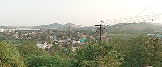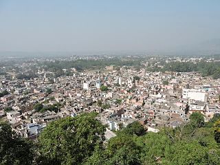
Yamunanagar, is a city and a municipal corporation in Yamunanagar district in the Indian state of Haryana. This town is known for the cluster of plywood units and paper factories. It provides timber to larger industries. The older town is called Jagadhri. The Yamunanagar-Jagadhri railway station (YJUD) services the city. Despite its name, Jagadhri Railway is situated in Yamunanagar. There is also another railway station called Jagadhri Workshop in Yamunanagar.

Sirsa district is the largest district by area in Haryana state, India. Sirsa is the district headquarters. It is located on National Highway 9 and 250 kilometres (160 mi) from the capital Delhi. On 1 September 1975, Sirsa became a district by taking Sirsa and Dabwali tahsils from Hisar District. There are a total of 342 villages in Sirsa district.

Thiruneermalai is a neighborhood in the city of Tambaram, situated within the Chennai Metropolitan Area, Tamil Nadu, India.

Nalagarh is a city and a municipal committee, near the city of Solan in Solan district in the Indian state of Himachal Pradesh. Nalagarh is a gateway to Himachal Pradesh in North India, 95.6 km (59.4 mi) from Shimla, 300 km (190 mi) from Delhi and 60 km (37 mi) from Chandigarh.

Sirsa is a city and a municipal council in Sirsa district in the westernmost region of the Indian state of Haryana, bordering Punjab and Rajasthan. It is located near to Thar desert ,250 kilometres north-west of New Delhi and 260 kilometers south-west of state capital Chandigarh. Sirsa's nearest cities include Hisar, Fatehabad, Ellenabad, Bhadra, Nohar, Mandi Dabwali and Hanumangarh. Its history dates back to the time of the Mahabharata. At one time, the Sarasvati River flowed in this area.

Ambala Cantonment is a cantonment town in Ambala district in the state of Haryana, India. It is 200 km north of Delhi and 55 km southwest of Chandigarh. This cantonment was established in the year 1843 and is an important centre for manufacturing of scientific and surgical instruments.

Assandh, historically known as Āsandīvat, is a town and a municipal committee in Karnal district in the state of Haryana, India. Assandh is located in 45 km south-west of Karnal.
Ellenabad, previously known as Kharial is a city with a municipal committee, near Sirsa City in the Sirsa district of the state of Haryana, India. It is located on the south bank of the Ghaggar River in the heart of Bagar tract areas of Punjab, Haryana and Rajasthan and serves as a port of entry into the state of Haryana from the Rajasthan side. Its location make it more strategic as not only it is located near Rajasthan border in Haryana but Punjab border is also near to it. Because of this the city has a kind off cosmopolitan culture of Punjabis particularly Malwayi culture, Rajasthani Marwadi culture, Deshwali Haryanvi culture and native Bagri culture and traditions or a mix of all of them or some of them. The Ellenabad city is divided into 17 wards for which elections are held every five years. As of 2011, the city had a population of 52,285, divided between two governing bodies: Ellenabad Municipal Committee with 44,452 persons and Ellenabad Rural Gram panchayat with 7,833. As of 2022, the city is estimated to have a population exceeding 60,000. There has been a rising demand to merge both administrative bodies into one and upgrade it to Municipal Council level. Ellenabad Municipal Committee has total administration over 8,387 houses to which it supplies basic amenities like water and sewerage. It is also authorize to build roads within Municipal Committee limits and impose taxes on properties coming under its jurisdiction.
Jakhal Mandi is a city and a municipal council, near Fatehabad town in Fatehabad district in the Indian state of Haryana.

Naraingarh is a town, municipal committee and assembly constituency in the Ambala district of the Indian state of Haryana, located on the border with the Indian state of Himachal Pradesh. Due to its geographical location, the Naraingarh plays an important role in local tourism, being located 39 km from Ambala, the district headquarter, 52 km of Chandigarh, the state capital, 144 km of Shimla, and 230 km of New Delhi.
Peerkankaranai is a neighborhood in the city of Tambaram, situated within the Chennai Metropolitan Area, Tamil Nadu, India.

Radaur is a town and municipal committee in Yamunanagar district in the Indian state of Haryana. It approx. 17 km from Yamunanagar, the district headquarters.
Shamsabad is a city and a municipal Corporation in Agra district in the Indian state of Uttar Pradesh.
Sirsa is a town and a nagar panchayat in Prayagraj district in the Indian state of Uttar Pradesh.
Banga is a town and Municipal council in the Shaheed Bhagat Singh Nagar district of Punjab, India. Banga is also one of the sub-division (tehsil) headquarters of the district. Banga is located on Phagwara-Rupnagar section of National Highway 344A. It is currently estimated to have a population of about 23,000 and is classified as a class 2 Municipality. The town also incorporates the former village of Jindowal apart from Banga town.
Rania is a town and a municipal committee in Sirsa district located on the upper bank of Ghaggar River in the Indian state of Haryana. Rania Town is a grain market in Sirsa district. Nearby cities to Rania includes Sirsa and Ellenabad. It shares its RTO office with Ellenabad which is also has its headquarters in Ellenabad. Earlier it was a part of Ellenabad subdivision but later carved out separately as a subdivision in Sirsa district of Haryana. It is at a distance of 22 km each from Sirsa and Ellenabad in opposite direction on Haryana State Highway 32A i.e. Bhambhoor-Jiwan Nagar Road which connects to Haryana State Highway 32 in Jiwan Nagar on one end and Haryana State Highway 23 in Bhambhoor on the other end.
Murthal, also known as Morthal Khas, is a village in Sonipat district of the Indian state of Haryana. It is located 6 kilometres (3.7 mi) north of Sonipat, 45 km (28 mi) from the national capital New Delhi, and 202 km (126 mi) southwest of Chandigarh, the state capital. It is famous for its parathas.
Khai Shergarh is a mid sized village located in the district of Sirsa in the state of Haryana in India. It is situated in the western part of district, around 8 km away from National Highway 09 and 28 km from district headquarter Sirsa. The location of Khai Shergarh is 29.678313°N 74.252679°E. Khai Shergarh has an average elevation of 186 metres. As per the report of census 2011 Khai Shergarh has a total population of 2734 including 1422 male and 1312 female residents. Sex Ratio of the village is 923 which is higher than the state average. Child Sex Ratio 905 is also higher than the state average. Literacy Ratio is 61.88 which is lower in comparison to the state average. The economy of the village is based on agriculture. Approximately 80% population of the village depends on agriculture and associated activities. The climate of the village is semi-arid. Majority of the peoples are Jat although schedule and backward casts also constituent considerable portion of village population.Dhaka is powerful jaat community and other, Karwa, Ghotia, Dhetarwal, Bana, Jakhar, Godara, Kashnia are the Jat clans. The temple of The Lord Siva, Krishna and Bala Ji is the centre of attraction for people which is situated in the northern side of the village. Two government schools and one private school fulfil the responsibility of imparting quality education to students in the village. The village is well connected by roads to the nearby villages and cities. Daily bus service is available for Sirsa, Rania, Kalanwali and other neighbour villages. Nearest railway stations are Baraguda, Kalanwali, Sirsa and Mandi Dabwali. Rahul Godara serving as current sarpanch
Kurali is a Village, Village Council in the Ambala district of the Indian state of Haryana, located 8 km South to Naraingarh.


