
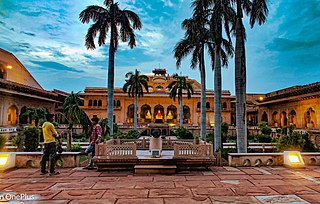
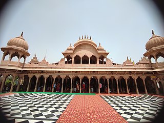
Agra is a city on the banks of the Yamuna river in the Indian state of Uttar Pradesh, about 230 kilometres (140 mi) south-east of the national capital Delhi and 330 km west of the state capital Lucknow. With a population of roughly 1.6 million, Agra is the fourth-most populous city in Uttar Pradesh and twenty-third most populous city in India.

Etawah, also known as Ishtikapuri, is a city on the banks of Yamuna River in the state of Western Uttar Pradesh in India. It is the administrative headquarters of Etawah District. Etawah's population of 256,838 makes it the 180th most populous city in India. The city lies 300 km (190 mi) southeast of the national capital New Delhi, 230 km (140 mi) northwest of the state capital Lucknow, 120 km east of Agra and 140 km west of Kanpur. The city was an important centre for the Indian Rebellion of 1857. It is also the sangam or confluence of the Yamuna and Chambal rivers. It is the 26th most populous city in Uttar Pradesh. There are six revenue divisions in Etawah district-Etawah, Bharthana, Jaswantnagar, Saifai, Chakarnagar and Takha.
Bharatpur is a city in the Indian state of Rajasthan, 180 km (110 mi) south of India's capital, New Delhi, 178 km (111 mi) from Rajasthan's capital Jaipur, 55 km (34 mi) west of Agra of Uttar Pradesh and 38 km (24 mi) from Mathura of Uttar Pradesh. It is the administrative headquarters of Bharatpur District and the headquarters of Bharatpur Division of Rajasthan State. Bharatpur is part of National Capital Region of India. The city was the capital of the Bharatpur State. It became a municipal corporation with 65 wards in 2014.

Firozabad is a city near Agra in Firozabad district in the state of Uttar Pradesh in India. It is the centre of India's glassmaking industry and is known for the quality of the bangles and glassware produced here.

Ballia is a city with a municipal board in the Indian state of Uttar Pradesh. The eastern boundary of the city lies at the junction of two major rivers, the Ganges and the Ghaghara. The city is situated 140 km (87 mi) east of Varanasi and about 380 km from the state capital Lucknow. It is home to a protected area, the Jai Prakash Narayan bird sanctuary. Ballia is around 4 km (2.5 mi) from Bihar.

Agra is one of the 75 districts in the northern Indian state of Uttar Pradesh. The district headquarters is the historical city of Agra. Agra district is a part of Agra division.

Etah district is one of the districts of Uttar Pradesh, India, since 1854. Etah City is the district headquarters. Etah district is a part of Aligarh Division.
Firozabad district is one of the western districts of the Indian state of Uttar Pradesh, which has Firozabad city as its district headquarters. Administratively, the district is a part of the Agra division.

Bhind District is a district in the Chambal division of the Indian state of Madhya Pradesh.
Jhajjar is a town in Jhajjar district in the Indian state of Haryana.It is a part of Delhi National Capital Region and situated on the road connecting Rewari to Rohtak (NH-352), Loharu to Meerut (NH334B), Charkhi Dadri to Delhi and Gurgaon to Bhiwani. Jhajjar is located 55 km (34 mi) west of Delhi.
Barsana is a historical town and nagar panchayat in the Mathura district of the state of Uttar Pradesh, India. The town holds cultural and religious significance as the birthplace of Hindu goddess Radha, the chief consort of Krishna. Barsana is situated in the Braj region. The main attraction of the town is the historical Radha Rani Temple which attracts huge number of devotees throughout the year.
Jagner is a small town and a nagar panchayat in Agra district in the Indian state of Uttar Pradesh. It is located in the southern part of Agra district and about 57 km from Agra city.
Kamalganj is a town and a nagar panchayat in Farrukhabad district in the Indian state of Uttar Pradesh. The town is one of the key contributors to Potato production in the district.
Kosi Kalan is a city & municipality of Mathura district in the Indian state of Uttar Pradesh. It is about 45 km from Mathura city and 100 km from New Delhi located in 27°47′N 77°26′E NH02 Delhi-Agra highway well connected with Mathura, Agra and Delhi with train and road. Khurd and Kalan Persian language word which means small and big respectively when two villages have same name then it is distinguished as Kalan means big and Khurd means small.
Nagram is a town in Lucknow district, Uttar Pradesh, India. It is located between the two roads from Lucknow to Sultanpur and Raebareli.It was founded and named after Nalgram Raja,a Pasi king.
Rajakhera is a city and a municipality situated near the banks of the Chambal River in Dholpur district in the Eastern part of the Indian state of Rajasthan. Its part of Braj region and the local language has Braj Bhasha dialect. The culture is fused with Rajasthan and its border states.

Tundla is a town and a municipal board in Firozabad district in the Indian state of Uttar Pradesh. It is an important railway junction between the Delhi-Kanpur main line and the Agra branch line. Tundla is a railway town that sprang up when the railway was built in the late 1800s. It is served by Tundla Junction railway station. As of 2011, Tundla has a population of 50,423 people, in 8,744 households.

Bateshwar is a village in Agra District, on the banks of the river Yamuna in the northern state of Uttar Pradesh, India. Bateshwar is in between Agra and Etawah and is 8 km from Bah. It is an important spiritual and cultural centre for Hindus and Jains. It is known for the 101 Shiv Temple Complex. An annual religious and animal fair is also organised in the village ground area.
Jagatpura Ahir is a village in Jalaun Tehsil of Jalaun District of Uttar Pradesh in India.
Bhadauria also referred as Bhadoria, Bhadouria, Bhadauriya, Bhadoriya or Bhaduria are a Kshatriya Rajput clan belonging to the Chauhans of Shakambhari and Ajmer. They were historically mainly concentrated in the ethno-linguistic and geographical regions of the modern day Braj and the Chambal river valley, in what are now the districts of Agra, Etawah, Bhind and Dholpur, in the states of Uttar Pradesh, Madhya Pradesh, and Rajasthan.
