Auras is a town and nagar panchayat in Hasanganj tehsil of Unnao district, Uttar Pradesh, India. First officially classified as a town for the 1981 census, Auras is located just north of the Sai River, on the road from Unnao to Sandila. Other roads branch off to Mohan, Newalganj, and Malihabad.

Etah district is one of the districts of Uttar Pradesh, India, since 1854. Etah City is the district headquarters. Etah district is a part of Aligarh Division.
Achhnera, is a town and a municipal board in Agra district in the Indian state of Uttar Pradesh.

Ganj Muradabad is a town and nagar panchayat in Safipur tehsil of Unnao district, Uttar Pradesh, India. It also serves as the headquarters of a community development block containing 86 rural villages. Handicrafts are a major industry here. As of 2011, Ganj Moradabad has a population of 10,957, in 1,723 households.
Kiraoli is a town and a nagar panchayat in Agra district in the Indian state of Uttar Pradesh.

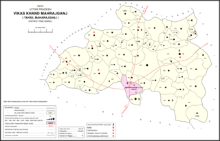
Maharajganj is a town and nagar panchayat in Rae Bareli district, Uttar Pradesh, India. It serves as the headquarters of a tehsil. As of 2011, its population is 6,673, in 1,037 households.
Parsadepur, also spelled Parshadepur, is a town and a nagar panchayat in Rae Bareli district in the Indian state of Uttar Pradesh. It is located on the north bank of the Sai river, at the crossroads between the road from Salon to Jais and the smaller road from Raebareli to Ateha. Historically noted for its large weaving industry, Parsadepur served as the headquarters of a pargana since the late 18th century. As of 2011, its population is 11,853 people, in 1,738 households.
Tundla is a town and a municipal board in Firozabad district in the Indian state of Uttar Pradesh.
Hyderabad is a town and nagar panchayat in Hasanganj tehsil of Unnao District, Uttar Pradesh, India. It is located on the main Unnao-Sandila road, near its intersection with the road connecting Lucknow and Bangarmau. Major commodities produced in Hyderabad include roasted rice, food products, and earthenware pottery. As of 2011, its population is 7,697 people, in 1,328 households.

Nawabganj is a town and nagar panchayat in Hasanganj tehsil of Unnao district, Uttar Pradesh, India. It is located northeast of Unnao on the Lucknow-Kanpur road, near the Ajgain railway station. Founded in 1842 and first officially classified as a town for the 1981 census, Nawabganj once served as the seat of a tehsil under the Nawabs of Awadh and is today the headquarters of a community development block containing 124 villages.
Chhoti Ballabh is a village situated in the Gonda block of Iglas tehsil in Aligarh district, Uttar Pradesh, India.
Gopalpur Khadana is a village in Baraut tehsil, Baghpat district, Uttar Pradesh, India. The village is administrated by a Sarpanch who is an elected representative.
Doora is a village in the Mysore Taluka of Mysore district, Karnataka state, India with a total population of 4,273 as of 2011.
Dhanghata is a small village located in Bansi Tehsil of Siddharth Nagar district, Uttar Pradesh state of India. It belongs to the Basti division. It is located 40 km west of District headquarters Naugarh and 225 km from State capital Lucknow. It is located on west side of the state highway between Basti and Lumbini.

Saifai is a large village and university town in the Etawah district of Indian state of Uttar Pradesh. It is also a sub-division (Tehsil) and Block of the Etawah district. It is the birthplace of Mulayam Singh Yadav, the founding president of Samajwadi Party, former Minister of Defence, India and former Chief Minister of Uttar Pradesh.
Sahara is a village in Bichpuri Block in Agra District of Uttar Pradesh State, India. It belongs to Agra Division. It is located 13 km towards west from District headquarters Agra. 3 km from Bichpuri. 356 km from State capital Lucknow
Sarsai Nawar is a large village in the Etawah district of Uttar Pradesh, India. It is 329 kilometres (204 mi) south of the national capital New Delhi.

Sarojaninagar, also spelled Sarojini Nagar, is a community development block in Lucknow district, Uttar Pradesh, India. It is part of the tehsil of Lucknow and it includes 90 villages. As of 2011, its population was 224,045, in 40,923 households.

Sikandarpur Sarausi is a community development block in Unnao tehsil of Unnao district, Uttar Pradesh, India. It consists of 96 rural villages, with a total population of 185,779 people.

Deenshah Gaura is a community development block in Dalmau tehsil of Raebareli district, Uttar Pradesh, India. It consists of 71 rural villages, with a total population of 104,149 people. The headquarters are located in the village of Gaura Hardo.


