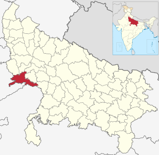
Agra district is one of the 75 Districts of Uttar Pradesh, India. The district headquarters is the historical city of Agra. Agra district is a part of Agra division.

Etah district is one of the districts of Uttar Pradesh, India, since 1854. Etah town is the district headquarters. Etah district is a part of Aligarh Division. Etah district is a part of Aligarh Division.

Achhnera, is a town and a municipal board in Agra district in the Indian state of Uttar Pradesh.
Bah is a city in Agra district of Uttar Pradesh in India.
Bahjoi is a Nagar Palika Parishad city in Sambhal district and division Moradabad, Uttar Pradesh, India. Bahjoi is a headquarter of Sambhal district. Pin code of Bahjoi is 244410. .In the past years of its life it was famous for the glass factory during the british colonisation.

Harchandpur is a village and corresponding community development block in Raebareli district, Uttar Pradesh, India. It is located on the Baiti river, which is a tributary of the Sai, and it is northeast from the district headquarters on the road to Lucknow. Particularly since the coming of the railway in the 1800s, Harchandpur serves as one of the main commercial centres for the surrounding region; it is also a major exporter of local goods. As of 2011, its population is 4,348 people, in 833 households.
Rudhmuli is a village in Bah Tehsil of Agra District of Uttar Pradesh in India.
Osa is a village in Allahabad, Uttar Pradesh, India. It is in the district of PrayagRaj and comes under the tehsil Karchhana. According to Census 2011 information the location code or village code of Osa village is 162063. Its PIN code is 212301. Osa village is located in Bara Vidhan Sabha of Allahabad district in Uttar Pradesh, India. It is situated 20km away from sub-district headquarter Bara and 40km away from district headquarter Allahabad. As per 2019 stats, Osa village is also a gram panchayat.
Daulatabad is a panchayat village in Kiraoli Tehsil of Agra district. This village is dominated by Sisodia rajputs. This village is surrounded by three towns viz Kiraoli, Acchhnera and Fatehpur Sikri. Administratively it is a Village Panchayat (Code: 39048) under Fatehpur Sikri, and includes three villages satha, Daulatabad and Naya Bass. It is 30 km from Agra and 25 km from Bharatpur.

Ashapur is a village in Pindra Tehsil of Varanasi district in the Indian state of Uttar Pradesh. Ashapur falls under Bagwanpur gram panchayat. The village is about 17 kilometres North of Varanasi district and 298 kilometres south-east of state capital Lucknow.
Ahamadpur is a village in located in Mant Tehsil of Mathura district, Uttar Pradesh, India. The village belongs to Agra Division.
Jarar is a village in Bah Tehsil in Agra District, Uttar Pradesh, India. It belongs to Agra Division. It is located 70 km towards the east from district headquarters Agra. 2 km from Bah. 276 km from state capital Lucknow. Hindi is the predominant language spoken.
Sahara is a village in Bichpuri Block in Agra District of Uttar Pradesh State, India. It belongs to Agra Division. It is located 13 km towards west from District headquarters Agra. 3 km from Bichpuri. 356 km from State capital Lucknow
Padera, also spelled Pandera, is a village in Harchandpur block of Raebareli district, Uttar Pradesh, India. As of 2011, its population is 3,034, in 564 households. It has one primary school and no healthcare facilities.
Joga Musahib is a village located in the Karail area of the Mohammadabad tehsil in Ghazipur district, Uttar Pradesh, India. It was founded more than 570 years ago, and at the 2011 census the village has a population of 3,612. Its local administration follows the Panchayati raj system, with a Pradhan as its head.

Saifai railway station, also spelled as Saiphai railway station is a small railway station in Saifai, Uttar Pradesh. Its code is SIPI. It serves Saifai village. The station consists of only one platform. The platform is not well sheltered. It lacks many facilities including water and sanitation. It is located on newly built Mainpuri-Etawah railway track.
Kamla Nagar is a locality in Agra City in Uttar Pradesh, India. It has PIN Code 282004, and is an approved colony. The current mayor of Agra(Naveen Jain), also resides in Kamla Nagar. Kamla Nagar is divided into 6 blocks namely A,B,C,D,E and F. Blocks A,B,C comprise Agra municipal corporation ward 81, and blocks D,E,F comprise ward 93. Kamla Nagar is one of the localities in Agra with PNG, or piped natural gas availability, which is provided by Green Gas Limited.
Chamrauli Village in Sumerpur Block in Unnao District of Uttar Pradesh State, India. It comes under Nikha Mau Panchayath. It belongs to Lucknow Division. It is located 51 km towards South from District headquarters Unnao. 82 km from Lucknow. The postal code is 209801
Chamrauli is a Village in Fatehabad Block in Agra District of Uttar Pradesh State, India. It belongs to Agra Division. It is located 33 KM towards South from District head quarters Agra. 12 KM from Fatehabad. 319 KM from State capital Lucknow
Chamrauli is a village in Barauli Ahir block of Agra District in Uttar Pradesh. The block headquarter Barauli Ahir is located at distance of 1.6 km. Agra is at a distance of 8 km from village.
