
Fatehpur Sikri is a town in the Agra District of Uttar Pradesh, India. The city itself was founded as the capital of Mughal Empire in 1571 by Emperor Akbar, serving this role from 1571 to 1585, when Akbar abandoned it due to a campaign in Punjab and was later completely abandoned in 1610.
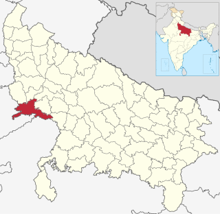
Agra district is one of the 75 Districts of Uttar Pradesh, India. The district headquarters is the historical city of Agra. Agra district is a part of Agra division.

Fatehpur Chaurasi is a town and a nagar panchayat in Unnao district in the state of Uttar Pradesh, India. First officially classified as a town for the 1981 census, Fatehpur Chaurasi is located on the north bank of the Kalyani river, a bit to the south of the main road from Unnao to Bangarmau. Local industries include the production of furniture, boxes, almirahs, shoes, and slippers. As of 2011, the town's population is 6,715, in 1,158 households.

Kiraoli is a town and a nagar panchayat in Agra district in the Indian state of Uttar Pradesh.

The Culture of Uttar Pradesh is an Indian Culture which has its roots in the Hindi and Urdu literature, music, fine arts, drama and cinema. Lucknow, the capital of Uttar Pradesh, has several beautiful historical monuments such as Bara Imambara and Chhota Imambara. It has also preserved the damaged complex of the Oudh-period British Resident's quarters, which are being restored.
Situated in the northern part of India, bordering with the capital of India New Delhi, Uttar Pradesh is one of the most popular and an established tourist destination for both Indians and non-Indians alike in India. The most populous state of India, Uttar Pradesh contains many historical monuments and places of religious significance. Geographically, Uttar Pradesh is very diverse, with Himalayan foothills in the extreme north and the Gangetic Plain in the centre. It is also home of India's most visited sites, the Taj Mahal, and Hinduism's holiest city, Varanasi. Kumbh city, Allahabad. Kathak, one of the eight forms of Indian classical dances, originated from Uttar Pradesh. Uttar Pradesh is at the heart of India, hence it is also known as The Heartland of India. Cuisine of Uttar Pradesh like Awadhi cuisine, Mughlai cuisine, Kumauni cuisine are very famous not only in India but also many places abroad and pratapgarh is also famous for Rajputana
Fatehpur Sikri Lok Sabha constituency is one of the 80 Lok Sabha (parliamentary) constituencies in the Indian state of Uttar Pradesh. This constituency in Agra district came into existence in 2008 as a part of the implementation of delimitation of parliamentary constituencies based on the recommendations of the Delimitation Commission of India constituted in 2002.
Fatehpur, Fatepur, or Phattepur may refer to any of a number of places:

The architecture of Uttar Pradesh demonstrates a diverse and eclectic combination of Buddhist, Hindu, Indo-Islamic and Indo-European architectural styles. Two of its architectural monuments—the Taj Mahal, the Agra Fort as well as the township of Fatehpur Sikri founded by the famous Mughal Emperor Akbar are designated UNESCO World Heritage Sites. The architectural structures in Uttar Pradesh include Buddhist Stupas and Viharas, ancient monasteries, townships, forts, palaces, temples, mosques, mausoleums, memorials and other community structures.
Agra Rural Assembly constituency is one of the 403 constituencies of the Uttar Pradesh Legislative Assembly, India. It is a part of the Agra district and one of the five assembly constituencies in the Fatehpur Sikri. First assembly election in this assembly constituency was conducted in 2012 after the constituency came into existence in the year 2008 as a result of the "Delimitation of Parliamentary and Assembly Constituencies Order, 2008".
Fatehpur Sikri Assembly constituency is one of the 403 constituencies of the Uttar Pradesh Legislative Assembly, India. It is a part of the Agra district and one of the five assembly constituencies in the Fatehpur Sikri. First election in this assembly constituency was held in 1957 after the "DPACO (1956)" was passed in 1956. After the "Delimitation of Parliamentary and Assembly Constituencies Order" was passed in 2008, the constituency was assigned identification number 91.
Kheragarh Assembly constituency is one of the 403 constituencies of the Uttar Pradesh Legislative Assembly, India. It is a part of the Agra district and one of the five assembly constituencies in the Fatehpur Sikri. First election in this assembly constituency was held in 1952 after the "DPACO (1951)" was passed in 1951. After the "Delimitation of Parliamentary and Assembly Constituencies Order" was passed in 2008, the constituency was assigned identification number 92.
Fatehabad Assembly constituency is one of the 403 constituencies of the Uttar Pradesh Legislative Assembly, India. It is a part of the Agra district and one of the five assembly constituencies in the Fatehpur Sikri. First election in this assembly constituency was held in 1957 after the "DPACO (1956)" was passed in 1956. After the "Delimitation of Parliamentary and Assembly Constituencies Order" was passed in 2008, the constituency was assigned identification number 93.
Haldighati Passenger is a passenger train of Indian Railways, which runs between Agra Fort railway station of Agra of Indian state Uttar Pradesh and Ratlam Junction railway station of Ratlam, Madhya Pradesh covering whole Haldighati region.
Sahara is a village in Bichpuri Block in Agra District of Uttar Pradesh State, India. It belongs to Agra Division. It is located 13 km towards west from District headquarters Agra. 3 km from Bichpuri. 356 km from State capital Lucknow
Barara is a village located in Agra district, Uttar Pradesh, in India. In 2001, the population was 10,217 people with 5,507 males and 4,710 females.

Chaudhary Babulal is an Indian Bharatiya Janata Party politician. He was the Member of Parliament (MP) for the Fatehpur Sikri constituency of 16th Lok Sabha. He is one of the most prominent Jat leaders of western Uttar Pradesh for more than three decades.
Barauli Ahir is a village in Fatehpur Sikri vidhan sabha dominated by yadav community. This village was Barauli Brahman 300 years earlier, during dusk of Mughal Empire, they won a challenge, and as a reward they burrowed a battalion of territorial Army and use it to avenge discrimination and tortures by Brahmin of low thinking of that time as they always treated them as low caste, so the villagers along with the battalion swiped the whole village as a part of an movement and settled there and named it as Barauli Ahir. Now living with Harmony.
Chaudhary Udaybhan Singh is an Indian politician and a member of 12th and 17th Legislative Assembly of Uttar Pradesh of India. He represents the Fatehpur Sikri in Agra district of Uttar Pradesh and is a member of the Bharatiya Janata Party. Currently he is serving as Minister of State for Khadi and Villages Industries, Sericulture Industries, Textile, Micro, Small and Medium Enterprise, Export Promotion in Government of Uttar Pradesh.