Arazi Tari

Last updated

Arazi Tari
Village
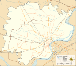
Varanasi district location map.svg
Red pog.svg
Arazi Tari
Village location on Varanasi district map
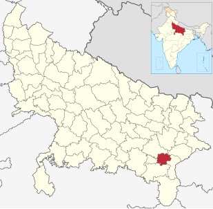
India Uttar Pradesh location map.svg
Red pog.svg
Arazi Tari
Arazi Tari (Uttar Pradesh)
India location map.svg
Red pog.svg
Arazi Tari
Arazi Tari (India)
Coordinates: 25°27′34″N82°45′06″E / 25.459530°N 82.751571°E / 25.459530; 82.751571 Coordinates: 25°27′34″N82°45′06″E / 25.459530°N 82.751571°E / 25.459530; 82.751571
CountryFlag of India.svg  India
State Uttar Pradesh
District Varanasi district
Tehsil Pindra
Elevation
82.037 m (269.150 ft)
Population
 (2011)
  Total78
Languages
  Official Hindi
Time zone UTC+5:30 (IST)
Postal code
221206
Telephone code +91-542
Vehicle registration UP65 XXXX
Village code208462
Lok Sabha constituency Varanasi
Vidhan Sabha constituency Pindra

Arazi Tari is a village in Pindra Tehsil of Varanasi district in the Indian state of Uttar Pradesh. Arazi Tari falls under Sarvipur gram panchayat. The village is about 40 kilometers North-West of Varanasi city, 274 kilometers South-East of state capital Lucknow and 789 kilometers South-East of the national capital Delhi. [1] [2] [3] [4] [5] [6]

Varanasi district District of Uttar Pradesh in India

Varanasi is a district in the north Indian state of Uttar Pradesh with Varanasi city as the district headquarters.It is also called as kashi, according to Hindu mythology it is one of the sacred places pilgrimage for Hindus as well as Buddhists. It is believed that Lord Shiva along with Parvathi as Vishwanatha and Vishalaakshi reside there to bless devotees. It is surrounded by Mirzapur district, Jaunpur district, Ghazipur district and Chandauli district. The Ganga (Ganges) river flows through the district. It is considered by Hindus to be a sacred and pure river, having the ability to wash away sins when people take a dip in it. Part of the Varanasi division, the district occupies an area of 1,535 square kilometres (593 sq mi) and as of the 2011 Census of India had a population of 3,682,194.

India Country in South Asia

India is a country in South Asia. It is the seventh-largest country by area, the second-most populous country, and the most populous democracy in the world. Bounded by the Indian Ocean on the south, the Arabian Sea on the southwest, and the Bay of Bengal on the southeast, it shares land borders with Pakistan to the west; China, Nepal, and Bhutan to the north; and Bangladesh and Myanmar to the east. In the Indian Ocean, India is in the vicinity of Sri Lanka and the Maldives; its Andaman and Nicobar Islands share a maritime border with Thailand and Indonesia.

States and union territories of India Indian national administrative subdivisions

India is a federal union comprising 29 states and 7 union territories, for a total of 36 entities. The states and union territories are further subdivided into districts and smaller administrative divisions.

Contents

Demography

Arazi Tari has a total population of 78 people amongst 9 families. Sex ratio of Arazi Tari is 696 and child sex ratio is 444. Uttar Pradesh state average for both ratios is 912 and 902 respectively [note] . [5]

Human sex ratio Ratio of males to females in a population

In anthropology and demography, the human sex ratio is the ratio of males to females in a population. More data are available for humans than for any other species, and the human sex ratio is more studied than that of any other species, but interpreting these statistics can be difficult.

In India, the child sex ratio is defined as the number of females per thousand males in the age group 0–6 years in a human population. Thus it is equal to 1000 x the reciprocal of the sex ratio in the same age group, i.e. under age seven. An imbalance in this age group will extend to older age groups in future years. Currently, the ratio of males to females is generally significantly greater than 1, i.e. there are more boys than girls.

Uttar Pradesh State in India

Uttar Pradesh is a state in northern India. With roughly 200 million inhabitants, it is the most populous state in India as well as the most populous country subdivision in the world. It was created on 1 April 1937 as the United Provinces of Agra and Oudh during British rule, and was renamed Uttar Pradesh in 1950. The state is divided into 18 divisions and 75 districts with the capital being Lucknow. The main ethnic group is the Hindavi people, forming the demographic plurality. On 9 November 2000, a new state, Uttarakhand, was carved out from the state's Himalayan hill region. The two major rivers of the state, the Ganga and Yamuna, join at Allahabad (Prayagraj) and then flow as the Ganga further east. Hindi is the most widely spoken language and is also the official language of the state.

DetailsMaleFemaleTotalComments
Number of houses--9(census 2011) [5]
Adult372865
Children (0–6 years)9413
Total population463278
Literacy81.08%78.57%80.00%

Transportation

Arazi Tari can be accessed by road and does not have a railway station of its own. Closest railway station to this village is Babatpur railway station (18.5 kilometers East). Nearest operational airports are Varanasi airport (18 kilometers East) and Allahabad Airports (127 kilometers West). [7] [8]

Train station Railway facility where trains regularly stop to load or unload passengers and/or freight

A train station, railway station, railroad station, or depot is a railway facility or area where trains regularly stop to load or unload passengers or freight. It generally consists of at least one track-side platform and a station building (depot) providing such ancillary services as ticket sales and waiting rooms. If a station is on a single-track line, it often has a passing loop to facilitate traffic movements. The smallest stations are most often referred to as "stops" or, in some parts of the world, as "halts".

Lal Bahadur Shastri Airport Airport located in Varanasi, Uttar Pradesh, India

Lal Bahadur Shastri Airport is a public airport located at Babatpur, 26 km (16 mi) northwest of Varanasi, Uttar Pradesh, India. Formerly known as Varanasi Airport, it was officially renamed after Lal Bahadur Shastri, the 2nd Prime Minister of India, in October 2005. It is India's 21st-busiest airport in terms of passenger movement and second-busiest airport in Uttar Pradesh.

Allahabad Airport Airport in Uttar Pradesh, India

Allahabad Airport, officially known as Prayagraj Airport, is a military airbase and public airport serving the city of Allahabad, in the state of Uttar Pradesh, India. It is located in Bamrauli at a distance of 12 km (7.5 mi) from Allahabad city and is operational for domestic flights. It is one of the oldest airports in India. The airport operation is jointly under the supervision of Indian Air Force and Airports Authority of India.

See also

Pindra is one of the 403 constituencies of the Uttar Pradesh Legislative Assembly, India. It is a part of the Varanasi district and one of the five assembly constituencies in the Machhlishahr. Pindra Assembly constituency came into existence in 2008 as a result of the "Delimitation of Parliamentary and Assembly Constituencies Order, 2008".

Notes

2011 Census of India 15th Indian Census

The 15th Indian Census was conducted in two phases, house listing and population enumeration. House listing phase began on 1 April 2010 and involved collection of information about all buildings. Information for National Population Register(NPR)was also collected in the first phase, which will be used to issue a 12-digit unique identification number to all registered Indian residents by Unique Identification Authority of India (UIDAI). The second population enumeration phase was conducted between 9 and 28 February 2011. Census has been conducted in India since 1872 and 2011 marks the first time biometric information was collected. According to the provisional reports released on 31 March 2011, the Indian population increased to 1.21 billion with a decadal growth of 17.70%. Adult literacy rate increased to 74.04% with a decadal growth of 9.21%. The motto of the census was 'Our Census, Our future'.

Related Research Articles

Ahiran, Pindra Village in Uttar Pradesh, India

Ahiran is a village in Pindra Tehsil of Varanasi district in the Indian state of Uttar Pradesh. Ahiran falls under Nathaiya Pur gram panchayat. The village is about 10.6 kilometers North-West of Varanasi city, 282 kilometers South-East of state capital Lucknow and 805 kilometers South-East of the national capital Delhi.

Ahirani, Pindra Village in Uttar Pradesh, India

Ahirani is a village in Pindra Tehsil of Varanasi district in the Indian state of Uttar Pradesh. Ahirani falls under Nathaiya Pur gram panchayat. The village is about 31.0 kilometers North-West of Varanasi city, 272 kilometers South-East of state capital Lucknow and 794 kilometers South-East of the national capital Delhi.

Ajaipur Village in Uttar Pradesh, India

Ajaipur is a village in Pindra Tehsil of Varanasi district in the Indian state of Uttar Pradesh. Ajaipur has its own gram panchayat by the same name as the village. The village is about 31.0 kilometers North-West of Varanasi city, 263 kilometers South-East of state capital Lucknow and 800 kilometers South-East of the national capital Delhi.

Akorha Village in Uttar Pradesh, India

Akorha is a village in Pindra Tehsil of Varanasi district in the Indian state of Uttar Pradesh. Akorha comes under the Akodha gram panchayat. The village is about 31.0 kilometers North-West of Varanasi city, 305 kilometers South-East of state capital Lucknow and 780 kilometers South-East of the national capital Delhi.

Amawar Village in Uttar Pradesh, India

Amawar is a village in Pindra Tehsil of Varanasi district in the Indian state of Uttar Pradesh. Amawar falls under Mohanpur gram panchayat. The village is about 15 kilometers North-West of Varanasi city, 277 kilometers South-East of state capital Lucknow and 802 kilometers South-East of the national capital Delhi.

Amilo, Varanasi Village in Uttar Pradesh, India

Amilo is a village in Pindra Tehsil of Varanasi district in the Indian state of Uttar Pradesh. Amilo falls under Dhananjaypur gram panchayat. The village is about 37 kilometers North-West of Varanasi city, 279 kilometers South-East of state capital Lucknow and 786 kilometers South-East of the national capital Delhi.

Aneai Village in Uttar Pradesh, India

Anei is a village in Pindra Tehsil of Varanasi district in the Indian state of Uttar Pradesh. Aneai has its own gram panchayat by the same name as the village. The village is about 38 kilometers South-East of Varanasi city, 276 kilometers South-East of state capital Lucknow and 787 kilometers South-East of the national capital Delhi.

Anura, Varanasi Village in Uttar Pradesh, India

Anura is a village in Pindra Tehsil of Varanasi district in the Indian state of Uttar Pradesh. Anura is within the Karoma gram panchayat. The village is about 18.5 kilometers North-West of Varanasi city, 321 kilometers South-East of state capital Lucknow and 797 kilometers South-East of the national capital Delhi.

Araji Hasanpur Village in Uttar Pradesh, India

Araji Hasanpur is a village in Pindra Tehsil of Varanasi district in the Indian state of Uttar Pradesh. Araji Hasanpur falls under Madhomakhiya gram panchayat. The village is about 34.5 kilometers North-West of Varanasi city, 308 kilometers South-East of state capital Lucknow and 784 kilometers South-East of the national capital Delhi.

Aswalpur Village in Uttar Pradesh, India

Aswalpur is a village in Pindra Tehsil of Varanasi district in the Indian state of Uttar Pradesh. Aswalpur has its own gram panchayat by the same name as the village. The village is about 30 kilometers North-West of Varanasi city, 264 kilometers South-East of state capital Lucknow and 798 kilometers South-East of the national capital Delhi.

Auraon Village in Uttar Pradesh, India

Auraon is a village in Pindra Tehsil of Varanasi district in the Indian state of Uttar Pradesh. Auraon has its own gram panchayat by the same name as the village. The village is about 30 kilometers North-West of Varanasi city, 308 kilometers South-East of state capital Lucknow and 800 kilometers South-East of the national capital Delhi.

Murdi, Pindra Village in Uttar Pradesh, India

Murdi is a village in Pindra Tehsil of Varanasi district in the Indian state of Uttar Pradesh. Murdi has its own gram panchayat by the same name as the village. The village is about 23 kilometers North-West of Varanasi city, 314 kilometers South-East of state capital Lucknow and 809 kilometers South-East of the national capital Delhi.

Gang Khurd Village in Uttar Pradesh, India

Gaag Khurd is a village in Pindra Tehsil of Varanasi district in the Indian state of Uttar Pradesh. Only one shia Muslim Village between Varanasi and Jaunpur District. The village comes under Gangkala gram panchayat. The village is about 27 kilometers North-West of Varanasi city, 266 kilometers South-East of state capital Lucknow and 791 kilometers South-East of the national capital Delhi.

Ausanpur Village in Uttar Pradesh, India

Ausan is a village in Pindra Tehsil of Varanasi district in the Indian state of Uttar Pradesh. The village has gram panchayat by the same name as the village. The village is about 16 kilometers North-West of Varanasi city, 320 kilometers South-East of state capital Lucknow and 796 kilometers South-East of the national capital Delhi.

Azoarepur Village in Uttar Pradesh, India

Azoarepur is a village in Pindra Tehsil of Varanasi district in the Indian state of Uttar Pradesh. The village falls under the Sarvipur gram panchayat. The village is about 39 kilometers northwest of Varanasi city, 284 kilometers southeast of the state capital Lucknow, and 789 kilometers southeast of the national capital Delhi.

Babatpur Village in Uttar Pradesh, India

Babatpur is a village in Pindra Tehsil of Varanasi district in the Indian state of Uttar Pradesh. The village falls under gram panchayat by the same name as the village. The village also houses Lal Bahadur Shastri Airport which serves Varanasi district. The village is about 26 kilometers North-West of Varanasi city, 260 kilometers South-East of state capital Lucknow and 797 kilometers South-East of the national capital Delhi.

Basni Village in Uttar Pradesh, India

Basni is a village in Pindra Tehsil of Varanasi district in the Indian state of Uttar Pradesh. The village falls under gram panchayat by the same name as the village. The village is about 26 kilometers North-West of Varanasi city, 262 kilometers South-East of state capital Lucknow and 794 kilometers South-East of the national capital Delhi.

Bachaura Village in Uttar Pradesh, India

Bachaura is a village in Pindra Tehsil of Varanasi district in the Indian state of Uttar Pradesh. The village falls under gram panchayat by the same name as the village. The village is about 34 kilometers North-West of Varanasi city, 273 kilometers South-East of state capital Lucknow and 794 kilometers South-East of the national capital Delhi.

Baghaita Village in Uttar Pradesh, India

Baghaita is a village in Pindra Tehsil of Varanasi district in the Indian state of Uttar Pradesh. The village falls under Nihalapur gram panchayat. The village is about 20 kilometers North-West of Varanasi city, 266 kilometers South-East of state capital Lucknow and 804 kilometers South-East of the national capital Delhi.

Baharipur Village in Uttar Pradesh, India

Baharipur is a village in Pindra Tehsil of Varanasi district in the Indian state of Uttar Pradesh. The village falls under the Aharak gram panchayat. The village is about 20 kilometers North-West of Varanasi city, 291 kilometers South-East of state capital Lucknow and 805 kilometers South-East of the national capital Delhi.
References

  1. "Village coordinates". latlong.net. Retrieved 9 March 2015.
  2. "Elevation". daftlogic.com. Retrieved 9 March 2015.
  3. "Delimitation of Parliamentary and Assembly Constituencies Order, 2008" (PDF). Election Commission of India official website. Retrieved 9 March 2015.
  4. "Village code & Tehsil". Local Government directory. Retrieved 9 March 2015.
  5. 1 2 3 "Demography". 2011 census. Retrieved 9 March 2015.
  6. "PIN & STD Code". One Five Nine. Retrieved 9 March 2015.
  7. "Rail information". indiarailinfo.com. Retrieved 9 March 2015.
  8. "Location". Google Maps. Retrieved 9 March 2015.