The Arctic Archipelago, also known as the Canadian Arctic Archipelago, is a group of islands north of the Canadian mainland.

The Moluccan Sea is located in the western Pacific Ocean, around the vicinity of Indonesia, specifically bordered by the Indonesian Islands of Celebes (Sulawesi) to the west, Halmahera to the east, and the Sula Islands to the south. The Molucca Sea has a total surface area of 77,000 square miles. The Molucca Sea is rich in coral and has many diving sites due to the deepness of its waters. The deepness of the water explains the reasoning behind dividing the sea into three zones, which functions to transport water from the Pacific Ocean to the shallower seas surrounding it. The deepest hollow in the Molucca Sea is the 15,780-foot (4,810-meter) Batjan basin. This region is known for its periodic experiences of earthquakes, which stems from the sea itself being a micro plate, in which the Molucca Sea is being subducted in two opposite directions: one in the direction of the Eurasian Plate to the west and the other in the direction of the Philippines Sea Plate to the east.
Lumsden was a provincial electoral division for the Legislative Assembly of the province of Saskatchewan, Canada. The district was one of 25 created before the 1st Saskatchewan general election in 1905. It was the riding of Premier Thomas Walter Scott.
Geesbrug is a village in the Netherlands and it is part of the Coevorden municipality in Drenthe. Geesbrug had a population of 720 in 2004. Its altitude is 14 meters (49 feet).
Langerak is a village in the Netherlands and it is part of the Coevorden municipality in Drenthe. Langerak has an altitude of 14 meters (49 feet).
Makavarapalem is a village in Visakhapatnam district in the state of Andhra Pradesh in India.
Kairana Lok Sabha constituency is one of the 80 Lok Sabha (parliamentary) constituencies in Uttar Pradesh state in northern India.
Bəşirli is a village in the municipality of Hacırəhmədli in the Goranboy Rayon of Azerbaijan.
Andipatti is a constituency in the Tamil Nadu legislative assembly, that includes the city, Andipatti. It is part of the Periyakulam.
Mustur is a village in the southern state of Karnataka, India. It is located in the Gangawati taluk of Koppal district in Karnataka.
Edapadi is a state assembly constituency in Salem district, Tamil Nadu, India. It comprises Edappadi taluk and a portion of Mettur taluk. It is a part of the wider Salem constituency for national elections to the Parliament of India. Elections were not held in 1957 and 1962.
Hosur is a state assembly constituency in Krishnagiri district in Tamil Nadu, India. It consists of a portion of Hosur taluk. It forms a part of Krishnagiri Lok Sabha constituency for national elections to the Parliament of India.
Oddanchatram is a state assembly constituency in Dindigul district in Tamil Nadu, India.
Kamargaon is a village on the Pune to Ahmednagar State Highway in India. There is a windmill farm 20 km outside town. The village deity is Kamaksha Devi. Pincode of Kamargaon is 414005
Sardhana is a village in Medak district in state of Telangana, India.
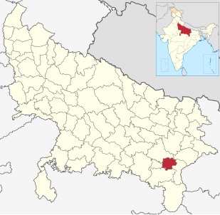
Kuri is a village in Mirzapur, Uttar Pradesh, India.
Jamalia is a village in Jaunpur, Uttar Pradesh, India.

Čibukovac is a village in the municipality of Kraljevo, western-central Serbia. According to the 2002 census, the village has a population of 1114 people.

Badarpur Border is an elevated station on the Violet Line of the Delhi Metro. It is located after Tughlakabad station and was the terminal station of the Violet Line till September 5, 2015.
Patharwadi is a village in Parner taluka in Ahmednagar district of state of Maharashtra, India.


