Faizabad district

Last updated

Faizabad district
Ayodhya district
Ayodhya Diwali 2021 09.jpg
Maqbara with palm trees.JPG
Gulabbari.JPG
Amsin bazar.jpg
Saryu.JPG
Clockwise from top-left: Diwali at Ram ki Paidi, Bahu Begum ka Maqbara, Amsin Bazar, Saryu river near Ayodhya, Gulab Bari
India Uttar Pradesh districts 2012 Faizabad.svg
Location of Faizabad district in Uttar Pradesh
CountryFlag of India.svg  India
State Uttar Pradesh
Division Faizabad
Headquarters Ayodhya
Tehsils 5
Government
   Lok Sabha constituencies
  1. Faizabad (Lok Sabha constituency) - Ayodhya, Bikapur, Milkipur, Rudauli
  2. Ambedkar Nagar (Lok Sabha constituency) - Goshainganj
   Vidhan Sabha constituencies
Area
[1]
  Total2,522 km2 (974 sq mi)
Population
 (2011) [2] [1]
  Total2,470,996
  Density980/km2 (2,500/sq mi)
   Urban
689,354
Demographics
   Literacy 69.57%
  Sex ratio961
Time zone UTC+05:30 (IST)
Vehicle registration UP-42
Major highways NH 27, NH 330, National Highway 330A (India), SH 30
Website ayodhya.nic.in

Faizabad district, officially Ayodhya district, is an administrative district of the Indian state of Uttar Pradesh. The city of Ayodhya is its administrative headquarters. [1] [3] The official name of the district was changed from Faizabad to Ayodhya in November 2018. [4] The district occupies an area of 2,522 square kilometres (974 sq mi), [1] and had a population of 2,470,996 in the 2011 census. [1] [2]

Contents

Demographics

According to the 2011 Indian census, the district had a population of 2,470,996, of which males were 1,259,628 and females were 1,211,368. Population in the age group of 0–6 years was 360,082. This gave it a ranking of 178th in India (out of a total of 640). [5] The district had a population density of 1,054 inhabitants per square kilometre (2,730/sq mi). Its population growth rate over the decade 2001-2011 was 18.16%. The district had a sex ratio of 961 females for every 1000 males. The total number of literates in the district were 1,450,901, which constitutes 58.7% of the population. The effective literacy rate of 7+ population was 70.63%. Scheduled Castes made up 22.46% of the population. [5]

At the 2011 Census of India, 83.00% of the population in the district identified their first language as Hindi, 13.50% as Awadhi and 3.14% as Urdu. [6]

Historical population
YearPop.±% p.a.
1901739,402    
1911693,018−0.65%
1921694,764+0.03%
1931714,938+0.29%
1941782,639+0.91%
1951873,686+1.11%
1961960,818+0.96%
19711,107,515+1.43%
19811,361,862+2.09%
19911,684,747+2.15%
20012,088,928+2.17%
20112,470,996+1.69%
source: [7]
Religions in Faizabad/Ayodhya district (2011) [8]
ReligionPercent
Hindus
84.75%
Muslims
14.80%
Other or not stated
0.45%
Distribution of religions

Politics

Faizabad district has one Lok Sabha constituency and five Vidhan Sabha constituencies. Lallu Singh of the Bharatiya Janata Party is the sitting MP of Faizabad Lok Sabha constituency. [9] Three of the five legislative assembly seats are held by the BJP and two by the Samajwadi Party. Ved Prakash Gupta (BJP) is the MLA for Ayodhya, Ram Chandra Yadav (BJP) for Rudauli, Awadesh Prasad (Samajwadi Party) for Milkipur, Amit Singh Chauhan (BJP) for Bikapur and Abhay Singh (Samajwadi Party) for Goshainganj. [10]

Police stations

There are 19 Police stations in Faizabad district. [11]

1.Kotwali Ayodhya 2.Inayat Nagar 3.Cantt. 4.Kumarganj 5.Kotwali Nagar 6.Khandasa 7.Gosainganj 8.Tarun 9.Patranga 10.Pura Kalandar 11.Kotwali Bikapur 12.Mawai 13.Maharajganj 14.Mahila Thana 15.Rudauli 16.Ram Janm Bhumi 17.Raunahi 18.Haiderganj 19.Baba Bazar [12] (newly created 2022). [13]

Transport

By Rail

The major railway stations in the district are

By Air

Ayodhya Airport (under construction) is the international airport in Ayodhya, Uttar Pradesh.

Education

Related Research Articles

Maya is a town in the Faizabad district of the Indian state of Uttar Pradesh, India. Maya is 24 km away from district headquarters Ayodhya city.

<span class="mw-page-title-main">Faizabad</span> City in Uttar Pradesh, India

Faizabad is a city in the Indian state of Uttar Pradesh. Faizabad and the neighbouring city of Ayodhya are administered by Ayodhya Municipal Corporation. It was the headquarters of Faizabad district and Faizabad division. On 6 November 2018 the Uttar Pradesh cabinet headed by chief minister Yogi Adityanath approved the renaming of Faizabad district as Ayodhya district and Faizabad division as Ayodhya division. Faizabad is situated on southern the bank of the River Saryu about 130 km east of state capital Lucknow. It was the first capital of the Nawabs of Awadh and has monuments built by the Nawabs, like the Tomb of Bahu Begum, Gulab Bari.

<span class="mw-page-title-main">Sultanpur district</span> District of Uttar Pradesh in India

Sultanpur district is a district in the Awadh region of the Indian state of Uttar Pradesh. This district is a part of Faizabad division in Uttar Pradesh. The administrative headquarters of the district is Sultanpur city. The total area of Sultanpur district is 2672.89 Sq. km.

<span class="mw-page-title-main">Barabanki district</span> District of Uttar Pradesh in India

Barabanki district is one of the five districts of Faizabad division, in the central Awadh region of Uttar Pradesh, India. Barabanki city is the administrative headquarters of Barabanki district. Total area of Barabanki district is 3891.5 Sq. Km.

<span class="mw-page-title-main">Mahoba district</span> District of Uttar Pradesh in India

Mahoba district is one of the districts of Uttar Pradesh state of India and Mahoba town is the district headquarters. Mahoba district is a part of Chitrakoot Division. The district occupies an area of 2884 km². It has a population of 875,958. As of 2011 it is the least populous district of Uttar Pradesh. Mahoba District is also known as Alha-Udal Nagari.

<span class="mw-page-title-main">Ambedkar Nagar district</span> District of Uttar Pradesh in India

Ambedkar Nagar is a district in the Indian state of Uttar Pradesh. This district is a part of Faizabad division in the Awadh region of the state. This district was established on 29 September 1995 by carving out parts of the erstwhile Faizabad district. It was created by the then Chief Minister Mayawati and named in memory of Bhimrao Ambedkar, who worked for the advancement of the depressed classes. The total area of Ambedkar Nagar district is 2350 Sq. Km.

Bhadarsa is a town and nagar panchayat in Faizabad district in state of Uttar Pradesh, India. Bhadarsa is 22 km south of district headquarters Ayodhya city.

Bikapur is a town, tehsil and nagar panchayat of Faizabad district of Uttar Pradesh state in India. Bikapur is 25 km south of the district headquarters Ayodhya city.

Rudauli is a town, tehsil and a municipal board in Faizabad district in the Indian state of Uttar Pradesh. Rudauli is 50 km west of the district headquarters Ayodhya.

<span class="mw-page-title-main">Milkipur</span> Town in Uttar Pradesh, India

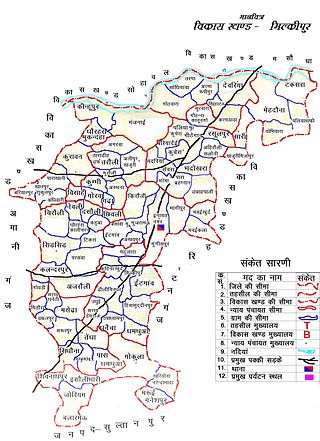
Milkipur is a town and tehsil in Ayodhya district in the Indian state of Uttar Pradesh. Milkipur is 32 km south of district headquarters Ayodhya city. District Ayodhya consists of 11 blocks and Milkipur is a block in Ayodhya, Uttar Pradesh.

<span class="mw-page-title-main">Amethi district</span> District of Uttar Pradesh in India

Amethi district is the 72nd district of the state of Uttar Pradesh in northern India. This district is a part of Ayodhya division in the Awadh region of the Uttar Pradesh. It covers an area of 2329.11 km². Gauriganj is the administrative headquarters of the district.

Goshainganj, also known as Gosainganj, is a town and nagar panchayat in the Faizabad district of the Indian state of Uttar Pradesh. Located 32 km from the district headquarters Ayodhya, Goshainganj has one of the oldest markets of the district.

Sohawal is a town and tehsil in Faizabad district in the Indian state of Uttar Pradesh and is subpost office of Faizabad. Sohawal is 18 km west of district headquarters Ayodhya.

Amaniganj is a town in Milkipur tehsil, Faizabad district in the Indian state of Uttar Pradesh. Amaniganj is situated on Milkipur-Rudauli road and is 51 km away from district headquarters Ayodhya city. Amaniganj is a block in Ayodhya, Uttar Pradesh.

Tarun is a town in Bikapur tehsil, Faizabad district in the Indian state of Uttar Pradesh, India. Tarun is 30 km south of district headquarters Ayodhya city.

Bhelsar is a village in Rudauli tehsil, Faizabad district in the Indian state of Uttar Pradesh, India. Bhelsar is situated on NH-27 Ayodhya- Barabanki road in Ayodhya, Uttar Pradesh. Rudauli is 3 km away from Bhelsar. And Bhelsar is 39 km west of district headquarters Ayodhya city.

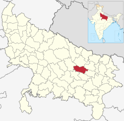
Bikapur is a constituency of the Uttar Pradesh Legislative Assembly covering the city of Bikapur in the Faizabad district of Uttar Pradesh, India.

Nandigram, also known by ancient name Bharatkund, is a village in Sohawal tehsil in Ayodhya district in the Indian state of Uttar Pradesh, India. During the exile of Lord Ram, King Bharat ruled from Nandigram instead of the kingdom's capital Ayodhya. Nandigram is 19 km south of district headquarters Ayodhya city.

Haiderganj is a town in Bikapur tehsil in Faizabad district of Uttar Pradesh state of India. Haiderganj is 40 km south of district headquarters Ayodhya city.

Dhamhar is a village in Bikapur tehsil, Faizabad district in the Uttar Pradesh state of India.

References

  1. 1 2 3 4 5 "About district". District Ayodhya, Government of Uttar Pradesh. Retrieved 27 July 2021.
  2. 1 2 "Census of India: Search Details – Faizabad District". www.censusindia.gov.in. Retrieved 6 November 2019.
  3. Tully, Mark (2017), India in Slow Motion, Penguin Random House India Private Limited, pp. 18–, ISBN   978-93-5118-097-5
  4. "Faizabad district to be renamed as Ayodhya, says UP CM Yogi Adityanath". The Financial Express. 6 November 2018. Retrieved 9 November 2019.
  5. 1 2 "District Census Handbook: Faizabad" (PDF). censusindia.gov.in. Registrar General and Census Commissioner of India. 2011.
  6. "Table C-16 Population by Mother Tongue: Uttar Pradesh". www.censusindia.gov.in. Registrar General and Census Commissioner of India.
  7. "Census of India Website : Office of the Registrar General & Census Commissioner, India". www.censusindia.gov.in. Retrieved 7 January 2020.
  8. "Table C-01 Population by Religion: Uttar Pradesh". censusindia.gov.in. Registrar General and Census Commissioner of India. 2011.
  9. "फैजाबाद लोकसभा सीट : 65 हजार वोटों से लल्लू सिंह विजयी". Hindustan (in Hindi). Retrieved 1 October 2022.
  10. "Goshainganj, Uttar Pradesh Assembly Election Results 2022 LIVE Updates: SP's Abhay Singh wins Goshainganj with 72186 votes". India Today. Retrieved 1 October 2022.
  11. "Uttar Pradesh Police | Police Units | Ayodhya | Officials". uppolice.gov.in. Retrieved 27 December 2022.
  12. "Uttar Pradesh to get 18 new police stations for increased policing". The Economic Times. Retrieved 27 December 2022.
  13. "Police | District Ayodhya - Government of Uttar Pradesh | India" . Retrieved 27 December 2022.

Coordinates: 26°47′N82°08′E / 26.783°N 82.133°E / 26.783; 82.133