Faizabad is a city located in Ayodhya district in the Indian state of Uttar Pradesh. It is situated on the southern bank of the River Saryu about 6.5 km from Ayodhya City, the district headquarter, 130 km east of the state capital Lucknow. Faizabad was the first capital of the Nawabs of Awadh and has monuments built by those Nawabs, like the Tomb of Bahu Begum, Gulab Bari. It was also the headquarters of Faizabad district and Faizabad division before November 2018. Faizabad is a twin city of Ayodhya and it is administered by Ayodhya Municipal Corporation.

Ayodhya district is one of the 75 districts in the northern Indian state of Uttar Pradesh. The city of Ayodhya is its administrative headquarters. The district occupies an area of 2,522 square kilometres (974 sq mi), and had a population of 2,470,996 in the 2011 census. Ayodhya district shares its borders with 6 districts of Uttar Pradesh. It is bordered by Gonda and Basti districts on the northern side, Amethi and Sultanpur districts on the south, and Ambedkar Nagar and Barabanki districts share the border on the east and west.

Ambedkar Nagar is one of the 75 districts of the Indian state of Uttar Pradesh. This district is a part of Ayodhya division in the Awadh region of the state. This district was established on 29 September 1995 by carving out parts of the erstwhile Faizabad district. It was created by the then Chief Minister Mayawati and named in memory of B. R. Ambedkar, who worked for the advancement of the depressed classes. The total area of Ambedkar Nagar district is 2350 Sq. Km.
Bansi is a city and municipal board situated on a bank of the Rapti River in the Siddharthnagar district in the state of Uttar Pradesh, India. It is one of the five vidhan sabha constituencies in Siddharthnagar district and one of the most important cities of the district. The Indo Nepal border is near to the town around 40 km. Lumbini of Nepal is the best place to visit from Bansi by crossing the open border between Nepal and India. The Magh Mela is a fair which is held for a month in Bansi from 25 January to 25 February, attracting visitors from all the surrounding areas.
Bhadarsa is a town and nagar panchayat in Ayodhya district in state of Uttar Pradesh, India. Bhadarsa is 22 km south of district headquarters Ayodhya city.
Jalalpur is a town, tehsil and a municipal board in Ambedkar Nagar district in the Indian state of Uttar Pradesh, India.
Kerakat or Kirakat is a town and nagar panchayat in Jaunpur district of the Indian state of Uttar Pradesh with a population of approximately 13,500. It is situated near the Gomati River, which helps the land around the town stay very fertile. Kerakat or Kirakat forms a part of Varanasi Division. It is located 30 km east of the city of Jaunpur and 279 km from Lucknow, the capital of Uttar Pradesh.
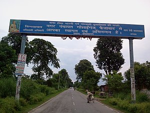
Rudauli is a town, tehsil and a municipal board in Ayodhya district in the Indian state of Uttar Pradesh. Rudauli is 50 km west of the district headquarters Ayodhya.
Akbarpur is a city, municipal corporation, tehsil, and the administrative headquarters of Ambedkar Nagar district in the state of Uttar Pradesh, India. It is a part of Ayodhya division.
Tanda is a town in Ambedkar Nagar district in the Indian state of Uttar Pradesh situated on the banks of Ghaghara River. It is a nagar palika parishad and is part of Ayodhya division in Uttar Pradesh. The town is situated 20 kilometres (12 mi) north east from district headquarter Akbarpur. Tanda is also a tehsil in the district. It has one of the largest handloom weaving industries for manufacturing varieties like gamchha, lungi, polyester clothing, check-shirt clothes material in state of Uttar Pradesh.
Ambedkar Nagar Lok Sabha constituency is one of the 80 Lok Sabha (parliamentary) constituencies in the Indian state of Uttar Pradesh. This lok sabha constituency came into existence in 1996 as 11th lok sabha was held in April-May 1996. On 29 September 1995 Ambedkar Nagar district carved out from faizabad division in the memory of Baba Saheb Dr. Bhim Rao Ambedkar.

Amsin is a town and Gram Panchayat in Ayodhya district in the Indian state of Uttar Pradesh, India. Amsin is 43 km away from district headquarters Ayodhya city.
Rajesultanpur or Raje Sultanpur is a town and nagar panchayat in Ambedkar Nagar district in the Indian state of Uttar Pradesh.
Akbarpur Assembly constituency is one of the 403 constituencies of the Uttar Pradesh Legislative Assembly, India. It is a part of the Ambedkar Nagar district and one of the five assembly constituencies in the Ambedkar Nagar Lok Sabha constituency. Akbarpur Assembly constituency came into existence in 1955 as a result of the "Final Order DC (1953-1955)". The extant and serial number of this constituency was last defined in "Delimitation of Parliamentary and Assembly Constituencies Order, 2008".
Sohawal is a town and tehsil in Ayodhya district in the Indian state of Uttar Pradesh and is sub post office of Ayodhya. Sohawal is 18 km west of district headquarters Ayodhya.
Tarun is a town in Bikapur tehsil, Ayodhya district in the Indian state of Uttar Pradesh, India. Tarun is 30 km south of district headquarters Ayodhya city.
Bhiyaon or Bhiyawan is a village block in Jalalpur, Ambedkar Nagar district of the Indian state of Uttar Pradesh. It belongs to Akbarpur Division. It is located 39 km east of the district headquarters, Akbarpur, and 230 km from Lucknow.
Haiderganj is a town in Bikapur tehsil in Ayodhya district of Uttar Pradesh state of India. Haiderganj is 40 km south of district headquarters Ayodhya city.
Dhamhar is a village in Bikapur tehsil, Ayodhya district in the Uttar Pradesh state of India.